| Home | City Bus | Maps | Villages | Cities | Rail | Tourist Places | School | College | Pin Codes | Corona Cases Count |
| Distance Calculator Bus Services IFSC Codes Trace Mobile Number Weather Search Place Trace IP Available Cash ATM/Banks Locate Polling Booth Report an Error contact People |
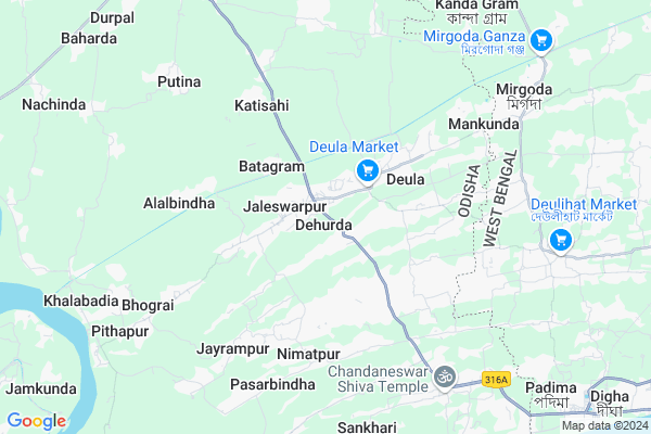
Dehurda Map
EDIT Map
Add Your House
 ..
..
Current Corona Virus Infected Patients Count in Baleshwar District
| City Name | District Name | Total Covid cases |
|---|
Locality Name :
Dehurda
( ଦେହୁର୍ଡ )
Tehsil Name : Bhograi
District : Baleshwar
State : Odisha
Language : Oriya and Hindi
Current Time 08:23 AM
Date: Wednesday , Apr 30,2025 (IST)
Time zone: IST (UTC+5:30)
Elevation / Altitude: 13 meters. Above Seal level
Telephone Code / Std Code: 06781
Assembly constituency : Bhograi assembly constituency
Assembly MLA : ananta das
Lok Sabha constituency : Balasore parliamentary constituency
Parliament MP : PRATAP CHANDRA SARANGI
Serpanch Name :
Pin Code : 756036
Post Office Name : Dehurda
Commodities Prices : Jaleswar Market / Mandi
Dehurda Live Weather
Temperature: 25.3 °C
broken clouds
Humidity: 74%
Wind : 0.83 mt/sec towards NE
StationName : "Digha"
observed on 2 Hours Back
Temperature: 25.3 °C
broken clouds
Humidity: 74%
Wind : 0.83 mt/sec towards NE
StationName : "Digha"
observed on 2 Hours Back
Dehurda Weather Forecast for Next 5 days
01-05-2025
25.1°C to 32.7°C
broken clouds, scattered clouds, few clouds, clear sky, light rain, overcast clouds
25.1°C to 32.7°C
broken clouds, scattered clouds, few clouds, clear sky, light rain, overcast clouds
02-05-2025
24.8°C to 31.5°C
scattered clouds, clear sky, overcast clouds
24.8°C to 31.5°C
scattered clouds, clear sky, overcast clouds
03-05-2025
25.5°C to 31.7°C
overcast clouds, clear sky
25.5°C to 31.7°C
overcast clouds, clear sky
04-05-2025
26.6°C to 32.5°C
broken clouds, scattered clouds, light rain, overcast clouds
26.6°C to 32.5°C
broken clouds, scattered clouds, light rain, overcast clouds
National Highways Reachable To Dehurda
Nationa High Way :NH116B
Nationa High Way :NH116B;SH4
Nationa High Way :NH116B
Nationa High Way :NH116B;SH4
Rivers Near Dehurda
Budhabalanga
Subarnarekha River
Budhabalanga
Subarnarekha River
About Dehurda
Correct below Info and add more info about DehurdaDehurda is a Village in Bhograi Tehsil in Baleshwar District of Odisha State, India. It is located 67 KM towards East from District head quarters Balasore. 2 KM from Bhograi. 265 KM from State capital Bhubaneswar
Dehurda Pin code is 756036 and postal head office is Dehurda .
Deula ( 3 KM ) , Nimatpur ( 5 KM ) , Kulida ( 5 KM ) , Analia ( 6 KM ) , Bhograi ( 7 KM ) are the nearby Villages to Dehurda. Dehurda is surrounded by Ramnagar-I Tehsil towards East , Mohanpur Tehsil towards North , Baliapal Tehsil towards west , Ramnagar-Ii Tehsil towards East .
Jaleswar , Contai , Balasore , Baleshwar are the near by Cities to Dehurda.
This Place is in the border of the Baleshwar District and Medinipur East District. Medinipur East District Ramnagar-i is East towards this place . It is near to the West Bengal State Border. It is near to bay of bengal. There is a chance of humidity in the weather.
Dehurda 2011 Census Details
Dehurda Local Language is Oriya. Dehurda Village Total population is 2819 and number of houses are 692. Female Population is 49.0%. Village literacy rate is 74.8% and the Female Literacy rate is 33.2%.
Population
| Census Parameter | Census Data |
| Total Population | 2819 |
| Total No of Houses | 692 |
| Female Population % | 49.0 % ( 1381) |
| Total Literacy rate % | 74.8 % ( 2110) |
| Female Literacy rate | 33.2 % ( 937) |
| Scheduled Tribes Population % | 1.1 % ( 32) |
| Scheduled Caste Population % | 9.9 % ( 279) |
| Working Population % | 43.3 % |
| Child(0 -6) Population by 2011 | 291 |
| Girl Child(0 -6) Population % by 2011 | 50.2 % ( 146) |
Dehurda Census More Deatils.
Politics in Dehurda
BJD is the major political party in this area.Polling Stations /Booths near Dehurda
1)Jaminikanta Nodal Up School2)Nenguan Pry School
3)Digarasi Pry.school
4)Dakhinasarisa Pry.school
5)Dakhinateghari Nodal Up School(e)
HOW TO REACH Dehurda
By Rail
There is no railway station near to Dehurda in less than 10 km.Colleges near Dehurda
Rural Institute Of Industrial Training Centre, Dehurda
Address :
Schools in Dehurda
Aruapal U.p.
Address : dehurda , bhogarai , balasore , Sikkim . PIN- 756085 , Post - Chandaneswar
Dehurda Sansk. Tole
Address : dehurda , bhogarai , balasore , Sikkim . PIN- 756036 , Post - Dehurda
Govt Health Centers near Dehurda
1) Sunhat OH , Sunhat OH , Sunhat , Near SBI ATMHospitals in Dehurda,Bhograi
Dr. S. K Das Clinic
Jaleswar-Chandaneswar Rd; Sribatsapur; Odisha 756036; India
0.8 KM distance Detail
more ..
Petrol Bunks in Dehurda,Bhograi
Indian Oil Petrol Pump Jagannathpur
Jaleswar-Chandaneswar Rd; Biswanathpur; Odisha 756085; India
6.2 KM distance Detail
Gayatri KSK Filling Station Indian Oil Petrol Pump
Bagada; Baleshwar; SH-57; Jaleswar Chandswar Road; Balasore; Balasore; Odisha 756083; India
6.2 KM distance Detail
more ..
Schools in Dehurda,Bhograi
Shree Bastapur Primary School
Bustrapur; Baleshwar; SH-57; Jaleswar Chandswar Road; Balasore; Balasore; Odisha 756035; India
1.3 KM distance Detail
Electronic Shops in Dehurda,Bhograi
Paul Marketing
Jaleswar-Chandaneswar Rd; ChaksanaJaleswarpur; Odisha 756036; India
0.7 KM distance Detail
Ayush Computer
Bhograi; Thanachaka to Deula; SH 57; ChaksanaJaleswarpur; Odisha 756036; India
0.7 KM distance Detail
Governement Offices near Dehurda,Bhograi
Panchayat Samiti Office (Block); Bhograi; Balasore
Jaleswarpur; Odisha 756036; India
1.8 KM distance Detail
About Dehurda &
History
How to reach Dehurda
Tourist Places Near By Dehurda
Schools in Dehurda
Colleges in Dehurda
Temperature & weather of Dehurda
places in Dehurda
Dehurda photos
More Information
How to reach Dehurda
Tourist Places Near By Dehurda
Schools in Dehurda
Colleges in Dehurda
Temperature & weather of Dehurda
places in Dehurda
Dehurda photos
More Information
Village Talk
Post News or Events about this Village
Near Cities
Jaleswar 25 KM near
Contai 40 KM near
Balasore 60 KM near
Baleshwar 64 KM near
Jaleswar 25 KM near
Contai 40 KM near
Balasore 60 KM near
Baleshwar 64 KM near
Near By Taluks
Bhograi 2 KM near
Ramnagar-I 14 KM near
Mohanpur 20 KM near
Baliapal 20 KM near
Bhograi 2 KM near
Ramnagar-I 14 KM near
Mohanpur 20 KM near
Baliapal 20 KM near
Near By Air Ports
Netaji Subhas Chandra Bose Airport 168 KM near
Bhubaneswar Airport 257 KM near
Ranchi Airport 315 KM near
Gaya Airport 475 KM near
Netaji Subhas Chandra Bose Airport 168 KM near
Bhubaneswar Airport 257 KM near
Ranchi Airport 315 KM near
Gaya Airport 475 KM near
Near By Tourist Places
Digha 13 KM near
Mandarmani 15 KM near
Chandipur 54 KM near
Sagardwip 79 KM near
Baripada 85 KM near
Digha 13 KM near
Mandarmani 15 KM near
Chandipur 54 KM near
Sagardwip 79 KM near
Baripada 85 KM near
Near By Districts
Baleshwar 64 KM near
Mayurbhanj 85 KM near
Medinipur West 92 KM near
Medinipur East 95 KM near
Baleshwar 64 KM near
Mayurbhanj 85 KM near
Medinipur West 92 KM near
Medinipur East 95 KM near
Near By RailWay Station
Digha Rail Way Station 12 KM near
Jaleswar Rail Way Station 27 KM near
Digha Rail Way Station 12 KM near
Jaleswar Rail Way Station 27 KM near