| Home | City Bus | Maps | Villages | Cities | Rail | Tourist Places | School | College | Pin Codes | Corona Cases Count |
| Distance Calculator Bus Services IFSC Codes Trace Mobile Number Weather Search Place Trace IP Available Cash ATM/Banks Locate Polling Booth Report an Error contact People |
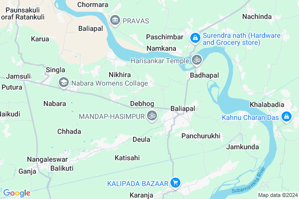
Debhog Map
EDIT Map
Add Your House
 ..
..
Current Corona Virus Infected Patients Count in Baleshwar District
| City Name | District Name | Total Covid cases |
|---|
Locality Name :
Debhog
( ଦେଭଙ୍ଗ )
Tehsil Name : Basta
District : Baleshwar
State : Odisha
Language : Oriya and Hindi
Current Time 05:22 AM
Date: Monday , Apr 28,2025 (IST)
Time zone: IST (UTC+5:30)
Elevation / Altitude: 13 meters. Above Seal level
Telephone Code / Std Code: 06781
Assembly constituency : Basta assembly constituency
Assembly MLA : nityananda sahoo
Lok Sabha constituency : Balasore parliamentary constituency
Parliament MP : PRATAP CHANDRA SARANGI
Serpanch Name :
Commodities Prices : Jaleswar Market / Mandi
Debhog Live Weather
Temperature: 27.9 °C
overcast clouds
Humidity: 66%
Wind : 2.75 mt/sec towards SW
StationName : "Jaleshwar"
observed on 1 Hours Back
Temperature: 27.9 °C
overcast clouds
Humidity: 66%
Wind : 2.75 mt/sec towards SW
StationName : "Jaleshwar"
observed on 1 Hours Back
Debhog Weather Forecast for Next 5 days
29-04-2025
21.7°C to 35.7°C
overcast clouds, light rain, heavy intensity rain, broken clouds
21.7°C to 35.7°C
overcast clouds, light rain, heavy intensity rain, broken clouds
30-04-2025
22.2°C to 32.7°C
scattered clouds, clear sky, light rain, moderate rain, overcast clouds
22.2°C to 32.7°C
scattered clouds, clear sky, light rain, moderate rain, overcast clouds
01-05-2025
24.6°C to 31.8°C
clear sky, few clouds, light rain, moderate rain, heavy intensity rain, overcast clouds
24.6°C to 31.8°C
clear sky, few clouds, light rain, moderate rain, heavy intensity rain, overcast clouds
02-05-2025
22.7°C to 32.1°C
few clouds, clear sky, light rain, moderate rain, heavy intensity rain, overcast clouds
22.7°C to 32.1°C
few clouds, clear sky, light rain, moderate rain, heavy intensity rain, overcast clouds
National Highways Reachable To Debhog
Nationa High Way :NH116B;SH4
Nationa High Way :NH116B
Nationa High Way :NH116B;SH4
Nationa High Way :NH116B
Rivers Near Debhog
Budhabalanga
Subarnarekha River
Budhabalanga
Subarnarekha River
About Debhog
Correct below Info and add more info about DebhogDebhog is a small Village/hamlet in Basta Tehsil in Baleshwar District of Odisha State, India. It is located 48 KM towards East from District head quarters Balasore. 15 KM from Basta. 249 KM from State capital Bhubaneswar
Madhupura ( 4 KM ) , Kumbhari ( 4 KM ) , Paschimbad ( 4 KM ) , Pratappur ( 7 KM ) , Nabara ( 7 KM ) are the nearby Villages to Debhog. Debhog is surrounded by Basta Tehsil towards west , Jaleswar Tehsil towards North , Bhograi Tehsil towards East , Rasgovindpur Tehsil towards west .
Jaleswar , Balasore , Baleshwar , Contai are the near by Cities to Debhog.
This Place is in the border of the Baleshwar District and Medinipur West District. Medinipur West District Mohanpur is North towards this place . It is near to the West Bengal State Border.
Demographics of Debhog
Oriya is the Local Language here.Politics in Debhog
BJD is the major political party in this area.Polling Stations /Booths near Debhog
1)Dangapita Pry. School2)Darada High School
3)Khagdapal Pry. School
4)Dhobachakurai Nodal U.p .school
5)Gunpur Pry. School
HOW TO REACH Debhog
By Rail
There is no railway station near to Debhog in less than 10 km.Pincodes near Debhog
756026 ( Baliapal ) , 756023 ( Singla ) , 756079 ( Dahamunda )Colleges near Debhog
Rural Institute Of Industrial Training Centre, Dehurda
Address :
Rural Instititue Of Indastrial Trinneng Center
Address :
Bahanaga College
Address :
Harekrushna Mahatab College,kupari
Address :
Remuna Juniur College
Address :
Schools near Debhog
Lachhaman Khunta High School
Address : lachhaman khunta , basta , balasore , Sikkim . PIN- 756028 , Post - Rupsa
D.s High School, Ranamundali
Address : ranamunduli , basta , balasore , Sikkim . PIN- 756029 , Post - Basta
Karuagadadhar High School
Address : beldandia , basta , balasore , Sikkim . PIN- 756023 , Post - Singla
Champamani Girls H.s
Address : nahanjara , basta , balasore , Sikkim . PIN- 756023 , Post - Singla
Govt Health Centers near Debhog
1) Sunhat OH , Sunhat OH , Sunhat , Near SBI ATM2) SABARANGA , , , L.I CENTRE
Petrol Bunks in Debhog,Basta
HP PETROL PUMP - SAI SERVICE STATION
M/S SAI Service Station Mouza- Salikotha Tahasil & SUB Registrar-jaleswar; Bhubaneshwar; Odisha 756032; India
16.8 KM distance Detail
more ..
Governement Offices near Debhog,Basta
Marriage License Bureau; Baliapal
Kalipada-Baliapal Rd; Badasimulia; Odisha 756026; India
2.5 KM distance Detail
About Debhog &
History
How to reach Debhog
Tourist Places Near By Debhog
Schools in Debhog
Colleges in Debhog
Temperature & weather of Debhog
places in Debhog
Debhog photos
More Information
How to reach Debhog
Tourist Places Near By Debhog
Schools in Debhog
Colleges in Debhog
Temperature & weather of Debhog
places in Debhog
Debhog photos
More Information
Village Talk
Post News or Events about this Village
Near Cities
Jaleswar 16 KM near
Balasore 42 KM near
Baleshwar 46 KM near
Contai 58 KM near
Jaleswar 16 KM near
Balasore 42 KM near
Baleshwar 46 KM near
Contai 58 KM near
Near By Taluks
Baliapal 3 KM near
Basta 14 KM near
Jaleswar 16 KM near
Bhograi 16 KM near
Baliapal 3 KM near
Basta 14 KM near
Jaleswar 16 KM near
Bhograi 16 KM near
Near By Air Ports
Netaji Subhas Chandra Bose Airport 183 KM near
Bhubaneswar Airport 242 KM near
Ranchi Airport 303 KM near
Gaya Airport 466 KM near
Netaji Subhas Chandra Bose Airport 183 KM near
Bhubaneswar Airport 242 KM near
Ranchi Airport 303 KM near
Gaya Airport 466 KM near
Near By Tourist Places
Digha 30 KM near
Mandarmani 33 KM near
Chandipur 38 KM near
Baripada 69 KM near
Medinipur 95 KM near
Digha 30 KM near
Mandarmani 33 KM near
Chandipur 38 KM near
Baripada 69 KM near
Medinipur 95 KM near
Near By Districts
Baleshwar 46 KM near
Mayurbhanj 69 KM near
Medinipur West 95 KM near
Medinipur East 109 KM near
Baleshwar 46 KM near
Mayurbhanj 69 KM near
Medinipur West 95 KM near
Medinipur East 109 KM near
Near By RailWay Station
Jaleswar Rail Way Station 17 KM near
Basta Rail Way Station 23 KM near
Jaleswar Rail Way Station 17 KM near
Basta Rail Way Station 23 KM near