| Home | City Bus | Maps | Villages | Cities | Rail | Tourist Places | School | College | Pin Codes | Corona Cases Count |
| Distance Calculator Bus Services IFSC Codes Trace Mobile Number Weather Search Place Trace IP Available Cash ATM/Banks Locate Polling Booth Report an Error contact People |
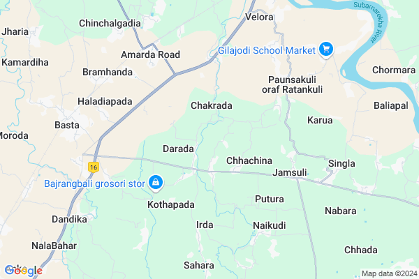
Baincha Map
EDIT Map
Add Your House
 ..
..
Current Corona Virus Infected Patients Count in Baleshwar District
| City Name | District Name | Total Covid cases |
|---|
Locality Name :
Baincha
( ବୈଂଚ )
Tehsil Name : Basta
District : Baleshwar
State : Odisha
Language : Oriya and Hindi
Current Time 05:17 AM
Date: Monday , Apr 28,2025 (IST)
Time zone: IST (UTC+5:30)
Elevation / Altitude: 13 meters. Above Seal level
Telephone Code / Std Code: 06781
Assembly constituency : Basta assembly constituency
Assembly MLA : nityananda sahoo
Lok Sabha constituency : Balasore parliamentary constituency
Parliament MP : PRATAP CHANDRA SARANGI
Serpanch Name :
Commodities Prices : Jaleswar Market / Mandi
Baincha Live Weather
Temperature: 27.9 °C
broken clouds
Humidity: 64%
Wind : 2.61 mt/sec towards SW
StationName : "Jaleshwar"
observed on 2 Hours Back
Temperature: 27.9 °C
broken clouds
Humidity: 64%
Wind : 2.61 mt/sec towards SW
StationName : "Jaleshwar"
observed on 2 Hours Back
Baincha Weather Forecast for Next 5 days
29-04-2025
22.7°C to 37.4°C
overcast clouds, moderate rain, heavy intensity rain, broken clouds, light rain
22.7°C to 37.4°C
overcast clouds, moderate rain, heavy intensity rain, broken clouds, light rain
30-04-2025
22.2°C to 34.1°C
broken clouds, clear sky, moderate rain, heavy intensity rain, overcast clouds
22.2°C to 34.1°C
broken clouds, clear sky, moderate rain, heavy intensity rain, overcast clouds
01-05-2025
23.9°C to 32.4°C
clear sky, few clouds, light rain, heavy intensity rain, overcast clouds, scattered clouds
23.9°C to 32.4°C
clear sky, few clouds, light rain, heavy intensity rain, overcast clouds, scattered clouds
02-05-2025
22.4°C to 32.7°C
few clouds, light rain, moderate rain, heavy intensity rain, overcast clouds
22.4°C to 32.7°C
few clouds, light rain, moderate rain, heavy intensity rain, overcast clouds
Edit below overview about Baincha
Edit below overview about Baincha
OverView of Baincha
Village of freedom fightersBirth place of great social worker-Bipin Behari Panda(Co worker of Mother TeressaEdit below overview about Baincha
National Highways Reachable To Baincha
Nationa High Way :NH116B;SH4
Nationa High Way :NH116B
Nationa High Way :NH116B;SH4
Nationa High Way :NH116B
Rivers Near Baincha
Budhabalanga
Subarnarekha River
Budhabalanga
Subarnarekha River
About Baincha
Baincha is a small Village/hamlet in Basta Tehsil in Baleshwar District of Odisha State, India. It is located 38 KM towards East from District head quarters Balasore. 242 KM from State capital Bhubaneswar
Baincha is surrounded by Baliapal Tehsil towards East , Rasgovindpur Tehsil towards North , Jaleswar Tehsil towards North , Betnoti Tehsil towards west .
Jaleswar , Balasore , Baleshwar , Baripada are the near by Cities to Baincha.
This Place is in the border of the Baleshwar District and Medinipur West District. Medinipur West District Mohanpur is East towards this place . It is near to the West Bengal State Border.
Baincha 2011 Census Details
Baincha Local Language is Oriya. Baincha Village Total population is 414 and number of houses are 90. Female Population is 46.9%. Village literacy rate is 61.4% and the Female Literacy rate is 26.1%.
Population
| Census Parameter | Census Data |
| Total Population | 414 |
| Total No of Houses | 90 |
| Female Population % | 46.9 % ( 194) |
| Total Literacy rate % | 61.4 % ( 254) |
| Female Literacy rate | 26.1 % ( 108) |
| Scheduled Tribes Population % | 70.0 % ( 290) |
| Scheduled Caste Population % | 11.1 % ( 46) |
| Working Population % | 34.3 % |
| Child(0 -6) Population by 2011 | 52 |
| Girl Child(0 -6) Population % by 2011 | 42.3 % ( 22) |
Baincha Census More Deatils.
Politics in Baincha
BJD is the major political party in this area.Polling Stations /Booths near Baincha
1)Malikud Pry. School2)Dwarikanath Nodal U.p School
3)Remu Pry. School
4)Mendhapada Pry. School
5)Mukulisi Ugme School
HOW TO REACH Baincha
By Rail
Amarda Road Rail Way Station , Basta Rail Way Station are the very nearby railway stations to Baincha.Pincodes near Baincha
756022 ( Darada ) , 756081 ( Jamsuli ) , 756080 ( Irda )Colleges near Baincha
Rural Institute Of Industrial Training Centre, Dehurda
Address :
Rural Instititue Of Indastrial Trinneng Center
Address :
Bahanaga College
Address :
Harekrushna Mahatab College,kupari
Address :
Remuna Juniur College
Address :
Schools in Baincha
Baincha Pry.
Address : baincha , basta , balasore , Sikkim . PIN- 756029 , Post - Basta
Govt Health Centers near Baincha
1) Sunhat OH , Sunhat OH , Sunhat , Near SBI ATM2) SABARANGA , , , L.I CENTRE
Colleges in Baincha,Basta
Siddheswar College Of Ph.Sciences;AmardaRoad;Odisha
Naranpur; Odisha 756030; India
6.2 KM distance Detail
more ..
Electronic Shops in Baincha,Basta
dtdc courier link office jamsuli;basta;balasore
Langleswar- Kamargadia Rd; Jamsuli; Odisha 756081; India
5.7 KM distance Detail
Governement Offices near Baincha,Basta
Irda Janasevakendra
Kaenda Bus Stop; Kundali - Darada Rd; Kaenda; Odisha 756080; India
5.0 KM distance Detail
About Baincha &
History
How to reach Baincha
Tourist Places Near By Baincha
Schools in Baincha
Colleges in Baincha
Temperature & weather of Baincha
places in Baincha
Baincha photos
More Information
How to reach Baincha
Tourist Places Near By Baincha
Schools in Baincha
Colleges in Baincha
Temperature & weather of Baincha
places in Baincha
Baincha photos
More Information
Village Talk
Post News or Events about this Village
Near Cities
Jaleswar 17 KM near
Balasore 33 KM near
Baleshwar 36 KM near
Baripada 55 KM near
Jaleswar 17 KM near
Balasore 33 KM near
Baleshwar 36 KM near
Baripada 55 KM near
Near By Taluks
Basta 0 KM near
Baliapal 14 KM near
Rasgovindpur 15 KM near
Jaleswar 17 KM near
Basta 0 KM near
Baliapal 14 KM near
Rasgovindpur 15 KM near
Jaleswar 17 KM near
Near By Air Ports
Netaji Subhas Chandra Bose Airport 192 KM near
Bhubaneswar Airport 235 KM near
Ranchi Airport 290 KM near
Gaya Airport 455 KM near
Netaji Subhas Chandra Bose Airport 192 KM near
Bhubaneswar Airport 235 KM near
Ranchi Airport 290 KM near
Gaya Airport 455 KM near
Near By Tourist Places
Chandipur 32 KM near
Digha 46 KM near
Mandarmani 48 KM near
Baripada 55 KM near
Barehipani & Joranda Barehipani & Joranda Falls 92 KM near
Chandipur 32 KM near
Digha 46 KM near
Mandarmani 48 KM near
Baripada 55 KM near
Barehipani & Joranda Barehipani & Joranda Falls 92 KM near
Near By Districts
Baleshwar 36 KM near
Mayurbhanj 54 KM near
Medinipur West 93 KM near
Bhadrak 106 KM near
Baleshwar 36 KM near
Mayurbhanj 54 KM near
Medinipur West 93 KM near
Bhadrak 106 KM near
Near By RailWay Station
Amarda Road Rail Way Station 6.7 KM near
Basta Rail Way Station 8.3 KM near
Rupsa Junction Rail Way Station 15 KM near
Amarda Road Rail Way Station 6.7 KM near
Basta Rail Way Station 8.3 KM near
Rupsa Junction Rail Way Station 15 KM near