| Home | City Bus | Maps | Villages | Cities | Rail | Tourist Places | School | College | Pin Codes | Corona Cases Count |
| Distance Calculator Bus Services IFSC Codes Trace Mobile Number Weather Search Place Trace IP Available Cash ATM/Banks Locate Polling Booth Report an Error contact People |
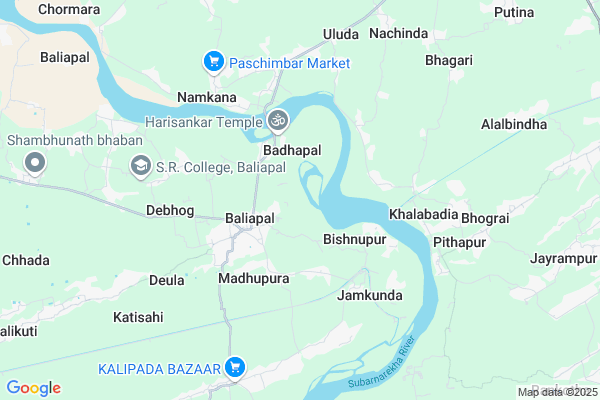
Gunapur Map
EDIT Map
Add Your House
 ..
..
Current Corona Virus Infected Patients Count in Baleshwar District
| City Name | District Name | Total Covid cases |
|---|
Locality Name :
Gunapur
( ଗୁଣପୁର )
Tehsil Name : Baliapal
District : Baleshwar
State : Odisha
Language : Oriya and Hindi
Current Time 07:57 PM
Date: Friday , Apr 25,2025 (IST)
Time zone: IST (UTC+5:30)
Elevation / Altitude: 13 meters. Above Seal level
Telephone Code / Std Code: 06781
Assembly constituency : Basta assembly constituency
Assembly MLA : nityananda sahoo
Lok Sabha constituency : Balasore parliamentary constituency
Parliament MP : PRATAP CHANDRA SARANGI
Serpanch Name :
Pin Code : 756026
Post Office Name : Baliapal
Commodities Prices : Jaleswar Market / Mandi
National Highways Reachable To Gunapur
Nationa High Way :NH116B;SH4
Nationa High Way :NH16
Nationa High Way :NH116B;SH4
Nationa High Way :NH16
Rivers Near Gunapur
Budhabalanga
Subarnarekha River
Budhabalanga
Subarnarekha River
About Gunapur
Correct below Info and add more info about GunapurGunapur is a small Village/hamlet in Baliapal Tehsil in Baleshwar District of Odisha State, India. It is located 52 KM towards East from District head quarters Balasore. 6 KM from Bahiapal. 252 KM from State capital Bhubaneswar
Gunapur Pin code is 756026 and postal head office is Baliapal .
Paschimbad ( 4 KM ) , Jamkunda ( 5 KM ) , Ghantua ( 5 KM ) , Kharidpipal ( 6 KM ) , Nikhira ( 7 KM ) are the nearby Villages to Gunapur. Gunapur is surrounded by Bhograi Tehsil towards East , Jaleswar Tehsil towards North , Basta Tehsil towards west , Mohanpur Tehsil towards North .
Jaleswar , Balasore , Baleshwar , Contai are the near by Cities to Gunapur.
It is near to bay of bengal. There is a chance of humidity in the weather.
Gunapur 2011 Census Details
Gunapur Local Language is Oriya. Gunapur Village Total population is 748 and number of houses are 159. Female Population is 50.8%. Village literacy rate is 76.5% and the Female Literacy rate is 36.6%.
Population
| Census Parameter | Census Data |
| Total Population | 748 |
| Total No of Houses | 159 |
| Female Population % | 50.8 % ( 380) |
| Total Literacy rate % | 76.5 % ( 572) |
| Female Literacy rate | 36.6 % ( 274) |
| Scheduled Tribes Population % | 11.8 % ( 88) |
| Scheduled Caste Population % | 51.1 % ( 382) |
| Working Population % | 47.9 % |
| Child(0 -6) Population by 2011 | 80 |
| Girl Child(0 -6) Population % by 2011 | 45.0 % ( 36) |
Gunapur Census More Deatils.
Politics in Gunapur
BJD is the major political party in this area.Polling Stations /Booths near Gunapur
1)Kudia Pry.school2)Gundurimara Pry.school
3)Asti Pardipa Pry. School
4)Balarampur Pry. School
5)Sunaroi Nodal School
HOW TO REACH Gunapur
By Rail
There is no railway station near to Gunapur in less than 10 km.Colleges near Gunapur
Rural Institute Of Industrial Training Centre, Dehurda
Address :
Rural Instititue Of Indastrial Trinneng Center
Address :
Bahanaga College
Address :
Harekrushna Mahatab College,kupari
Address :
Remuna Juniur College
Address :
Schools in Gunapur
Dharamduar Pry. School
Address : gunapur , baliapal , balasore , Sikkim . PIN- 756026 , Post - Baliapal
Govt Health Centers near Gunapur
1) Sunhat OH , Sunhat OH , Sunhat , Near SBI ATM2) SABARANGA , , , L.I CENTRE
Petrol Bunks in Gunapur,Baliapal
Putineswar Filling Station Bharat Petroleum
Kamarda; Baleshwar; SH-57; Jaleswar Chandswar Road; Balasore; Balasore; Odisha 756035; India
14.7 KM distance Detail
more ..
Governement Offices near Gunapur,Baliapal
Marriage License Bureau; Baliapal
Kalipada-Baliapal Rd; Badasimulia; Odisha 756026; India
3.3 KM distance Detail
About Gunapur &
History
How to reach Gunapur
Tourist Places Near By Gunapur
Schools in Gunapur
Colleges in Gunapur
Temperature & weather of Gunapur
places in Gunapur
Gunapur photos
More Information
How to reach Gunapur
Tourist Places Near By Gunapur
Schools in Gunapur
Colleges in Gunapur
Temperature & weather of Gunapur
places in Gunapur
Gunapur photos
More Information
Village Talk
Post News or Events about this Village
Near Cities
Jaleswar 18 KM near
Balasore 46 KM near
Baleshwar 50 KM near
Contai 54 KM near
Jaleswar 18 KM near
Balasore 46 KM near
Baleshwar 50 KM near
Contai 54 KM near
Near By Taluks
Baliapal 7 KM near
Bhograi 12 KM near
Jaleswar 18 KM near
Basta 19 KM near
Baliapal 7 KM near
Bhograi 12 KM near
Jaleswar 18 KM near
Basta 19 KM near
Near By Air Ports
Netaji Subhas Chandra Bose Airport 179 KM near
Bhubaneswar Airport 245 KM near
Ranchi Airport 307 KM near
Gaya Airport 469 KM near
Netaji Subhas Chandra Bose Airport 179 KM near
Bhubaneswar Airport 245 KM near
Ranchi Airport 307 KM near
Gaya Airport 469 KM near
Near By Tourist Places
Digha 26 KM near
Mandarmani 29 KM near
Chandipur 41 KM near
Baripada 73 KM near
Sagardwip 93 KM near
Digha 26 KM near
Mandarmani 29 KM near
Chandipur 41 KM near
Baripada 73 KM near
Sagardwip 93 KM near
Near By Districts
Baleshwar 50 KM near
Mayurbhanj 73 KM near
Medinipur West 94 KM near
Medinipur East 106 KM near
Baleshwar 50 KM near
Mayurbhanj 73 KM near
Medinipur West 94 KM near
Medinipur East 106 KM near
Near By RailWay Station
Jaleswar Rail Way Station 19 KM near
Digha Rail Way Station 24 KM near
Jaleswar Rail Way Station 19 KM near
Digha Rail Way Station 24 KM near