| Home | City Bus | Maps | Villages | Cities | Rail | Tourist Places | School | College | Pin Codes | Corona Cases Count |
| Distance Calculator Bus Services IFSC Codes Trace Mobile Number Weather Search Place Trace IP Available Cash ATM/Banks Locate Polling Booth Report an Error contact People |
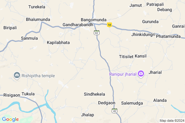
Pitamahul
Pitamahul Map
EDIT Map
Add Your House
 ..
..
Current Corona Virus Infected Patients Count in Balangir District
| City Name | District Name | Total Covid cases |
|---|
Locality Name :
Pitamahul
( ପିତାମହୁଲ )
Tehsil Name : Bangomunda
District : Balangir
State : Odisha
Language : Oriya and Hindi, And Tribal Languages
Current Time 09:29 AM
Date: Wednesday , Feb 05,2025 (IST)
Time zone: IST (UTC+5:30)
Elevation / Altitude: 272 meters. Above Seal level
Telephone Code / Std Code: 06657
Assembly constituency : Kantabanji assembly constituency
Assembly MLA : ayub khan
Lok Sabha constituency : Bolangir parliamentary constituency
Parliament MP : Sangeeta Kumari Singh Deo
Serpanch Name :
Commodities Prices : Khariar Market / Mandi
Pitamahul Live Weather
Temperature: 22.4 °C
scattered clouds
Humidity: 50%
Wind : 0.85 mt/sec towards SE
StationName : "KharhiÄ\u0081l"
observed on 1 Hours Back
Temperature: 22.4 °C
scattered clouds
Humidity: 50%
Wind : 0.85 mt/sec towards SE
StationName : "KharhiÄ\u0081l"
observed on 1 Hours Back
Pitamahul Weather Forecast for Next 5 days
06-02-2025
22.7°C to 34.8°C
scattered clouds, few clouds, clear sky
22.7°C to 34.8°C
scattered clouds, few clouds, clear sky
07-02-2025
21.1°C to 34.3°C
clear sky
21.1°C to 34.3°C
clear sky
08-02-2025
20.4°C to 33.6°C
clear sky
20.4°C to 33.6°C
clear sky
09-02-2025
18.6°C to 33.3°C
clear sky
18.6°C to 33.3°C
clear sky
10-02-2025
17.3°C to 33.7°C
clear sky
17.3°C to 33.7°C
clear sky
National Highways Reachable To Pitamahul
Nationa High Way :NH130C
Nationa High Way :NH130C
Rivers Near Pitamahul
Kodobhāta Nadi :Kodobhata Nadi
Kharji Nadi :Kharji Nadi
Kodobhāta Nadi :Kodobhata Nadi
Kharji Nadi :Kharji Nadi
About Pitamahul
Correct below Info and add more info about PitamahulPitamahul is a small Village/hamlet in Bangomunda Tehsil in Balangir District of Odisha State, India. It is located 86 KM towards west from District head quarters Balangir. 357 KM from State capital Bhubaneswar
Pitamahul is surrounded by Muribahal Tehsil towards East , Khariar Tehsil towards west , Turekela Tehsil towards North , Titlagarh Tehsil towards East .
Kantabanji , Titlagarh , Bhawanipatna , Balangir are the near by Cities to Pitamahul.
This Place is in the border of the Balangir District and Nuapada District. Nuapada District Khariar is west towards this place .
Pitamahul 2011 Census Details
Pitamahul Local Language is Oriya. Pitamahul Village Total population is 366 and number of houses are 83. Female Population is 48.6%. Village literacy rate is 42.3% and the Female Literacy rate is 12.8%.
Population
| Census Parameter | Census Data |
| Total Population | 366 |
| Total No of Houses | 83 |
| Female Population % | 48.6 % ( 178) |
| Total Literacy rate % | 42.3 % ( 155) |
| Female Literacy rate | 12.8 % ( 47) |
| Scheduled Tribes Population % | 20.5 % ( 75) |
| Scheduled Caste Population % | 3.0 % ( 11) |
| Working Population % | 52.2 % |
| Child(0 -6) Population by 2011 | 68 |
| Girl Child(0 -6) Population % by 2011 | 42.6 % ( 29) |
Pitamahul Census More Deatils.
Politics in Pitamahul
BJD , INC are the major political parties in this area.Polling Stations /Booths near Pitamahul
1)Routmunda Govt. Primary School Routmunda2)Sagunbhadi Govt.project Upper Primary School Sagunbhadi
3)Govt. Primary School(w) Balikhamar
4)Kameimunda Govt. Upgraded Upper Primary School Kameimunda
5)Ghusuramunda Govt. Project Upper Primary School Ghusuramunda
HOW TO REACH Pitamahul
By Rail
There is no railway station near to Pitamahul in less than 10 km.Pincodes near Pitamahul
767035 ( Sindhekela ) , 766107 ( Khariar ) , 767039 ( Kantabanji )Colleges near Pitamahul
Prasanna Pal Junior College
Address : Near Bus Stand, Nh Road ,bhalumunda
Schools in Pitamahul
Pitamahul Nclp
Address : pitamahul , bangomunda , bolangir , Sikkim . PIN- 767035 , Post - Sindhekela
Saltarpali Gps
Address : pitamahul , bangomunda , bolangir , Sikkim . PIN- 767033 , Post - Titilagarh
Govt Health Centers near Pitamahul
1) Udit Narayan Pur T.B Hospital , Kalahandi , Kalahandi , Kalahandi2) KOMNA , CHC KOMNA , KOMNA ,
3) SC AGREN , AGREN SC , BHELA ,
Hospitals in Pitamahul,Bangomunda
Smile Zone Oral & Dental care
Bellaguntha - Baragaon; Bangomunda; Odisha 767035; India
5.1 KM distance Detail
more ..
Petrol Bunks in Pitamahul,Bangomunda
HP PETROL PUMP - KANHA FILLING STATION
HP Petrol Pump SH-42 Bangomunda; Odisha 737040; India
6.7 KM distance Detail
more ..
Electronic Shops in Pitamahul,Bangomunda
Sri Krishna Electronic Sindhekela
Main road; Sindhekela; Odisha 767040; India
4.5 KM distance Detail
About Pitamahul &
History
How to reach Pitamahul
Tourist Places Near By Pitamahul
Schools in Pitamahul
Colleges in Pitamahul
Temperature & weather of Pitamahul
places in Pitamahul
Pitamahul photos
More Information
How to reach Pitamahul
Tourist Places Near By Pitamahul
Schools in Pitamahul
Colleges in Pitamahul
Temperature & weather of Pitamahul
places in Pitamahul
Pitamahul photos
More Information
Village Talk
Post News or Events about this Village
Near Cities
Kantabanji 21 KM near
Titlagarh 27 KM near
Bhawanipatna 56 KM near
Balangir 83 KM near
Kantabanji 21 KM near
Titlagarh 27 KM near
Bhawanipatna 56 KM near
Balangir 83 KM near
Near By Taluks
Bangomunda 0 KM near
Muribahal 16 KM near
Khariar 17 KM near
Turekela 23 KM near
Bangomunda 0 KM near
Muribahal 16 KM near
Khariar 17 KM near
Turekela 23 KM near
Near By Air Ports
Raipur Airport 175 KM near
Vishakhapatnam Airport 322 KM near
Bhubaneswar Airport 339 KM near
Rajahmundry Airport 417 KM near
Raipur Airport 175 KM near
Vishakhapatnam Airport 322 KM near
Bhubaneswar Airport 339 KM near
Rajahmundry Airport 417 KM near
Near By Tourist Places
Kalahandi 62 KM near
Mahasamund 138 KM near
Phulbani 155 KM near
Kanker 165 KM near
Dhamtari 166 KM near
Kalahandi 62 KM near
Mahasamund 138 KM near
Phulbani 155 KM near
Kanker 165 KM near
Dhamtari 166 KM near
Near By Districts
Kalahandi 56 KM near
Nuapada 77 KM near
Balangir 83 KM near
Sonepur 133 KM near
Kalahandi 56 KM near
Nuapada 77 KM near
Balangir 83 KM near
Sonepur 133 KM near
Near By RailWay Station
Kantabanji Rail Way Station 21 KM near
Titlagarh Junction Rail Way Station 27 KM near
Kantabanji Rail Way Station 21 KM near
Titlagarh Junction Rail Way Station 27 KM near