| Home | City Bus | Maps | Villages | Cities | Rail | Tourist Places | School | College | Pin Codes | Corona Cases Count |
| Distance Calculator Bus Services IFSC Codes Trace Mobile Number Weather Search Place Trace IP Available Cash ATM/Banks Locate Polling Booth Report an Error contact People |
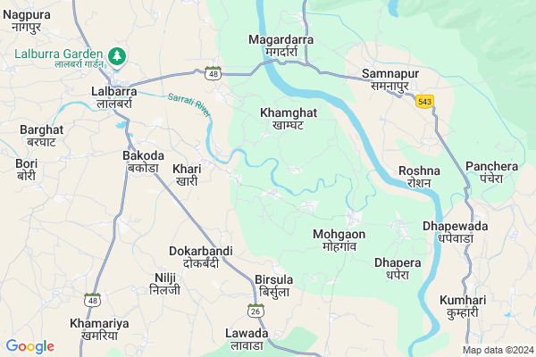
Murjhad
Murjhad Map
EDIT Map
Add Your House
 ..
..
Current Corona Virus Infected Patients Count in Balaghat District
| City Name | District Name | Total Covid cases |
|---|
Locality Name :
Murjhad
( मुरझड़ )
Tehsil Name : Lalbarra
District : Balaghat
State : Madhya Pradesh
Division : Jabalpur
Language : Hindi and Marathi
Current Time 09:14 AM
Date: Friday , Apr 18,2025 (IST)
Time zone: IST (UTC+5:30)
Elevation / Altitude: 327 meters. Above Seal level
Telephone Code / Std Code: 07633
Assembly constituency : Balaghat assembly constituency
Assembly MLA : Anubha Munjare
Lok Sabha constituency : Balaghat parliamentary constituency
Parliament MP : DR DHAL SINGH BISEN
Serpanch Name :
Pin Code : 481441
Post Office Name : Lalbarra
Commodities Prices : Mohgaon Market / Mandi
Murjhad Live Weather
Temperature: 30.7 °C
clear sky
Humidity: 40%
Wind : 3.37 mt/sec towards S
StationName : "BÄ\u0081lÄ\u0081ghÄ\u0081t"
observed on 1 Hours Back
Temperature: 30.7 °C
clear sky
Humidity: 40%
Wind : 3.37 mt/sec towards S
StationName : "BÄ\u0081lÄ\u0081ghÄ\u0081t"
observed on 1 Hours Back
Murjhad Weather Forecast for Next 5 days
19-04-2025
31.2°C to 42.7°C
clear sky, few clouds, broken clouds, scattered clouds
31.2°C to 42.7°C
clear sky, few clouds, broken clouds, scattered clouds
20-04-2025
28.7°C to 43.6°C
broken clouds, few clouds, clear sky
28.7°C to 43.6°C
broken clouds, few clouds, clear sky
21-04-2025
28.8°C to 43.5°C
clear sky, few clouds, broken clouds, scattered clouds
28.8°C to 43.5°C
clear sky, few clouds, broken clouds, scattered clouds
22-04-2025
28.0°C to 43.9°C
clear sky
28.0°C to 43.9°C
clear sky
23-04-2025
27.6°C to 44.5°C
clear sky, few clouds
27.6°C to 44.5°C
clear sky, few clouds
National Highways Reachable To Murjhad
Nationa High Way :NH247
Nationa High Way :NH30
Nationa High Way :NH247
Nationa High Way :NH30
Rivers Near Murjhad
Juban
Chilband
Juban
Chilband
About Murjhad
Correct below Info and add more info about MurjhadMurjhad is a Village in Lalbarra Tehsil in Balaghat District of Madhya Pradesh State, India. It belongs to Jabalpur Division . It is located 15 KM towards North from District head quarters Balaghat. 7 KM from Lalbarra. 368 KM from State capital Bhopal
Murjhad Pin code is 481441 and postal head office is Lalbarra .
Khari ( 3 KM ) , Dadiya ( 4 KM ) , Belgaon ( 4 KM ) , Birsola ( 4 KM ) , Dokarbandi ( 5 KM ) are the nearby Villages to Murjhad. Murjhad is surrounded by Balaghat Tehsil towards East , Waraseoni Tehsil towards South , Barghat Tehsil towards west , Khairlanji Tehsil towards South .
Balaghat , Wara Seoni , Gondiya , Tirora are the near by Cities to Murjhad.
Murjhad 2011 Census Details
Murjhad Local Language is Hindi. Murjhad Village Total population is 1897 and number of houses are 483. Female Population is 51.0%. Village literacy rate is 64.1% and the Female Literacy rate is 30.3%.
Population
| Census Parameter | Census Data |
| Total Population | 1897 |
| Total No of Houses | 483 |
| Female Population % | 51.0 % ( 968) |
| Total Literacy rate % | 64.1 % ( 1216) |
| Female Literacy rate | 30.3 % ( 574) |
| Scheduled Tribes Population % | 15.3 % ( 290) |
| Scheduled Caste Population % | 7.1 % ( 134) |
| Working Population % | 59.6 % |
| Child(0 -6) Population by 2011 | 242 |
| Girl Child(0 -6) Population % by 2011 | 47.5 % ( 115) |
Murjhad Census More Deatils.
Politics in Murjhad
Bharatiya Janata Party , BJP , INC are the major political parties in this area.Polling Stations /Booths near Murjhad
1)Murjhad-12)Khari-1
3)Khirri
4)Mohgaon-3
5)Dadiya-2
HOW TO REACH Murjhad
By Rail
Dhapewara Rail Way Station , Samnapur Rail Way Station are the very nearby railway stations to Murjhad.Colleges near Murjhad
Govt Art And Commerce College Katangi
Address :
Om Politechnic College, Manegaon
Address :
Govt.college Kirnapur
Address :
Mt. Sm Deo Homoeopathic & Biochemic Medical College & Hospital, Balaghat, Madhya Pradesh
Address : Dev Nagarikhursodi, Gondia Road
Schools in Murjhad
Jps Murjhad
Address : murjhad , lal burra , balaghat , Madhya Pradesh . PIN- 481441 , Post - Lalbarra
Govt Health Centers near Murjhad
1) SHC Khari , Sub Health Centre , Mohgaon dh Road , Near by Grampanchayat Bhavan2) SHC Dadiya , Sub Health Centre , Mata mandir Street , Near by Govt.Primary School Dadiya
3) SHC Birsola , Sub Health Centre , Ward no 1 , Near by Aganwadi Center
Hospitals in Murjhad,Lalbarra
Sub-Health Centre Samnapur
Chota Bada; Samnapur; Madhya Pradesh 481001; India
7.2 KM distance Detail
Shri Sai Dental Clinic
MP SH 26; Manpur; Lalbarra; Madhya Pradesh 481441; India
8.3 KM distance Detail
more ..
Petrol Bunks in Murjhad,Lalbarra
BHAWNA FILLING STATION
INDIAN OIL CORPORATION LIMITED; STATE HIGHWAY NO.-26; BALAGHAT- SEONI ROAD; MANPUR; Lalbarra; Madhya Pradesh 481441; India
7.2 KM distance Detail
more ..
Colleges in Murjhad,Lalbarra
ORIENTAL INSTITUTE OF PHARMACY LALBURRA
Lalbarra - Balaghat Road; Manpur; Lalbarra; Madhya Pradesh 481441; India
6.8 KM distance Detail
Shree Balaji Institute Lalburra
Lalbarra Rd; Manpur; Lalbarra; Madhya Pradesh 481441; India
8.1 KM distance Detail
Shree balaji pvt. ITI college
Lalbarra Rd; Manpur; Lalbarra; Madhya Pradesh 481441; India
8.1 KM distance Detail
more ..
Schools in Murjhad,Lalbarra
Sai English School BAKODA (LALBURRA)
near by Sai Mandir; Bakoda; Madhya Pradesh; India
5.9 KM distance Detail
Electronic Shops in Murjhad,Lalbarra
New National Rolling Shutter
Chota Bada; Samnapur; Madhya Pradesh 481001; India
7.2 KM distance Detail
Super Markets in Murjhad,Lalbarra
Kirana Supermarket
Lalburra Gujri Chowk Rd; Lalbarra; Madhya Pradesh 481441; India
8.5 KM distance Detail
Police Stations near Murjhad,Lalbarra
police Station;Garra
Garra Industrial Area; Garra; Madhya Pradesh 481331; India
14.6 KM distance Detail
About Murjhad &
History
How to reach Murjhad
Tourist Places Near By Murjhad
Schools in Murjhad
Colleges in Murjhad
Temperature & weather of Murjhad
places in Murjhad
Murjhad photos
More Information
How to reach Murjhad
Tourist Places Near By Murjhad
Schools in Murjhad
Colleges in Murjhad
Temperature & weather of Murjhad
places in Murjhad
Murjhad photos
More Information
Village Talk
Post News or Events about this Village
Near Cities
Balaghat 15 KM near
Wara Seoni 19 KM near
Gondiya 56 KM near
Tirora 65 KM near
Balaghat 15 KM near
Wara Seoni 19 KM near
Gondiya 56 KM near
Tirora 65 KM near
Near By Taluks
Lalbarra 6 KM near
Balaghat 13 KM near
Waraseoni 24 KM near
Barghat 41 KM near
Lalbarra 6 KM near
Balaghat 13 KM near
Waraseoni 24 KM near
Barghat 41 KM near
Near By Air Ports
Jabalpur Airport 96 KM near
Sonegaon Airport 159 KM near
Raipur Airport 209 KM near
Bhopal Airport 361 KM near
Jabalpur Airport 96 KM near
Sonegaon Airport 159 KM near
Raipur Airport 209 KM near
Bhopal Airport 361 KM near
Near By Tourist Places
Pench National Park 56 KM near
Seoni 68 KM near
Kanha National park 74 KM near
Bhandara 106 KM near
Kawardha 130 KM near
Pench National Park 56 KM near
Seoni 68 KM near
Kanha National park 74 KM near
Bhandara 106 KM near
Kawardha 130 KM near
Near By Districts
Balaghat 14 KM near
Gondia 57 KM near
Seoni 68 KM near
Mandla 90 KM near
Balaghat 14 KM near
Gondia 57 KM near
Seoni 68 KM near
Mandla 90 KM near
Near By RailWay Station
Dhapewara Rail Way Station 7.0 KM near
Gondia Junction Rail Way Station 56 KM near
Tirora Rail Way Station 65 KM near
Dhapewara Rail Way Station 7.0 KM near
Gondia Junction Rail Way Station 56 KM near
Tirora Rail Way Station 65 KM near