| Home | City Bus | Maps | Villages | Cities | Rail | Tourist Places | School | College | Pin Codes | Corona Cases Count |
| Distance Calculator Bus Services IFSC Codes Trace Mobile Number Weather Search Place Trace IP Available Cash ATM/Banks Locate Polling Booth Report an Error contact People |
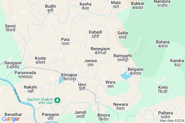
Janwa
Janwa Map
EDIT Map
Add Your House
 ..
..
Current Corona Virus Infected Patients Count in Balaghat District
| City Name | District Name | Total Covid cases |
|---|
Locality Name :
Janwa
( जणवा )
Tehsil Name : Kirnapur
District : Balaghat
State : Madhya Pradesh
Division : Jabalpur
Language : Hindi and Marathi
Current Time 07:32 AM
Date: Saturday , Apr 26,2025 (IST)
Time zone: IST (UTC+5:30)
Elevation / Altitude: 295 meters. Above Seal level
Telephone Code / Std Code: 07635
Assembly constituency : Lanji assembly constituency
Assembly MLA : Rajkumar Karrahe
Lok Sabha constituency : Balaghat parliamentary constituency
Parliament MP : DR DHAL SINGH BISEN
Serpanch Name :
Pin Code : 481115
Post Office Name : Kirnapur
Commodities Prices : Gondiya Market / Mandi
Janwa Live Weather
Temperature: 29.0 °C
scattered clouds
Humidity: 22%
Wind : 1.09 mt/sec towards S
StationName : "GondiÄ\u0081"
observed on 2 Hours Back
Temperature: 29.0 °C
scattered clouds
Humidity: 22%
Wind : 1.09 mt/sec towards S
StationName : "GondiÄ\u0081"
observed on 2 Hours Back
Janwa Weather Forecast for Next 5 days
27-04-2025
28.6°C to 43.1°C
scattered clouds, few clouds, clear sky, light rain, overcast clouds
28.6°C to 43.1°C
scattered clouds, few clouds, clear sky, light rain, overcast clouds
28-04-2025
26.5°C to 39.9°C
broken clouds, clear sky, scattered clouds, overcast clouds
26.5°C to 39.9°C
broken clouds, clear sky, scattered clouds, overcast clouds
29-04-2025
25.4°C to 41.7°C
scattered clouds, clear sky, few clouds, broken clouds
25.4°C to 41.7°C
scattered clouds, clear sky, few clouds, broken clouds
30-04-2025
27.1°C to 43.2°C
scattered clouds, clear sky, few clouds, broken clouds
27.1°C to 43.2°C
scattered clouds, clear sky, few clouds, broken clouds
National Highways Reachable To Janwa
Nationa High Way :NH543
Nationa High Way :NH753;NH543
Nationa High Way :NH543
Nationa High Way :NH753;NH543
Rivers Near Janwa
Chadan
Ghisri
Chadan
Ghisri
About Janwa
Correct below Info and add more info about JanwaJanwa is a Village in Kirnapur Tehsil in Balaghat District of Madhya Pradesh State, India. It belongs to Jabalpur Division . It is located 31 KM towards South from District head quarters Balaghat. 1 KM from Kirnapur. 412 KM from State capital Bhopal
Janwa Pin code is 481115 and postal head office is Kirnapur .
Benegaon ( 2 KM ) , Ramgarhi ( 2 KM ) , Hirri ( 3 KM ) , Kirnapur ( 3 KM ) , Dahedi ( 3 KM ) are the nearby Villages to Janwa. Janwa is surrounded by Lanji Tehsil towards South , Gondia Tehsil towards South , Balaghat Tehsil towards North , Amgaon Tehsil towards South .
Gondiya , Balaghat , Wara Seoni , Tirora are the near by Cities to Janwa.
Janwa 2011 Census Details
Janwa Local Language is Hindi. Janwa Village Total population is 1152 and number of houses are 270. Female Population is 49.6%. Village literacy rate is 68.8% and the Female Literacy rate is 29.3%.
Population
| Census Parameter | Census Data |
| Total Population | 1152 |
| Total No of Houses | 270 |
| Female Population % | 49.6 % ( 571) |
| Total Literacy rate % | 68.8 % ( 792) |
| Female Literacy rate | 29.3 % ( 338) |
| Scheduled Tribes Population % | 14.8 % ( 171) |
| Scheduled Caste Population % | 5.8 % ( 67) |
| Working Population % | 54.0 % |
| Child(0 -6) Population by 2011 | 125 |
| Girl Child(0 -6) Population % by 2011 | 46.4 % ( 58) |
Janwa Census More Deatils.
Politics in Janwa
Bharatiya Janata Party , BJP , INC are the major political parties in this area.Polling Stations /Booths near Janwa
1)Laveri-12)Kirnapur-4
3)Dhoriya Parsawada
4)Hirri-1
5)Hirri-3
HOW TO REACH Janwa
By Rail
There is no railway station near to Janwa in less than 10 km.Colleges near Janwa
Govt.college Kirnapur
Address :
Schools in Janwa
Gps Janwa
Address : janwa , kirnapur , balaghat , Madhya Pradesh . PIN- 481115 , Post - Kirnapur
Govt Health Centers near Janwa
1) SHC Laweri , Sub Health Centre , , NEAR GOVT SCHOOL2) SHC Hirree , Sub Health Centre , , Bajar Chouk, Near Bus Stand
3) CHC Kirnapur , Community Health Centre , Lanji Balaghat road, , Beside Gram Panchayat Bhawan
Hospitals in Janwa,Kirnapur
तनुश्री क्लिनिक आयुर्वेदीक केयर सेंटर
Govt; Utkrusht Vidyalay; Infront Of Sai Computers; Lanji Road; Kirnapur; Dist; Madhya Pradesh 481115; India
3.4 KM distance Detail
more ..
Petrol Bunks in Janwa,Kirnapur
HP PETROL PUMP - KHYATI PETROLEUM
HPC Dealer KH NO 130/13;PH NO 01 Village Bhanegaon; Jabalpur; Madhya Pradesh 481115; India
9.7 KM distance Detail
more ..
Colleges in Janwa,Kirnapur
govt Art and Sci college kirnapur
Gujri Rd; Kirnapur; Madhya Pradesh 481115; India
3.6 KM distance Detail
more ..
Super Markets in Janwa,Kirnapur
Mohare Traders Kirnapur
near dhanlaxmi kirana; Gujri Rd; Kalyani Kunj; Kirnapur; Madhya Pradesh 481115; India
3.6 KM distance Detail
About Janwa &
History
How to reach Janwa
Tourist Places Near By Janwa
Schools in Janwa
Colleges in Janwa
Temperature & weather of Janwa
places in Janwa
Janwa photos
More Information
How to reach Janwa
Tourist Places Near By Janwa
Schools in Janwa
Colleges in Janwa
Temperature & weather of Janwa
places in Janwa
Janwa photos
More Information
Village Talk
Post News or Events about this Village
Near Cities
Gondiya 29 KM near
Balaghat 29 KM near
Wara Seoni 39 KM near
Tirora 57 KM near
Gondiya 29 KM near
Balaghat 29 KM near
Wara Seoni 39 KM near
Tirora 57 KM near
Near By Taluks
Kirnapur 1 KM near
Lanji 26 KM near
Gondia 27 KM near
Balaghat 31 KM near
Kirnapur 1 KM near
Lanji 26 KM near
Gondia 27 KM near
Balaghat 31 KM near
Near By Air Ports
Jabalpur Airport 137 KM near
Sonegaon Airport 165 KM near
Raipur Airport 169 KM near
Khajuraho Airport 399 KM near
Jabalpur Airport 137 KM near
Sonegaon Airport 165 KM near
Raipur Airport 169 KM near
Khajuraho Airport 399 KM near
Near By Tourist Places
Kanha National park 85 KM near
Pench National Park 91 KM near
Bhandara 101 KM near
Rajnandgaon 103 KM near
Seoni 109 KM near
Kanha National park 85 KM near
Pench National Park 91 KM near
Bhandara 101 KM near
Rajnandgaon 103 KM near
Seoni 109 KM near
Near By Districts
Gondia 29 KM near
Balaghat 29 KM near
Bhandara 99 KM near
Rajnandgaon 103 KM near
Gondia 29 KM near
Balaghat 29 KM near
Bhandara 99 KM near
Rajnandgaon 103 KM near
Near By RailWay Station
Gondia Junction Rail Way Station 29 KM near
Amgaon Rail Way Station 34 KM near
Gondia Junction Rail Way Station 29 KM near
Amgaon Rail Way Station 34 KM near