| Home | City Bus | Maps | Villages | Cities | Rail | Tourist Places | School | College | Pin Codes | Corona Cases Count |
| Distance Calculator Bus Services IFSC Codes Trace Mobile Number Weather Search Place Trace IP Available Cash ATM/Banks Locate Polling Booth Report an Error contact People |
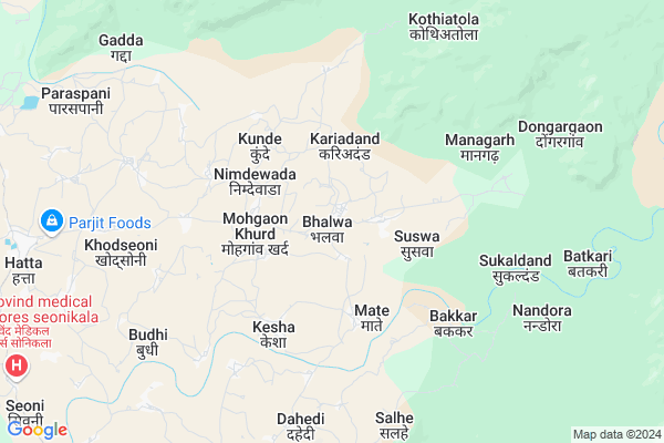
Bhalwa
Bhalwa Map
EDIT Map
Add Your House
 ..
..
Current Corona Virus Infected Patients Count in Balaghat District
| City Name | District Name | Total Covid cases |
|---|
Locality Name :
Bhalwa
( भलवा )
Tehsil Name : Kirnapur
District : Balaghat
State : Madhya Pradesh
Division : Jabalpur
Language : Hindi and Marathi
Current Time 04:46 PM
Date: Tuesday , Apr 29,2025 (IST)
Time zone: IST (UTC+5:30)
Elevation / Altitude: 295 meters. Above Seal level
Telephone Code / Std Code: 07635
Assembly constituency : Lanji assembly constituency
Assembly MLA : Rajkumar Karrahe
Lok Sabha constituency : Balaghat parliamentary constituency
Parliament MP : DR DHAL SINGH BISEN
Serpanch Name :
Pin Code : 481226
Post Office Name : Hatta (Balaghat)
Commodities Prices : Balaghat Market / Mandi
National Highways Reachable To Bhalwa
Nationa High Way :NH543
Nationa High Way :NH753;NH543
Nationa High Way :NH543
Nationa High Way :NH753;NH543
Rivers Near Bhalwa
Chadan
Ghisri
Chadan
Ghisri
About Bhalwa
Correct below Info and add more info about BhalwaBhalwa is a Village in Kirnapur Tehsil in Balaghat District of Madhya Pradesh State, India. It belongs to Jabalpur Division . It is located 24 KM towards East from District head quarters Balaghat. 10 KM from Kirnapur. 407 KM from State capital Bhopal
Bhalwa Pin code is 481226 and postal head office is Hatta (Balaghat).
Kariadand ( 3 KM ) , Suswa ( 3 KM ) , Nimdewada ( 3 KM ) , Kunde ( 3 KM ) , Kesha ( 4 KM ) are the nearby Villages to Bhalwa. Bhalwa is surrounded by Balaghat Tehsil towards west , Lanji Tehsil towards South , Gondia Tehsil towards South , Waraseoni Tehsil towards west .
Balaghat , Wara Seoni , Gondiya , Malajkhand are the near by Cities to Bhalwa.
Bhalwa 2011 Census Details
Bhalwa Local Language is Hindi. Bhalwa Village Total population is 2138 and number of houses are 470. Female Population is 50.1%. Village literacy rate is 66.7% and the Female Literacy rate is 30.9%.
Population
| Census Parameter | Census Data |
| Total Population | 2138 |
| Total No of Houses | 470 |
| Female Population % | 50.1 % ( 1072) |
| Total Literacy rate % | 66.7 % ( 1426) |
| Female Literacy rate | 30.9 % ( 661) |
| Scheduled Tribes Population % | 8.4 % ( 179) |
| Scheduled Caste Population % | 14.0 % ( 299) |
| Working Population % | 51.6 % |
| Child(0 -6) Population by 2011 | 272 |
| Girl Child(0 -6) Population % by 2011 | 44.9 % ( 122) |
Bhalwa Census More Deatils.
Politics in Bhalwa
Bharatiya Janata Party , BJP , INC are the major political parties in this area.Polling Stations /Booths near Bhalwa
1)Laveri-22)Kesa-1
3)Kariyadand-1
4)Kunde-1
5)Devalgaon-2
HOW TO REACH Bhalwa
By Rail
There is no railway station near to Bhalwa in less than 10 km.Colleges near Bhalwa
Govt.college Kirnapur
Address :
Schools in Bhalwa
Gn Ms Bhalva
Address : bhalwa , kirnapur , balaghat , Madhya Pradesh . PIN- 481226 , Post - Hatta (Balaghat)
Govt Health Centers near Bhalwa
1) SHC Mohgaonkhurd , Sub Health Centre , , Near Gram Panchayat Building2) SHC Mate , Sub Health Centre , Near PHC Building ,
3) PHC Mate , Primary Health Centre , Mate ,
Hospitals in Bhalwa,Kirnapur
Dr. Dekwar's Ayushman Hospital
Bala Ghat to Lalji Rd; Sarad Sioni; Gunai; Kirnapur; Madhya Pradesh 481226; India
10.6 KM distance Detail
more ..
Colleges in Bhalwa,Kirnapur
govt Art and Sci college kirnapur
Gujri Rd; Kirnapur; Madhya Pradesh 481115; India
14.2 KM distance Detail
more ..
Electronic Shops in Bhalwa,Kirnapur
Jamre Mobile Shop Mohgaon Khurd
jamre mobile shop Mohgaon Khurd; Madhya Pradesh; India
2.6 KM distance Detail
Ravi Electricals & Agriculture Center
Mohgaon Khurd; Madhya Pradesh 481226; India
2.9 KM distance Detail
Super Markets in Bhalwa,Kirnapur
Mohare Traders Kirnapur
near dhanlaxmi kirana; Gujri Rd; Kalyani Kunj; Kirnapur; Madhya Pradesh 481115; India
14.2 KM distance Detail
Local Parks in Bhalwa,Kirnapur
Railway Colony Garden
Chitragupt Nagar; Balaghat; Madhya Pradesh 481001; India
23.1 KM distance Detail
Police Stations near Bhalwa,Kirnapur
New Police Station
Lanji-Balaghat Rd; Kirnapur; Madhya Pradesh 481115; India
14.3 KM distance Detail
About Bhalwa &
History
How to reach Bhalwa
Tourist Places Near By Bhalwa
Schools in Bhalwa
Colleges in Bhalwa
Temperature & weather of Bhalwa
places in Bhalwa
Bhalwa photos
More Information
How to reach Bhalwa
Tourist Places Near By Bhalwa
Schools in Bhalwa
Colleges in Bhalwa
Temperature & weather of Bhalwa
places in Bhalwa
Bhalwa photos
More Information
Village Talk
Post News or Events about this Village
Near Cities
Balaghat 22 KM near
Wara Seoni 37 KM near
Gondiya 38 KM near
Malajkhand 51 KM near
Balaghat 22 KM near
Wara Seoni 37 KM near
Gondiya 38 KM near
Malajkhand 51 KM near
Near By Taluks
Kirnapur 10 KM near
Balaghat 23 KM near
Lanji 34 KM near
Gondia 37 KM near
Kirnapur 10 KM near
Balaghat 23 KM near
Lanji 34 KM near
Gondia 37 KM near
Near By Air Ports
Jabalpur Airport 127 KM near
Sonegaon Airport 171 KM near
Raipur Airport 172 KM near
Khajuraho Airport 388 KM near
Jabalpur Airport 127 KM near
Sonegaon Airport 171 KM near
Raipur Airport 172 KM near
Khajuraho Airport 388 KM near
Near By Tourist Places
Kanha National park 74 KM near
Pench National Park 89 KM near
Seoni 104 KM near
Kawardha 106 KM near
Bhandara 108 KM near
Kanha National park 74 KM near
Pench National Park 89 KM near
Seoni 104 KM near
Kawardha 106 KM near
Bhandara 108 KM near
Near By Districts
Balaghat 23 KM near
Gondia 39 KM near
Seoni 104 KM near
Kabirdham 105 KM near
Balaghat 23 KM near
Gondia 39 KM near
Seoni 104 KM near
Kabirdham 105 KM near
Near By RailWay Station
Gondia Junction Rail Way Station 39 KM near
Amgaon Rail Way Station 45 KM near
Gondia Junction Rail Way Station 39 KM near
Amgaon Rail Way Station 45 KM near