| Home | City Bus | Maps | Villages | Cities | Rail | Tourist Places | School | College | Pin Codes | Corona Cases Count |
| Distance Calculator Bus Services IFSC Codes Trace Mobile Number Weather Search Place Trace IP Available Cash ATM/Banks Locate Polling Booth Report an Error contact People |
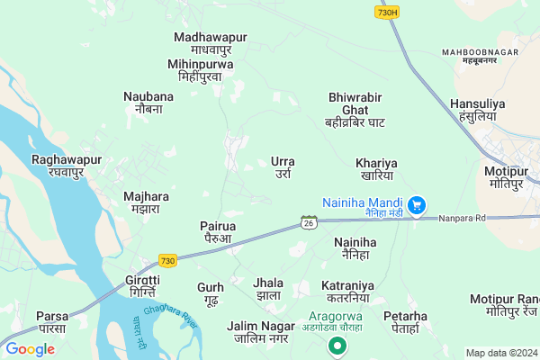
Urra
Urra Map
EDIT Map
Add Your House
 ..
..
Current Corona Virus Infected Patients Count in Bahraich District
| City Name | District Name | Total Covid cases |
|---|---|---|
| Bahraich District | Bahraich | 9 |
Locality Name :
Urra
( ुर्रा )
Block Name : Mihinpurwa
District : Bahraich
State : Uttar Pradesh
Division : Devipatan
Language : Hindi and Urdu, Awadhi
Current Time 07:27 AM
Date: Saturday , Apr 26,2025 (IST)
Time zone: IST (UTC+5:30)
Elevation / Altitude: 145 meters. Above Seal level
Telephone Code / Std Code: 05253
Assembly constituency : Balha assembly constituency
Assembly MLA : Saroj Sonkar
Lok Sabha constituency : Bahraich parliamentary constituency
Parliament MP : AKSHAIBAR LAL
Serpanch Name :
Pin Code : 271855
Post Office Name : Mihinpurwa
Commodities Prices : Mihipurwa Market / Mandi
Urra Live Weather
Temperature: 25.6 °C
clear sky
Humidity: 11%
Wind : 1.33 mt/sec towards N
StationName : "Dhaurahra"
observed on 2 Hours Back
Temperature: 25.6 °C
clear sky
Humidity: 11%
Wind : 1.33 mt/sec towards N
StationName : "Dhaurahra"
observed on 2 Hours Back
Urra Weather Forecast for Next 5 days
27-04-2025
25.3°C to 43.0°C
clear sky, scattered clouds, broken clouds
25.3°C to 43.0°C
clear sky, scattered clouds, broken clouds
28-04-2025
28.0°C to 43.0°C
broken clouds, overcast clouds, scattered clouds
28.0°C to 43.0°C
broken clouds, overcast clouds, scattered clouds
29-04-2025
26.9°C to 40.9°C
overcast clouds, broken clouds, scattered clouds, clear sky
26.9°C to 40.9°C
overcast clouds, broken clouds, scattered clouds, clear sky
30-04-2025
27.3°C to 39.3°C
overcast clouds, broken clouds, clear sky, scattered clouds
27.3°C to 39.3°C
overcast clouds, broken clouds, clear sky, scattered clouds
Rivers Near Urra
Bhada River
Man Khola
Bhada River
Man Khola
About Urra
Correct below Info and add more info about UrraUrra is a Village in Mihinpurwa Block in Bahraich District of Uttar Pradesh State, India. It belongs to Devipatan Division . It is located 69 KM towards North from District head quarters Bahraich. 5 KM from Mihi Purwa. 159 KM from State capital Lucknow
Urra Pin code is 271855 and postal head office is Mihinpurwa .
Khariya ( 4 KM ) , Jhala ( 5 KM ) , Majhara ( 6 KM ) , Gurh ( 6 KM ) , Naubana ( 6 KM ) are the nearby Villages to Urra. Urra is surrounded by Balaha Block towards East , Dhaurhara Block towards west , Isanagar Block towards South , Ramia Behar Block towards west .
Nanpara , Kheri , Lakhimpur , Laharpur are the near by Cities to Urra.
This Place is in the border of the Bahraich District and Kheri District. Kheri District Isanagar is South towards this place .
Urra 2011 Census Details
Urra Local Language is Hindi. Urra Village Total population is 10943 and number of houses are 1938. Female Population is 47.6%. Village literacy rate is 32.9% and the Female Literacy rate is 12.4%.
Population
| Census Parameter | Census Data |
| Total Population | 10943 |
| Total No of Houses | 1938 |
| Female Population % | 47.6 % ( 5212) |
| Total Literacy rate % | 32.9 % ( 3597) |
| Female Literacy rate | 12.4 % ( 1353) |
| Scheduled Tribes Population % | 0.0 % ( 0) |
| Scheduled Caste Population % | 13.5 % ( 1474) |
| Working Population % | 35.3 % |
| Child(0 -6) Population by 2011 | 2035 |
| Girl Child(0 -6) Population % by 2011 | 48.8 % ( 994) |
Urra Census More Deatils.
Politics in Urra
BJP , BjP , SP , BSP are the major political parties in this area.Polling Stations /Booths near Urra
1)P.s.-gulahriya Jagtapur R.n.-22)P.s.-tepri (gudhu) R.n.-1
3)P.s.-urra First R.n.-1
4)U.p.s.-urra R.n.-1
5)P.s.-urra R.n.-1
HOW TO REACH Urra
By Rail
Kakraha Rest House Rail Way Station , Murthiha Rail Way Station are the very nearby railway stations to Urra.Colleges near Urra
Dr.ram Manohar Lohiya Inter College Babhaniya Fata Mihinpurwa Bahraich
Address :
J D Inter College Bojhiya Bahraich
Address :
Sarvoday Inter College
Address :
J D Inter College Bojhiya Bahraich
Address : Bojhiya Mihinpurwa Bahraich 271855
J D Inter College Bojhiya Bahraich
Address : Bojhiya Mihinpurwa Bahraich 271855
Schools in Urra
Dhruw G.l.m.school Urra
Address :
Govt Health Centers near Urra
1) Shahpur-Kala , , ,2) DAULATPUR , , ,
3) Kanjarava , , ,
Sub Villages in Urra
Hospitals in Urra,Mihinpurwa
Seva Poly Clinic
Near Budh Vihar; Urra; Bahraich;; Urra; Uttar Pradesh 271855; India
2.0 KM distance Detail
more ..
Petrol Bunks in Urra,Mihinpurwa
HP PETROL PUMP - STAR AUTOMOTIVE SERVICES
HP Dealers Mihinpurwa DT; Lucknow; Uttar Pradesh 271855; India
11.8 KM distance Detail
more ..
Colleges in Urra,Mihinpurwa
Dr Ram Manoher Lohiya Inter Collage Babhniya Fata Bahraich Up
Babhaniya Fata; Uttar Pradesh 271855; India
10.6 KM distance Detail
Dr. Ram Manohar Lohiya Intet College
Babhaniya Fata; Mihinpurwa; Uttar Pradesh 271855; India
10.9 KM distance Detail
more ..
Local Parks in Urra,Mihinpurwa
Governement Offices near Urra,Mihinpurwa
Forest Range Office and Tourist Cottages
Motipur; Uttar Pradesh 271855; India
9.7 KM distance Detail
About Urra &
History
How to reach Urra
Tourist Places Near By Urra
Schools in Urra
Colleges in Urra
Temperature & weather of Urra
places in Urra
Urra photos
More Information
How to reach Urra
Tourist Places Near By Urra
Schools in Urra
Colleges in Urra
Temperature & weather of Urra
places in Urra
Urra photos
More Information
Village Talk
Post News or Events about this Village
Near Cities
Nanpara 31 KM near
Kheri 54 KM near
Lakhimpur 56 KM near
Laharpur 57 KM near
Nanpara 31 KM near
Kheri 54 KM near
Lakhimpur 56 KM near
Laharpur 57 KM near
Near By Taluks
Mihinpurwa 5 KM near
Dhaurhara 24 KM near
Balaha 24 KM near
Isanagar 26 KM near
Mihinpurwa 5 KM near
Dhaurhara 24 KM near
Balaha 24 KM near
Isanagar 26 KM near
Near By Air Ports
Amausi Airport 163 KM near
Kanpur Airport 224 KM near
Pantnagar Airport 233 KM near
Gorakhpur Airport 287 KM near
Amausi Airport 163 KM near
Kanpur Airport 224 KM near
Pantnagar Airport 233 KM near
Gorakhpur Airport 287 KM near
Near By Tourist Places
Naimisharanya 87 KM near
Sravasti 98 KM near
Lucknow 152 KM near
Khatima 181 KM near
Tanakpur 182 KM near
Naimisharanya 87 KM near
Sravasti 98 KM near
Lucknow 152 KM near
Khatima 181 KM near
Tanakpur 182 KM near
Near By Districts
Kheri 56 KM near
Bahraich 66 KM near
Sitapur 87 KM near
Shravasti 105 KM near
Kheri 56 KM near
Bahraich 66 KM near
Sitapur 87 KM near
Shravasti 105 KM near
Near By RailWay Station
Sitapur Cantt. Rail Way Station 86 KM near
Jarwal Road Rail Way Station 116 KM near
Sitapur Cantt. Rail Way Station 86 KM near
Jarwal Road Rail Way Station 116 KM near