| Home | City Bus | Maps | Villages | Cities | Rail | Tourist Places | School | College | Pin Codes | Corona Cases Count |
| Distance Calculator Bus Services IFSC Codes Trace Mobile Number Weather Search Place Trace IP Available Cash ATM/Banks Locate Polling Booth Report an Error contact People |
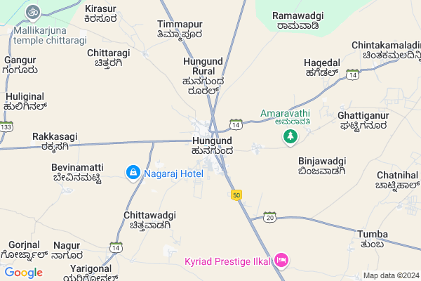
Hungund Map
EDIT Map
Add Your House
 ..
..
Current Corona Virus Infected Patients Count in Bagalkot District
| City Name | District Name | Total Covid cases |
|---|---|---|
| Bagalkote District | Bagalkote | 13 |
| Mudhol | Bagalkote | 8 |
| Jamakhandi | Bagalkote | 2 |
| Jamkhandi | Bagalkote | 1 |
Locality Name :
Hungund
( ಹುನಗುಂದ್ )
Taluk Name : Hungund
District : Bagalkot
State : Karnataka
Division : Belgaum
Language : Kannada and Konkani, Telugu, English
Current Time 07:30 AM
Date: Saturday , Apr 26,2025 (IST)
Time zone: IST (UTC+5:30)
Elevation / Altitude: 508 meters. Above Seal level
Telephone Code / Std Code: 08351
Assembly constituency : Hungund assembly constituency
Assembly MLA : Kashappanavara Vijayanand Shivashankrappa
Lok Sabha constituency : Bagalkot parliamentary constituency
Parliament MP : Gaddigoudar Parvatagouda Chandanagouda
Serpanch Name :
Pin Code : 587118
Post Office Name : Hungund
Commodities Prices : Kustagi Market / Mandi
Hungund Live Weather
Temperature: 31.0 °C
broken clouds
Humidity: 40%
Wind : 1.78 mt/sec towards N
StationName : "Hungund"
observed on 2 Hours Back
Temperature: 31.0 °C
broken clouds
Humidity: 40%
Wind : 1.78 mt/sec towards N
StationName : "Hungund"
observed on 2 Hours Back
Hungund Weather Forecast for Next 5 days
27-04-2025
30.6°C to 37.8°C
broken clouds, scattered clouds, light rain, overcast clouds
30.6°C to 37.8°C
broken clouds, scattered clouds, light rain, overcast clouds
28-04-2025
28.9°C to 35.8°C
overcast clouds, broken clouds, clear sky, scattered clouds
28.9°C to 35.8°C
overcast clouds, broken clouds, clear sky, scattered clouds
29-04-2025
27.8°C to 39.1°C
broken clouds, clear sky, scattered clouds, overcast clouds, few clouds
27.8°C to 39.1°C
broken clouds, clear sky, scattered clouds, overcast clouds, few clouds
30-04-2025
26.2°C to 39.6°C
few clouds, clear sky
26.2°C to 39.6°C
few clouds, clear sky
National Highways Reachable To Hungund
Nationa High Way :NH50
Nationa High Way :NH367
Nationa High Way :NH50
Nationa High Way :NH367
Rivers Near Hungund
Malaprabha :ಮಲಪ್ರಭಾ
Malaprabha :ಮಲಪ್ರಭಾ
Malaprabha :ಮಲಪ್ರಭಾ
Malaprabha :ಮಲಪ್ರಭಾ
About Hungund
Correct below Info and add more info about HungundHungund is a Town in Hungund Taluk in Bagalkot District of Karnataka State, India. It belongs to Belgaum Division . It is located 50 KM towards East from District head quarters Bagalkot. It is a Taluk head quarter.
Hungund Pin code is 587118 and postal head office is Hungund .
Binjawadgi ( 6 KM ) , Rakkasagi ( 9 KM ) , Belgal ( 10 KM ) , Nagur ( 10 KM ) , Dhannur ( 12 KM ) are the nearby Villages to Hungund. Hungund is surrounded by Kushtagi Taluk towards South , Muddebihal Taluk towards North , Bagalkot Taluk towards west , Badami Taluk towards west .
Muddebihal , Lingsugur , Ron , Talikota are the nearby Cities to Hungund.
Demographics of Hungund
Kannada is the Local Language here.Politics in Hungund
JD(U) , Bharatiya Janata Party , BJP , Bharatiya Janata Party (BJP) , INC are the major political parties in this area.Polling Stations /Booths near Hungund
1)Govt Higher Primary School No 9 ( West Side ) Ilkal2)V M High School (east Wing ) Hungund
3)Govt Lower Primary School(east Wing) Maratageri
4)T M C Right Side Ilkal
5)Grama Panchayat Office (new Building) Gudur Sc
HOW TO REACH Hungund
By Rail
There is no railway station near to Hungund in less than 10 km. Mugalalli Halt Rail Way Station (near to Bagalkot) , Bagalkot Junction Rail Way Station (near to Bagalkot) are the Rail way stations reachable from near by towns.By Road
Ilkal , Gajendragarh , Bagalkot are the nearby by towns to Hungund having road connectivity to HungundGovt Health Centers near Hungund
1) Sirur , Sirur , Sirur , Sirur2) Nalatwad CHC , Government Hospital Nalatwad , CHC Nalatwad , Main road Nalatwad
3) Tavargera-A , Sub Centre Tavargera A , Mudagal Road ,
Petrol Bunks in Hungund,Hungund
Indian Oil Corporation Ltd: VIJAY OIL AGENCIES
Ilkal Gate; Hungund; Bagalkot - Raichur Highway; Nagaral; Karnataka 587118; India
2.2 KM distance Detail
Hindustan Petroleum
Bagalkot; NH-13; Solapur Mangalore Highway; Hungund; Hungund; Karnataka 587125; India
3.1 KM distance Detail
HP PETROL PUMP - SAI PETROLEUMS
NH 13; NO 356 1 A; Solapur Chitradur Road; Hungund; Belgaum; Karnataka 587118; India
3.1 KM distance Detail
more ..
Colleges in Hungund,Hungund
International Vachana Studies Centre
Kudalasangama; Hungund; Karnataka 587118; India
0.2 KM distance Detail
more ..
Electronic Shops in Hungund,Hungund
Riyaz Mulla Motor rewinding Electrical Work
Bachi - Raichur Hwy; Hungund; Karnataka 587118; India
0.1 KM distance Detail
About Hungund &
History
How to reach Hungund
Tourist Places Near By Hungund
Schools in Hungund
Colleges in Hungund
Temperature & weather of Hungund
places in Hungund
Hungund photos
More Information
How to reach Hungund
Tourist Places Near By Hungund
Schools in Hungund
Colleges in Hungund
Temperature & weather of Hungund
places in Hungund
Hungund photos
More Information
Town Talk
Post News or Events about this Town
Near Cities
Muddebihal 35 KM near
Lingsugur 48 KM near
Ron 60 KM near
Talikota 60 KM near
Muddebihal 35 KM near
Lingsugur 48 KM near
Ron 60 KM near
Talikota 60 KM near
Near By Taluks
Hungund 0 KM near
Kushtagi 33 KM near
Muddebihal 37 KM near
Bagalkot 43 KM near
Hungund 0 KM near
Kushtagi 33 KM near
Muddebihal 37 KM near
Bagalkot 43 KM near
Near By Air Ports
Hubli Airport 145 KM near
Sambre Airport 174 KM near
Sholapur Airport 196 KM near
Kolhapur Airport 219 KM near
Hubli Airport 145 KM near
Sambre Airport 174 KM near
Sholapur Airport 196 KM near
Kolhapur Airport 219 KM near
Near By Tourist Places
Aihole 21 KM near
Pattadakkal 32 KM near
Badami 49 KM near
Hampi 102 KM near
Bijapur 103 KM near
Aihole 21 KM near
Pattadakkal 32 KM near
Badami 49 KM near
Hampi 102 KM near
Bijapur 103 KM near
Near By Districts
Bagalkot 47 KM near
Koppal 90 KM near
Gadag 93 KM near
Bijapur District 103 KM near
Bagalkot 47 KM near
Koppal 90 KM near
Gadag 93 KM near
Bijapur District 103 KM near
Near By RailWay Station
Almatti Rail Way Station 40 KM near
Bagalkot Junction Rail Way Station 45 KM near
Almatti Rail Way Station 40 KM near
Bagalkot Junction Rail Way Station 45 KM near