| Home | City Bus | Maps | Villages | Cities | Rail | Tourist Places | School | College | Pin Codes | Corona Cases Count |
| Distance Calculator Bus Services IFSC Codes Trace Mobile Number Weather Search Place Trace IP Available Cash ATM/Banks Locate Polling Booth Report an Error contact People |
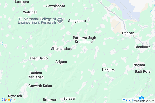
Bugroo A
Bugroo A Map
EDIT Map
Add Your House
 ..
..
Current Corona Virus Infected Patients Count in Badgam District
| City Name | District Name | Total Covid cases |
|---|
Locality Name :
Bugroo A
( बगरू ा )
Block Name : Khan-sahib
District : Badgam
State : Jammu & Kashmir
Language : Hindi and Urdu
Current Time 08:30 PM
Date: Wednesday , Feb 05,2025 (IST)
Time zone: IST (UTC+5:30)
Elevation / Altitude: 1668 meters. Above Seal level
Telephone Code / Std Code: 01951
Assembly constituency : assembly constituency
Assembly MLA :
Lok Sabha constituency : parliamentary constituency
Parliament MP :
Serpanch Name :
Pin Code : 191111
Post Office Name : Budgam
Commodities Prices : Parimpore Market / Mandi
Bugroo A Live Weather
Temperature: 2.5 °C
few clouds
Humidity: 68%
Wind : 2.47 mt/sec towards NW
StationName : "TsrÄ\u0081r SharÄ«f"
observed on 1 Hours Back
Temperature: 2.5 °C
few clouds
Humidity: 68%
Wind : 2.47 mt/sec towards NW
StationName : "TsrÄ\u0081r SharÄ«f"
observed on 1 Hours Back
Bugroo A Weather Forecast for Next 5 days
06-02-2025
-1.4°C to 1.8°C
light snow, scattered clouds, broken clouds
-1.4°C to 1.8°C
light snow, scattered clouds, broken clouds
07-02-2025
-2.4°C to 5.9°C
broken clouds, scattered clouds, clear sky
-2.4°C to 5.9°C
broken clouds, scattered clouds, clear sky
08-02-2025
-2.7°C to 6.4°C
clear sky, few clouds, scattered clouds, broken clouds
-2.7°C to 6.4°C
clear sky, few clouds, scattered clouds, broken clouds
09-02-2025
-1.5°C to 7.1°C
broken clouds, overcast clouds, scattered clouds
-1.5°C to 7.1°C
broken clouds, overcast clouds, scattered clouds
10-02-2025
1.6°C to 9.7°C
light rain, broken clouds, scattered clouds, overcast clouds
1.6°C to 9.7°C
light rain, broken clouds, scattered clouds, overcast clouds
Edit below overview about Bugroo A
About Bugroo, though it is not associated with any historical event; however it is unique in many ways. There is a beautiful shrine of Hazrat Syed Sahib (R.A).And there is big graveyard known as Astan Dagg .This is the main gate of Khansahib Constituency.This is very big village of about 1500 Houses. There is a Army camp of 53 RR.
Edit below overview about Bugroo A
OverView of Bugroo A
|
This z beautiful Hamlet. In every part of village, one can hear nature talking to him and enjoy lots of miracles of nature. I invite people to explore the beauty of Bugroo and Doodhpathri. You will really remember this for your life. Culture of people is very pure and simple. The youth of village is very educated and hold some key positions at the government level |
Edit below overview about Bugroo A
National Highways Reachable To Bugroo A
Nationa High Way :NH444
Nationa High Way :NH44
Nationa High Way :NH444
Nationa High Way :NH44
Rivers Near Bugroo A
Jhelum River :Jhelum River
Sukhnag River
Jhelum River :Jhelum River
Sukhnag River
About Bugroo A
Bugroo A is a Village in Khan-sahib Block in Badgam District of Jammu & Kashmir State, India. It is located 16 KM towards South from District head quarters Budgam. 6 KM from Khan-Sahib. 21 KM from State capital Srinagar, Jammu
Bugroo A Pin code is 191111 and postal head office is Budgam .
Khan-sahib ( 4 KM ) , Hushroo ( 4 KM ) , Sursyar-b (check) ( 5 KM ) , Choon ( 5 KM ) , Raithan ( 6 KM ) are the nearby Villages to Bugroo A. Bugroo A is surrounded by Chadoora Block towards East , Nagam Block towards East , Badgam Block towards North , Beerwah Block towards west .
Srinagar , Baramula , Sopore , Anantnag are the near by Cities to Bugroo A.
This Place is in the border of the Badgam District and Pulwama District. Pulwama District Pulwama is East towards this place .
Demographics of Bugroo A
Hindi is the Local Language here.HOW TO REACH Bugroo A
By Rail
There is no railway station near to Bugroo A in less than 10 km.Colleges near Bugroo A
Govt.degree College Khansahib
Address :
Schools near Bugroo A
Ms Bugroo
Address : bugroo , khansahib , badgam , Jammu & Kashmir . PIN- 191111 , Post - Budgam
Hs Raithan
Address : raithan , khansahib , badgam , Jammu & Kashmir . PIN- 191111 , Post - Budgam
Smiei Shamasabad
Address : shamasabad , khansahib , badgam , Jammu & Kashmir . PIN- 191111 , Post - Budgam
Hs Yarikhah
Address : yarikhah , khansahib , badgam , Jammu & Kashmir . PIN- 191111 , Post - Budgam
Govt Health Centers near Bugroo A
1) MAC Bugro , Auqaaf Building(Rented) , Bugroo Main Road , Near Jamia Masjid2) SC Lanora , Rented Building , Lanora A , Near Masjid Shareef
3) CHC Kremshore , Govt Building , Kremshore , Near Bus Stop
Hospitals in Bugroo A,Khan-sahib
Accurate Clinical Laboratory
White House Building; S V Rd; Fish Market Area; Navneeth Colony; Mumbai; Maharashtra 400058
1.9 KM distance Detail
more ..
Petrol Bunks in Bugroo A,Khan-sahib
HP PETROL PUMP - WALI HP FILLING STATION
Ichgam Budgam-chadoora Road Budgam; Jammu and Kashmir 191111
7.6 KM distance Detail
HP PETROL PUMP - GULSHAN FILLING SERVICE STATION
Badgam J+K; Jammu; Jammu and Kashmir 191111
10.8 KM distance Detail
more ..
Colleges in Bugroo A,Khan-sahib
Chinab Valley College of Education
Wagar - Shamas Abad Parnewa Road; Budgam; Srinagar; Jammu and Kashmir 190018
7.6 KM distance Detail
Government Polytechnic College
Nagam - Dalipora Link Street; Srinagar-Charar-i-Sharief Rd; Nagam; Jammu and Kashmir 191113
8.7 KM distance Detail
more ..
Super Markets in Bugroo A,Khan-sahib
Tantray Provisional Stores
Old Airport Rd; Wanabal; Rawalpora; Srinagar; Jammu and Kashmir 190019
13.2 KM distance Detail
Daily Needs Mart
GULSHAN NAGAR; Srinagar Bypass Road; Gulshan Nagar; Nowgam; Srinagar; 190015
16.4 KM distance Detail
Police Stations near Bugroo A,Khan-sahib
Police Station Chadoora
Chadoora Srinagar Road; Chadoora; Jammu and Kashmir 191113
9.3 KM distance Detail
Governement Offices near Bugroo A,Khan-sahib
Range Forest Office
01; Near Smart Communications; Chadoora; Jammu and Kashmir 191113
9.6 KM distance Detail
About Bugroo A &
History
How to reach Bugroo A
Tourist Places Near By Bugroo A
Schools in Bugroo A
Colleges in Bugroo A
Temperature & weather of Bugroo A
places in Bugroo A
Bugroo A photos
More Information
How to reach Bugroo A
Tourist Places Near By Bugroo A
Schools in Bugroo A
Colleges in Bugroo A
Temperature & weather of Bugroo A
places in Bugroo A
Bugroo A photos
More Information
Village Talk
Post News or Events about this Village
Near Cities
Srinagar 29 KM near
Baramula 48 KM near
Sopore 51 KM near
Anantnag 52 KM near
Srinagar 29 KM near
Baramula 48 KM near
Sopore 51 KM near
Anantnag 52 KM near
Near By Taluks
Khan-Sahib 6 KM near
Chadoora 7 KM near
Nagam 9 KM near
Badgam 10 KM near
Khan-Sahib 6 KM near
Chadoora 7 KM near
Nagam 9 KM near
Badgam 10 KM near
Near By Air Ports
Srinagar Airport 9 KM near
Satwari Airport 157 KM near
Pathankot Airport 235 KM near
Gaggal Airport 260 KM near
Srinagar Airport 9 KM near
Satwari Airport 157 KM near
Pathankot Airport 235 KM near
Gaggal Airport 260 KM near
Near By Tourist Places
Budgam 12 KM near
Yusmarg 14 KM near
Srinagar 20 KM near
Pulwama 27 KM near
Aharbal 30 KM near
Budgam 12 KM near
Yusmarg 14 KM near
Srinagar 20 KM near
Pulwama 27 KM near
Aharbal 30 KM near
Near By Districts
Badgam 16 KM near
Srinagar 20 KM near
Pulwama 21 KM near
Shopian 29 KM near
Badgam 16 KM near
Srinagar 20 KM near
Pulwama 21 KM near
Shopian 29 KM near
Near By RailWay Station
Udhampur Rail Way Station 134 KM near
Jammu Tawi Rail Way Station 154 KM near
Udhampur Rail Way Station 134 KM near
Jammu Tawi Rail Way Station 154 KM near