| Home | City Bus | Maps | Villages | Cities | Rail | Tourist Places | School | College | Pin Codes | Corona Cases Count |
| Distance Calculator Bus Services IFSC Codes Trace Mobile Number Weather Search Place Trace IP Available Cash ATM/Banks Locate Polling Booth Report an Error contact People |
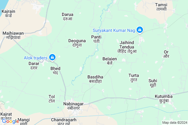
Simra
Simra Map
EDIT Map
Add Your House
 ..
..
Current Corona Virus Infected Patients Count in Aurangabad District
| City Name | District Name | Total Covid cases |
|---|---|---|
| Aurangabad District | Aurangabad | 2 |
Locality Name :
Simra
( सिमरा )
Block Name : Nabinagar
District : Aurangabad
State : Bihar
Division : Magadh
Language : Maithili and Hindi, Urdu
Current Time 12:08 PM
Date: Tuesday , Apr 29,2025 (IST)
Time zone: IST (UTC+5:30)
Elevation / Altitude: 140 meters. Above Seal level
Telephone Code / Std Code: 06332
Assembly constituency : Nabinagar assembly constituency
Assembly MLA : Vijay Kumar Singh Alias Dabloo Singh
Lok Sabha constituency : Karakat parliamentary constituency
Parliament MP : MAHABALI SINGH
Serpanch Name :
Pin Code : 824302
Post Office Name : Tandwa (Aurangabad(BH))
Main Village Name : SIMRA
Commodities Prices : Gadhwah Market / Mandi
Simra Live Weather
Temperature: 34.3 °C
overcast clouds
Humidity: 26%
Wind : 3.97 mt/sec towards E
StationName : "Nabīnagar"
observed on 2 Hours Back
Temperature: 34.3 °C
overcast clouds
Humidity: 26%
Wind : 3.97 mt/sec towards E
StationName : "Nabīnagar"
observed on 2 Hours Back
Simra Weather Forecast for Next 5 days
30-04-2025
26.3°C to 38.5°C
overcast clouds, broken clouds, scattered clouds, clear sky
26.3°C to 38.5°C
overcast clouds, broken clouds, scattered clouds, clear sky
01-05-2025
24.6°C to 40.6°C
clear sky, few clouds
24.6°C to 40.6°C
clear sky, few clouds
02-05-2025
25.3°C to 40.4°C
clear sky, scattered clouds, light rain
25.3°C to 40.4°C
clear sky, scattered clouds, light rain
03-05-2025
24.4°C to 40.2°C
clear sky, few clouds, light rain, broken clouds
24.4°C to 40.2°C
clear sky, few clouds, light rain, broken clouds
04-05-2025
27.2°C to 41.6°C
scattered clouds, light rain, few clouds, overcast clouds
27.2°C to 41.6°C
scattered clouds, light rain, few clouds, overcast clouds
Edit below overview about Simra
Edit below overview about Simra
OverView of Simra
Villagers are good. Janeswar Singh is the organiser of 1008 kund maha yagya of gayatriaswamegh. Which is going to be a huge success for his life.Edit below overview about Simra
National Highways Reachable To Simra
Nationa High Way :NH119
Nationa High Way :NH119
Rivers Near Simra
Morhar
Son
Morhar
Son
About Simra
Simra is a small Village/hamlet in Nabinagar Block in Aurangabad District of Bihar State, India. It comes under SIMRA Panchayath. It belongs to Magadh Division . It is located 29 KM towards west from District head quarters Aurangabad. 170 KM from State capital Patna
Simra Pin code is 824302 and postal head office is Tandwa (Aurangabad(BH)).
Simra is surrounded by Rohtas Block towards west , Kutumba Block towards East , Hariharganj Block towards South , Hussainabad Block towards South .
Hussainabad , Aurangabad , Dehri-on-Sone , Sasaram are the near by Cities to Simra.
This Place is in the border of the Aurangabad District and Palamu District. Palamu District Hussainabad is South towards this place . It is near to the Jharkhand State Border.
Simra 2011 Census Details
Simra Local Language is Maithili. Simra Village Total population is 691 and number of houses are 84. Female Population is 47.8%. Village literacy rate is 59.3% and the Female Literacy rate is 24.5%.
Population
| Census Parameter | Census Data |
| Total Population | 691 |
| Total No of Houses | 84 |
| Female Population % | 47.8 % ( 330) |
| Total Literacy rate % | 59.3 % ( 410) |
| Female Literacy rate | 24.5 % ( 169) |
| Scheduled Tribes Population % | 0.0 % ( 0) |
| Scheduled Caste Population % | 24.0 % ( 166) |
| Working Population % | 30.7 % |
| Child(0 -6) Population by 2011 | 117 |
| Girl Child(0 -6) Population % by 2011 | 46.2 % ( 54) |
Simra Census More Deatils.
Politics in Simra
JD(U) , LJP , BJP , Rashtriya Lok Samta Party , Janata Dal (United) , RJD are the major political parties in this area.Polling Stations /Booths near Simra
1)Utkramit Madhya Vidyalay Pandey Karama2)Urdu Prathamik Vidyalay Darua
3)Prathamik Vidyalay Ajanniya
4)Utkramit Madhya Vidyalay Badaki Reganiya
5)Prathamik Vidyalay Karama
HOW TO REACH Simra
By Rail
Nabinagar Road Rail Way Station is the very nearby railway stations to Simra. Nabinagar Road Rail Way Station (near to Nabinagar) , Kajrat Nawadih Rail Way Station (near to Nabinagar) , Dehri On Sone Rail Way Station (near to Dehri-on-Sone) , Advance Starter Rail Way Station (near to Dehri-on-Sone) are the Rail way stations reachable from near by towns.By Road
Nabinagar , Dehri-on-Sone are the nearby by towns to Simra having road connectivity to SimraColleges near Simra
D N College Daudnagar
Address :
Madanpur College Madanpur
Address : Madanpur Itkhoiya Bihar
Kci Computer Education
Address : Block Road New Area Goh
G.p.g Collage Itwan Haspura
Address : Itwan Haspura Aurangabad
Sri Bhagwat Prasad Singh Memorial B.ed College
Address : Sri Bhagwat Prasad Singh Memorial B.ed Collegedist
Schools in Simra
Govt. Pr.school, Simra
Address : simra , navinagar , aurangabad (bihar) , Bihar . PIN- 824302 , Post - Tandwa (Aurangabad(BH))
Govt Health Centers near Simra
1) Nabinagar , PHC Building , ,2) Chandragarh , Chandragarh , Chandragarh ,
3) Jharha , , ,
Hospitals in Simra,Nabinagar
Mahavir Medical Hall
tandwa road magadh multi speciality hospital; Nabinagar; Bihar; India
6.3 KM distance Detail
more ..
Colleges in Simra,Nabinagar
Gaureshvar narayan singh teacher training college
P.No-741;742;743;; Chandar Garh;Nabinagar; Aurahgabad; Bihar 824301; India
9.3 KM distance Detail
more ..
Schools in Simra,Nabinagar
Jaihind Tenua Upgraded Middle School
Nabinagar Rd; Jaihind Tendua; Bihar 824123; India
4.8 KM distance Detail
Electronic Shops in Simra,Nabinagar
Sarma Watch;New Area ;Nabinagar
Parasia - Nabinagar Road; Nabinagar; Bihar 824301; India
6.0 KM distance Detail
Super Markets in Simra,Nabinagar
Rajesh General Store ( Kirana Shop) ; Durga Chowk ; Sanichar Bazar
Nabinagar; Bihar 824301; India
6.2 KM distance Detail
Police Stations near Simra,Nabinagar
Mali thana (Police Station); Mali-Parariya
Nabinagar Rd; Bihar 824102; India
11.0 KM distance Detail
Governement Offices near Simra,Nabinagar
Magadh Multispeciality Hospitalnabinagar
Tandwa; road; Nabinagar; Bihar 824301; India
6.3 KM distance Detail
Block Cum Circle Office
Hariharganj; Palamu; NH-98; Aurangabad Road; Chhatarpur; Chhatarpur; Jharkhand 822131; India
19.9 KM distance Detail
About Simra &
History
How to reach Simra
Tourist Places Near By Simra
Schools in Simra
Colleges in Simra
Temperature & weather of Simra
places in Simra
Simra photos
More Information
How to reach Simra
Tourist Places Near By Simra
Schools in Simra
Colleges in Simra
Temperature & weather of Simra
places in Simra
Simra photos
More Information
Village Talk
Post News or Events about this Village
Near Cities
Hussainabad 8 KM near
Aurangabad 27 KM near
Dehri-on-Sone 32 KM near
Sasaram 40 KM near
Hussainabad 8 KM near
Aurangabad 27 KM near
Dehri-on-Sone 32 KM near
Sasaram 40 KM near
Near By Taluks
Nabinagar 0 KM near
Kutumba 16 KM near
Rohtas 16 KM near
Hariharganj 23 KM near
Nabinagar 0 KM near
Kutumba 16 KM near
Rohtas 16 KM near
Hariharganj 23 KM near
Near By Air Ports
Gaya Airport 90 KM near
Patna Airport 158 KM near
Varanasi Airport 176 KM near
Ranchi Airport 212 KM near
Gaya Airport 90 KM near
Patna Airport 158 KM near
Varanasi Airport 176 KM near
Ranchi Airport 212 KM near
Near By Tourist Places
Rohtasgarh Fort 26 KM near
Sasaram 40 KM near
Palamu 92 KM near
Bodh Gaya 94 KM near
Betla National Park 96 KM near
Rohtasgarh Fort 26 KM near
Sasaram 40 KM near
Palamu 92 KM near
Bodh Gaya 94 KM near
Betla National Park 96 KM near
Near By Districts
Aurangabad 28 KM near
Rohtas 40 KM near
Garhwa 71 KM near
Kaimur (Bhabua) 73 KM near
Aurangabad 28 KM near
Rohtas 40 KM near
Garhwa 71 KM near
Kaimur (Bhabua) 73 KM near
Near By RailWay Station
Nabinagar Road Rail Way Station 6.6 KM near
Ankorha Rail Way Station 14 KM near
Nabinagar Road Rail Way Station 6.6 KM near
Ankorha Rail Way Station 14 KM near