| Home | City Bus | Maps | Villages | Cities | Rail | Tourist Places | School | College | Pin Codes | Corona Cases Count |
| Distance Calculator Bus Services IFSC Codes Trace Mobile Number Weather Search Place Trace IP Available Cash ATM/Banks Locate Polling Booth Report an Error contact People |
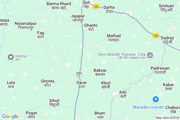
Motha
Motha Map
EDIT Map
Add Your House
 ..
..
Current Corona Virus Infected Patients Count in Aurangabad District
| City Name | District Name | Total Covid cases |
|---|---|---|
| Aurangabad District | Aurangabad | 2 |
Locality Name :
Motha
( मोठा )
Block Name : Goh
District : Aurangabad
State : Bihar
Division : Magadh
Language : Maithili and Hindi, Urdu
Current Time 12:24 PM
Date: Sunday , Apr 27,2025 (IST)
Time zone: IST (UTC+5:30)
Elevation / Altitude: 102 meters. Above Seal level
Telephone Code / Std Code: 06327
Assembly constituency : Goh assembly constituency
Assembly MLA : Bhim Kumar Singh
Lok Sabha constituency : Karakat parliamentary constituency
Parliament MP : MAHABALI SINGH
Serpanch Name :
Pin Code : 824129
Post Office Name : Rukundi Jhikatia
Main Village Name : Motha
Edit below overview about Motha
Edit below overview about Motha
OverView of Motha
Motha is small village under goh block. It comes under Dihuri panchyat. Pin Code of Motha is 824129 under Rukundi Post Office. Magahi is the language of village. Sun temple, Siv temple and Devi temple are main temple in the village. Here live various caste people with cooperation of each other. Prominent persons of the village is Dr Ramnandan Sharma, Jeetendra Sharma who have upgraded the status of the village in the ibid Panchayat.Edit below overview about Motha
National Highways Reachable To Motha
Nationa High Way :NH22
Nationa High Way :NH120
Nationa High Way :NH22
Nationa High Way :NH120
Rivers Near Motha
Son
Phalgu :फल्गु
Son
Phalgu :फल्गु
About Motha
Motha is a small Village/hamlet in Goh Block in Aurangabad District of Bihar State, India. It comes under Motha Panchayath. It belongs to Magadh Division . It is located 40 KM towards East from District head quarters Aurangabad. 5 KM from Goh. 105 KM from State capital Patna
Motha Pin code is 824129 and postal head office is Rukundi Jhikatia .
Bela ( 6 KM ) , Goh ( 6 KM ) , Malhad ( 7 KM ) , Bazar Barma ( 7 KM ) , Sihuli ( 8 KM ) are the nearby Villages to Motha. Motha is surrounded by Konch Block towards East , Rafiganj Block towards South , Haspura Block towards North , Guraru Block towards South .
Rafiganj , Daudnagar , Aurangabad , Makhdumpur are the near by Cities to Motha.
Motha 2011 Census Details
Motha Local Language is Maithili. Motha Village Total population is 1427 and number of houses are 214. Female Population is 48.6%. Village literacy rate is 60.2% and the Female Literacy rate is 24.2%.
Population
| Census Parameter | Census Data |
| Total Population | 1427 |
| Total No of Houses | 214 |
| Female Population % | 48.6 % ( 693) |
| Total Literacy rate % | 60.2 % ( 859) |
| Female Literacy rate | 24.2 % ( 346) |
| Scheduled Tribes Population % | 0.0 % ( 0) |
| Scheduled Caste Population % | 23.5 % ( 335) |
| Working Population % | 32.2 % |
| Child(0 -6) Population by 2011 | 246 |
| Girl Child(0 -6) Population % by 2011 | 51.6 % ( 127) |
Motha Census More Deatils.
Politics in Motha
JD(U) , BJP , Rashtriya Lok Samta Party , Janata Dal (United) , RJD are the major political parties in this area.Polling Stations /Booths near Motha
1)Madhya Vidyalay Chapuk Bayan Bhag2)Prathamik Vidhalay Piparahi
3)Uchch Vidyalay Amari Dayan Bhag
4)Utkramit Madhya Vidyalay Bhauli
5)Prathamik Vidhalay Kaithi Banakat
HOW TO REACH Motha
By Road
Rafiganj is the Nearest Town to Motha. Rafiganj is 18 km from Motha. Road connectivity is there from Rafiganj to Motha.By Rail
There is no railway station near to Motha in less than 10 km. How ever there are railway Stations from Near By town Rafiganj. are the railway Stations near to Rafiganj. You can reach from Rafiganj to Motha by road after .Colleges near Motha
Kci Computer Education
Address : Block Road New Area Goh
Schools in Motha
Primary School Motha
Address : motha , goh , aurangabad (bihar) , Bihar . PIN- 824219
Govt Health Centers near Motha
1) Malhad , , ,2) Rukundi , , ,
3) Mudwan , , ,
Hospitals in Motha,Goh
Jeewan Jyoti Clinic
Goh; Aurangabad; SH-7; Daudnagar Goh Road; Aurangabad; Aurangabad; Bihar 824203; India
7.6 KM distance Detail
more ..
Colleges in Motha,Goh
SPYNET COMPUTER EDUCATION
INFRONT OF PUNJAB NATIONAL BANK GAYA ROAD; Goh; Bihar 824203; India
7.9 KM distance Detail
Sanjay singh yadav college rafiganj
Obra - Rafiganj Road; Rafiganj; Bihar 824125; India
13.4 KM distance Detail
more ..
Schools in Motha,Goh
Government Urdu Middle School
Jaitiya; Goh; Aurangabad; SH-68; Aurangabad; Aurangabad; Bihar 824203; India
2.7 KM distance Detail
Local Parks in Motha,Goh
Rahmani Complex
Al madina masjid imam ahmad raza road; Taiba Nagar; Rafiganj; Bihar; India
13.7 KM distance Detail
Governement Offices near Motha,Goh
About Motha &
History
How to reach Motha
Tourist Places Near By Motha
Schools in Motha
Colleges in Motha
Temperature & weather of Motha
places in Motha
Motha photos
More Information
How to reach Motha
Tourist Places Near By Motha
Schools in Motha
Colleges in Motha
Temperature & weather of Motha
places in Motha
Motha photos
More Information
Village Talk
Post News or Events about this Village
Near Cities
Rafiganj 13 KM near
Daudnagar 34 KM near
Aurangabad 39 KM near
Makhdumpur 40 KM near
Rafiganj 13 KM near
Daudnagar 34 KM near
Aurangabad 39 KM near
Makhdumpur 40 KM near
Near By Taluks
Goh 6 KM near
Konch 11 KM near
Rafiganj 15 KM near
Haspura 18 KM near
Goh 6 KM near
Konch 11 KM near
Rafiganj 15 KM near
Haspura 18 KM near
Near By Air Ports
Gaya Airport 38 KM near
Patna Airport 97 KM near
Ranchi Airport 213 KM near
Varanasi Airport 213 KM near
Gaya Airport 38 KM near
Patna Airport 97 KM near
Ranchi Airport 213 KM near
Varanasi Airport 213 KM near
Near By Tourist Places
Bodh Gaya 45 KM near
Sasaram 72 KM near
Rohtasgarh Fort 92 KM near
Chatra 92 KM near
Kakolat 98 KM near
Bodh Gaya 45 KM near
Sasaram 72 KM near
Rohtasgarh Fort 92 KM near
Chatra 92 KM near
Kakolat 98 KM near
Near By Districts
Aurangabad 38 KM near
Arwal 40 KM near
Gaya 40 KM near
Jehanabad 51 KM near
Aurangabad 38 KM near
Arwal 40 KM near
Gaya 40 KM near
Jehanabad 51 KM near
Near By RailWay Station
Rafiganj Rail Way Station 12 KM near
Jakhim Rail Way Station 18 KM near
Rafiganj Rail Way Station 12 KM near
Jakhim Rail Way Station 18 KM near