| Home | City Bus | Maps | Villages | Cities | Rail | Tourist Places | School | College | Pin Codes | Corona Cases Count |
| Distance Calculator Bus Services IFSC Codes Trace Mobile Number Weather Search Place Trace IP Available Cash ATM/Banks Locate Polling Booth Report an Error contact People |
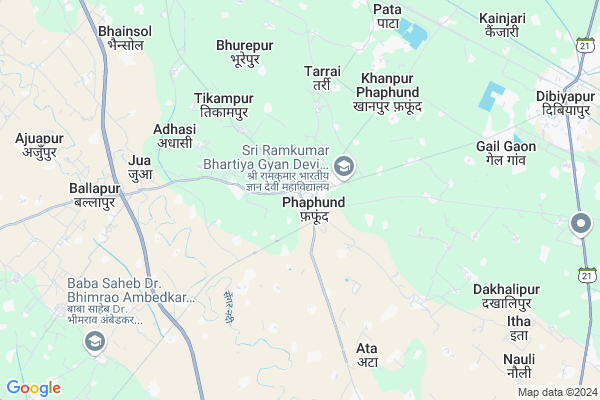
Phaphund
Phaphund Map
EDIT Map
Add Your House
 ..
..
Current Corona Virus Infected Patients Count in Auraiya District
| City Name | District Name | Total Covid cases |
|---|---|---|
| Auraiya District | Auraiya | 10 |
Locality Name :
Phaphund
( फफूंद )
Block Name : Bhagyanagar
District : Auraiya
State : Uttar Pradesh
Division : Kanpur
Language : Hindi and Urdu
Current Time 01:04 PM
Date: Friday , Apr 25,2025 (IST)
Time zone: IST (UTC+5:30)
Elevation / Altitude: 146 meters. Above Seal level
Telephone Code / Std Code: 05683
Assembly constituency : Dibiyapur assembly constituency
Assembly MLA : Pradeep Kumar Yadav
Lok Sabha constituency : Etawah parliamentary constituency
Parliament MP : Dr RAM SHANKAR KATHERIA
Serpanch Name :
Pin Code : 206247
Post Office Name : Phaphund
Commodities Prices : Dibiapur Market / Mandi
Phaphund Live Weather
Temperature: 43.5 °C
clear sky
Humidity: 4%
Wind : 4.45 mt/sec towards NW
StationName : "Phaphūnd"
observed on Now
Temperature: 43.5 °C
clear sky
Humidity: 4%
Wind : 4.45 mt/sec towards NW
StationName : "Phaphūnd"
observed on Now
Phaphund Weather Forecast for Next 5 days
26-04-2025
32.5°C to 43.6°C
clear sky, scattered clouds
32.5°C to 43.6°C
clear sky, scattered clouds
27-04-2025
29.3°C to 44.2°C
broken clouds, clear sky, scattered clouds, few clouds
29.3°C to 44.2°C
broken clouds, clear sky, scattered clouds, few clouds
28-04-2025
29.5°C to 42.6°C
scattered clouds, overcast clouds, broken clouds, few clouds
29.5°C to 42.6°C
scattered clouds, overcast clouds, broken clouds, few clouds
29-04-2025
28.4°C to 43.6°C
few clouds, clear sky
28.4°C to 43.6°C
few clouds, clear sky
30-04-2025
27.8°C to 43.0°C
few clouds, overcast clouds, clear sky
27.8°C to 43.0°C
few clouds, overcast clouds, clear sky
Edit below overview about Phaphund
Edit below overview about Phaphund
OverView of Phaphund
Phaphund is a town of District Auraiya. Near Railway Station- Phaphund Railway station is far from 9 km from Phaphund Town. This railway station is built by Britisher in near 1928 to 1938.Town is famous for Mosques and Temples.Edit below overview about Phaphund
Rivers Near Phaphund
Kunwari
Yamuna :যমুনা :યમુના :यमुना :ಯಮುನಾ :यमुना :யமுனை :Ямуна :https://1drv.ms/b/s!Ar-WXIFaX7UdgQuO6WpVrTr6YYsQ
Kunwari
Yamuna :যমুনা :યમુના :यमुना :ಯಮುನಾ :यमुना :யமுனை :Ямуна :https://1drv.ms/b/s!Ar-WXIFaX7UdgQuO6WpVrTr6YYsQ
About Phaphund
Phaphund is a Village in Bhagyanagar Block in Auraiya District of Uttar Pradesh State, India. It belongs to Kanpur Division . It is located 18 KM towards North from District head quarters Auraiya. 4 KM from Bhagyanagar. 175 KM from State capital Lucknow
Phaphund Pin code is 206247 and postal head office is Phaphund .
Gadanpur ( 1 KM ) , Kothipur ( 2 KM ) , Banarpur ( 2 KM ) , Khagipur ( 2 KM ) , Jaitpur Phaphund ( 2 KM ) are the nearby Villages to Phaphund. Phaphund is surrounded by Achchalda Block towards North , Ajitmal Block towards west , Auraiya Block towards South , Sahar Block towards East .
Achhalda , Bhajanpura , Bharthana , Etawah are the near by Cities to Phaphund.
This Place is in the border of the Auraiya District and Kanpur Dehat District. Kanpur Dehat District Jhinjhak is East towards this place .
Phaphund 2011 Census Details
Phaphund Local Language is Hindi. Phaphund Village Total population is 4390 and number of houses are 816. Female Population is 44.6%. Village literacy rate is 51.2% and the Female Literacy rate is 19.8%.
Population
| Census Parameter | Census Data |
| Total Population | 4390 |
| Total No of Houses | 816 |
| Female Population % | 44.6 % ( 1957) |
| Total Literacy rate % | 51.2 % ( 2247) |
| Female Literacy rate | 19.8 % ( 868) |
| Scheduled Tribes Population % | 0.1 % ( 6) |
| Scheduled Caste Population % | 67.3 % ( 2954) |
| Working Population % | 25.1 % |
| Child(0 -6) Population by 2011 | 727 |
| Girl Child(0 -6) Population % by 2011 | 49.0 % ( 356) |
Phaphund Census More Deatils.
Politics in Phaphund
SP , BSP are the major political parties in this area.Polling Stations /Booths near Phaphund
1)G.l.k.inter Collage Kasba Phaphund R.n.12)G.l.k.inter Collage Kasba Phaphund R.n.2
3)P V Murcha
4)P.v.kasba Phaphund First R.n.2
5)P.v.kasimnagar
HOW TO REACH Phaphund
By Rail
Phaphund Rail Way Station , Kanchausi Rail Way Station are the very nearby railway stations to Phaphund.Colleges near Phaphund
Tilak Mahavidhyalay Auraiya U P
Address :
Narayan Inter Collage Malhausi-auraiya
Address :
Shree Narayan Inter College
Address :
Shyamsakhi Smarak Vidhyalya
Address :
J C A Inter College
Address :
Schools near Phaphund
U.p.s.dasraura
Address : dusraura , bhagyanagar , auraiya , Uttar Pradesh . PIN- 206248 , Post - Sahar (Auraiya)
U.p.s.gulabpur
Address : gulabpur , bhagyanagar , auraiya , Uttar Pradesh . PIN- 206248 , Post - Sahar (Auraiya)
Ups Ranipur
Address : ranipur , bhagyanagar , auraiya , Uttar Pradesh . PIN- 206247 , Post - Phaphund
U.p.s.ajmatpur
Address : ajmatpur , bhagyanagar , auraiya , Uttar Pradesh . PIN- 206244 , Post - N. T. P. C. Dibiapur
Govt Health Centers near Phaphund
1) JAGJEEVANPUR , SubCentre Jagjeevanpur , Jagjeevanpur , Subcentre2) SALLAIYA , Sallaiya , Sallaiya , Neer of Sengar River
3) District Combind Hospital Chicholi , District Combind Hospital Chicholi, 100 Bedded Hospital , Kakor Road , Chicholi Village
Petrol Bunks in Phaphund,Bhagyanagar
HP PETROL PUMP - PATA FILLING STATION
Fafund BY Pass Near Pata Gail Plant Tehsil -auraiya; Kanpur; Uttar Pradesh 206247; India
4.0 KM distance Detail
more ..
Colleges in Phaphund,Bhagyanagar
Dr.Zakir Hussain National Islamiya Inter College
Phaphund; Uttar Pradesh 206247; India
0.2 KM distance Detail
Shree Ram Kumar Bharti Mahavidhyalay Phaphund
Auraiya; Uttar Pradesh 206247; India
1.9 KM distance Detail
Shri Ram Kumar Bharatiy Gyan Devi PG Mahavidyalay Phaphund
plot no 49; Dibiyapur Phaphund Road; Auraiya; Uttar Pradesh 206247; India
2.0 KM distance Detail
more ..
Schools in Phaphund,Bhagyanagar
मकतब इस्लामियां स्कूल बरकीटोला फफूंद
मोहल्ला बरकीटोला थाना Road; Phaphund; Uttar Pradesh 206247; India
0.4 KM distance Detail
Local Parks in Phaphund,Bhagyanagar
Our Mango Tree
Shortcut to Satahandi; Bahadurpur Uncha; Uttar Pradesh 206129; India
6.4 KM distance Detail
Gopi's Garden
Uncha Satahandi Rd; Bahadurpur Uncha; Uttar Pradesh 206129; India
6.5 KM distance Detail
Police Stations near Phaphund,Bhagyanagar
Uncha Police Station
Uncha Police Station; Mirzapur Muwahiz; Uttar Pradesh 206129; India
6.2 KM distance Detail
About Phaphund &
History
How to reach Phaphund
Tourist Places Near By Phaphund
Schools in Phaphund
Colleges in Phaphund
Temperature & weather of Phaphund
places in Phaphund
Phaphund photos
More Information
How to reach Phaphund
Tourist Places Near By Phaphund
Schools in Phaphund
Colleges in Phaphund
Temperature & weather of Phaphund
places in Phaphund
Phaphund photos
More Information
Village Talk
Post News or Events about this Village
Near Cities
Achhalda 15 KM near
Bhajanpura 35 KM near
Bharthana 36 KM near
Etawah 54 KM near
Achhalda 15 KM near
Bhajanpura 35 KM near
Bharthana 36 KM near
Etawah 54 KM near
Near By Taluks
Bhagyanagar 5 KM near
Achchalda 12 KM near
Ajitmal 13 KM near
Auraiya 14 KM near
Bhagyanagar 5 KM near
Achchalda 12 KM near
Ajitmal 13 KM near
Auraiya 14 KM near
Near By Air Ports
Kanpur Airport 108 KM near
Gwalior Airport 142 KM near
Amausi Airport 159 KM near
Kheria Airport 180 KM near
Kanpur Airport 108 KM near
Gwalior Airport 142 KM near
Amausi Airport 159 KM near
Kheria Airport 180 KM near
Near By Tourist Places
Kannauj 77 KM near
Bithur 90 KM near
Kanpur 98 KM near
Gwalior 150 KM near
Datia 160 KM near
Kannauj 77 KM near
Bithur 90 KM near
Kanpur 98 KM near
Gwalior 150 KM near
Datia 160 KM near
Near By Districts
Auraiya 17 KM near
Etawah 53 KM near
Jalaun 58 KM near
Kanpur Dehat 61 KM near
Auraiya 17 KM near
Etawah 53 KM near
Jalaun 58 KM near
Kanpur Dehat 61 KM near
Near By RailWay Station
Phaphund Rail Way Station 9.0 KM near
Jhinjhak Rail Way Station 30 KM near
Phaphund Rail Way Station 9.0 KM near
Jhinjhak Rail Way Station 30 KM near