| Home | City Bus | Maps | Villages | Cities | Rail | Tourist Places | School | College | Pin Codes | Corona Cases Count |
| Distance Calculator Bus Services IFSC Codes Trace Mobile Number Weather Search Place Trace IP Available Cash ATM/Banks Locate Polling Booth Report an Error contact People |
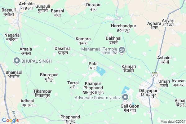
Pata
Pata Map
EDIT Map
Add Your House
 ..
..
Current Corona Virus Infected Patients Count in Auraiya District
| City Name | District Name | Total Covid cases |
|---|---|---|
| Auraiya District | Auraiya | 10 |
Locality Name :
Pata
( पता )
Block Name : Achchalda
District : Auraiya
State : Uttar Pradesh
Division : Kanpur
Language : Hindi and Urdu
Current Time 12:35 PM
Date: Tuesday , Apr 29,2025 (IST)
Time zone: IST (UTC+5:30)
Elevation / Altitude: 144 meters. Above Seal level
Telephone Code / Std Code: 05681
Assembly constituency : Dibiyapur assembly constituency
Assembly MLA : Pradeep Kumar Yadav
Lok Sabha constituency : Etawah parliamentary constituency
Parliament MP : Dr RAM SHANKAR KATHERIA
Serpanch Name :
Pin Code : 206241
Post Office Name : Nevilganj
Commodities Prices : Dibiapur Market / Mandi
Pata Live Weather
Temperature: 37.3 °C
few clouds
Humidity: 18%
Wind : 5.67 mt/sec towards E
StationName : "Bidhūna"
observed on 1 Hours Back
Temperature: 37.3 °C
few clouds
Humidity: 18%
Wind : 5.67 mt/sec towards E
StationName : "Bidhūna"
observed on 1 Hours Back
Pata Weather Forecast for Next 5 days
30-04-2025
30.0°C to 39.9°C
few clouds, clear sky
30.0°C to 39.9°C
few clouds, clear sky
01-05-2025
27.6°C to 40.9°C
clear sky
27.6°C to 40.9°C
clear sky
02-05-2025
30.3°C to 42.4°C
clear sky, broken clouds
30.3°C to 42.4°C
clear sky, broken clouds
03-05-2025
29.6°C to 42.3°C
scattered clouds, overcast clouds, broken clouds
29.6°C to 42.3°C
scattered clouds, overcast clouds, broken clouds
04-05-2025
29.2°C to 42.9°C
broken clouds, overcast clouds
29.2°C to 42.9°C
broken clouds, overcast clouds
Edit below overview about Pata
Edit below overview about Pata
OverView of Pata
Pata is very old village. A petrochemical plant of Gail (India) Ltd positioned here.
Edit below overview about Pata
National Highways Reachable To Pata
Nationa High Way :NH552
Nationa High Way :NH552
Rivers Near Pata
Chambal River :चम्बल
Pandu
Chambal River :चम्बल
Pandu
About Pata
Pata is a Village in Achchalda Block in Auraiya District of Uttar Pradesh State, India. It belongs to Kanpur Division . It is located 24 KM towards North from District head quarters Auraiya. 9 KM from Achchalda. 171 KM from State capital Lucknow
Pata Pin code is 206241 and postal head office is Nevilganj .
Kanhon ( 2 KM ) , Purwa Asha ( 2 KM ) , Seeganpur ( 2 KM ) , Khanpur Phaphund ( 3 KM ) , Kamara ( 3 KM ) are the nearby Villages to Pata. Pata is surrounded by Achchalda Block towards west , Sahar Block towards East , Bidhuna Block towards North , Ajitmal Block towards west .
Achhalda , Bharthana , Bhajanpura , Etawah are the near by Cities to Pata.
This Place is in the border of the Auraiya District and Kannauj District. Kannauj District Haseran is North towards this place .
Pata 2011 Census Details
Pata Local Language is Hindi. Pata Village Total population is 4098 and number of houses are 763. Female Population is 46.6%. Village literacy rate is 65.9% and the Female Literacy rate is 27.5%.
Population
| Census Parameter | Census Data |
| Total Population | 4098 |
| Total No of Houses | 763 |
| Female Population % | 46.6 % ( 1910) |
| Total Literacy rate % | 65.9 % ( 2700) |
| Female Literacy rate | 27.5 % ( 1125) |
| Scheduled Tribes Population % | 0.0 % ( 0) |
| Scheduled Caste Population % | 34.0 % ( 1393) |
| Working Population % | 30.7 % |
| Child(0 -6) Population by 2011 | 641 |
| Girl Child(0 -6) Population % by 2011 | 47.0 % ( 301) |
Pata Census More Deatils.
Politics in Pata
SP , BSP are the major political parties in this area.Polling Stations /Booths near Pata
1)P.v.pasiya Part Banshi2)P.v.pata Room N.1
3)P.v.pata Room N.2
4)P.v.purva Gumani
5)P.v.bhulaipur
HOW TO REACH Pata
By Rail
Phaphund Rail Way Station , Pata Rail Way Station are the very nearby railway stations to Pata.Colleges near Pata
Tilak Mahavidhyalay Auraiya U P
Address :
Narayan Inter Collage Malhausi-auraiya
Address :
Shree Narayan Inter College
Address :
Shyamsakhi Smarak Vidhyalya
Address :
J C A Inter College
Address :
Schools in Pata
U.p.s.pata
Address : pata , achhalda , auraiya , Uttar Pradesh . PIN- 206241 , Post - Nevilganj
Bhu.v.m.v.pata
Address : pata , achhalda , auraiya , Uttar Pradesh . PIN- 206241 , Post - Nevilganj
Sri K.m.v.rly Station Pata
Address : pata , achhalda , auraiya , Uttar Pradesh . PIN- 206250 , Post - Harchandpur (Auraiya)
Govt Health Centers near Pata
1) Sahar , Sub Center , Purva Tara , Under CHC Sahar2) District Combind Hospital Chicholi , District Combind Hospital Chicholi, 100 Bedded Hospital , Kakor Road , Chicholi Village
3) JAGJEEVANPUR , SubCentre Jagjeevanpur , Jagjeevanpur , Subcentre
Sub Villages in Pata
Hospitals in Pata,Achchalda
Radhika Dental Clinic
Janki vatika marriage home Jalaun chauraha; Uttar Pradesh; India
4.2 KM distance Detail
State Ayurvedic Hospital Dibiyapur Near Gailgaovn Dibiyapur
Gail Gaon; Uttar Pradesh 206244; India
6.8 KM distance Detail
more ..
Petrol Bunks in Pata,Achchalda
HP PETROL PUMP - PATA FILLING STATION
Fafund BY Pass Near Pata Gail Plant Tehsil -auraiya; Kanpur; Uttar Pradesh 206247; India
4.8 KM distance Detail
more ..
Colleges in Pata,Achchalda
Sundar Singh Inter College.
Phaphund-Pata-Ramgarh Rd; Ramgarh; Harchandpur; Uttar Pradesh 206250; India
6.2 KM distance Detail
more ..
Schools in Pata,Achchalda
Gyani Gautam
Home; Bank Colony; Shanti Nagar; Orai; Uttar Pradesh 285001; India
1.5 KM distance Detail
DR LOHIYA J B S MUNSHIPUR
Phaphund-Pata Rd; Tarrai; Uttar Pradesh 206247; India
3.6 KM distance Detail
Bikalp Acedmi Choching
Tilak nager Auraiya Bharat petrol pamp ke bagal wali; gali; Uttar Pradesh; India
4.2 KM distance Detail
Electronic Shops in Pata,Achchalda
Dheeru Mobile Center
Pata-Ramgarh Rd; Ramgarh; Harchandpur; Uttar Pradesh 206250; India
6.2 KM distance Detail
Governement Offices near Pata,Achchalda
Vaishvik Manvadhikar Association
Krishna Nagar; Jamuhin; Uttar Pradesh 206244; India
7.6 KM distance Detail
Aadhar Card & Jan Seva Kendra
Indra Nagar; Dibiyapur; Uttar Pradesh 206244; India
8.1 KM distance Detail
About Pata &
History
How to reach Pata
Tourist Places Near By Pata
Schools in Pata
Colleges in Pata
Temperature & weather of Pata
places in Pata
Pata photos
More Information
How to reach Pata
Tourist Places Near By Pata
Schools in Pata
Colleges in Pata
Temperature & weather of Pata
places in Pata
Pata photos
More Information
Village Talk
Post News or Events about this Village
Near Cities
Achhalda 10 KM near
Bharthana 34 KM near
Bhajanpura 42 KM near
Etawah 55 KM near
Achhalda 10 KM near
Bharthana 34 KM near
Bhajanpura 42 KM near
Etawah 55 KM near
Near By Taluks
Achchalda 8 KM near
Bhagyanagar 8 KM near
Sahar 14 KM near
Bidhuna 17 KM near
Achchalda 8 KM near
Bhagyanagar 8 KM near
Sahar 14 KM near
Bidhuna 17 KM near
Near By Air Ports
Kanpur Airport 107 KM near
Gwalior Airport 147 KM near
Amausi Airport 155 KM near
Kheria Airport 180 KM near
Kanpur Airport 107 KM near
Gwalior Airport 147 KM near
Amausi Airport 155 KM near
Kheria Airport 180 KM near
Near By Tourist Places
Kannauj 69 KM near
Bithur 87 KM near
Kanpur 97 KM near
Gwalior 155 KM near
Lucknow 159 KM near
Kannauj 69 KM near
Bithur 87 KM near
Kanpur 97 KM near
Gwalior 155 KM near
Lucknow 159 KM near
Near By Districts
Auraiya 24 KM near
Etawah 54 KM near
Kanpur Dehat 61 KM near
Jalaun 66 KM near
Auraiya 24 KM near
Etawah 54 KM near
Kanpur Dehat 61 KM near
Jalaun 66 KM near
Near By RailWay Station
Phaphund Rail Way Station 1.5 KM near
Pata Rail Way Station 6.4 KM near
Kanchausi Rail Way Station 8.3 KM near
Jhinjhak Rail Way Station 29 KM near
Phaphund Rail Way Station 1.5 KM near
Pata Rail Way Station 6.4 KM near
Kanchausi Rail Way Station 8.3 KM near
Jhinjhak Rail Way Station 29 KM near