| Home | City Bus | Maps | Villages | Cities | Rail | Tourist Places | School | College | Pin Codes | Corona Cases Count |
| Distance Calculator Bus Services IFSC Codes Trace Mobile Number Weather Search Place Trace IP Available Cash ATM/Banks Locate Polling Booth Report an Error contact People |
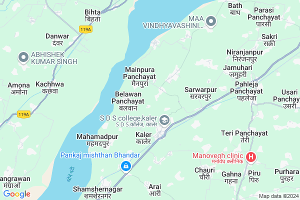
Nawad Map
EDIT Map
Add Your House
 ..
..
Current Corona Virus Infected Patients Count in Arwal District
| City Name | District Name | Total Covid cases |
|---|---|---|
| Arwal District | Arwal | 4 |
Locality Name :
Nawad
( नवाद )
Block Name : Kaler
District : Arwal
State : Bihar
Division : Magadh
Language : Maithili and Hindi, Urdu
Current Time 09:27 PM
Date: Wednesday , Feb 05,2025 (IST)
Time zone: IST (UTC+5:30)
Elevation / Altitude: 87 meters. Above Seal level
Telephone Code / Std Code: 06328
Assembly constituency : Arwal assembly constituency
Assembly MLA : Maha Nand Singh
Lok Sabha constituency : Jahanabad parliamentary constituency
Parliament MP : CHANDESHWAR PRASAD
Serpanch Name :
Pin Code : 824127
Post Office Name : Kaler
Main Village Name : Nawad
Commodities Prices : Ballia Market / Mandi
Nawad Live Weather
Temperature: 21.4 °C
clear sky
Humidity: 50%
Wind : 4.61 mt/sec towards NW
StationName : "Daudnagar"
observed on Now
Temperature: 21.4 °C
clear sky
Humidity: 50%
Wind : 4.61 mt/sec towards NW
StationName : "Daudnagar"
observed on Now
Nawad Weather Forecast for Next 5 days
06-02-2025
15.9°C to 21.2°C
clear sky
15.9°C to 21.2°C
clear sky
07-02-2025
11.9°C to 28.3°C
clear sky
11.9°C to 28.3°C
clear sky
08-02-2025
9.6°C to 27.7°C
clear sky
9.6°C to 27.7°C
clear sky
09-02-2025
10.0°C to 28.0°C
clear sky, scattered clouds
10.0°C to 28.0°C
clear sky, scattered clouds
10-02-2025
12.0°C to 30.0°C
clear sky
12.0°C to 30.0°C
clear sky
National Highways Reachable To Nawad
Nationa High Way :NH22
Nationa High Way :NH22
Rivers Near Nawad
Son
Phalgu :फल्गु
Son
Phalgu :फल्गु
About Nawad
Correct below Info and add more info about NawadNawad is a small Village/hamlet in Kaler Block in Arwal District of Bihar State, India. It comes under Nawad Panchayath. It belongs to Magadh Division . It is located 24 KM towards west from District head quarters Arwal. 7 KM from Kaler. 97 KM from State capital Patna
Nawad Pin code is 824127 and postal head office is Kaler .
Kaler ( 2 KM ) , Sohsa Panchayat ( 3 KM ) , Belsar Panchayat ( 3 KM ) , Pahleja Panchayat ( 6 KM ) , Kamta Panchayat ( 7 KM ) are the nearby Villages to Nawad. Nawad is surrounded by Haspura Block towards South , Tarari Block towards North , Daudnagar Block towards South , Sahar Block towards North .
Daudnagar , Piro , Arrah , Bikramganj are the near by Cities to Nawad.
This Place is in the border of the Arwal District and Aurangabad District. Aurangabad District Haspura is South towards this place . Also it is in the Border of other district Rohtas .
Nawada 2011 Census Details
Nawad Local Language is Maithili. Nawada Village Total population is 751 and number of houses are 146. Female Population is 49.4%. Village literacy rate is 54.6% and the Female Literacy rate is 20.9%.
Population
| Census Parameter | Census Data |
| Total Population | 751 |
| Total No of Houses | 146 |
| Female Population % | 49.4 % ( 371) |
| Total Literacy rate % | 54.6 % ( 410) |
| Female Literacy rate | 20.9 % ( 157) |
| Scheduled Tribes Population % | 0.0 % ( 0) |
| Scheduled Caste Population % | 32.9 % ( 247) |
| Working Population % | 51.7 % |
| Child(0 -6) Population by 2011 | 150 |
| Girl Child(0 -6) Population % by 2011 | 53.3 % ( 80) |
Nawada Census More Deatils.
Politics in Nawad
JD(U) , CPI(ML)(L) , BJP , Rashtriya Lok Samta Party , Janata Dal (United) , RJD are the major political parties in this area.Polling Stations /Booths near Nawad
1)Primary School Nath Kharsha2)Samudayik Bhavan Bangala Kothi
3)Primary School Brindawan
4)Panchayat Bhavan Sonvarsa
5)Primary School Amir Bigha (left Part)
HOW TO REACH Nawad
By Rail
There is no railway station near to Nawad in less than 10 km.Colleges near Nawad
Shiv Deni Sao College
Address :
Schools near Nawad
Target
Address : Kumar medical mehandia[arwal]
S.k High School
Address : Vill-chanda po-mainpura chanda ps-kaler
Aganoor Midile School
Address : Agnoor bajar near electric hydro power of agnoor .
T.h.h.s.teri
Address :
Govt Health Centers near Nawad
1) Kaler , Health Sub-Center Kaler , PO - Kaler ,2) Kaler , Primary Health Centre Kaler , PO - Kaler , Block Office
3) BELSAR , Health Sub-Center Belsar , PO - Belsar ,
Petrol Bunks in Nawad,Kaler
Hindustan Petroleum
Mahendia; Arwal; NH-98; Bagaha Dhala Road; Arwal; Arwal; Bihar 824143; India
7.4 KM distance Detail
HP PETROL PUMP - MATHURA PRASAD S S MEHANDIA HP
PO Mehendia District Jehanabad State Bihar; Patna; Bihar 804428; India
7.6 KM distance Detail
more ..
Schools in Nawad,Kaler
Genius coaching centre kaler
Kaler - Mainpura Road; Durgapur; Bihar 824127; India
1.7 KM distance Detail
Super Markets in Nawad,Kaler
Fashion Parlor & Saloon
Aganoor (Opposite Middle School; Kaler; Bihar 824143; India
5.2 KM distance Detail
About Nawad &
History
How to reach Nawad
Tourist Places Near By Nawad
Schools in Nawad
Colleges in Nawad
Temperature & weather of Nawad
places in Nawad
Nawad photos
More Information
How to reach Nawad
Tourist Places Near By Nawad
Schools in Nawad
Colleges in Nawad
Temperature & weather of Nawad
places in Nawad
Nawad photos
More Information
Village Talk
Post News or Events about this Village
Near Cities
Daudnagar 17 KM near
Piro 24 KM near
Arrah 26 KM near
Bikramganj 27 KM near
Daudnagar 17 KM near
Piro 24 KM near
Arrah 26 KM near
Bikramganj 27 KM near
Near By Taluks
Kaler 7 KM near
Tarari 14 KM near
Haspura 15 KM near
Daudnagar 16 KM near
Kaler 7 KM near
Tarari 14 KM near
Haspura 15 KM near
Daudnagar 16 KM near
Near By Air Ports
Gaya Airport 71 KM near
Patna Airport 88 KM near
Varanasi Airport 188 KM near
Gorakhpur Airport 231 KM near
Gaya Airport 71 KM near
Patna Airport 88 KM near
Varanasi Airport 188 KM near
Gorakhpur Airport 231 KM near
Near By Tourist Places
Sasaram 58 KM near
Bodh Gaya 78 KM near
Rohtasgarh Fort 91 KM near
Patna 94 KM near
Golghar 94 KM near
Sasaram 58 KM near
Bodh Gaya 78 KM near
Rohtasgarh Fort 91 KM near
Patna 94 KM near
Golghar 94 KM near
Near By Districts
Arwal 23 KM near
Aurangabad 50 KM near
Bhojpur 55 KM near
Jehanabad 56 KM near
Arwal 23 KM near
Aurangabad 50 KM near
Bhojpur 55 KM near
Jehanabad 56 KM near
Near By RailWay Station
Jakhim Rail Way Station 38 KM near
Anugraha Narayan Road Rail Way Station 39 KM near
Jakhim Rail Way Station 38 KM near
Anugraha Narayan Road Rail Way Station 39 KM near