| Home | City Bus | Maps | Villages | Cities | Rail | Tourist Places | School | College | Pin Codes | Corona Cases Count |
| Distance Calculator Bus Services IFSC Codes Trace Mobile Number Weather Search Place Trace IP Available Cash ATM/Banks Locate Polling Booth Report an Error contact People |
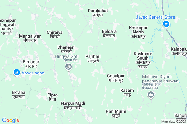
Parihari Map
EDIT Map
Add Your House
 ..
..
Current Corona Virus Infected Patients Count in Araria District
| City Name | District Name | Total Covid cases |
|---|
Locality Name :
Parihari
( परिहरि )
Block Name : Raniganj
District : Araria
State : Bihar
Division : Purnia
Language : Maithili and Hindi, Urdu, Thethi, Maithili, Bhojpuri
Current Time 11:34 AM
Date: Sunday , Apr 27,2025 (IST)
Time zone: IST (UTC+5:30)
Elevation / Altitude: 56 meters. Above Seal level
Telephone Code / Std Code: 06461
Assembly constituency : Raniganj assembly constituency
Assembly MLA : Achmit Rishidev
Lok Sabha constituency : Araria parliamentary constituency
Parliament MP : PRADEEP KUMAR SINGH
Serpanch Name :
Pin Code : 854334
Post Office Name : Maryganj
Parihari Live Weather
Temperature: 35.4 °C
overcast clouds
Humidity: 40%
Wind : 6.88 mt/sec towards E
StationName : "Banmankhi"
observed on 54 Mins Back
Temperature: 35.4 °C
overcast clouds
Humidity: 40%
Wind : 6.88 mt/sec towards E
StationName : "Banmankhi"
observed on 54 Mins Back
Parihari Weather Forecast for Next 5 days
28-04-2025
23.7°C to 38.2°C
overcast clouds, light rain, broken clouds
23.7°C to 38.2°C
overcast clouds, light rain, broken clouds
29-04-2025
23.5°C to 36.4°C
overcast clouds, broken clouds, scattered clouds, light rain
23.5°C to 36.4°C
overcast clouds, broken clouds, scattered clouds, light rain
30-04-2025
23.8°C to 31.9°C
overcast clouds, light rain, broken clouds, scattered clouds
23.8°C to 31.9°C
overcast clouds, light rain, broken clouds, scattered clouds
01-05-2025
23.0°C to 34.5°C
broken clouds, scattered clouds, light rain, overcast clouds
23.0°C to 34.5°C
broken clouds, scattered clouds, light rain, overcast clouds
02-05-2025
23.6°C to 35.3°C
overcast clouds, broken clouds, scattered clouds, clear sky, few clouds
23.6°C to 35.3°C
overcast clouds, broken clouds, scattered clouds, clear sky, few clouds
Edit below overview about Parihari
Edit below overview about Parihari
OverView of Parihari
Beautiful village located in Araria district of Bihar.Its just 12 km from Raniganj town.It is well connected with roads,rail is around 10km(Banmankhi junction).Farming is main source of income apart from this poor people's visit to Punjabi,Delhi for earnings.Rajput, Brahmins,Yadav is main caste of Parihari.Peoples have good gesture against the guest.Government must take responsibility to open school,hospital,banks and provides them opportunities to earn which is stills dark side which must discuss for welfare of people.Apart from agriculture is not paid properly by the vendors.Hopes still many more problem with needs to solve by government.Edit below overview about Parihari
National Highways Reachable To Parihari
Nationa High Way :NH27
Nationa High Way :NH27;NH327
Nationa High Way :NH27
Nationa High Way :NH27;NH327
Rivers Near Parihari
Koshi river
Mahananda River
Koshi river
Mahananda River
About Parihari
Parihari is a Village in Raniganj Block in Araria District of Bihar State, India. It belongs to Purnia Division . It is located 38 KM towards west from District head quarters Araria. 21 KM from Raniganj. 244 KM from State capital Patna
Parihari Pin code is 854334 and postal head office is Maryganj .
Parshahat ( 5 KM ) , Naya Bhargama ( 7 KM ) , Bagulaha ( 9 KM ) , Rampuraadi ( 10 KM ) , Bhargama ( 10 KM ) are the nearby Villages to Parihari. Parihari is surrounded by Banmankhi Block towards South , Kumarkhand Block towards west , Raniganj Block towards East , Srinagar Block towards East .
Banmankhi Bazar , Murliganj , Araria , Forbesganj are the near by Cities to Parihari.
This Place is in the border of the Araria District and Purnia District. Purnia District Banmankhi is South towards this place .
Parihari 2011 Census Details
Parihari Local Language is Maithili. Parihari Village Total population is 5892 and number of houses are 1156. Female Population is 47.0%. Village literacy rate is 40.1% and the Female Literacy rate is 15.0%.
Population
| Census Parameter | Census Data |
| Total Population | 5892 |
| Total No of Houses | 1156 |
| Female Population % | 47.0 % ( 2768) |
| Total Literacy rate % | 40.1 % ( 2360) |
| Female Literacy rate | 15.0 % ( 881) |
| Scheduled Tribes Population % | 8.0 % ( 474) |
| Scheduled Caste Population % | 25.4 % ( 1499) |
| Working Population % | 46.9 % |
| Child(0 -6) Population by 2011 | 1027 |
| Girl Child(0 -6) Population % by 2011 | 46.1 % ( 473) |
Parihari Census More Deatils.
Politics in Parihari
JD(U) , Bharatiya Janata Party , LJP , BJP , RJD are the major political parties in this area.Polling Stations /Booths near Parihari
1)Prathamik Vidyalay Sanjhaili2)Prathamik Vidyalay Tonaha (purab Bhag)
3)Prathamik Vighalay Mangalavar Charaiya (kanya)
4)Utkramit Madhya Vidyalay Kothihat
5)Utkramit Madhya Vidyalay Madhulata South Part
HOW TO REACH Parihari
By Road
Araria is the Nearest Town to Parihari. Road connectivity is there from Araria to Parihari.By Rail
There is no railway station near to Parihari in less than 10 km. How ever there are railway Stations from Near By town Araria. are the railway Stations near to Araria. You can reach from Araria to Parihari by road after .Colleges near Parihari
Kalawati Degree College, Raniganj
Address :
S.n.v.inter Collage Ranigange
Address : Farbisgang Road
M.p. College
Address : Belsara, Bodh-gaya
Schools in Parihari
Ps Rajput Tola (parihari)
Address : parihari , raniganj , araria , Bihar . PIN- 854334 , Post - Maryganj
Ps Parihari Santhal Tol
Address : parihari , raniganj , araria , Bihar . PIN- 854334 , Post - Maryganj
Ps Parihari
Address : parihari , raniganj , araria , Bihar . PIN- 854334 , Post - Maryganj
Govt Health Centers near Parihari
1) Belachand Sukhia , Sukhiya , Sah tola , Mandir ke pass2) Dhokardhara , Dhokardhara , Kumhaar tola , Mandir ke pass
3) Chakmaka , Chakmaka , Eakraha mohan tola , Mandir ke pass
Petrol Bunks in Parihari,Raniganj
HP Petrol Pump - Sri Keishna Petroleum
HP Petrol Pump At-raniganj P.o-meriganj; Begusarai; Bihar 854334; India
15.9 KM distance Detail
more ..
Colleges in Parihari,Raniganj
YNPD COLLAGE ;RANIGANJ (by :-manishkr.supaulmk@facebokk.com)
SH 77; Barbana; Bihar 854334; India
13.9 KM distance Detail
S.N.V.Inter College Raniganj
E - West Corridor; Hasanpur; Bihar 854334; India
16.1 KM distance Detail
more ..
Schools in Parihari,Raniganj
Utkramit Middle School ;Tharua Patti
Banmankhi Road; Khajuri; Bihar 854334; India
9.3 KM distance Detail
Electronic Shops in Parihari,Raniganj
Pawan Kumar Raj Mobile Ripening Center
Khajuri-Khutha Rd; Khajuri; Bihar 854334; India
10.2 KM distance Detail
Local Parks in Parihari,Raniganj
Police Stations near Parihari,Raniganj
Raniganj Police Station
State Highway 77; Dist Araria; Raniganj; Bihar 854334; India
14.8 KM distance Detail
Governement Offices near Parihari,Raniganj
About Parihari &
History
How to reach Parihari
Tourist Places Near By Parihari
Schools in Parihari
Colleges in Parihari
Temperature & weather of Parihari
places in Parihari
Parihari photos
More Information
How to reach Parihari
Tourist Places Near By Parihari
Schools in Parihari
Colleges in Parihari
Temperature & weather of Parihari
places in Parihari
Parihari photos
More Information
Village Talk
Post News or Events about this Village
Near Cities
Banmankhi Bazar 12 KM near
Murliganj 24 KM near
Araria 37 KM near
Forbesganj 39 KM near
Banmankhi Bazar 12 KM near
Murliganj 24 KM near
Araria 37 KM near
Forbesganj 39 KM near
Near By Taluks
Banmankhi 8 KM near
Bhargama 9 KM near
Kumarkhand 19 KM near
Raniganj 20 KM near
Banmankhi 8 KM near
Bhargama 9 KM near
Kumarkhand 19 KM near
Raniganj 20 KM near
Near By Air Ports
Bagdogra Airport 155 KM near
Patna Airport 239 KM near
Gaya Airport 294 KM near
Rupsi Airport 306 KM near
Bagdogra Airport 155 KM near
Patna Airport 239 KM near
Gaya Airport 294 KM near
Rupsi Airport 306 KM near
Near By Tourist Places
Bhagalpur 94 KM near
Sahibganj 104 KM near
Munger 108 KM near
Madhubani 132 KM near
Darbhanga 145 KM near
Bhagalpur 94 KM near
Sahibganj 104 KM near
Munger 108 KM near
Madhubani 132 KM near
Darbhanga 145 KM near
Near By Districts
Araria 37 KM near
Purnia 41 KM near
Madhepura 45 KM near
Saharsa 66 KM near
Araria 37 KM near
Purnia 41 KM near
Madhepura 45 KM near
Saharsa 66 KM near
Near By RailWay Station
Purnea Junction Rail Way Station 44 KM near
Semapur Rail Way Station 65 KM near
Purnea Junction Rail Way Station 44 KM near
Semapur Rail Way Station 65 KM near