| Home | City Bus | Maps | Villages | Cities | Rail | Tourist Places | School | College | Pin Codes | Corona Cases Count |
| Distance Calculator Bus Services IFSC Codes Trace Mobile Number Weather Search Place Trace IP Available Cash ATM/Banks Locate Polling Booth Report an Error contact People |
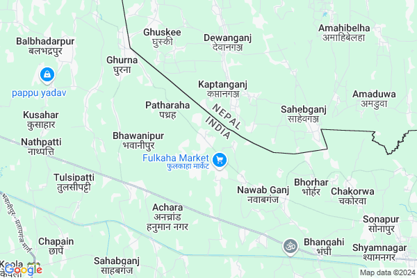
Manikpur
Manikpur Map
EDIT Map
Add Your House
 ..
..
Current Corona Virus Infected Patients Count in Araria District
| City Name | District Name | Total Covid cases |
|---|
Locality Name :
Manikpur
( मानिकपुर )
Block Name : Narpatganj
District : Araria
State : Bihar
Division : Purnia
Language : Maithili and Hindi, Urdu, Thethi, Maithili, Bhojpuri
Current Time 03:13 PM
Date: Tuesday , Apr 29,2025 (IST)
Time zone: IST (UTC+5:30)
Elevation / Altitude: 68 meters. Above Seal level
Telephone Code / Std Code: 06455
Assembly constituency : Narpatganj assembly constituency
Assembly MLA : Jai Prakash Yadav
Lok Sabha constituency : Araria parliamentary constituency
Parliament MP : PRADEEP KUMAR SINGH
Serpanch Name :
Pin Code : 854336
Post Office Name : Nawabganj (Araria)
Manikpur Live Weather
Temperature: 34.1 °C
scattered clouds
Humidity: 29%
Wind : 3.37 mt/sec towards SE
StationName : "Jogbani"
observed on 54 Mins Back
Temperature: 34.1 °C
scattered clouds
Humidity: 29%
Wind : 3.37 mt/sec towards SE
StationName : "Jogbani"
observed on 54 Mins Back
Manikpur Weather Forecast for Next 5 days
30-04-2025
24.7°C to 34.0°C
scattered clouds, broken clouds, overcast clouds
24.7°C to 34.0°C
scattered clouds, broken clouds, overcast clouds
01-05-2025
23.7°C to 34.8°C
broken clouds, overcast clouds, light rain
23.7°C to 34.8°C
broken clouds, overcast clouds, light rain
02-05-2025
25.6°C to 34.3°C
light rain, overcast clouds, broken clouds, scattered clouds
25.6°C to 34.3°C
light rain, overcast clouds, broken clouds, scattered clouds
03-05-2025
25.4°C to 36.5°C
overcast clouds, broken clouds, scattered clouds, few clouds
25.4°C to 36.5°C
overcast clouds, broken clouds, scattered clouds, few clouds
04-05-2025
25.5°C to 37.3°C
light rain, scattered clouds, few clouds, broken clouds, overcast clouds
25.5°C to 37.3°C
light rain, scattered clouds, few clouds, broken clouds, overcast clouds
Edit below overview about Manikpur
Edit below overview about Manikpur
OverView of Manikpur
Replicaa stoop is situated here a historic stoop formed by villagers every day 30-40 tourists come hereEdit below overview about Manikpur
National Highways Reachable To Manikpur
Nationa High Way :NH27
Nationa High Way :NH57
Nationa High Way :NH27
Nationa High Way :NH57
Rivers Near Manikpur
Keshaliya River
Keshaliya River
Keshaliya River
Keshaliya River
About Manikpur
Manikpur is a Village in Narpatganj Block in Araria District of Bihar State, India. It belongs to Purnia Division . It is located 52 KM towards west from District head quarters Araria. 9 KM from Narpatganj. 255 KM from State capital Patna
Manikpur Pin code is 854336 and postal head office is Nawabganj (Araria).
Madhura West ( 9 KM ) , Madhura South ( 9 KM ) , Madhura North ( 9 KM ) , Narpatganj ( 9 KM ) , Posdaha ( 10 KM ) are the nearby Villages to Manikpur. Manikpur is surrounded by Basantpur Block towards west , Chhatapur Block towards South , Forbesganj Block towards East , Pratapganj Block towards west .
Jogabani , Forbesganj , Araria , Banmankhi Bazar are the near by Cities to Manikpur.
This Place is in the border of the Araria District and Supaul District. Supaul District Chhatapur is South towards this place .
Manikpur 2011 Census Details
Manikpur Local Language is Maithili. Manikpur Village Total population is 5925 and number of houses are 1228. Female Population is 47.6%. Village literacy rate is 42.2% and the Female Literacy rate is 15.0%.
Population
| Census Parameter | Census Data |
| Total Population | 5925 |
| Total No of Houses | 1228 |
| Female Population % | 47.6 % ( 2821) |
| Total Literacy rate % | 42.2 % ( 2498) |
| Female Literacy rate | 15.0 % ( 888) |
| Scheduled Tribes Population % | 0.0 % ( 2) |
| Scheduled Caste Population % | 14.9 % ( 881) |
| Working Population % | 40.1 % |
| Child(0 -6) Population by 2011 | 1018 |
| Girl Child(0 -6) Population % by 2011 | 50.1 % ( 510) |
Manikpur Census More Deatils.
Politics in Manikpur
Bharatiya Janata Party , LJP , BJP , RJD are the major political parties in this area.Polling Stations /Booths near Manikpur
1)Utkramit Madhya Vidhalay Ramghat South Part2)Madhya Vidyalay Achra (west Part)
3)Prathmik Vidyalay Gokhalapur Purv (south Part)
4)Utkramit Madhya Vidyalay Laxmipur
5)Prathamik Vidhyaly Mangan Paswan Tola Bhawanipur
HOW TO REACH Manikpur
By Rail
Narpatganj Rail Way Station is the very nearby railway stations to Manikpur. Dholbaja Rail Way Station (near to Forbesganj) , Bathnaha Rail Way Station (near to Jogabani) , Jogbani Rail Way Station (near to Jogabani) , Forbesganj Junction Rail Way Station (near to Forbesganj) are the Rail way stations reachable from near by towns.By Road
Forbesganj , Jogabani are the nearby by towns to Manikpur having road connectivity to ManikpurColleges near Manikpur
Kalawati Degree College, Raniganj
Address :
Forbesganj Collage Forbesganj
Address :
S.n.v.inter Collage Ranigange
Address : Farbisgang Road
M.p. College
Address : Belsara, Bodh-gaya
Schools near Manikpur
Mdr Miswahul Uloom
Address : mazhua , narpatganj , araria , Bihar . PIN- 854318 , Post - S.R.Forbesganj
Mdr Hussainiya
Address : chakorba , narpatganj , araria , Bihar . PIN- 854316 , Post - Bathnaha
Mdr Nasirul Uloom
Address : badhepara , narpatganj , araria , Bihar . PIN- 854316 , Post - Bathnaha
Ps Khair Banna
Address : khair banna , narpatganj , araria , Bihar . PIN- 854335 , Post - Narpatganj
Govt Health Centers near Manikpur
1) Narpatganj , PHC Narpatganj , Hospital Rod , Hospital Road narpatganj2) Sonapur , Hsc Sonapur , Sonapur , Near Panchayat Bhawan
3) APHC Jogbani , Jogbani APHC , Jogbani Forbesganj Road , Near Netaji chowk
Hospitals in Manikpur,Narpatganj
Ganga Printers Fulkaha Kali Mandir Road
Manikpur - Nawabganj Rd; Manikpur; Bihar 854336; India
1.2 KM distance Detail
more ..
Colleges in Manikpur,Narpatganj
Moti Babu Institute Of Technology
Industrial Estate; Off NH 57; Araria District; Forbesanj; Bihar 854318; India
18.2 KM distance Detail
more ..
About Manikpur &
History
How to reach Manikpur
Tourist Places Near By Manikpur
Schools in Manikpur
Colleges in Manikpur
Temperature & weather of Manikpur
places in Manikpur
Manikpur photos
More Information
How to reach Manikpur
Tourist Places Near By Manikpur
Schools in Manikpur
Colleges in Manikpur
Temperature & weather of Manikpur
places in Manikpur
Manikpur photos
More Information
Village Talk
Post News or Events about this Village
Near Cities
Jogabani 13 KM near
Forbesganj 20 KM near
Araria 50 KM near
Banmankhi Bazar 65 KM near
Jogabani 13 KM near
Forbesganj 20 KM near
Araria 50 KM near
Banmankhi Bazar 65 KM near
Near By Taluks
Narpatganj 9 KM near
Basantpur 11 KM near
Chhatapur 20 KM near
Forbesganj 25 KM near
Narpatganj 9 KM near
Basantpur 11 KM near
Chhatapur 20 KM near
Forbesganj 25 KM near
Near By Air Ports
Bagdogra Airport 137 KM near
Patna Airport 249 KM near
Rupsi Airport 312 KM near
Gaya Airport 321 KM near
Bagdogra Airport 137 KM near
Patna Airport 249 KM near
Rupsi Airport 312 KM near
Gaya Airport 321 KM near
Near By Tourist Places
Madhubani 118 KM near
Mirik 132 KM near
Darbhanga 140 KM near
Kurseong 140 KM near
Bhagalpur 146 KM near
Madhubani 118 KM near
Mirik 132 KM near
Darbhanga 140 KM near
Kurseong 140 KM near
Bhagalpur 146 KM near
Near By Districts
Araria 50 KM near
Supaul 69 KM near
Madhepura 72 KM near
Purnia 87 KM near
Araria 50 KM near
Supaul 69 KM near
Madhepura 72 KM near
Purnia 87 KM near
Near By RailWay Station
Purnea Junction Rail Way Station 88 KM near
Saharsa Junction Rail Way Station 89 KM near
Purnea Junction Rail Way Station 88 KM near
Saharsa Junction Rail Way Station 89 KM near