| Home | City Bus | Maps | Villages | Cities | Rail | Tourist Places | School | College | Pin Codes | Corona Cases Count |
| Distance Calculator Bus Services IFSC Codes Trace Mobile Number Weather Search Place Trace IP Available Cash ATM/Banks Locate Polling Booth Report an Error contact People |
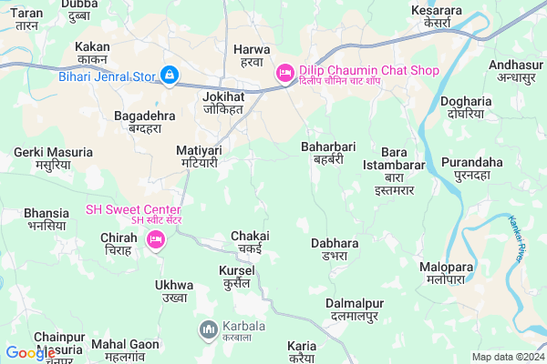
Pirganj Map
EDIT Map
Add Your House
 ..
..
Current Corona Virus Infected Patients Count in Araria District
| City Name | District Name | Total Covid cases |
|---|
Locality Name :
Pirganj
( पीरगंज )
Block Name : Jokihat
District : Araria
State : Bihar
Division : Purnia
Language : Maithili and Hindi, Urdu, Thethi, Maithili, Bhojpuri
Current Time 01:00 PM
Date: Tuesday , Apr 29,2025 (IST)
Time zone: IST (UTC+5:30)
Elevation / Altitude: 52 meters. Above Seal level
Telephone Code / Std Code: 06453
Assembly constituency : Jokihat assembly constituency
Assembly MLA : Shahnawaz
Lok Sabha constituency : Araria parliamentary constituency
Parliament MP : PRADEEP KUMAR SINGH
Serpanch Name :
Main Village Name : Pirganj
Commodities Prices : Islampur Market / Mandi
Pirganj Live Weather
Temperature: 30.8 °C
clear sky
Humidity: 41%
Wind : 4.51 mt/sec towards E
StationName : "ArÄ\u0081ria"
observed on 2 Hours Back
Temperature: 30.8 °C
clear sky
Humidity: 41%
Wind : 4.51 mt/sec towards E
StationName : "ArÄ\u0081ria"
observed on 2 Hours Back
Pirganj Weather Forecast for Next 5 days
30-04-2025
24.4°C to 32.6°C
few clouds, scattered clouds, clear sky, overcast clouds
24.4°C to 32.6°C
few clouds, scattered clouds, clear sky, overcast clouds
01-05-2025
23.8°C to 33.5°C
overcast clouds, broken clouds, clear sky, light rain
23.8°C to 33.5°C
overcast clouds, broken clouds, clear sky, light rain
02-05-2025
24.5°C to 35.5°C
light rain, broken clouds, overcast clouds
24.5°C to 35.5°C
light rain, broken clouds, overcast clouds
03-05-2025
25.1°C to 36.2°C
overcast clouds, few clouds, light rain, clear sky
25.1°C to 36.2°C
overcast clouds, few clouds, light rain, clear sky
04-05-2025
26.2°C to 36.3°C
few clouds, light rain, scattered clouds, broken clouds
26.2°C to 36.3°C
few clouds, light rain, scattered clouds, broken clouds
National Highways Reachable To Pirganj
Nationa High Way :NH27
Nationa High Way :NH27;NH327
Nationa High Way :NH27
Nationa High Way :NH27;NH327
Rivers Near Pirganj
Mahananda River
Dahuk
Mahananda River
Dahuk
About Pirganj
Correct below Info and add more info about PirganjPirganj is a small Village/hamlet in Jokihat Block in Araria District of Bihar State, India. It comes under Pirganj Panchayath. It belongs to Purnia Division . It is located 19 KM towards East from District head quarters Araria. 5 KM from Jokihat. 300 KM from State capital Patna
Matiyari ( 3 KM ) , Sisauna ( 4 KM ) , Jokihat ( 4 KM ) , Hardar ( 5 KM ) , Ramnagar ( 7 KM ) are the nearby Villages to Pirganj. Pirganj is surrounded by Palasi Block towards North , Baisa Block towards East , Araria Block towards west , Jalalgarh Block towards South .
Araria , Bahadurganj , Kishanganj , Dalkhola are the near by Cities to Pirganj.
Pirganj 2011 Census Details
Pirganj Local Language is Maithili. Pirganj Village Total population is 591 and number of houses are 124. Female Population is 47.7%. Village literacy rate is 38.7% and the Female Literacy rate is 15.7%.
Population
| Census Parameter | Census Data |
| Total Population | 591 |
| Total No of Houses | 124 |
| Female Population % | 47.7 % ( 282) |
| Total Literacy rate % | 38.7 % ( 229) |
| Female Literacy rate | 15.7 % ( 93) |
| Scheduled Tribes Population % | 0.0 % ( 0) |
| Scheduled Caste Population % | 0.0 % ( 0) |
| Working Population % | 20.5 % |
| Child(0 -6) Population by 2011 | 139 |
| Girl Child(0 -6) Population % by 2011 | 49.6 % ( 69) |
Pirganj Census More Deatils.
Politics in Pirganj
JD(U) , Bharatiya Janata Party , LJP , BJP , RJD , are the major political parties in this area.Polling Stations /Booths near Pirganj
1)Madhya Vidyalay Chainpur (west Part)2)Utkarmit Madhya Vidyalay Kesarra
3)Madhya Vidyalay Bagnagar
4)Madhya Vidyalay Baharbari North Part
5)Prathmik Vidyalay Hardar Dakshin Bhag
HOW TO REACH Pirganj
By Road
Araria is the Nearest Town to Pirganj. Araria is 22 km from Pirganj. Road connectivity is there from Araria to Pirganj.By Rail
There is no railway station near to Pirganj in less than 10 km. How ever there are railway Stations from Near By town Araria. are the railway Stations near to Araria. You can reach from Araria to Pirganj by road after .Pincodes near Pirganj
854329 ( Jokihat ) , 854325 ( Garhbanaili ) , 854311 ( Araria )Colleges near Pirganj
Kalawati Degree College, Raniganj
Address :
Forbesganj Collage Forbesganj
Address :
S.n.v.inter Collage Ranigange
Address : Farbisgang Road
M.p. College
Address : Belsara, Bodh-gaya
Schools near Pirganj
Mdr Islahul Muslemin Jokihat
Address : sisauna , jokihat , araria , Bihar . PIN- 854311 , Post - Araria
Ps Durga Pur
Address : durga pur , jokihat , araria , Bihar . PIN- 854325 , Post - Garhbanaili
Ps Koch Tola
Address : baluwa , jokihat , araria , Bihar . PIN- 854311 , Post - Araria
Mdr Saidul Banat
Address : parman pur , jokihat , araria , Bihar . PIN- 854329 , Post - Jokihat
Govt Health Centers near Pirganj
1) Chakai , HSC CHAKAI , FAKIR TOLA WARD NO 05 , CHAKAI HAT2) RH Jokihat , RH Jokihat , Jokihat Main Market , Near Dak Banglow
3) PHC Jokihat , RH JOKIHAT , MAIN MARKET , NEAR DAKBANGLA
Petrol Bunks in Pirganj,Jokihat
HP PETROL PUMP - KISAN SERVICE CENTRE
H P Petrol Pump P.o-jokhihat; SH-63 Dist; Begusarai; Bihar 854329; India
4.1 KM distance Detail
more ..
Colleges in Pirganj,Jokihat
VISION INTERNATIONAL EDUCATIONAL TRUST AND VISION INSTITUTE OF TECHNOLOGY
AIIT VISION COMPUTER CLASSES SHIV PURI WARD NO. 09 APS ROAD GALI NO 04 WEST OF MAHADEV CHOCK; 854311; 854311; 854311; India
12.9 KM distance Detail
more ..
Local Parks in Pirganj,Jokihat
Netaji Subhash Stadium; Araria
Chitragupt Nagar Thana Rd; Chitragupt Nagar; PHED Colony; Araria; Bihar 851204; India
19.3 KM distance Detail
About Pirganj &
History
How to reach Pirganj
Tourist Places Near By Pirganj
Schools in Pirganj
Colleges in Pirganj
Temperature & weather of Pirganj
places in Pirganj
Pirganj photos
More Information
How to reach Pirganj
Tourist Places Near By Pirganj
Schools in Pirganj
Colleges in Pirganj
Temperature & weather of Pirganj
places in Pirganj
Pirganj photos
More Information
Village Talk
Post News or Events about this Village
Near Cities
Araria 18 KM near
Bahadurganj 27 KM near
Kishanganj 34 KM near
Dalkhola 40 KM near
Araria 18 KM near
Bahadurganj 27 KM near
Kishanganj 34 KM near
Dalkhola 40 KM near
Near By Taluks
Jokihat 5 KM near
Palasi 13 KM near
Baisa 14 KM near
Araria 18 KM near
Jokihat 5 KM near
Palasi 13 KM near
Baisa 14 KM near
Araria 18 KM near
Near By Air Ports
Bagdogra Airport 105 KM near
Rupsi Airport 255 KM near
Patna Airport 291 KM near
Gaya Airport 346 KM near
Bagdogra Airport 105 KM near
Rupsi Airport 255 KM near
Patna Airport 291 KM near
Gaya Airport 346 KM near
Near By Tourist Places
Sahibganj 107 KM near
Samsing 110 KM near
Mirik 115 KM near
Siliguri 116 KM near
Kurseong 120 KM near
Sahibganj 107 KM near
Samsing 110 KM near
Mirik 115 KM near
Siliguri 116 KM near
Kurseong 120 KM near
Near By Districts
Araria 18 KM near
Kishanganj 36 KM near
Purnia 44 KM near
Katihar 71 KM near
Araria 18 KM near
Kishanganj 36 KM near
Purnia 44 KM near
Katihar 71 KM near
Near By RailWay Station
Kishanganj Rail Way Station 35 KM near
Dalkhola Rail Way Station 37 KM near
Kishanganj Rail Way Station 35 KM near
Dalkhola Rail Way Station 37 KM near