| Home | City Bus | Maps | Villages | Cities | Rail | Tourist Places | School | College | Pin Codes | Corona Cases Count |
| Distance Calculator Bus Services IFSC Codes Trace Mobile Number Weather Search Place Trace IP Available Cash ATM/Banks Locate Polling Booth Report an Error contact People |
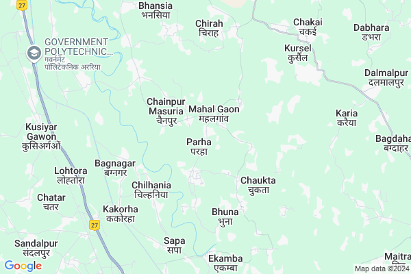
Parha Map
EDIT Map
Add Your House
 ..
..
Current Corona Virus Infected Patients Count in Araria District
| City Name | District Name | Total Covid cases |
|---|
Locality Name :
Parha
( पढ़ा )
Block Name : Jokihat
District : Araria
State : Bihar
Division : Purnia
Language : Maithili and Hindi, Urdu, Thethi, Maithili, Bhojpuri
Current Time 12:30 PM
Date: Tuesday , Apr 29,2025 (IST)
Time zone: IST (UTC+5:30)
Elevation / Altitude: 52 meters. Above Seal level
Telephone Code / Std Code: 06453
Assembly constituency : Jokihat assembly constituency
Assembly MLA : Shahnawaz
Lok Sabha constituency : Araria parliamentary constituency
Parliament MP : PRADEEP KUMAR SINGH
Serpanch Name :
Pin Code : 854325
Post Office Name : Garhbanaili
Main Village Name : Parha
Commodities Prices : Islampur Market / Mandi
National Highways Reachable To Parha
Nationa High Way :NH27
Nationa High Way :NH27;NH327
Nationa High Way :NH27
Nationa High Way :NH27;NH327
Rivers Near Parha
Mahananda River
Dahuk
Mahananda River
Dahuk
About Parha
Correct below Info and add more info about ParhaParha is a small Village/hamlet in Jokihat Block in Araria District of Bihar State, India. It comes under Parha Panchayath. It belongs to Purnia Division . It is located 17 KM towards South from District head quarters Araria. 10 KM from Jokihat. 290 KM from State capital Patna
Parha Pin code is 854325 and postal head office is Garhbanaili .
Bagnagar ( 5 KM ) , Chikani ( 5 KM ) , Chirah ( 6 KM ) , Bhansia ( 8 KM ) , Chatar ( 9 KM ) are the nearby Villages to Parha. Parha is surrounded by Jokihat Block towards North , Amour Block towards East , Baisa Block towards East , Araria Block towards North .
Araria , Purnia , Bahadurganj , Dalkhola are the near by Cities to Parha.
Parha 2011 Census Details
Parha Local Language is Maithili. Parha Village Total population is 1491 and number of houses are 261. Female Population is 48.0%. Village literacy rate is 45.6% and the Female Literacy rate is 22.1%.
Population
| Census Parameter | Census Data |
| Total Population | 1491 |
| Total No of Houses | 261 |
| Female Population % | 48.0 % ( 716) |
| Total Literacy rate % | 45.6 % ( 680) |
| Female Literacy rate | 22.1 % ( 329) |
| Scheduled Tribes Population % | 0.0 % ( 0) |
| Scheduled Caste Population % | 0.0 % ( 0) |
| Working Population % | 37.6 % |
| Child(0 -6) Population by 2011 | 316 |
| Girl Child(0 -6) Population % by 2011 | 49.7 % ( 157) |
Parha Census More Deatils.
Politics in Parha
JD(U) , Bharatiya Janata Party , LJP , BJP , RJD , are the major political parties in this area.Polling Stations /Booths near Parha
1)High School Sohandar2)Prathmik Vikyalay Siktiya Hat West Part
3)Madhya Vidyalay Sishona South Part
4)Prathmik Vidyalay Pipra Tola
5)Prathmik Vidyalay Hardar Uttar Bhag
HOW TO REACH Parha
By Road
Araria is the Nearest Town to Parha. Araria is 25 km from Parha. Road connectivity is there from Araria to Parha.By Rail
Kusiargaon Rail Way Station , Jalalgarh Rail Way Station are the very nearby railway stations to Parha. Also you can consider railway Stations from Near By town Araria. Araria Court Rail Way Station , Arariya Rail Way Station are the railway Stations near to Araria. You can reach from Araria to Parha by road after .Colleges near Parha
Kalawati Degree College, Raniganj
Address :
Forbesganj Collage Forbesganj
Address :
S.n.v.inter Collage Ranigange
Address : Farbisgang Road
M.p. College
Address : Belsara, Bodh-gaya
Schools near Parha
Mdr Islahul Muslemin Jokihat
Address : sisauna , jokihat , araria , Bihar . PIN- 854311 , Post - Araria
Ps Durga Pur
Address : durga pur , jokihat , araria , Bihar . PIN- 854325 , Post - Garhbanaili
Ps Koch Tola
Address : baluwa , jokihat , araria , Bihar . PIN- 854311 , Post - Araria
Mdr Saidul Banat
Address : parman pur , jokihat , araria , Bihar . PIN- 854329 , Post - Jokihat
Govt Health Centers near Parha
1) APHC Udahat , APHC UDAHAT , AT+PO - CHIRAH WARD NO 03 ,2) APHC Padampur , APHC PADAMPUR , BHANSIYA , WARD NO 13
3) Chakai , HSC CHAKAI , FAKIR TOLA WARD NO 05 , CHAKAI HAT
Petrol Bunks in Parha,Jokihat
HP PETROL PUMP - KISAN SERVICE CENTRE
H P Petrol Pump P.o-jokhihat; SH-63 Dist; Begusarai; Bihar 854329; India
14.7 KM distance Detail
more ..
Local Parks in Parha,Jokihat
Netaji Subhash Stadium; Araria
Chitragupt Nagar Thana Rd; Chitragupt Nagar; PHED Colony; Araria; Bihar 851204; India
17.0 KM distance Detail
About Parha &
History
How to reach Parha
Tourist Places Near By Parha
Schools in Parha
Colleges in Parha
Temperature & weather of Parha
places in Parha
Parha photos
More Information
How to reach Parha
Tourist Places Near By Parha
Schools in Parha
Colleges in Parha
Temperature & weather of Parha
places in Parha
Parha photos
More Information
Village Talk
Post News or Events about this Village
Near Cities
Araria 16 KM near
Purnia 34 KM near
Bahadurganj 38 KM near
Dalkhola 39 KM near
Araria 16 KM near
Purnia 34 KM near
Bahadurganj 38 KM near
Dalkhola 39 KM near
Near By Taluks
Jokihat 9 KM near
Jalalgarh 9 KM near
Baisa 17 KM near
Amour 17 KM near
Jokihat 9 KM near
Jalalgarh 9 KM near
Baisa 17 KM near
Amour 17 KM near
Near By Air Ports
Bagdogra Airport 116 KM near
Rupsi Airport 262 KM near
Patna Airport 283 KM near
Gaya Airport 336 KM near
Bagdogra Airport 116 KM near
Rupsi Airport 262 KM near
Patna Airport 283 KM near
Gaya Airport 336 KM near
Near By Tourist Places
Sahibganj 99 KM near
Bhagalpur 119 KM near
Samsing 120 KM near
Mirik 126 KM near
Siliguri 127 KM near
Sahibganj 99 KM near
Bhagalpur 119 KM near
Samsing 120 KM near
Mirik 126 KM near
Siliguri 127 KM near
Near By Districts
Araria 16 KM near
Purnia 34 KM near
Kishanganj 43 KM near
Katihar 62 KM near
Araria 16 KM near
Purnia 34 KM near
Kishanganj 43 KM near
Katihar 62 KM near
Near By RailWay Station
Purnea Junction Rail Way Station 31 KM near
Dalkhola Rail Way Station 36 KM near
Purnea Junction Rail Way Station 31 KM near
Dalkhola Rail Way Station 36 KM near