| Home | City Bus | Maps | Villages | Cities | Rail | Tourist Places | School | College | Pin Codes | Corona Cases Count |
| Distance Calculator Bus Services IFSC Codes Trace Mobile Number Weather Search Place Trace IP Available Cash ATM/Banks Locate Polling Booth Report an Error contact People |
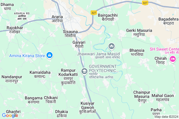
Majgawan Map
EDIT Map
Add Your House
 ..
..
Current Corona Virus Infected Patients Count in Araria District
| City Name | District Name | Total Covid cases |
|---|
Locality Name :
Majgawan
( मझगवां )
Block Name : Jokihat
District : Araria
State : Bihar
Division : Purnia
Language : Maithili and Hindi, Urdu, Thethi, Maithili, Bhojpuri
Current Time 12:44 PM
Date: Tuesday , Apr 29,2025 (IST)
Time zone: IST (UTC+5:30)
Elevation / Altitude: 52 meters. Above Seal level
Telephone Code / Std Code: 06453
Assembly constituency : Araria assembly constituency
Assembly MLA : Abidur Rahman
Lok Sabha constituency : Araria parliamentary constituency
Parliament MP : PRADEEP KUMAR SINGH
Serpanch Name :
Main Village Name : Majgawan
Commodities Prices : Islampur Market / Mandi
Majgawan Live Weather
Temperature: 29.3 °C
few clouds
Humidity: 46%
Wind : 5.05 mt/sec towards E
StationName : "ArÄ\u0081ria"
observed on 2 Hours Back
Temperature: 29.3 °C
few clouds
Humidity: 46%
Wind : 5.05 mt/sec towards E
StationName : "ArÄ\u0081ria"
observed on 2 Hours Back
Majgawan Weather Forecast for Next 5 days
30-04-2025
24.5°C to 32.9°C
few clouds, scattered clouds, clear sky, overcast clouds
24.5°C to 32.9°C
few clouds, scattered clouds, clear sky, overcast clouds
01-05-2025
23.9°C to 33.7°C
overcast clouds, broken clouds, few clouds, clear sky
23.9°C to 33.7°C
overcast clouds, broken clouds, few clouds, clear sky
02-05-2025
24.6°C to 35.6°C
light rain, broken clouds, overcast clouds
24.6°C to 35.6°C
light rain, broken clouds, overcast clouds
03-05-2025
25.2°C to 36.3°C
overcast clouds, broken clouds, scattered clouds, light rain, few clouds
25.2°C to 36.3°C
overcast clouds, broken clouds, scattered clouds, light rain, few clouds
04-05-2025
26.4°C to 36.5°C
few clouds, light rain, scattered clouds, broken clouds
26.4°C to 36.5°C
few clouds, light rain, scattered clouds, broken clouds
National Highways Reachable To Majgawan
Nationa High Way :NH27
Nationa High Way :NH27;NH327
Nationa High Way :NH27
Nationa High Way :NH27;NH327
Rivers Near Majgawan
Mahananda River
Dahuk
Mahananda River
Dahuk
About Majgawan
Correct below Info and add more info about MajgawanMajgawan is a small Village/hamlet in Jokihat Block in Araria District of Bihar State, India. It comes under Majgawan Panchayath. It belongs to Purnia Division . It is located 6 KM towards South from District head quarters Araria. 11 KM from Jokihat. 283 KM from State capital Patna
Chikani ( 5 KM ) , Bhansia ( 6 KM ) , Kamaldaha ( 7 KM ) , Bhagwan Pur ( 7 KM ) , Godaraha-vishanpur ( 8 KM ) are the nearby Villages to Majgawan. Majgawan is surrounded by Jokihat Block towards East , Jalalgarh Block towards South , Raniganj Block towards west , Palasi Block towards North .
Araria , Forbesganj , Purnia , Bahadurganj are the near by Cities to Majgawan.
Majgawan 2011 Census Details
Majgawan Local Language is Maithili. Majgawan Village Total population is 2766 and number of houses are 589. Female Population is 47.8%. Village literacy rate is 41.2% and the Female Literacy rate is 15.8%.
Population
| Census Parameter | Census Data |
| Total Population | 2766 |
| Total No of Houses | 589 |
| Female Population % | 47.8 % ( 1321) |
| Total Literacy rate % | 41.2 % ( 1140) |
| Female Literacy rate | 15.8 % ( 437) |
| Scheduled Tribes Population % | 0.0 % ( 0) |
| Scheduled Caste Population % | 0.0 % ( 0) |
| Working Population % | 41.1 % |
| Child(0 -6) Population by 2011 | 620 |
| Girl Child(0 -6) Population % by 2011 | 49.7 % ( 308) |
Majgawan Census More Deatils.
Politics in Majgawan
LJP , Bharatiya Janata Party , LJSP , BJP , RJD , INC are the major political parties in this area.Polling Stations /Booths near Majgawan
1)Prathamik Vidyalay Murballa (south Part)2)Prathamik Vidyalay Premnagar (north Part)
3)Prathamik Vidyalay Koskipur
4)Prathamik Vidyalay Ghat Tola Belwa
5)Utkramit Madhya Vidyalay Hariyabara Middil Part
HOW TO REACH Majgawan
By Road
Araria is the Nearest Town to Majgawan. Road connectivity is there from Araria to Majgawan.By Rail
Kusiargaon Rail Way Station , Araria Court Rail Way Station are the very nearby railway stations to Majgawan. Also you can consider railway Stations from Near By town Araria. Araria Court Rail Way Station , Arariya Rail Way Station are the railway Stations near to Araria. You can reach from Araria to Majgawan by road after .Pincodes near Majgawan
854312 ( Araria RS ) , 854325 ( Garhbanaili ) , 854311 ( Araria )Colleges near Majgawan
Kalawati Degree College, Raniganj
Address :
Forbesganj Collage Forbesganj
Address :
S.n.v.inter Collage Ranigange
Address : Farbisgang Road
M.p. College
Address : Belsara, Bodh-gaya
Schools near Majgawan
Mdr Islahul Muslemin Jokihat
Address : sisauna , jokihat , araria , Bihar . PIN- 854311 , Post - Araria
Ps Durga Pur
Address : durga pur , jokihat , araria , Bihar . PIN- 854325 , Post - Garhbanaili
Ps Koch Tola
Address : baluwa , jokihat , araria , Bihar . PIN- 854311 , Post - Araria
Mdr Saidul Banat
Address : parman pur , jokihat , araria , Bihar . PIN- 854329 , Post - Jokihat
Govt Health Centers near Majgawan
1) PHC Araria Sadar , ARARIA PHC , STATION ROAD WARD NO 7 , Near Block Office2) Sadar Hospital Araria , 0 , Araria , Araria
3) APHC Padampur , APHC PADAMPUR , BHANSIYA , WARD NO 13
Hospitals in Majgawan,Jokihat
Galenic Ayurvedic Hospital
Beside Uttar Bihar Gramin Bank; Zeromile; Bihar; India
4.1 KM distance Detail
more ..
Petrol Bunks in Majgawan,Jokihat
HP PETROL PUMP - S.D.FUEL CENTER
HP Petrol Pump Bausi P.o-bausi; Begusarai; Bihar 854312; India
4.2 KM distance Detail
more ..
Schools in Majgawan,Jokihat
Turkaili Upgraded Middle School
Bairagachhi - Uda Rd; Turkaili; Bihar 854312; India
5.0 KM distance Detail
Electronic Shops in Majgawan,Jokihat
cool care
Chandni Chowk Zero Mile Rd; Islam Nagar; PHED Colony; Araria; Bihar 854311; India
5.2 KM distance Detail
Super Markets in Majgawan,Jokihat
MoharramRaahi/Genral Store
molana abul kalam aazad chok zero mile araria.bus top; 0mile; India
3.9 KM distance Detail
Local Parks in Majgawan,Jokihat
Netaji Subhash Stadium; Araria
Chitragupt Nagar Thana Rd; Chitragupt Nagar; PHED Colony; Araria; Bihar 851204; India
6.1 KM distance Detail
Governement Offices near Majgawan,Jokihat
District Health Society
Chandani Chowk; Chandni Chowk Zero Mile Rd; Gachhi Tola; Araria; Bihar 854311; India
5.8 KM distance Detail
About Majgawan &
History
How to reach Majgawan
Tourist Places Near By Majgawan
Schools in Majgawan
Colleges in Majgawan
Temperature & weather of Majgawan
places in Majgawan
Majgawan photos
More Information
How to reach Majgawan
Tourist Places Near By Majgawan
Schools in Majgawan
Colleges in Majgawan
Temperature & weather of Majgawan
places in Majgawan
Majgawan photos
More Information
Village Talk
Post News or Events about this Village
Near Cities
Araria 6 KM near
Forbesganj 36 KM near
Purnia 38 KM near
Bahadurganj 41 KM near
Araria 6 KM near
Forbesganj 36 KM near
Purnia 38 KM near
Bahadurganj 41 KM near
Near By Taluks
Araria 8 KM near
Jokihat 10 KM near
Jalalgarh 17 KM near
Raniganj 18 KM near
Araria 8 KM near
Jokihat 10 KM near
Jalalgarh 17 KM near
Raniganj 18 KM near
Near By Air Ports
Bagdogra Airport 119 KM near
Rupsi Airport 271 KM near
Patna Airport 275 KM near
Gaya Airport 331 KM near
Bagdogra Airport 119 KM near
Rupsi Airport 271 KM near
Patna Airport 275 KM near
Gaya Airport 331 KM near
Near By Tourist Places
Sahibganj 106 KM near
Bhagalpur 120 KM near
Samsing 125 KM near
Mirik 126 KM near
Siliguri 130 KM near
Sahibganj 106 KM near
Bhagalpur 120 KM near
Samsing 125 KM near
Mirik 126 KM near
Siliguri 130 KM near
Near By Districts
Araria 6 KM near
Purnia 38 KM near
Kishanganj 51 KM near
Katihar 68 KM near
Araria 6 KM near
Purnia 38 KM near
Kishanganj 51 KM near
Katihar 68 KM near
Near By RailWay Station
Kusiargaon Rail Way Station 4.9 KM near
Araria Court Rail Way Station 5.9 KM near
Purnea Junction Rail Way Station 37 KM near
Dalkhola Rail Way Station 47 KM near
Kusiargaon Rail Way Station 4.9 KM near
Araria Court Rail Way Station 5.9 KM near
Purnea Junction Rail Way Station 37 KM near
Dalkhola Rail Way Station 47 KM near