| Home | City Bus | Maps | Villages | Cities | Rail | Tourist Places | School | College | Pin Codes | Corona Cases Count |
| Distance Calculator Bus Services IFSC Codes Trace Mobile Number Weather Search Place Trace IP Available Cash ATM/Banks Locate Polling Booth Report an Error contact People |
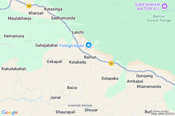
Bamur
Bamur Map
EDIT Map
Add Your House
 ..
..
Current Corona Virus Infected Patients Count in Anugul District
| City Name | District Name | Total Covid cases |
|---|
Locality Name :
Bamur
( ବେମୁର )
Tehsil Name : Kishorenagar
District : Anugul
State : Odisha
Language : Oriya and Hindi,
Current Time 10:13 AM
Date: Sunday , Apr 27,2025 (IST)
Time zone: IST (UTC+5:30)
Elevation / Altitude: 197 meters. Above Seal level
Telephone Code / Std Code: 06763
Assembly constituency : Athmallik assembly constituency
Assembly MLA : sanjeeb kumar sahoo
Lok Sabha constituency : Sambalpur parliamentary constituency
Parliament MP : NITESH GANGA DEB
Serpanch Name :
Pin Code : 759126
Post Office Name : Rajkishorenagar
Commodities Prices : Boudh Market / Mandi
Bamur Live Weather
Temperature: 37.2 °C
overcast clouds
Humidity: 24%
Wind : 8.21 mt/sec towards W
StationName : "Baud"
observed on Now
Temperature: 37.2 °C
overcast clouds
Humidity: 24%
Wind : 8.21 mt/sec towards W
StationName : "Baud"
observed on Now
Bamur Weather Forecast for Next 5 days
28-04-2025
27.2°C to 38.8°C
broken clouds, overcast clouds
27.2°C to 38.8°C
broken clouds, overcast clouds
29-04-2025
24.2°C to 40.5°C
broken clouds, few clouds, clear sky, light rain, scattered clouds
24.2°C to 40.5°C
broken clouds, few clouds, clear sky, light rain, scattered clouds
30-04-2025
23.1°C to 41.7°C
few clouds, clear sky, light rain
23.1°C to 41.7°C
few clouds, clear sky, light rain
01-05-2025
23.2°C to 41.5°C
clear sky, few clouds, light rain
23.2°C to 41.5°C
clear sky, few clouds, light rain
02-05-2025
22.3°C to 40.5°C
clear sky, heavy intensity rain, overcast clouds, scattered clouds
22.3°C to 40.5°C
clear sky, heavy intensity rain, overcast clouds, scattered clouds
Edit below overview about Bamur
Edit below overview about Bamur
OverView of Bamur
Puri to Rourkela passenger train and Puri to Sambalpur intercity Express halt at Bamur railway station..good people.. government should stop 2/3 pair Train more both up and down for BAMUR development..jai JagannathEdit below overview about Bamur
National Highways Reachable To Bamur
Nationa High Way :NH153B
Nationa High Way :NH53
Nationa High Way :NH153B
Nationa High Way :NH53
Rivers Near Bamur
Nandir
Surubali Jhor
Nandir
Surubali Jhor
About Bamur
Bamur is a small Village/hamlet in Kishorenagar Tehsil in Anugul District of Odisha State, India. It is located 76 KM towards west from District head quarters Angul. 11 KM from Kishorenagar. 191 KM from State capital Bhubaneswar
Bamur Pin code is 759126 and postal head office is Rajkishorenagar .
Dhaurapali ( 8 KM ) , Himitira ( 11 KM ) , Angapada ( 14 KM ) , Kadalimunda ( 16 KM ) , Sanjamura ( 16 KM ) are the nearby Villages to Bamur. Bamur is surrounded by Rairakhol Tehsil towards west , Naktideul Tehsil towards North , Athmallik Tehsil towards South , Boudh Tehsil towards west .
Debagarh , Phulabani , Anugul , Sambalpur are the near by Cities to Bamur.
Bamur 2011 Census Details
Bamur Local Language is Oriya. Bamur Village Total population is 923 and number of houses are 226. Female Population is 47.5%. Village literacy rate is 68.6% and the Female Literacy rate is 29.6%.
Population
| Census Parameter | Census Data |
| Total Population | 923 |
| Total No of Houses | 226 |
| Female Population % | 47.5 % ( 438) |
| Total Literacy rate % | 68.6 % ( 633) |
| Female Literacy rate | 29.6 % ( 273) |
| Scheduled Tribes Population % | 15.9 % ( 147) |
| Scheduled Caste Population % | 4.7 % ( 43) |
| Working Population % | 35.2 % |
| Child(0 -6) Population by 2011 | 106 |
| Girl Child(0 -6) Population % by 2011 | 47.2 % ( 50) |
Bamur Census More Deatils.
Politics in Bamur
BJD is the major political party in this area.Polling Stations /Booths near Bamur
1)Bamur P S(e) Bamur2)Balijereng P.s.
3)Baija P.u.p.s.
4)Chudakhai P.u.p.s.
5)Jamunali P.p.s.
HOW TO REACH Bamur
By Rail
Bamur Rail Way Station , Saragipali Rail Way Station are the very nearby railway stations to Bamur.Colleges near Bamur
Janata College,boinda
Address :
Schools in Bamur
Jubajyoti Hs
Address : bamur , kishorenagar , angul , Sikkim . PIN- 759126 , Post - Rajkishorenagar
Bamur Ups
Address : bamur , kishorenagar , angul , Sikkim . PIN- 759126 , Post - Rajkishorenagar
Govt Health Centers near Bamur
1) Hatibari , , ,2) DR.JANARDAN PUJARI MATERNITY HOME SAMBALPUR , JPM SAMBALPUR , GOLEBAZAR , Golebazar
3) UFWC, AITHAPALI , URBAN FAMILY WELFARE CENTER AINTHAPALI , Aithapali , Near Trafic
Hospitals in Bamur,Kishorenagar
Kishore Nagar Govt Hospital
KishorNagar Rd; Pipalabahal; Odisha 759127; India
6.4 KM distance Detail
more ..
Local Parks in Bamur,Kishorenagar
Police Stations near Bamur,Kishorenagar
About Bamur &
History
How to reach Bamur
Tourist Places Near By Bamur
Schools in Bamur
Colleges in Bamur
Temperature & weather of Bamur
places in Bamur
Bamur photos
More Information
How to reach Bamur
Tourist Places Near By Bamur
Schools in Bamur
Colleges in Bamur
Temperature & weather of Bamur
places in Bamur
Bamur photos
More Information
Village Talk
Post News or Events about this Village
Near Cities
Debagarh 70 KM near
Phulabani 73 KM near
Anugul 75 KM near
Sambalpur 84 KM near
Debagarh 70 KM near
Phulabani 73 KM near
Anugul 75 KM near
Sambalpur 84 KM near
Near By Taluks
Kishorenagar 11 KM near
Rairakhol 26 KM near
Naktideul 29 KM near
Athmallik 32 KM near
Kishorenagar 11 KM near
Rairakhol 26 KM near
Naktideul 29 KM near
Athmallik 32 KM near
Near By Air Ports
Bhubaneswar Airport 182 KM near
Ranchi Airport 303 KM near
Raipur Airport 319 KM near
Vishakhapatnam Airport 434 KM near
Bhubaneswar Airport 182 KM near
Ranchi Airport 303 KM near
Raipur Airport 319 KM near
Vishakhapatnam Airport 434 KM near
Near By Tourist Places
Phulbani 72 KM near
Sambalpur 81 KM near
Hirakud 94 KM near
Rourkela 161 KM near
Raigarh 167 KM near
Phulbani 72 KM near
Sambalpur 81 KM near
Hirakud 94 KM near
Rourkela 161 KM near
Raigarh 167 KM near
Near By Districts
Boudh 28 KM near
Sonepur 70 KM near
Deogarh 71 KM near
Kandhamal 71 KM near
Boudh 28 KM near
Sonepur 70 KM near
Deogarh 71 KM near
Kandhamal 71 KM near
Near By RailWay Station
Bamur Rail Way Station 0.7 KM near
Rairakhol Rail Way Station 18 KM near
Boinda Rail Way Station 33 KM near
Bamur Rail Way Station 0.7 KM near
Rairakhol Rail Way Station 18 KM near
Boinda Rail Way Station 33 KM near