| Home | City Bus | Maps | Villages | Cities | Rail | Tourist Places | School | College | Pin Codes | Corona Cases Count |
| Distance Calculator Bus Services IFSC Codes Trace Mobile Number Weather Search Place Trace IP Available Cash ATM/Banks Locate Polling Booth Report an Error contact People |
Tebud
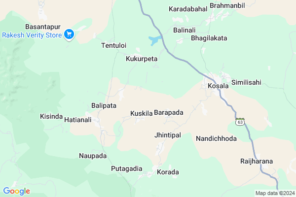
Tebud Map
EDIT Map
Add Your House
 ..
..
Current Corona Virus Infected Patients Count in Anugul District
| City Name | District Name | Total Covid cases |
|---|
Locality Name :
Tebud
( ଟେବୁଡ଼ )
Tehsil Name : Chhendipada
District : Anugul
State : Odisha
Language : Oriya and Hindi,
Current Time 08:39 AM
Date: Friday , Apr 25,2025 (IST)
Time zone: IST (UTC+5:30)
Elevation / Altitude: 205 meters. Above Seal level
Telephone Code / Std Code: 06761
Assembly constituency : Chhendipada assembly constituency
Assembly MLA : susanta kumar behera
Lok Sabha constituency : Sambalpur parliamentary constituency
Parliament MP : NITESH GANGA DEB
Serpanch Name :
Alternate Village Name : Tebudu
Commodities Prices : Angaura Market / Mandi
Tebud Live Weather
Temperature: 28.1 °C
clear sky
Humidity: 48%
Wind : 0.84 mt/sec towards N
StationName : "Angul"
observed on 1 Hours Back
Temperature: 28.1 °C
clear sky
Humidity: 48%
Wind : 0.84 mt/sec towards N
StationName : "Angul"
observed on 1 Hours Back
Tebud Weather Forecast for Next 5 days
26-04-2025
26.0°C to 44.0°C
clear sky
26.0°C to 44.0°C
clear sky
27-04-2025
25.2°C to 44.0°C
clear sky, scattered clouds, broken clouds, few clouds
25.2°C to 44.0°C
clear sky, scattered clouds, broken clouds, few clouds
28-04-2025
26.6°C to 42.2°C
scattered clouds, overcast clouds, broken clouds
26.6°C to 42.2°C
scattered clouds, overcast clouds, broken clouds
29-04-2025
26.1°C to 41.5°C
overcast clouds, broken clouds, scattered clouds, light rain, few clouds
26.1°C to 41.5°C
overcast clouds, broken clouds, scattered clouds, light rain, few clouds
30-04-2025
23.3°C to 40.9°C
scattered clouds, few clouds, light rain, clear sky
23.3°C to 40.9°C
scattered clouds, few clouds, light rain, clear sky
National Highways Reachable To Tebud
Nationa High Way :NH53
Nationa High Way :NH53
Rivers Near Tebud
Gauduni
Ghosar Jhor
Gauduni
Ghosar Jhor
About Tebud
Correct below Info and add more info about TebudTebud is a small Village/hamlet in Chhendipada Tehsil in Anugul District of Odisha State, India. It is located 30 KM towards west from District head quarters Angul. 148 KM from State capital Bhubaneswar
Tebud is surrounded by Kaniha Tehsil towards East , Talacher Tehsil towards East , Anugul Tehsil towards South , Banarpal Tehsil towards East .
Anugul , Talcher , Debagarh , Dhenkanal are the near by Cities to Tebud.
Tebudu 2011 Census Details
Tebud Local Language is Oriya. Tebudu Village Total population is 766 and number of houses are 173. Female Population is 47.3%. Village literacy rate is 64.2% and the Female Literacy rate is 23.0%.
Population
| Census Parameter | Census Data |
| Total Population | 766 |
| Total No of Houses | 173 |
| Female Population % | 47.3 % ( 362) |
| Total Literacy rate % | 64.2 % ( 492) |
| Female Literacy rate | 23.0 % ( 176) |
| Scheduled Tribes Population % | 5.2 % ( 40) |
| Scheduled Caste Population % | 25.8 % ( 198) |
| Working Population % | 55.5 % |
| Child(0 -6) Population by 2011 | 98 |
| Girl Child(0 -6) Population % by 2011 | 41.8 % ( 41) |
Tebudu Census More Deatils.
Politics in Tebud
UTC , BJD , JAC are the major political parties in this area.Polling Stations /Booths near Tebud
1)Kusasingha Primary School.2)Kuskila - Ii
3)Sankerjang P.s. (w)
4)Govt. U.g.h.s. Ogi
5)Dhipasahi Tasara Ps(w) Tubey
HOW TO REACH Tebud
By Rail
There is no railway station near to Tebud in less than 10 km.Pincodes near Tebud
768109 ( Reamal ) , 759146 ( Igit Sarang ) , 759121 ( Meramandali )Colleges near Tebud
Patitapaban Mahavidyala,jarapada,angul
Address :
Schools in Tebud
Khuntanali Ps
Address : tebudu , chhendipada , angul , Sikkim . PIN- 759171
Tebudu Nclp
Address : tebudu , chhendipada , angul , Sikkim . PIN- 759141 , Post - Bagedia
Govt Health Centers near Tebud
1) HINDOL , HINDOL , HINDOL , HINDOL HIGH SCHOOL2) KHAJURIA KATA , KHAJURIAKATA CHC , KHAJURIAKATA , NEAR STATE BANK OF INDIA
3) Khajurikata (Main) SC , KHAJURIAKATA , KHAJURIAKATA , KHAJURIAKATA CHC
Petrol Bunks in Tebud,Chhendipada
HP PETROL PUMP - SARALIA FUELS
Hpcl Dealer Near Kimet College; A.T. Charibati P.O Nuapada VIA Chendipada; Bhubaneshwar; Odisha 759124; India
10.7 KM distance Detail
Ratan Filling Station
Tukuda; Near Jarapada College; Vai Kishoregunj Angul Dist; Jarapada; Odisha 759127; India
15.4 KM distance Detail
more ..
Colleges in Tebud,Chhendipada
angul chendipada bapuji college
Chhendipada - Jarapada Rd; Putagadia; Odisha 759124; India
6.5 KM distance Detail
more ..
Electronic Shops in Tebud,Chhendipada
Behera Electrical Ac Refrigerator REPAIRING CENTER
Angul; Odisha 759130; India
5.2 KM distance Detail
Local Parks in Tebud,Chhendipada
Kanakpada Cricket Ground
Bagdia - Basantapur Rd; Dehury Sahi; Bagdia; Odisha 759141; India
14.9 KM distance Detail
About Tebud &
History
How to reach Tebud
Tourist Places Near By Tebud
Schools in Tebud
Colleges in Tebud
Temperature & weather of Tebud
places in Tebud
Tebud photos
More Information
How to reach Tebud
Tourist Places Near By Tebud
Schools in Tebud
Colleges in Tebud
Temperature & weather of Tebud
places in Tebud
Tebud photos
More Information
Village Talk
Post News or Events about this Village
Near Cities
Anugul 31 KM near
Talcher 38 KM near
Debagarh 68 KM near
Dhenkanal 93 KM near
Anugul 31 KM near
Talcher 38 KM near
Debagarh 68 KM near
Dhenkanal 93 KM near
Near By Taluks
Chhendipada 0 KM near
Kaniha 25 KM near
Talacher 33 KM near
Anugul 35 KM near
Chhendipada 0 KM near
Kaniha 25 KM near
Talacher 33 KM near
Anugul 35 KM near
Near By Air Ports
Bhubaneswar Airport 142 KM near
Ranchi Airport 292 KM near
Raipur Airport 366 KM near
Vishakhapatnam Airport 451 KM near
Bhubaneswar Airport 142 KM near
Ranchi Airport 292 KM near
Raipur Airport 366 KM near
Vishakhapatnam Airport 451 KM near
Near By Tourist Places
Phulbani 100 KM near
Sambalpur 121 KM near
Nandan Kanan National Park 131 KM near
Cuttack 133 KM near
Hirakud 133 KM near
Phulbani 100 KM near
Sambalpur 121 KM near
Nandan Kanan National Park 131 KM near
Cuttack 133 KM near
Hirakud 133 KM near
Near By Districts
Anugul 29 KM near
Boudh 69 KM near
Deogarh 70 KM near
Dhenkanal 92 KM near
Anugul 29 KM near
Boudh 69 KM near
Deogarh 70 KM near
Dhenkanal 92 KM near
Near By RailWay Station
Boinda Rail Way Station 19 KM near
Angul Rail Way Station 30 KM near
Boinda Rail Way Station 19 KM near
Angul Rail Way Station 30 KM near