| Home | City Bus | Maps | Villages | Cities | Rail | Tourist Places | School | College | Pin Codes | Corona Cases Count |
| Distance Calculator Bus Services IFSC Codes Trace Mobile Number Weather Search Place Trace IP Available Cash ATM/Banks Locate Polling Booth Report an Error contact People |
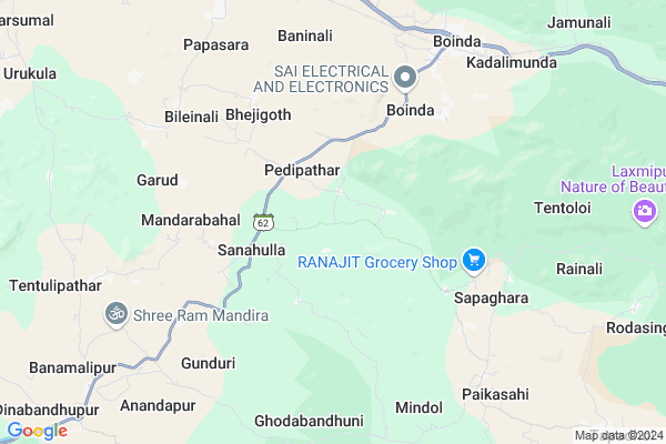
Jhilimunda Map
EDIT Map
Add Your House
 ..
..
Current Corona Virus Infected Patients Count in Anugul District
| City Name | District Name | Total Covid cases |
|---|
Locality Name :
Jhilimunda
( ଝିଲିମୁଣ୍ଡା )
Tehsil Name : Athmallik
District : Anugul
State : Odisha
Language : Oriya and Hindi,
Current Time 04:05 PM
Date: Monday , Apr 28,2025 (IST)
Time zone: IST (UTC+5:30)
Elevation / Altitude: 197 meters. Above Seal level
Telephone Code / Std Code: 06763
Assembly constituency : Athmallik assembly constituency
Assembly MLA : sanjeeb kumar sahoo
Lok Sabha constituency : Sambalpur parliamentary constituency
Parliament MP : NITESH GANGA DEB
Serpanch Name :
Pin Code : 759125
Post Office Name : Athamallik
Commodities Prices : Khunthabandha Market / Mandi
National Highways Reachable To Jhilimunda
Nationa High Way :NH55
Nationa High Way :NH655
Nationa High Way :NH55
Nationa High Way :NH655
Rivers Near Jhilimunda
Mahanadi :Mahanadi River :महानदी नदी
Singa Jhor
Mahanadi :Mahanadi River :महानदी नदी
Singa Jhor
About Jhilimunda
Correct below Info and add more info about JhilimundaJhilimunda is a small Village/hamlet in Athmallik Tehsil in Anugul District of Odisha State, India. It is located 45 KM towards west from District head quarters Angul. 19 KM from Athmallik. 158 KM from State capital Bhubaneswar
Jhilimunda Pin code is 759125 and postal head office is Athamallik .
Paikasahi ( 8 KM ) , Handapa ( 10 KM ) , Urukula ( 13 KM ) , Tapadhol ( 13 KM ) , Kanteikulia ( 14 KM ) are the nearby Villages to Jhilimunda. Jhilimunda is surrounded by Kishorenagar Tehsil towards west , Chhendipada Tehsil towards East , Harabhanga Tehsil towards South , Anugul Tehsil towards East .
Anugul , Talcher , Phulabani , Debagarh are the near by Cities to Jhilimunda.
This Place is in the border of the Anugul District and Boudh District. Boudh District Harabhanga is South towards this place .
Jhilimunda 2011 Census Details
Jhilimunda Local Language is Oriya. Jhilimunda Village Total population is 798 and number of houses are 182. Female Population is 52.4%. Village literacy rate is 65.3% and the Female Literacy rate is 29.2%.
Population
| Census Parameter | Census Data |
| Total Population | 798 |
| Total No of Houses | 182 |
| Female Population % | 52.4 % ( 418) |
| Total Literacy rate % | 65.3 % ( 521) |
| Female Literacy rate | 29.2 % ( 233) |
| Scheduled Tribes Population % | 15.2 % ( 121) |
| Scheduled Caste Population % | 7.3 % ( 58) |
| Working Population % | 60.8 % |
| Child(0 -6) Population by 2011 | 98 |
| Girl Child(0 -6) Population % by 2011 | 50.0 % ( 49) |
Jhilimunda Census More Deatils.
Politics in Jhilimunda
BJD is the major political party in this area.Polling Stations /Booths near Jhilimunda
1)Jharabereni P.u.p.s.2)Barapali P.u.p.s. Kurumtap
3)Badabahal P.s.
4)Pathargarh P.s
5)Mahendra High School
HOW TO REACH Jhilimunda
By Rail
Boinda Rail Way Station , Handapa Rail Way Station are the very nearby railway stations to Jhilimunda.Colleges near Jhilimunda
Satyabadi Meher Mahavidyalaya
Address :
Schools in Jhilimunda
Rainali Ss
Address : jhilimunda , athamallik , angul , Sikkim . PIN- 759125 , Post - Athamallik
Govt Health Centers near Jhilimunda
1) HINDOL , HINDOL , HINDOL , HINDOL HIGH SCHOOL2) KHAJURIA KATA , KHAJURIAKATA CHC , KHAJURIAKATA , NEAR STATE BANK OF INDIA
3) Khajurikata (Main) SC , KHAJURIAKATA , KHAJURIAKATA , KHAJURIAKATA CHC
Petrol Bunks in Jhilimunda,Athmallik
Keshav Filling Station
Boinda; Anugul; NH-42; Cuttack Samabalpur Highway; Angul; Angul; Odisha 759127; India
8.5 KM distance Detail
Ratan Filling Station
Tukuda; Near Jarapada College; Vai Kishoregunj Angul Dist; Jarapada; Odisha 759127; India
20.9 KM distance Detail
more ..
Colleges in Jhilimunda,Athmallik
IGNOU Study Centre;Viswa Yuva Kendra;Baninali;Luhamunda
Sambalpur - Angul - Dhenkanal - Cuttack Rd; Deberapali; Odisha 759127; India
8.6 KM distance Detail
more ..
Schools in Jhilimunda,Athmallik
Pedipathar Primary School
Pedipathar; Athmallik; Anugul; SH-62; Boinda to Jhatimunda Road; Angul; Angul; Odisha 759126; India
2.6 KM distance Detail
Boinda Primary School
Boinda; Athmallik; Anugul; SH-62; Boinda to Jhatimunda Road; Angul; Angul; Odisha 759128; India
5.8 KM distance Detail
Electronic Shops in Jhilimunda,Athmallik
Kanchan Motors
55; Sambalpur - Angul - Dhenkanal - Cuttack Rd; Boinda; Odisha 759127; India
8.4 KM distance Detail
Police Stations near Jhilimunda,Athmallik
Boinda Police Station
55; Sambalpur - Angul - Dhenkanal - Cuttack Rd; Boinda; Odisha 759127; India
8.3 KM distance Detail
About Jhilimunda &
History
How to reach Jhilimunda
Tourist Places Near By Jhilimunda
Schools in Jhilimunda
Colleges in Jhilimunda
Temperature & weather of Jhilimunda
places in Jhilimunda
Jhilimunda photos
More Information
How to reach Jhilimunda
Tourist Places Near By Jhilimunda
Schools in Jhilimunda
Colleges in Jhilimunda
Temperature & weather of Jhilimunda
places in Jhilimunda
Jhilimunda photos
More Information
Village Talk
Post News or Events about this Village
Near Cities
Anugul 45 KM near
Talcher 60 KM near
Phulabani 74 KM near
Debagarh 82 KM near
Anugul 45 KM near
Talcher 60 KM near
Phulabani 74 KM near
Debagarh 82 KM near
Near By Taluks
Athmallik 17 KM near
Kishorenagar 21 KM near
Chhendipada 26 KM near
Harabhanga 40 KM near
Athmallik 17 KM near
Kishorenagar 21 KM near
Chhendipada 26 KM near
Harabhanga 40 KM near
Near By Air Ports
Bhubaneswar Airport 150 KM near
Ranchi Airport 312 KM near
Raipur Airport 347 KM near
Vishakhapatnam Airport 428 KM near
Bhubaneswar Airport 150 KM near
Ranchi Airport 312 KM near
Raipur Airport 347 KM near
Vishakhapatnam Airport 428 KM near
Near By Tourist Places
Phulbani 74 KM near
Sambalpur 113 KM near
Hirakud 125 KM near
Nandan Kanan National Park 141 KM near
Cuttack 145 KM near
Phulbani 74 KM near
Sambalpur 113 KM near
Hirakud 125 KM near
Nandan Kanan National Park 141 KM near
Cuttack 145 KM near
Near By Districts
Anugul 43 KM near
Boudh 46 KM near
Kandhamal 73 KM near
Deogarh 83 KM near
Anugul 43 KM near
Boudh 46 KM near
Kandhamal 73 KM near
Deogarh 83 KM near
Near By RailWay Station
Boinda Rail Way Station 8.0 KM near
Angul Rail Way Station 45 KM near
Boinda Rail Way Station 8.0 KM near
Angul Rail Way Station 45 KM near