| Home | City Bus | Maps | Villages | Cities | Rail | Tourist Places | School | College | Pin Codes | Corona Cases Count |
| Distance Calculator Bus Services IFSC Codes Trace Mobile Number Weather Search Place Trace IP Available Cash ATM/Banks Locate Polling Booth Report an Error contact People |
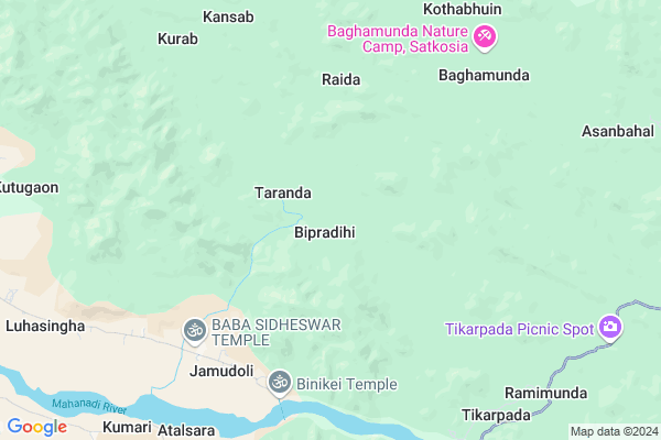
Bipradihi Map
EDIT Map
Add Your House
 ..
..
Current Corona Virus Infected Patients Count in Anugul District
| City Name | District Name | Total Covid cases |
|---|
Locality Name :
Bipradihi
( ବିପ୍ରାଡ଼ିହି )
Tehsil Name : Athmallik
District : Anugul
State : Odisha
Language : Oriya and Hindi,
Current Time 04:31 PM
Date: Monday , Apr 28,2025 (IST)
Time zone: IST (UTC+5:30)
Elevation / Altitude: 197 meters. Above Seal level
Telephone Code / Std Code: 06763
Assembly constituency : Athmallik assembly constituency
Assembly MLA : sanjeeb kumar sahoo
Lok Sabha constituency : Sambalpur parliamentary constituency
Parliament MP : NITESH GANGA DEB
Serpanch Name :
Pin Code : 759125
Post Office Name : Athamallik
Commodities Prices : Khunthabandha Market / Mandi
National Highways Reachable To Bipradihi
Nationa High Way :NH55
Nationa High Way :NH655
Nationa High Way :NH55
Nationa High Way :NH655
Rivers Near Bipradihi
Mahanadi :Mahanadi River :महानदी नदी
Singa Jhor
Mahanadi :Mahanadi River :महानदी नदी
Singa Jhor
About Bipradihi
Correct below Info and add more info about BipradihiBipradihi is a small Village/hamlet in Athmallik Tehsil in Anugul District of Odisha State, India. It is located 48 KM towards west from District head quarters Angul. 22 KM from Athmallik. 143 KM from State capital Bhubaneswar
Bipradihi Pin code is 759125 and postal head office is Athamallik .
Kothabhuin ( 9 KM ) , Luhasingha ( 11 KM ) , Maimura ( 12 KM ) , Purunakot ( 13 KM ) , Tainsi ( 14 KM ) are the nearby Villages to Bipradihi. Bipradihi is surrounded by Harabhanga Tehsil towards west , Kishorenagar Tehsil towards North , Dasapalla Tehsil towards South , Anugul Tehsil towards East .
Anugul , Phulabani , Talcher , Dhenkanal are the near by Cities to Bipradihi.
This Place is in the border of the Anugul District and Boudh District. Boudh District Harabhanga is west towards this place .
Bipradihi 2011 Census Details
Bipradihi Local Language is Oriya. Bipradihi Village Total population is 370 and number of houses are 89. Female Population is 50.3%. Village literacy rate is 75.4% and the Female Literacy rate is 36.2%.
Population
| Census Parameter | Census Data |
| Total Population | 370 |
| Total No of Houses | 89 |
| Female Population % | 50.3 % ( 186) |
| Total Literacy rate % | 75.4 % ( 279) |
| Female Literacy rate | 36.2 % ( 134) |
| Scheduled Tribes Population % | 40.8 % ( 151) |
| Scheduled Caste Population % | 24.6 % ( 91) |
| Working Population % | 56.5 % |
| Child(0 -6) Population by 2011 | 59 |
| Girl Child(0 -6) Population % by 2011 | 50.8 % ( 30) |
Bipradihi Census More Deatils.
Politics in Bipradihi
BJD is the major political party in this area.Polling Stations /Booths near Bipradihi
1)Tapurusinga P.u.p.s.2)Jamudoli.u.p.s (east).
3)Jagannathpur P.s.
4)Laxmipur P.u.p.s.
5)Badahula U.p.school
HOW TO REACH Bipradihi
By Rail
There is no railway station near to Bipradihi in less than 10 km.Colleges near Bipradihi
Satyabadi Meher Mahavidyalaya
Address :
Schools near Bipradihi
Arjuna Hs
Address : basudevpur , athamallik , angul , Sikkim . PIN- 759126 , Post - Rajkishorenagar
Panchasakha Hs, Mandarbahal
Address : mandarbahal , athamallik , angul , Sikkim . PIN- 759125 , Post - Athamallik
Panchayatraj Hs
Address : maimura , athamallik , angul , Sikkim . PIN- 759125 , Post - Athamallik
Grampanchayat Hs
Address : sapaghara , athamallik , angul , Sikkim . PIN- 759125 , Post - Athamallik
Govt Health Centers near Bipradihi
1) HINDOL , HINDOL , HINDOL , HINDOL HIGH SCHOOL2) Kalanga SC , Kalanga , , Near water Tank
3) KHAJURIA KATA , KHAJURIAKATA CHC , KHAJURIAKATA , NEAR STATE BANK OF INDIA
Electronic Shops in Bipradihi,Athmallik
Super Markets in Bipradihi,Athmallik
Local Parks in Bipradihi,Athmallik
Police Stations near Bipradihi,Athmallik
About Bipradihi &
History
How to reach Bipradihi
Tourist Places Near By Bipradihi
Schools in Bipradihi
Colleges in Bipradihi
Temperature & weather of Bipradihi
places in Bipradihi
Bipradihi photos
More Information
How to reach Bipradihi
Tourist Places Near By Bipradihi
Schools in Bipradihi
Colleges in Bipradihi
Temperature & weather of Bipradihi
places in Bipradihi
Bipradihi photos
More Information
Village Talk
Post News or Events about this Village
Near Cities
Anugul 46 KM near
Phulabani 64 KM near
Talcher 66 KM near
Dhenkanal 100 KM near
Anugul 46 KM near
Phulabani 64 KM near
Talcher 66 KM near
Dhenkanal 100 KM near
Near By Taluks
Athmallik 20 KM near
Harabhanga 31 KM near
Kishorenagar 40 KM near
Anugul 42 KM near
Athmallik 20 KM near
Harabhanga 31 KM near
Kishorenagar 40 KM near
Anugul 42 KM near
Near By Air Ports
Bhubaneswar Airport 136 KM near
Ranchi Airport 336 KM near
Raipur Airport 354 KM near
Vishakhapatnam Airport 407 KM near
Bhubaneswar Airport 136 KM near
Ranchi Airport 336 KM near
Raipur Airport 354 KM near
Vishakhapatnam Airport 407 KM near
Near By Tourist Places
Phulbani 63 KM near
Chilika 123 KM near
Nandan Kanan National Park 129 KM near
Sambalpur 133 KM near
Bhubaneswar 134 KM near
Phulbani 63 KM near
Chilika 123 KM near
Nandan Kanan National Park 129 KM near
Sambalpur 133 KM near
Bhubaneswar 134 KM near
Near By Districts
Anugul 46 KM near
Boudh 53 KM near
Kandhamal 63 KM near
Nayagarh 79 KM near
Anugul 46 KM near
Boudh 53 KM near
Kandhamal 63 KM near
Nayagarh 79 KM near
Near By RailWay Station
Boinda Rail Way Station 31 KM near
Angul Rail Way Station 48 KM near
Boinda Rail Way Station 31 KM near
Angul Rail Way Station 48 KM near