| Home | City Bus | Maps | Villages | Cities | Rail | Tourist Places | School | College | Pin Codes | Corona Cases Count |
| Distance Calculator Bus Services IFSC Codes Trace Mobile Number Weather Search Place Trace IP Available Cash ATM/Banks Locate Polling Booth Report an Error contact People |
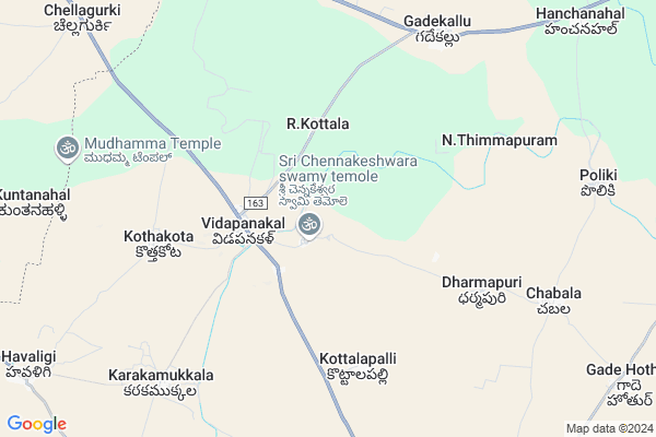
Velpumadugu
Velpumadugu Map
EDIT Map
Add Your House
 ..
..
Current Corona Virus Infected Patients Count in Anantapur District
| City Name | District Name | Total Covid cases |
|---|---|---|
| Anantapur District | Anantapur | 36 |
| Anantapur | Anantapur | 5 |
| Hindupur | Anantapur | 3 |
| R K Function Hall Backside | Anantapur | 2 |
| Lepakshi | Anantapur | 2 |
| Kalyana Durgam | Anantapur | 1 |
| Hindupur Mandal | Anantapur | 1 |
| Naik Nagar | Anantapur | 1 |
| Kothacheruvu | Anantapur | 1 |
| Aravinda Nagar | Anantapur | 1 |
Locality Name :
Velpumadugu
( వేల్పుమడుగు )
Mandal Name : Vidapanakal
District : Anantapur
State : Andhra Pradesh
Region : Rayalaseema
Language : Telugu and Urdu
Current Time 03:26 PM
Date: Tuesday , Apr 29,2025 (IST)
Time zone: IST (UTC+5:30)
Elevation / Altitude: 431 meters. Above Seal level
Telephone Code / Std Code: 08496
Assembly constituency : assembly constituency
Assembly MLA : PAYYAVULA KESHAV
Lok Sabha constituency : parliamentary constituency
Parliament MP : TALARI RANGAIAH
Serpanch Name :
Pin Code : 515870
Post Office Name : Vidapanakal
Commodities Prices : Bellary Market / Mandi
Velpumadugu Live Weather
Temperature: 39.2 °C
clear sky
Humidity: 17%
Wind : 3.73 mt/sec towards E
StationName : "Uravakonda"
observed on 10 Mins Back
Temperature: 39.2 °C
clear sky
Humidity: 17%
Wind : 3.73 mt/sec towards E
StationName : "Uravakonda"
observed on 10 Mins Back
Velpumadugu Weather Forecast for Next 5 days
30-04-2025
31.6°C to 38.8°C
few clouds, broken clouds
31.6°C to 38.8°C
few clouds, broken clouds
01-05-2025
28.7°C to 39.6°C
broken clouds, scattered clouds
28.7°C to 39.6°C
broken clouds, scattered clouds
02-05-2025
27.0°C to 40.2°C
broken clouds, scattered clouds, few clouds, clear sky
27.0°C to 40.2°C
broken clouds, scattered clouds, few clouds, clear sky
03-05-2025
26.5°C to 40.0°C
few clouds, clear sky, scattered clouds
26.5°C to 40.0°C
few clouds, clear sky, scattered clouds
04-05-2025
26.6°C to 41.3°C
scattered clouds, clear sky, broken clouds
26.6°C to 41.3°C
scattered clouds, clear sky, broken clouds
National Highways Reachable To Velpumadugu
Nationa High Way :NH150A
Nationa High Way :NH 67;150A
Nationa High Way :NH150A
Nationa High Way :NH 67;150A
Rivers Near Velpumadugu
Tungabhadra :ತುಂಗಭದ್ರಾ
Puli Vanka
Tungabhadra :ತುಂಗಭದ್ರಾ
Puli Vanka
About Velpumadugu
Correct below Info and add more info about VelpumaduguVelpumadugu is a Village in Vidapanakal Mandal in Anantapur District of Andhra Pradesh State, India. It belongs to Rayalaseema region . It is located 68 KM towards North from District head quarters Anantapur. 1 KM from Vidapanakal. 342 KM from State capital Hyderabad
Velpumadugu Pin code is 515870 and postal head office is Vidapanakal .
R.kottala ( 4 KM ) , Janardhana Palli ( 4 KM ) , Malapuram ( 5 KM ) , V.kothakota ( 6 KM ) , Karakamukkala ( 8 KM ) are the nearby Villages to Velpumadugu. Velpumadugu is surrounded by Uravakonda Mandal towards South , Vajrakarur Mandal towards East , Chippagiri Mandal towards North , Bommanahal Mandal towards west .
Uravakonda , Guntakal , Bellary , Gooty are the near by Cities to Velpumadugu.
Velpumadugu 2011 Census Details
Velpumadugu Local Language is Telugu. Velpumadugu Village Total population is 5822 and number of houses are 1365. Female Population is 49.1%. Village literacy rate is 54.5% and the Female Literacy rate is 22.2%.
Population
| Census Parameter | Census Data |
| Total Population | 5822 |
| Total No of Houses | 1365 |
| Female Population % | 49.1 % ( 2858) |
| Total Literacy rate % | 54.5 % ( 3172) |
| Female Literacy rate | 22.2 % ( 1290) |
| Scheduled Tribes Population % | 0.0 % ( 0) |
| Scheduled Caste Population % | 15.0 % ( 873) |
| Working Population % | 52.6 % |
| Child(0 -6) Population by 2011 | 571 |
| Girl Child(0 -6) Population % by 2011 | 51.1 % ( 292) |
Velpumadugu Census More Deatils.
HOW TO REACH Velpumadugu
By Road
Guntakal is the Nearest Town to Velpumadugu. Guntakal is 38 km from Velpumadugu. Road connectivity is there from Guntakal to Velpumadugu.By Rail
There is no railway station near to Velpumadugu in less than 10 km. How ever there are railway Stations from Near By town Guntakal. are the railway Stations near to Guntakal. You can reach from Guntakal to Velpumadugu by road after .By Bus
Uravakonda APSRTC Bus Station , Vajra Karur APSRTC Bus Station , Guntakal APSRTC Bus Station are the nearby by Bus Stations to Velpumadugu .APSRTC runs Number of busses from major cities to here.Colleges near Velpumadugu
Mahatma Jr College(incentive),vidapanakal
Address : Vidapanakal
Schools in Velpumadugu
Zphs Kottalapalli
Address : velpumadugu , vidapanakal , anantapur , Andhra Pradesh . PIN- 515870 , Post - Vidapanakal
Govt Health Centers near Velpumadugu
1) Sc V.Kothakota , 1-87 A , Near Maremma Temple ,2) Sc Poliki , 3-45-2 , Gunthakal Road ,
3) Sc Palthur , , Near Bus stand , Near Bus stand
Hospitals in Velpumadugu,Vidapanakal
Gade Hothur Government Hospital
guntakal road; main; Gade Hothur; Andhra Pradesh 515832; India
13.2 KM distance Detail
Gade Houther Hospital;Donated By Thimma Chowdary;
gade houther; Anantapuram; Andhra Pradesh; India
13.3 KM distance Detail
Lv Prasad Eye Institute
Uravakonda - Bellary Rd; Palthur; Andhra Pradesh 515870; India
13.5 KM distance Detail
more ..
Petrol Bunks in Velpumadugu,Vidapanakal
SIDDARTHA FILLING STATION
VIDAPANAKALLU; ANANTAPUR; Andhra Pradesh 515870; India
4.1 KM distance Detail
Indian Oil Petrol Pump
Bellary; NH-63; Bellary Krishnapatnam Port Highway; Bellary Nellore Road; Bellary; Bellary; Karnataka 583111; India
10.3 KM distance Detail
more ..
Colleges in Velpumadugu,Vidapanakal
Government Polytechnic Uravakonda
Bellary Bypass Road; Uravakonda; Anantapur; Andhra Pradesh 515812; India
16.1 KM distance Detail
more ..
Schools in Velpumadugu,Vidapanakal
Mandal Parishad Upper Primary School
Karakamukkala; Andhra Pradesh 515870; India
9.1 KM distance Detail
Governement Offices near Velpumadugu,Vidapanakal
MeeSeva Center
Havaligi; Vadapanakal; Ananthapur-515870; 2/1208.1; Havaligi; Andhra Pradesh 515870; India
13.5 KM distance Detail
MeeSeva Center
Ks Dtp Center; Anantapur Road; S.V Complex;Near Mro Office Oppisite;; :9-2-192/3; Uravakonda; Andhra Pradesh 515812; India
16.5 KM distance Detail
About Velpumadugu &
History
How to reach Velpumadugu
Tourist Places Near By Velpumadugu
Schools in Velpumadugu
Colleges in Velpumadugu
Temperature & weather of Velpumadugu
places in Velpumadugu
Velpumadugu photos
More Information
How to reach Velpumadugu
Tourist Places Near By Velpumadugu
Schools in Velpumadugu
Colleges in Velpumadugu
Temperature & weather of Velpumadugu
places in Velpumadugu
Velpumadugu photos
More Information
Village Talk
Post News or Events about this Village
Near Cities
Uravakonda 13 KM near
Guntakal 24 KM near
Bellary 36 KM near
Gooty 50 KM near
Uravakonda 13 KM near
Guntakal 24 KM near
Bellary 36 KM near
Gooty 50 KM near
Near By Taluks
Vidapanakal 1 KM near
Uravakonda 18 KM near
Vajrakarur 19 KM near
Chippagiri 24 KM near
Vidapanakal 1 KM near
Uravakonda 18 KM near
Vajrakarur 19 KM near
Chippagiri 24 KM near
Near By Air Ports
Bengaluru International Airport 239 KM near
Hubli Airport 257 KM near
Rajiv Gandhi International Airport 308 KM near
Sambre Airport 326 KM near
Bengaluru International Airport 239 KM near
Hubli Airport 257 KM near
Rajiv Gandhi International Airport 308 KM near
Sambre Airport 326 KM near
Near By Tourist Places
Hampi 95 KM near
Hospet 102 KM near
Mantralayam 112 KM near
Puttaparthi 130 KM near
Kurnool 137 KM near
Hampi 95 KM near
Hospet 102 KM near
Mantralayam 112 KM near
Puttaparthi 130 KM near
Kurnool 137 KM near
Near By Districts
Bellary 36 KM near
Anantapur 65 KM near
Koppal 131 KM near
Kurnool 137 KM near
Bellary 36 KM near
Anantapur 65 KM near
Koppal 131 KM near
Kurnool 137 KM near
Near By RailWay Station
Guntakal Junction Rail Way Station 23 KM near
Maddikera Rail Way Station 34 KM near
Guntakal Junction Rail Way Station 23 KM near
Maddikera Rail Way Station 34 KM near