| Home | City Bus | Maps | Villages | Cities | Rail | Tourist Places | School | College | Pin Codes | Corona Cases Count |
| Distance Calculator Bus Services IFSC Codes Trace Mobile Number Weather Search Place Trace IP Available Cash ATM/Banks Locate Polling Booth Report an Error contact People |
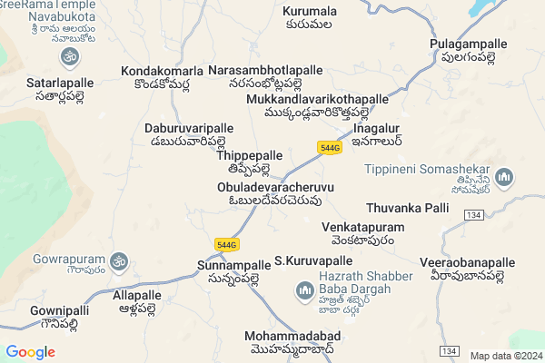
Gowrapuram
Gowrapuram Map
EDIT Map
Add Your House
 ..
..
Current Corona Virus Infected Patients Count in Anantapur District
| City Name | District Name | Total Covid cases |
|---|---|---|
| Anantapur District | Anantapur | 36 |
| Anantapur | Anantapur | 5 |
| Hindupur | Anantapur | 3 |
| R K Function Hall Backside | Anantapur | 2 |
| Lepakshi | Anantapur | 2 |
| Kalyana Durgam | Anantapur | 1 |
| Hindupur Mandal | Anantapur | 1 |
| Naik Nagar | Anantapur | 1 |
| Kothacheruvu | Anantapur | 1 |
| Aravinda Nagar | Anantapur | 1 |
Locality Name :
Gowrapuram
( గౌరపురం )
Mandal Name : Obuladevarecheruvu
District : Anantapur
State : Andhra Pradesh
Region : Rayalaseema
Language : Telugu and Urdu
Current Time 12:47 PM
Date: Thursday , Mar 13,2025 (IST)
Time zone: IST (UTC+5:30)
Elevation / Altitude: 577 meters. Above Seal level
Telephone Code / Std Code: 08494
Assembly constituency : assembly constituency
Assembly MLA : DUDDUKUNTA SREEDHAR REDDY
Lok Sabha constituency : parliamentary constituency
Parliament MP : KURUVA GORANTLA MADHAV
Serpanch Name :
Pin Code : 515561
Post Office Name : Obula Devara Cheruvu
Main Village Name : Allapalle
Commodities Prices : Mulakalacheruvu Market / Mandi
Gowrapuram Live Weather
Temperature: 34.5 °C
overcast clouds
Humidity: 15%
Wind : 4.37 mt/sec towards E
StationName : "Kadiri"
observed on Now
Temperature: 34.5 °C
overcast clouds
Humidity: 15%
Wind : 4.37 mt/sec towards E
StationName : "Kadiri"
observed on Now
Gowrapuram Weather Forecast for Next 5 days
14-03-2025
24.1°C to 35.1°C
overcast clouds, broken clouds
24.1°C to 35.1°C
overcast clouds, broken clouds
15-03-2025
23.4°C to 37.1°C
overcast clouds, scattered clouds, clear sky
23.4°C to 37.1°C
overcast clouds, scattered clouds, clear sky
16-03-2025
23.0°C to 37.5°C
clear sky, scattered clouds, broken clouds, overcast clouds
23.0°C to 37.5°C
clear sky, scattered clouds, broken clouds, overcast clouds
17-03-2025
23.0°C to 37.5°C
overcast clouds, few clouds, clear sky
23.0°C to 37.5°C
overcast clouds, few clouds, clear sky
18-03-2025
21.9°C to 37.5°C
clear sky, scattered clouds, broken clouds, few clouds
21.9°C to 37.5°C
clear sky, scattered clouds, broken clouds, few clouds
National Highways Reachable To Gowrapuram
Nationa High Way :NH42
Nationa High Way :NH342
Nationa High Way :NH42
Nationa High Way :NH342
Rivers Near Gowrapuram
Chitravati :ಚಿತ್ರಾವತಿ :చిత్రావతి
Papagni :ಪಾಪಾಗ್ನಿ :పాపాగ్ని
Chitravati :ಚಿತ್ರಾವತಿ :చిత్రావతి
Papagni :ಪಾಪಾಗ್ನಿ :పాపాగ్ని
About Gowrapuram
Correct below Info and add more info about GowrapuramGowrapuram is a small Village/hamlet in Obuladevarecheruvu Mandal in Anantapur District of Andhra Pradesh State, India. It comes under Allapalle Panchayath. It belongs to Rayalaseema region . It is located 99 KM towards South from District head quarters Anantapur. 441 KM from State capital Hyderabad
Gowrapuram Pin code is 515561 and postal head office is Obula Devara Cheruvu .
Gowrapuram is surrounded by Amadagur Mandal towards South , Nallamada Mandal towards North , Nallacheruvu Mandal towards East , Kadiri Mandal towards North .
Kadiri , Dharmavaram , Hindupur , Chintamani are the near by Cities to Gowrapuram.
Demographics of Gowrapuram
Telugu is the Local Language here. Total population of Gowrapuram is 5231 .Males are 2691 and Females are 2,540 living in 1267 Houses. Total area of Gowrapuram is 2851 hectares.HOW TO REACH Gowrapuram
By Road
Kadiri is the Nearest Town to Gowrapuram. Kadiri is 32 km from Gowrapuram. Road connectivity is there from Kadiri to Gowrapuram.By Rail
There is no railway station near to Gowrapuram in less than 10 km. How ever there are railway Stations from Near By town Kadiri. are the railway Stations near to Kadiri. You can reach from Kadiri to Gowrapuram by road after .By Bus
Kadiri APSRTC Bus Station , Mamillakunta X APSRTC Bus Station , Pedapalli APSRTC Bus Station are the nearby by Bus Stations to Gowrapuram .APSRTC runs Number of busses from major cities to here.Colleges near Gowrapuram
S V B Jr Coll Obuladevara Cheruvu
Address : S V B Jr Coll Obuladevara Cheruvu
Schools in Gowrapuram
K.g.b.v Gownipalli
Address : allapalle , obuladevaracheruvu , anantapur , Andhra Pradesh . PIN- 515561 , Post - Obula Devara Cheruvu
Zphs Gownipalli
Address : allapalle , obuladevaracheruvu , anantapur , Andhra Pradesh . PIN- 515561 , Post - Obula Devara Cheruvu
Govt Health Centers near Gowrapuram
1) Obuladevaracheruvu , Jan-89 , S.C Colony , Near RDT Community Hall2) O.D.Cheruvu , 3-110 , Hindupur Road , Opp.Police Station
3) Sc M.M.Cross , Apr-33 , Kolimi Bazar ,
Hospitals in Gowrapuram,Obuladevarecheruvu
Srikakula's Dental & Homoeopathy Clinic
Kurumala; Andhra Pradesh 515531; India
7.0 KM distance Detail
more ..
Petrol Bunks in Gowrapuram,Obuladevarecheruvu
HP Petrol Pump ODC
Hindupur - Kadiri Hwy; Obuladevaracheruvu; Andhra Pradesh 515561; India
1.4 KM distance Detail
more ..
Colleges in Gowrapuram,Obuladevarecheruvu
VIGNAN Agricultural Diploma College
Obuladevaracheruvu; Andhra Pradesh 515561; India
0.5 KM distance Detail
Vignan TTC; Rehoboth Church
Hindupur - Kadiri Hwy; Obuladevaracheruvu; Andhra Pradesh 515561; India
0.5 KM distance Detail
more ..
Schools in Gowrapuram,Obuladevarecheruvu
Pata Majeed
Hindupur - Kadiri Hwy; Obuladevaracheruvu; Andhra Pradesh 515561; India
0.8 KM distance Detail
Jeevan Jyothi EMHS ODC
Jeevan Jyothi English Medium High School; Odc; Thippepalle; Andhra Pradesh 515561; India
0.8 KM distance Detail
Electronic Shops in Gowrapuram,Obuladevarecheruvu
harshad sound systems&decorations
Obuladevaracheruvu; Andhra Pradesh 515561; India
0.6 KM distance Detail
Super Markets in Gowrapuram,Obuladevarecheruvu
Akram General Store
Akram General Store; Kadiri- highway; Obuladevara cheruvu; Hindupur; Andhra Pradesh; India
0.6 KM distance Detail
Manohar General Stores
Hindupur - Kadiri Hwy; Poola Bazar; Revenue Colony; Kadiri; Andhra Pradesh 515591; India
22.4 KM distance Detail
Police Stations near Gowrapuram,Obuladevarecheruvu
Police Station Timmama Marri Maanu
Police Quarters; Kadiri; Andhra Pradesh 515591; India
22.9 KM distance Detail
Governement Offices near Gowrapuram,Obuladevarecheruvu
MeeSeva Center
tahasildar office;Obula Devara Cheruvu;anantapur;andhra pradesh; Andhra Pradesh 515561; India
0.6 KM distance Detail
MeeSeva Center
H No.5-197-A; Hanumanthareddy Complex; Main Road;Kodakamarla Ananthapur-515531; Kondakomarla; Andhra Pradesh 515531; India
7.4 KM distance Detail
MeeSeva Center
D.NO:1-193; Vasu Online Services; Main Road; Anr Complex;Main Road; Nallamada(V); Nallamada(M); Anantapur(D);515501; Nallamada; Andhra Pradesh 515501; India
14.7 KM distance Detail
About Gowrapuram &
History
How to reach Gowrapuram
Tourist Places Near By Gowrapuram
Schools in Gowrapuram
Colleges in Gowrapuram
Temperature & weather of Gowrapuram
places in Gowrapuram
Gowrapuram photos
More Information
How to reach Gowrapuram
Tourist Places Near By Gowrapuram
Schools in Gowrapuram
Colleges in Gowrapuram
Temperature & weather of Gowrapuram
places in Gowrapuram
Gowrapuram photos
More Information
Village Talk
Post News or Events about this Village
Near Cities
Kadiri 22 KM near
Dharmavaram 57 KM near
Hindupur 65 KM near
Chintamani 78 KM near
Kadiri 22 KM near
Dharmavaram 57 KM near
Hindupur 65 KM near
Chintamani 78 KM near
Near By Taluks
Obuladevarecheruvu 0 KM near
Nallamada 13 KM near
Amadagur 14 KM near
Nallacheruvu 21 KM near
Obuladevarecheruvu 0 KM near
Nallamada 13 KM near
Amadagur 14 KM near
Nallacheruvu 21 KM near
Near By Air Ports
Bengaluru International Airport 109 KM near
Tirupati Airport 192 KM near
Mysore Airport 270 KM near
Chennai Airport 292 KM near
Bengaluru International Airport 109 KM near
Tirupati Airport 192 KM near
Mysore Airport 270 KM near
Chennai Airport 292 KM near
Near By Tourist Places
Puttaparthi 30 KM near
Lepakshi 55 KM near
Horsley Hills 67 KM near
Nandi Hills 91 KM near
Kadapa 113 KM near
Puttaparthi 30 KM near
Lepakshi 55 KM near
Horsley Hills 67 KM near
Nandi Hills 91 KM near
Kadapa 113 KM near
Near By Districts
Chikballapur 82 KM near
Anantapur 95 KM near
Bangalore Rural 103 KM near
Kolar 112 KM near
Chikballapur 82 KM near
Anantapur 95 KM near
Bangalore Rural 103 KM near
Kolar 112 KM near
Near By RailWay Station
Kadiri Rail Way Station 22 KM near
Sri Sathya Sai Prashanthi Nilayam Rail Way Station 33 KM near
Kadiri Rail Way Station 22 KM near
Sri Sathya Sai Prashanthi Nilayam Rail Way Station 33 KM near