| Home | City Bus | Maps | Villages | Cities | Rail | Tourist Places | School | College | Pin Codes | Corona Cases Count |
| Distance Calculator Bus Services IFSC Codes Trace Mobile Number Weather Search Place Trace IP Available Cash ATM/Banks Locate Polling Booth Report an Error contact People |
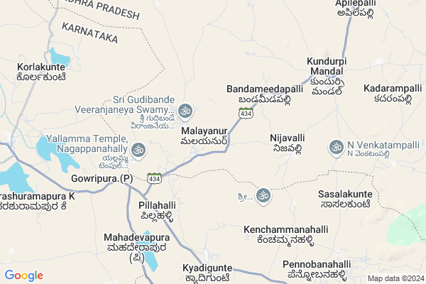
Nagepalli
Nagepalli Map
EDIT Map
Add Your House
 ..
..
Current Corona Virus Infected Patients Count in Anantapur District
| City Name | District Name | Total Covid cases |
|---|---|---|
| Anantapur District | Anantapur | 36 |
| Anantapur | Anantapur | 5 |
| Hindupur | Anantapur | 3 |
| R K Function Hall Backside | Anantapur | 2 |
| Lepakshi | Anantapur | 2 |
| Aravinda Nagar | Anantapur | 1 |
| Kalyana Durgam | Anantapur | 1 |
| Hindupur Mandal | Anantapur | 1 |
| Naik Nagar | Anantapur | 1 |
| Kothacheruvu | Anantapur | 1 |
Locality Name :
Nagepalli
( నాగేపల్లి )
Mandal Name : Kundurpi
District : Anantapur
State : Andhra Pradesh
Region : Rayalaseema
Language : Telugu and Urdu
Current Time 07:22 AM
Date: Saturday , Apr 26,2025 (IST)
Time zone: IST (UTC+5:30)
Elevation / Altitude: 550 meters. Above Seal level
Telephone Code / Std Code: 08492
Assembly constituency : assembly constituency
Assembly MLA : K.V. Usha Sricharan
Lok Sabha constituency : parliamentary constituency
Parliament MP : TALARI RANGAIAH
Serpanch Name :
Pin Code : 515766
Post Office Name : Kundurpi
Main Village Name : Malayanur
Commodities Prices : Challakere Market / Mandi
National Highways Reachable To Nagepalli
Nationa High Way :NH42
Nationa High Way :NH69
Nationa High Way :NH42
Nationa High Way :NH69
Rivers Near Nagepalli
Vedavati :Hagari :ವೇದಾವತಿ
Puli Vanka
Vedavati :Hagari :ವೇದಾವತಿ
Puli Vanka
About Nagepalli
Correct below Info and add more info about NagepalliNagepalli is a small Village/hamlet in Kundurpi Mandal in Anantapur District of Andhra Pradesh State, India. It comes under Malayanur Panchayath. It belongs to Rayalaseema region . It is located 95 KM towards west from District head quarters Anantapur. 12 KM from Kundurpi. 447 KM from State capital Hyderabad
Nagepalli Pin code is 515766 and postal head office is Kundurpi .
Nagepalli is surrounded by Settur Mandal towards North , Amarapuram Mandal towards South , Pavagada Mandal towards East , Challakere Mandal towards west .
Kalyandurg , Pavagada , Rayadurg , Sira are the near by Cities to Nagepalli.
Demographics of Nagepalli
Telugu is the Local Language here. Total population of Nagepalli is 6162 .Males are 3148 and Females are 3,014 living in 1182 Houses. Total area of Nagepalli is 3646 hectares.HOW TO REACH Nagepalli
By Road
Rayadurg is the Nearest Town to Nagepalli. Rayadurg is 72 km from Nagepalli. Road connectivity is there from Rayadurg to Nagepalli.By Rail
There is no railway station near to Nagepalli in less than 10 km. How ever there are railway Stations from Near By town Rayadurg. are the railway Stations near to Rayadurg. You can reach from Rayadurg to Nagepalli by road after .By Bus
Kundurpi APSRTC Bus Station , Kambadur APSRTC Bus Station , Kalyandurgam APSRTC Bus Station are the nearby by Bus Stations to Nagepalli .APSRTC runs Number of busses from major cities to here.Colleges near Nagepalli
Govt Junior College Kundurpi
Address : Govt Junior College Kundurpi Near Rama Swamy Temple Kundurpi Anantapur
Govt Jr College, Kundurpi
Address : Kundurpi
Schools in Nagepalli
Zphs Malayanur
Address : malayanur , kundurpi , anantapur , Andhra Pradesh . PIN- 515766 , Post - Kundurpi
Mpups Sreemajjinapalli
Address : malayanur , kundurpi , anantapur , Andhra Pradesh . PIN- 515766 , Post - Kundurpi
Mpups Vaddepalyem
Address : malayanur , kundurpi , anantapur , Andhra Pradesh . PIN- 515766 , Post - Kundurpi
Govt Health Centers near Nagepalli
1) Sc Valasa , 1-423 , NEAR MAREMMA TEMPLE , NEAR MAREMMA TEMPLE2) Sc Thammadepalli , 1-340 , NEW INDIRAMMA COLONY , RDT SCHOOL BACK
3) Amarapuram , 1-400 , NEAR POST OFFICE , NEAR POST OFFICE
Hospitals in Nagepalli,Kundurpi
Department of Public Health and Primary Care - Jajur
Buddayyadoddi Perugupalyam Rd; Jajur; Karnataka 577537; India
22.3 KM distance Detail
more ..
Colleges in Nagepalli,Kundurpi
GFGC Parashuramapura Challakere TQ
Challakere Taluk; Chitradurga District; Parashuramapura; Karnataka 577538; India
13.9 KM distance Detail
more ..
Super Markets in Nagepalli,Kundurpi
Police Stations near Nagepalli,Kundurpi
Governement Offices near Nagepalli,Kundurpi
VEERANJANEYA FARMERS PRODUCER COMPANY LIMITED
NK.Maruthiraj S/O N.Ramanjineyulu Door No 2-15; Kapu Veedhi; Makodiki Main Road; Yerragunta(Village); Allapuram(Post); Kundurpi(Mandal Kalyanadurgam(Taluk; Yerragunta; Basapuram; Andhra Pradesh 515766; India
13.1 KM distance Detail
About Nagepalli &
History
How to reach Nagepalli
Tourist Places Near By Nagepalli
Schools in Nagepalli
Colleges in Nagepalli
Temperature & weather of Nagepalli
places in Nagepalli
Nagepalli photos
More Information
How to reach Nagepalli
Tourist Places Near By Nagepalli
Schools in Nagepalli
Colleges in Nagepalli
Temperature & weather of Nagepalli
places in Nagepalli
Nagepalli photos
More Information
Village Talk
Post News or Events about this Village
Near Cities
Kalyandurg 38 KM near
Pavagada 42 KM near
Rayadurg 55 KM near
Sira 63 KM near
Kalyandurg 38 KM near
Pavagada 42 KM near
Rayadurg 55 KM near
Sira 63 KM near
Near By Taluks
Kundurpi 11 KM near
Settur 20 KM near
Amarapuram 23 KM near
Pavagada 33 KM near
Kundurpi 11 KM near
Settur 20 KM near
Amarapuram 23 KM near
Pavagada 33 KM near
Near By Air Ports
Bengaluru International Airport 158 KM near
Mysore Airport 247 KM near
Hubli Airport 265 KM near
Bajpe Airport 300 KM near
Bengaluru International Airport 158 KM near
Mysore Airport 247 KM near
Hubli Airport 265 KM near
Bajpe Airport 300 KM near
Near By Tourist Places
Chitradurga 70 KM near
Lepakshi 94 KM near
Puttaparthi 98 KM near
Shivagange 137 KM near
Nandi Hills 139 KM near
Chitradurga 70 KM near
Lepakshi 94 KM near
Puttaparthi 98 KM near
Shivagange 137 KM near
Nandi Hills 139 KM near
Near By Districts
Chitradurga 70 KM near
Anantapur 90 KM near
Bellary 110 KM near
Tumkur 115 KM near
Chitradurga 70 KM near
Anantapur 90 KM near
Bellary 110 KM near
Tumkur 115 KM near
Near By RailWay Station
Penukonda Junction Rail Way Station 76 KM near
Hindupur Rail Way Station 83 KM near
Penukonda Junction Rail Way Station 76 KM near
Hindupur Rail Way Station 83 KM near