| Home | City Bus | Maps | Villages | Cities | Rail | Tourist Places | School | College | Pin Codes | Corona Cases Count |
| Distance Calculator Bus Services IFSC Codes Trace Mobile Number Weather Search Place Trace IP Available Cash ATM/Banks Locate Polling Booth Report an Error contact People |
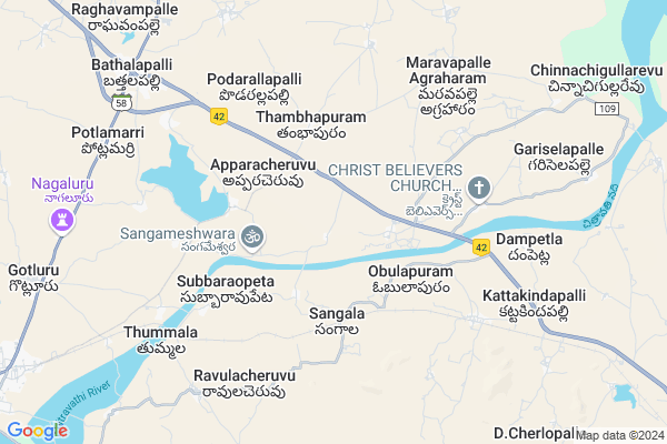
Jwalapuram
Jwalapuram Map
EDIT Map
Add Your House
 ..
..
Current Corona Virus Infected Patients Count in Anantapur District
| City Name | District Name | Total Covid cases |
|---|---|---|
| Anantapur District | Anantapur | 36 |
| Anantapur | Anantapur | 5 |
| Hindupur | Anantapur | 3 |
| R K Function Hall Backside | Anantapur | 2 |
| Lepakshi | Anantapur | 2 |
| Aravinda Nagar | Anantapur | 1 |
| Kalyana Durgam | Anantapur | 1 |
| Hindupur Mandal | Anantapur | 1 |
| Naik Nagar | Anantapur | 1 |
| Kothacheruvu | Anantapur | 1 |
Locality Name :
Jwalapuram
( జ్వాలాపురం )
Mandal Name : Bathalapalle
District : Anantapur
State : Andhra Pradesh
Region : Rayalaseema
Language : Telugu and Urdu
Current Time 12:04 PM
Date: Sunday , Apr 27,2025 (IST)
Time zone: IST (UTC+5:30)
Elevation / Altitude: 375 meters. Above Seal level
Telephone Code / Std Code: 08559
Assembly constituency : assembly constituency
Assembly MLA : KETHIREDDY VENKATARAMI REDDY
Lok Sabha constituency : parliamentary constituency
Parliament MP : KURUVA GORANTLA MADHAV
Serpanch Name :
Pin Code : 515661
Post Office Name : Bathalapalli
Main Village Name : Sangala
Commodities Prices : Mulakalacheruvu Market / Mandi
Jwalapuram Live Weather
Temperature: 37.9 °C
few clouds
Humidity: 19%
Wind : 5.49 mt/sec towards E
StationName : "Dharmavaram"
observed on Now
Temperature: 37.9 °C
few clouds
Humidity: 19%
Wind : 5.49 mt/sec towards E
StationName : "Dharmavaram"
observed on Now
Jwalapuram Weather Forecast for Next 5 days
28-04-2025
28.9°C to 39.1°C
broken clouds, overcast clouds
28.9°C to 39.1°C
broken clouds, overcast clouds
29-04-2025
27.8°C to 39.3°C
overcast clouds, scattered clouds, few clouds, broken clouds
27.8°C to 39.3°C
overcast clouds, scattered clouds, few clouds, broken clouds
30-04-2025
29.4°C to 39.9°C
broken clouds, scattered clouds, overcast clouds
29.4°C to 39.9°C
broken clouds, scattered clouds, overcast clouds
01-05-2025
29.3°C to 41.0°C
broken clouds, clear sky, scattered clouds, overcast clouds
29.3°C to 41.0°C
broken clouds, clear sky, scattered clouds, overcast clouds
02-05-2025
28.9°C to 41.0°C
scattered clouds, clear sky, few clouds
28.9°C to 41.0°C
scattered clouds, clear sky, few clouds
National Highways Reachable To Jwalapuram
Nationa High Way :NH42
Nationa High Way :NH42
Rivers Near Jwalapuram
Penna :ಪೆನ್ನಾ :పెన్నా
Penna :ಪೆನ್ನಾ :పెన్నా
Penna :ಪೆನ್ನಾ :పెన్నా
Penna :ಪೆನ್ನಾ :పెన్నా
About Jwalapuram
Correct below Info and add more info about JwalapuramJwalapuram is a small Village/hamlet in Bathalapalle Mandal in Anantapur District of Andhra Pradesh State, India. It comes under Sangala Panchayath. It belongs to Rayalaseema region . It is located 40 KM towards East from District head quarters Anantapur. 6 KM from Bathalapalli. 388 KM from State capital Hyderabad
Jwalapuram Pin code is 515661 and postal head office is Bathalapalli .
Subbaraopeta ( 4 KM ) , Podarallapalli ( 6 KM ) , Ravulacheruvu ( 6 KM ) , Thummala ( 7 KM ) , Dampetla ( 7 KM ) are the nearby Villages to Jwalapuram. Jwalapuram is surrounded by Dharmavaram Mandal towards west , Tadimarri Mandal towards North , Mudigubba Mandal towards East , Narpala Mandal towards North .
Dharmavaram , Anantapur , Kadiri , Tadpatri are the near by Cities to Jwalapuram.
Demographics of Jwalapuram
Telugu is the Local Language here. Total population of Jwalapuram is 2670 .Males are 1388 and Females are 1,282 living in 613 Houses. Total area of Jwalapuram is 2306 hectares.HOW TO REACH Jwalapuram
By Road
Dharmavaram is the Nearest Town to Jwalapuram. Dharmavaram is 15 km from Jwalapuram. Road connectivity is there from Dharmavaram to Jwalapuram.By Rail
Chinnekunta Palli Rail Way Station , Ramanujam Palli Rail Way Station are the very nearby railway stations to Jwalapuram. Also you can consider railway Stations from Near By town Dharmavaram. Dharmavaram Junction Rail Way Station are the railway Stations near to Dharmavaram. You can reach from Dharmavaram to Jwalapuram by road after .By Bus
Battala Pally APSRTC Bus Station , Dharmavaram APSRTC Bus Station , Mudigubba APSRTC Bus Station are the nearby by Bus Stations to Jwalapuram .APSRTC runs Number of busses from major cities to here.Colleges near Jwalapuram
S K G Memorial Jr Coll Bathalapalli
Address : S K G Memorial Jr Coll Bathalapalli
Schools in Jwalapuram
Mpps Tambapuram
Address : sangala , bathalapalle , anantapur , Andhra Pradesh . PIN- 515661 , Post - Bathalapalli
Mpps Jwalapuram
Address : sangala , bathalapalle , anantapur , Andhra Pradesh . PIN- 515672 , Post - Dharmavaram R.S
Mpps Sangala
Address : sangala , bathalapalle , anantapur , Andhra Pradesh . PIN- 515672 , Post - Dharmavaram R.S
Govt Health Centers near Jwalapuram
1) Sc Apparasacheruvu , 1-106 b , , Beside A W Centre2) Sc Ramapuram , Feb-78 , , Near Priamary School
3) Sc Obulapuram , Feb-57 , , Near Priamary School
Petrol Bunks in Jwalapuram,Bathalapalle
Indian Oil Petrol and Diesel Pump
District;; Kadiri - Ananthapur Hwy; Anantapur; Andhra Pradesh 515661; India
8.2 KM distance Detail
more ..
Colleges in Jwalapuram,Bathalapalle
Prasad Medical & General Stores
Siva Nagar; Dharmavaram; Andhra Pradesh 515672; India
14.2 KM distance Detail
more ..
Schools in Jwalapuram,Bathalapalle
Jasthi Venkataiah Memorial Rural Development Trust (School)
Anantapuram; Andhra Pradesh 515661; India
9.1 KM distance Detail
Electronic Shops in Jwalapuram,Bathalapalle
LAKSHMI ENTERPRISES
National Highway 544D;Dharmavaram Road;; New Building; Bathalapalli; Andhra Pradesh 515661; India
9.7 KM distance Detail
Super Markets in Jwalapuram,Bathalapalle
Venu gopal general store
Akkpedianera; Maruthinagar; Akkpedianera; Dharmavaram; Andhra Pradesh 515671; India
15.4 KM distance Detail
Sobha supermarket
16/125; Anjuman Circle Road;main Bazar; Dharmavaram; Andhra Pradesh 515671; India
15.4 KM distance Detail
Local Parks in Jwalapuram,Bathalapalle
Ramakrishna Reddy Gardens
Maravapalle Agraharam; Andhra Pradesh 515631; India
9.8 KM distance Detail
LADDU GARDEN
Near to dharmavaram; water plant; Dharmavaram; Andhra Pradesh 515672; India
10.9 KM distance Detail
Police Stations near Jwalapuram,Bathalapalle
Deputy Superintendent Of Police Office
14-39; Gita Bhawan Rd; P.R.T street; Gita Bhawan Rd; P.R.T street; Indiranagar; Dharmavaram; Andhra Pradesh 515671; India
15.8 KM distance Detail
Governement Offices near Jwalapuram,Bathalapalle
MeeSeva Center
Near tahasildar office;bathalapalle; Bathalapalli; Andhra Pradesh 515661; India
9.6 KM distance Detail
About Jwalapuram &
History
How to reach Jwalapuram
Tourist Places Near By Jwalapuram
Schools in Jwalapuram
Colleges in Jwalapuram
Temperature & weather of Jwalapuram
places in Jwalapuram
Jwalapuram photos
More Information
How to reach Jwalapuram
Tourist Places Near By Jwalapuram
Schools in Jwalapuram
Colleges in Jwalapuram
Temperature & weather of Jwalapuram
places in Jwalapuram
Jwalapuram photos
More Information
Village Talk
Post News or Events about this Village
Near Cities
Dharmavaram 14 KM near
Anantapur 40 KM near
Kadiri 59 KM near
Tadpatri 60 KM near
Dharmavaram 14 KM near
Anantapur 40 KM near
Kadiri 59 KM near
Tadpatri 60 KM near
Near By Taluks
Bathalapalle 6 KM near
Dharmavaram 10 KM near
Tadimarri 15 KM near
Mudigubba 19 KM near
Bathalapalle 6 KM near
Dharmavaram 10 KM near
Tadimarri 15 KM near
Mudigubba 19 KM near
Near By Air Ports
Bengaluru International Airport 159 KM near
Tirupati Airport 231 KM near
Mysore Airport 305 KM near
Chennai Airport 337 KM near
Bengaluru International Airport 159 KM near
Tirupati Airport 231 KM near
Mysore Airport 305 KM near
Chennai Airport 337 KM near
Near By Tourist Places
Puttaparthi 37 KM near
Lepakshi 87 KM near
Kadapa 119 KM near
Horsley Hills 122 KM near
Nandi Hills 138 KM near
Puttaparthi 37 KM near
Lepakshi 87 KM near
Kadapa 119 KM near
Horsley Hills 122 KM near
Nandi Hills 138 KM near
Near By Districts
Anantapur 38 KM near
Cuddapah 120 KM near
Chikballapur 130 KM near
Bellary 138 KM near
Anantapur 38 KM near
Cuddapah 120 KM near
Chikballapur 130 KM near
Bellary 138 KM near
Near By RailWay Station
Chinnekunta Palli Rail Way Station 3.9 KM near
Ramanujam Palli Rail Way Station 6.6 KM near
Dharmavaram Junction Rail Way Station 14 KM near
Anantapur Rail Way Station 39 KM near
Chinnekunta Palli Rail Way Station 3.9 KM near
Ramanujam Palli Rail Way Station 6.6 KM near
Dharmavaram Junction Rail Way Station 14 KM near
Anantapur Rail Way Station 39 KM near