| Home | City Bus | Maps | Villages | Cities | Rail | Tourist Places | School | College | Pin Codes | Corona Cases Count |
| Distance Calculator Bus Services IFSC Codes Trace Mobile Number Weather Search Place Trace IP Available Cash ATM/Banks Locate Polling Booth Report an Error contact People |
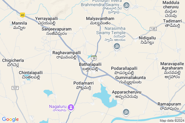
Bathalapalli
Bathalapalli Map
EDIT Map
Add Your House
 ..
..
Current Corona Virus Infected Patients Count in Anantapur District
| City Name | District Name | Total Covid cases |
|---|---|---|
| Anantapur District | Anantapur | 36 |
| Anantapur | Anantapur | 5 |
| Hindupur | Anantapur | 3 |
| R K Function Hall Backside | Anantapur | 2 |
| Lepakshi | Anantapur | 2 |
| Aravinda Nagar | Anantapur | 1 |
| Kalyana Durgam | Anantapur | 1 |
| Hindupur Mandal | Anantapur | 1 |
| Naik Nagar | Anantapur | 1 |
| Kothacheruvu | Anantapur | 1 |
Locality Name :
Bathalapalli
( బత్తలపల్లి )
Mandal Name : Bathalapalle
District : Anantapur
State : Andhra Pradesh
Region : Rayalaseema
Language : Telugu and Urdu
Current Time 11:57 AM
Date: Sunday , Apr 27,2025 (IST)
Time zone: IST (UTC+5:30)
Elevation / Altitude: 375 meters. Above Seal level
Telephone Code / Std Code: 08559
Assembly constituency : assembly constituency
Assembly MLA : KETHIREDDY VENKATARAMI REDDY
Lok Sabha constituency : parliamentary constituency
Parliament MP : KURUVA GORANTLA MADHAV
Serpanch Name :
Pin Code : 515661
Post Office Name : Bathalapalli
Alternate Village Name : Bathalapalle
Commodities Prices : Mulakalacheruvu Market / Mandi
Edit below overview about Bathalapalli
Edit below overview about Bathalapalli
OverView of Bathalapalli
From Bathalapalli there is APSRTC transport facility to the famous Kadri Lakshmi Narasimha Swamy Temple (KADIRI),and Timmama MarrimanuEdit below overview about Bathalapalli
National Highways Reachable To Bathalapalli
Nationa High Way :NH42
Nationa High Way :NH42
Rivers Near Bathalapalli
Penna :ಪೆನ್ನಾ :పెన్నా
Penna :ಪೆನ್ನಾ :పెన్నా
Penna :ಪೆನ್ನಾ :పెన్నా
Penna :ಪೆನ್ನಾ :పెన్నా
About Bathalapalli
Bathalapalli is a Town in Bathalapalle Mandal in Anantapur District of Andhra Pradesh State, India. It belongs to Rayalaseema region . It is located 30 KM towards East from District head quarters Anantapur. It is a Mandal head quarter.
Bathalapalli Pin code is 515661 and postal head office is Bathalapalli .
Edula Mustur ( 5 KM ) , Malyavantham ( 5 KM ) , Apparacheruvu ( 6 KM ) , Nidigallu ( 8 KM ) , Gotluru ( 9 KM ) are the nearby Villages to Bathalapalli. Bathalapalli is surrounded by Dharmavaram Mandal towards South , Tadimarri Mandal towards East , Narpala Mandal towards North , Raptadu Mandal towards west .
Dharmavaram , Anantapur , Tadpatri , Kadiri are the nearby Cities to Bathalapalli.
Bathalapalle 2011 Census Details
Bathalapalli Local Language is Telugu. Bathalapalle town Total population is 12697 and number of houses are 3251. Female Population is 48.9%. town literacy rate is 56.2% and the Female Literacy rate is 23.8%.
Population
| Census Parameter | Census Data |
| Total Population | 12697 |
| Total No of Houses | 3251 |
| Female Population % | 48.9 % ( 6203) |
| Total Literacy rate % | 56.2 % ( 7133) |
| Female Literacy rate | 23.8 % ( 3018) |
| Scheduled Tribes Population % | 5.1 % ( 644) |
| Scheduled Caste Population % | 16.7 % ( 2123) |
| Working Population % | 47.8 % |
| Child(0 -6) Population by 2011 | 1387 |
| Girl Child(0 -6) Population % by 2011 | 46.5 % ( 645) |
Bathalapalle Census More Deatils.
Demographics of Bathalapalli
Telugu is the Local Language here. Total population of Bathalapalli is 9810 .Males are 5085 and Females are 4,725 living in 2209 Houses. Total area of Bathalapalli is 3517 hectares.HOW TO REACH Bathalapalli
By Road
Dharmavaram is the Nearest Town to Bathalapalli. Dharmavaram is 13 km from Bathalapalli. Road connectivity is there from Dharmavaram to Bathalapalli.By Rail
Chigicherla Rail Way Station are the very nearby railway stations to Bathalapalli. Also you can consider railway Stations from Near By town Dharmavaram. Dharmavaram Junction Rail Way Station are the railway stations near to Dharmavaram. You can reach from Dharmavaram to Bathalapalli by road after .By Bus
Battala Pally APSRTC Bus Station , Dharmavaram APSRTC Bus Station , S.K. University APSRTC Bus Station are the nearby by Bus Stations to Bathalapalli .APSRTC runs Number of busses from major cities to here.Govt Health Centers near Bathalapalli
1) Sc Bonthalapalli , 1-Jan , MAIN ROAD , ZP HIGH SCHOOL2) Bathalapalli , 3-126 , BC Colony , MAIN ROAD
3) Bathalapalli , , Near Care & Support Centre, RDT Hospital , Kadiri Road
Sub Villages in Bathalapalli
Petrol Bunks in Bathalapalli,Bathalapalle
Indian Oil Petrol and Diesel Pump
District;; Kadiri - Ananthapur Hwy; Anantapur; Andhra Pradesh 515661; India
1.8 KM distance Detail
more ..
Colleges in Bathalapalli,Bathalapalle
Prasad Medical & General Stores
Siva Nagar; Dharmavaram; Andhra Pradesh 515672; India
13.6 KM distance Detail
more ..
Schools in Bathalapalli,Bathalapalle
Sri Upendra Subdesu Z P Boys High School
Battala Palli; Anantapur; NH-205; Tadipatri Anantapur Highway; Bhathalapalli; Bhathalapalli; Andhra Pradesh 515003; India
0.8 KM distance Detail
Super Markets in Bathalapalli,Bathalapalle
Sharath Kumar General Store
Ramnagar; Kothapeta; Dharmavaram; Andhra Pradesh 515672; India
14.2 KM distance Detail
New 5star Fancy And Cool Drinks
Railway Station Road; Kothapeta; Dharmavaram; Andhra Pradesh 515672; India
14.5 KM distance Detail
Police Stations near Bathalapalli,Bathalapalle
Deputy Superintendent Of Police Office
14-39; Gita Bhawan Rd; P.R.T street; Gita Bhawan Rd; P.R.T street; Indiranagar; Dharmavaram; Andhra Pradesh 515671; India
15.4 KM distance Detail
Governement Offices near Bathalapalli,Bathalapalle
MeeSeva Center
Near tahasildar office;bathalapalle; Bathalapalli; Andhra Pradesh 515661; India
0.9 KM distance Detail
About Bathalapalli &
History
How to reach Bathalapalli
Tourist Places Near By Bathalapalli
Schools in Bathalapalli
Colleges in Bathalapalli
Temperature & weather of Bathalapalli
places in Bathalapalli
Bathalapalli photos
More Information
How to reach Bathalapalli
Tourist Places Near By Bathalapalli
Schools in Bathalapalli
Colleges in Bathalapalli
Temperature & weather of Bathalapalli
places in Bathalapalli
Bathalapalli photos
More Information
Town Talk
Post News or Events about this Town
Near Cities
Dharmavaram 15 KM near
Anantapur 31 KM near
Tadpatri 58 KM near
Kadiri 69 KM near
Dharmavaram 15 KM near
Anantapur 31 KM near
Tadpatri 58 KM near
Kadiri 69 KM near
Near By Taluks
Bathalapalle 3 KM near
Dharmavaram 13 KM near
Tadimarri 14 KM near
Narpala 19 KM near
Bathalapalle 3 KM near
Dharmavaram 13 KM near
Tadimarri 14 KM near
Narpala 19 KM near
Near By Air Ports
Bengaluru International Airport 164 KM near
Tirupati Airport 240 KM near
Mysore Airport 307 KM near
Hubli Airport 339 KM near
Bengaluru International Airport 164 KM near
Tirupati Airport 240 KM near
Mysore Airport 307 KM near
Hubli Airport 339 KM near
Near By Tourist Places
Puttaparthi 43 KM near
Lepakshi 91 KM near
Kadapa 127 KM near
Horsley Hills 132 KM near
Nandi Hills 144 KM near
Puttaparthi 43 KM near
Lepakshi 91 KM near
Kadapa 127 KM near
Horsley Hills 132 KM near
Nandi Hills 144 KM near
Near By Districts
Anantapur 29 KM near
Cuddapah 127 KM near
Bellary 128 KM near
Chikballapur 136 KM near
Anantapur 29 KM near
Cuddapah 127 KM near
Bellary 128 KM near
Chikballapur 136 KM near
Near By RailWay Station
Dharmavaram Junction Rail Way Station 13 KM near
Anantapur Rail Way Station 29 KM near
Dharmavaram Junction Rail Way Station 13 KM near
Anantapur Rail Way Station 29 KM near