| Home | City Bus | Maps | Villages | Cities | Rail | Tourist Places | School | College | Pin Codes | Corona Cases Count |
| Distance Calculator Bus Services IFSC Codes Trace Mobile Number Weather Search Place Trace IP Available Cash ATM/Banks Locate Polling Booth Report an Error contact People |
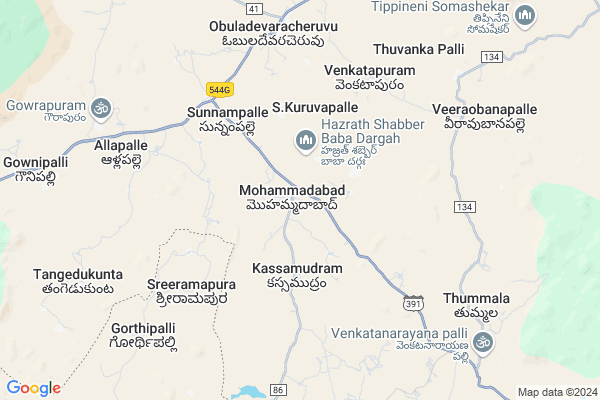
Mohammadabad
Mohammadabad Map
EDIT Map
Add Your House
 ..
..
Current Corona Virus Infected Patients Count in Anantapur District
| City Name | District Name | Total Covid cases |
|---|---|---|
| Anantapur District | Anantapur | 36 |
| Anantapur | Anantapur | 5 |
| Hindupur | Anantapur | 3 |
| R K Function Hall Backside | Anantapur | 2 |
| Lepakshi | Anantapur | 2 |
| Aravinda Nagar | Anantapur | 1 |
| Kalyana Durgam | Anantapur | 1 |
| Hindupur Mandal | Anantapur | 1 |
| Naik Nagar | Anantapur | 1 |
| Kothacheruvu | Anantapur | 1 |
Locality Name :
Mohammadabad
( మొహమ్మదాబాద్ )
Mandal Name : Amadagur
District : Anantapur
State : Andhra Pradesh
Region : Rayalaseema
Language : Telugu and Urdu
Current Time 01:24 PM
Date: Sunday , Apr 27,2025 (IST)
Time zone: IST (UTC+5:30)
Elevation / Altitude: 615 meters. Above Seal level
Telephone Code / Std Code: 08498
Assembly constituency : assembly constituency
Assembly MLA : DUDDUKUNTA SREEDHAR REDDY
Lok Sabha constituency : parliamentary constituency
Parliament MP : KURUVA GORANTLA MADHAV
Serpanch Name :
Pin Code : 515561
Post Office Name : Obula Devara Cheruvu
Alternate Village Name : Mahammadabad HW
Commodities Prices : Mulakalacheruvu Market / Mandi
Mohammadabad Live Weather
Temperature: 32.9 °C
broken clouds
Humidity: 31%
Wind : 3.02 mt/sec towards E
StationName : "Kadiri"
observed on 2 Hours Back
Temperature: 32.9 °C
broken clouds
Humidity: 31%
Wind : 3.02 mt/sec towards E
StationName : "Kadiri"
observed on 2 Hours Back
Mohammadabad Weather Forecast for Next 5 days
28-04-2025
25.2°C to 37.1°C
broken clouds, overcast clouds
25.2°C to 37.1°C
broken clouds, overcast clouds
29-04-2025
24.3°C to 37.3°C
broken clouds, scattered clouds, few clouds, overcast clouds, light rain
24.3°C to 37.3°C
broken clouds, scattered clouds, few clouds, overcast clouds, light rain
30-04-2025
26.9°C to 36.8°C
overcast clouds, clear sky, scattered clouds, broken clouds, light rain
26.9°C to 36.8°C
overcast clouds, clear sky, scattered clouds, broken clouds, light rain
01-05-2025
26.7°C to 38.1°C
broken clouds, few clouds, clear sky, scattered clouds, overcast clouds
26.7°C to 38.1°C
broken clouds, few clouds, clear sky, scattered clouds, overcast clouds
02-05-2025
26.6°C to 39.0°C
overcast clouds, scattered clouds, clear sky, few clouds, broken clouds
26.6°C to 39.0°C
overcast clouds, scattered clouds, clear sky, few clouds, broken clouds
Edit below overview about Mohammadabad
Edit below overview about Mohammadabad
OverView of Mohammadabad
Mohammadabad is a historical place.once upon a time kings are living here and also having old buildings yet in 1995 not present . Muslims population is high in this area and also people's work is formers and ground net business high in this area and also this area is shortcut to going chennai bangalore .Edit below overview about Mohammadabad
National Highways Reachable To Mohammadabad
Nationa High Way :NH42
Nationa High Way :NH44
Nationa High Way :NH42
Nationa High Way :NH44
Rivers Near Mohammadabad
Papagni :ಪಾಪಾಗ್ನಿ :పాపాగ్ని
Kushavati :ಕುಶಾವತಿ
Papagni :ಪಾಪಾಗ್ನಿ :పాపాగ్ని
Kushavati :ಕುಶಾವತಿ
About Mohammadabad
Mohammadabad is a Village in Amadagur Mandal in Anantapur District of Andhra Pradesh State, India. It belongs to Rayalaseema region . It is located 106 KM towards South from District head quarters Anantapur. 6 KM from Amadagur. 448 KM from State capital Hyderabad
Mohammadabad Pin code is 515561 and postal head office is Obula Devara Cheruvu .
Sunnampalli ( 5 KM ) , Venkatapuram ( 6 KM ) , Obuladevara Cheruvu ( 7 KM ) , Thippepalli ( 8 KM ) , Amadagur ( 10 KM ) are the nearby Villages to Mohammadabad. Mohammadabad is surrounded by Obuladevarecheruvu Mandal towards North , Nallacheruvu Mandal towards East , Nallamada Mandal towards North , Tanakal Mandal towards East .
Kadiri , Hindupur , Dharmavaram , Chintamani are the near by Cities to Mohammadabad.
Mohammadabad 2011 Census Details
Mohammadabad Local Language is Telugu. Mohammadabad Village Total population is 4123 and number of houses are 1040. Female Population is 50.8%. Village literacy rate is 51.7% and the Female Literacy rate is 21.9%.
Population
| Census Parameter | Census Data |
| Total Population | 4123 |
| Total No of Houses | 1040 |
| Female Population % | 50.8 % ( 2095) |
| Total Literacy rate % | 51.7 % ( 2130) |
| Female Literacy rate | 21.9 % ( 901) |
| Scheduled Tribes Population % | 1.5 % ( 62) |
| Scheduled Caste Population % | 17.2 % ( 710) |
| Working Population % | 58.7 % |
| Child(0 -6) Population by 2011 | 439 |
| Girl Child(0 -6) Population % by 2011 | 48.5 % ( 213) |
Mohammadabad Census More Deatils.
HOW TO REACH Mohammadabad
By Road
Kadiri is the Nearest Town to Mohammadabad. Kadiri is 30 km from Mohammadabad. Road connectivity is there from Kadiri to Mohammadabad.By Rail
There is no railway station near to Mohammadabad in less than 10 km. How ever there are railway Stations from Near By town Kadiri. are the railway Stations near to Kadiri. You can reach from Kadiri to Mohammadabad by road after .By Bus
Thanakallu APSRTC Bus Station , Kadiri APSRTC Bus Station , Gorantla APSRTC Bus Station are the nearby by Bus Stations to Mohammadabad .APSRTC runs Number of busses from major cities to here.Colleges near Mohammadabad
Govt Jr College Amadaguru
Address : Govt Jr College Amadaguru
Prathibha Jr College, Mahabubnagar
Address : Mahabubnagar
Schools in Mohammadabad
S.r.krishna Vidyaniketan
Address : mohammadabad , amadagur , anantapur , Andhra Pradesh . PIN- 515561 , Post - Obula Devara Cheruvu
P.m.r. Zphs Mahammadabad
Address : mohammadabad , amadagur , anantapur , Andhra Pradesh . PIN- 515561 , Post - Obula Devara Cheruvu
Mpups Urdu Mahammadabad
Address : mohammadabad , amadagur , anantapur , Andhra Pradesh . PIN- 515561 , Post - Obula Devara Cheruvu
Govt Health Centers near Mohammadabad
1) Sc M.M.Cross , Apr-33 , Kolimi Bazar ,2) Sc Kotuvaripalli , Nov-63 , RAMAKRISHNA STREET , NEAR BIG BANAYAN TREE
3) Obuladevaracheruvu , Jan-89 , S.C Colony , Near RDT Community Hall
Sub Villages in Mohammadabad
Hospitals in Mohammadabad,Amadagur
Srikakula's Dental & Homoeopathy Clinic
Kurumala; Andhra Pradesh 515531; India
14.3 KM distance Detail
more ..
Petrol Bunks in Mohammadabad,Amadagur
HP Petrol Pump ODC
Hindupur - Kadiri Hwy; Obuladevaracheruvu; Andhra Pradesh 515561; India
6.9 KM distance Detail
HP PETROL PUMP - SRI LAKSHMI SRINIVASA FILLING ST
Survey NO.224; Nallacheruvu Mandal OLD NH 205 (NEW NH 42) Kadri; Kadapa; Andhra Pradesh 515551; India
21.4 KM distance Detail
more ..
Colleges in Mohammadabad,Amadagur
Vignan TTC; Rehoboth Church
Hindupur - Kadiri Hwy; Obuladevaracheruvu; Andhra Pradesh 515561; India
7.5 KM distance Detail
VIGNAN Agricultural Diploma College
Obuladevaracheruvu; Andhra Pradesh 515561; India
7.5 KM distance Detail
Krishna Edu Solutions
Kammavari Palli Rd; Chinagani Palli; Andhra Pradesh 515556; India
13.8 KM distance Detail
more ..
Schools in Mohammadabad,Amadagur
P Masthan Reddy Memorial Zilla Parishad School
Mohammadabad; Andhra Pradesh 515561; India
0.4 KM distance Detail
Electronic Shops in Mohammadabad,Amadagur
harshad sound systems&decorations
Obuladevaracheruvu; Andhra Pradesh 515561; India
7.3 KM distance Detail
Super Markets in Mohammadabad,Amadagur
Akram General Store
Akram General Store; Kadiri- highway; Obuladevara cheruvu; Hindupur; Andhra Pradesh; India
7.3 KM distance Detail
Police Stations near Mohammadabad,Amadagur
Nallacheruvu Police Station
NH205; Nallacheruvu; Andhra Pradesh 515551; India
21.7 KM distance Detail
Governement Offices near Mohammadabad,Amadagur
MeeSeva Center
tahasildar office;Obula Devara Cheruvu;anantapur;andhra pradesh; Andhra Pradesh 515561; India
7.4 KM distance Detail
MeeSeva Center
H No.5-197-A; Hanumanthareddy Complex; Main Road;Kodakamarla Ananthapur-515531; Kondakomarla; Andhra Pradesh 515531; India
14.4 KM distance Detail
MeeSeva Center
D.NO:9-80-67 ; Student Net Center ;Main Road; National Highway 205; Nallacheruvu; Andhra Pradesh 515551; India
22.1 KM distance Detail
About Mohammadabad &
History
How to reach Mohammadabad
Tourist Places Near By Mohammadabad
Schools in Mohammadabad
Colleges in Mohammadabad
Temperature & weather of Mohammadabad
places in Mohammadabad
Mohammadabad photos
More Information
How to reach Mohammadabad
Tourist Places Near By Mohammadabad
Schools in Mohammadabad
Colleges in Mohammadabad
Temperature & weather of Mohammadabad
places in Mohammadabad
Mohammadabad photos
More Information
Village Talk
Post News or Events about this Village
Near Cities
Kadiri 25 KM near
Hindupur 64 KM near
Dharmavaram 64 KM near
Chintamani 71 KM near
Kadiri 25 KM near
Hindupur 64 KM near
Dharmavaram 64 KM near
Chintamani 71 KM near
Near By Taluks
Amadagur 6 KM near
Obuladevarecheruvu 7 KM near
Nallacheruvu 19 KM near
Nallamada 21 KM near
Amadagur 6 KM near
Obuladevarecheruvu 7 KM near
Nallacheruvu 19 KM near
Nallamada 21 KM near
Near By Air Ports
Bengaluru International Airport 102 KM near
Tirupati Airport 190 KM near
Mysore Airport 265 KM near
Chennai Airport 288 KM near
Bengaluru International Airport 102 KM near
Tirupati Airport 190 KM near
Mysore Airport 265 KM near
Chennai Airport 288 KM near
Near By Tourist Places
Puttaparthi 36 KM near
Lepakshi 52 KM near
Horsley Hills 61 KM near
Nandi Hills 85 KM near
Kadapa 116 KM near
Puttaparthi 36 KM near
Lepakshi 52 KM near
Horsley Hills 61 KM near
Nandi Hills 85 KM near
Kadapa 116 KM near
Near By Districts
Chikballapur 76 KM near
Bangalore Rural 96 KM near
Anantapur 102 KM near
Kolar 104 KM near
Chikballapur 76 KM near
Bangalore Rural 96 KM near
Anantapur 102 KM near
Kolar 104 KM near
Near By RailWay Station
Kadiri Rail Way Station 25 KM near
Sri Sathya Sai Prashanthi Nilayam Rail Way Station 38 KM near
Kadiri Rail Way Station 25 KM near
Sri Sathya Sai Prashanthi Nilayam Rail Way Station 38 KM near