| Home | City Bus | Maps | Villages | Cities | Rail | Tourist Places | School | College | Pin Codes | Corona Cases Count |
| Distance Calculator Bus Services IFSC Codes Trace Mobile Number Weather Search Place Trace IP Available Cash ATM/Banks Locate Polling Booth Report an Error contact People |
Dhaga
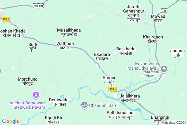
Dhaga Map
EDIT Map
Add Your House
 ..
..
Current Corona Virus Infected Patients Count in Amravati District
| City Name | District Name | Total Covid cases |
|---|---|---|
| Amravati District | Amravati | 7 |
| Amaravati | Amravati | 3 |
Locality Name :
Dhaga
( धागा )
Taluka Name : Warud
District : Amravati
State : Maharashtra
Region : Vidarbha
Division : Amravati
Language : English and Hindi, Marathi,
Current Time 01:08 PM
Date: Sunday , Apr 27,2025 (IST)
Time zone: IST (UTC+5:30)
Elevation / Altitude: 411 meters. Above Seal level
Telephone Code / Std Code: 07105
Assembly constituency : Morshi assembly constituency
Assembly MLA : Devendra Mahadevrao Bhuyar
Lok Sabha constituency : Wardha parliamentary constituency
Parliament MP : Ramdas Chandrabhanji Tadas
Serpanch Name :
Pin Code : 444906
Post Office Name : Warud
Commodities Prices : Varud Market / Mandi
Dhaga Live Weather
Temperature: 38.3 °C
clear sky
Humidity: 19%
Wind : 2.19 mt/sec towards SW
StationName : "MowÄ\u0081d"
observed on 1 Hours Back
Temperature: 38.3 °C
clear sky
Humidity: 19%
Wind : 2.19 mt/sec towards SW
StationName : "MowÄ\u0081d"
observed on 1 Hours Back
Dhaga Weather Forecast for Next 5 days
28-04-2025
28.4°C to 39.1°C
few clouds, scattered clouds
28.4°C to 39.1°C
few clouds, scattered clouds
29-04-2025
27.2°C to 42.0°C
scattered clouds, few clouds, clear sky
27.2°C to 42.0°C
scattered clouds, few clouds, clear sky
30-04-2025
30.4°C to 42.8°C
broken clouds, scattered clouds, clear sky
30.4°C to 42.8°C
broken clouds, scattered clouds, clear sky
01-05-2025
32.7°C to 44.2°C
broken clouds, clear sky
32.7°C to 44.2°C
broken clouds, clear sky
02-05-2025
32.4°C to 44.1°C
clear sky, few clouds, scattered clouds
32.4°C to 44.1°C
clear sky, few clouds, scattered clouds
Rivers Near Dhaga
Wardha
Wardha
Wardha
Wardha
About Dhaga
Correct below Info and add more info about DhagaDhaga is a Village in Warud Taluka in Amravati District of Maharashtra State, India. It belongs to Vidarbha region . It belongs to Amravati Division . It is located 99 KM towards East from District head quarters Amravati. 14 KM from Warud. 743 KM from State capital Mumbai
Dhaga Pin code is 444906 and postal head office is Warud .
Amner ( 2 KM ) , Ghorad ( 2 KM ) , Babhulkheda ( 3 KM ) , Wathoda ( 4 KM ) , Chandas ( 5 KM ) are the nearby Villages to Dhaga. Dhaga is surrounded by Warud Taluka towards west , Pandhurna Taluka towards North , Ashti Taluka towards South , Prabhat Pattan Taluka towards North .
Warud , Shendurjana , Narkhed , Pandhurna are the near by Cities to Dhaga.
Dhaga 2011 Census Details
Dhaga Local Language is English. Dhaga Village Total population is 962 and number of houses are 240. Female Population is 48.8%. Village literacy rate is 79.7% and the Female Literacy rate is 37.4%.
Population
| Census Parameter | Census Data |
| Total Population | 962 |
| Total No of Houses | 240 |
| Female Population % | 48.8 % ( 469) |
| Total Literacy rate % | 79.7 % ( 767) |
| Female Literacy rate | 37.4 % ( 360) |
| Scheduled Tribes Population % | 8.7 % ( 84) |
| Scheduled Caste Population % | 10.6 % ( 102) |
| Working Population % | 37.6 % |
| Child(0 -6) Population by 2011 | 84 |
| Girl Child(0 -6) Population % by 2011 | 46.4 % ( 39) |
Dhaga Census More Deatils.
Politics in Dhaga
Bharatiya Janata Party , BJP , NCP , MSP , INC are the major political parties in this area.Polling Stations /Booths near Dhaga
1)G. P. East Madhyamik Shala Kholi Kr. 62)G. P. East Madhyamik Shala Kholi Kr. 2
3)G. P. East Madhyamik Shala Kholi Kr. 3
4)G. P. East Madhyamik Marathi Shala Kholi Kr. 2
5)G. P. East Madhyamik Marathi Shala Punarvasan Imarat Uttarekadi Kholi Kr. 1
HOW TO REACH Dhaga
By Road
Warud is the Nearest Town to Dhaga. Warud is 12 km from Dhaga. Road connectivity is there from Warud to Dhaga.By Rail
There is no railway station near to Dhaga in less than 10 km.Colleges near Dhaga
Utkranti B.c.a. Collage Jarud
Address :
J.h.deshmukh Jr.college Jarud
Address :
Utkranti Vidhi Mahavidyalaya , Jarud
Address :
Schools in Dhaga
Z P Pre Mid School
Address : dhaga , warud , amravati , Maharashtra . PIN- 444906 , Post - Warud
Govt Health Centers near Dhaga
1) Belkheda , Sub Center , Ward 1 , Near Anganwadi kendra2) Rural Hospital Warud , 1825 , Sawata square , Near BSNL Office
3) PHC Ambada , Primary Health Centre Ambada , Ambada , PHC AMBADA
Hospitals in Dhaga,Warud
Getwell Physiotherapy Clinic
In Front off Telephone Exchange Office; Sawata Chouck; Warud; Maharashtra 444906; India
14.5 KM distance Detail
Municipal Hospital; Warud
Police Station Road; Sawta Square; Warud; Maharashtra 444906; India
14.7 KM distance Detail
more ..
Petrol Bunks in Dhaga,Warud
Hindustan Petroleum
Surali; Amravati; SH-248; Nagpur Warud raod; Warud; Warud; Maharashtra 444906; India
8.8 KM distance Detail
more ..
Colleges in Dhaga,Warud
Jagrut High School Art MCVC and Science Junior College
MH SH 244; Warud; Maharashtra 444906; India
14.4 KM distance Detail
Mauli Computer Institute and Online Services
Shaniwar Peth; Warud; Maharashtra 444906; India
15.5 KM distance Detail
more ..
Schools in Dhaga,Warud
P V Sable Jagrut Vidyalaya
Surali; Amravati; SH-248; Nagpur Warud Road; Warud; Warud; Maharashtra 444906; India
8.8 KM distance Detail
Super Markets in Dhaga,Warud
As/ Fruit Company .
SHENDURJANAGHAT multi roads Ta; Warud Road; Maharashtra 444907; India
13.9 KM distance Detail
ShreeJI Trading Company
Nagar Parishad Complex; Near Police Station; Main Road; Amravati; Warud; Maharashtra 444906; India
14.7 KM distance Detail
Amar Marketing
Near Jain temple; Main Rd; Motha Bhaji Bazar; Shaniwar Peth; Warud; Maharashtra 444906; India
14.9 KM distance Detail
Local Parks in Dhaga,Warud
Aadarsh Square And Ganesh Mandal
Shaniwar Peth; Warud; Maharashtra 444906; India
15.4 KM distance Detail
Governement Offices near Dhaga,Warud
Raj Associates Warud
Police Station; SH 5; Deori Bangla; Chhattisgarh 491771; India
14.8 KM distance Detail
About Dhaga &
History
How to reach Dhaga
Tourist Places Near By Dhaga
Schools in Dhaga
Colleges in Dhaga
Temperature & weather of Dhaga
places in Dhaga
Dhaga photos
More Information
How to reach Dhaga
Tourist Places Near By Dhaga
Schools in Dhaga
Colleges in Dhaga
Temperature & weather of Dhaga
places in Dhaga
Dhaga photos
More Information
Village Talk
Post News or Events about this Village
Near Cities
Warud 15 KM near
Shendurjana 17 KM near
Narkhed 18 KM near
Pandhurna 27 KM near
Warud 15 KM near
Shendurjana 17 KM near
Narkhed 18 KM near
Pandhurna 27 KM near
Near By Taluks
Narkhed 12 KM near
Warud 13 KM near
Pandhurna 30 KM near
Ashti 33 KM near
Narkhed 12 KM near
Warud 13 KM near
Pandhurna 30 KM near
Ashti 33 KM near
Near By Air Ports
Sonegaon Airport 88 KM near
Jabalpur Airport 236 KM near
Bhopal Airport 261 KM near
Nanded Airport 304 KM near
Sonegaon Airport 88 KM near
Jabalpur Airport 236 KM near
Bhopal Airport 261 KM near
Nanded Airport 304 KM near
Near By Tourist Places
Nagpur 87 KM near
Sevagram 89 KM near
Amravati 94 KM near
Chikhaldara Wildlife Sanctuary 121 KM near
Pachmarhi 130 KM near
Nagpur 87 KM near
Sevagram 89 KM near
Amravati 94 KM near
Chikhaldara Wildlife Sanctuary 121 KM near
Pachmarhi 130 KM near
Near By Districts
Betul 82 KM near
Wardha 88 KM near
Nagpur 88 KM near
Amravati 95 KM near
Betul 82 KM near
Wardha 88 KM near
Nagpur 88 KM near
Amravati 95 KM near
Near By RailWay Station
Narkher Junction Rail Way Station 17 KM near
Pandhurna Rail Way Station 27 KM near
Narkher Junction Rail Way Station 17 KM near
Pandhurna Rail Way Station 27 KM near