| Home | City Bus | Maps | Villages | Cities | Rail | Tourist Places | School | College | Pin Codes | Corona Cases Count |
| Distance Calculator Bus Services IFSC Codes Trace Mobile Number Weather Search Place Trace IP Available Cash ATM/Banks Locate Polling Booth Report an Error contact People |
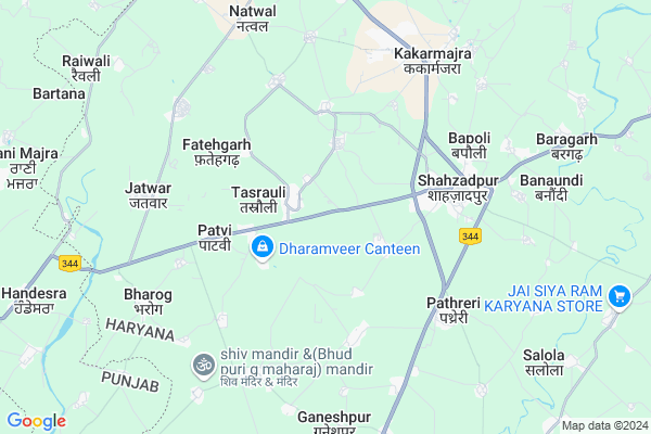
Gobindpur
Gobindpur Map
EDIT Map
Add Your House
 ..
..
Current Corona Virus Infected Patients Count in Ambala District
| City Name | District Name | Total Covid cases |
|---|---|---|
| Ambala District | Ambala | 12 |
| Ambala | Ambala | 1 |
Locality Name :
Gobindpur
( गोबिंदपुर )
Tehsil Name : Shahzadpur
District : Ambala
State : Haryana
Division : Ambala
Language : Hindi and Punjabi
Current Time 02:08 PM
Date: Wednesday , Feb 05,2025 (IST)
Time zone: IST (UTC+5:30)
Elevation / Altitude: 275 meters. Above Seal level
Telephone Code / Std Code: 0184
Assembly constituency : Naraingarh assembly constituency
Assembly MLA : Shalley
Lok Sabha constituency : Ambala parliamentary constituency
Parliament MP : RATTAN LAL KATARIA
Serpanch Name :
Pin Code : 134202
Post Office Name : Shahzadpur
Commodities Prices : Shahzadpur Market / Mandi
Gobindpur Live Weather
Temperature: 21.7 °C
clear sky
Humidity: 40%
Wind : 3.01 mt/sec towards W
StationName : "NarÄ\u0081yangarh"
observed on 39 Mins Back
Temperature: 21.7 °C
clear sky
Humidity: 40%
Wind : 3.01 mt/sec towards W
StationName : "NarÄ\u0081yangarh"
observed on 39 Mins Back
Gobindpur Weather Forecast for Next 5 days
06-02-2025
11.6°C to 22.3°C
clear sky
11.6°C to 22.3°C
clear sky
07-02-2025
11.3°C to 23.8°C
clear sky
11.3°C to 23.8°C
clear sky
08-02-2025
10.7°C to 24.8°C
clear sky, few clouds, scattered clouds, broken clouds
10.7°C to 24.8°C
clear sky, few clouds, scattered clouds, broken clouds
09-02-2025
9.9°C to 26.4°C
few clouds, broken clouds, overcast clouds, clear sky
9.9°C to 26.4°C
few clouds, broken clouds, overcast clouds, clear sky
10-02-2025
11.7°C to 27.8°C
few clouds, scattered clouds, clear sky
11.7°C to 27.8°C
few clouds, scattered clouds, clear sky
Edit below overview about Gobindpur
Edit below overview about Gobindpur
OverView of Gobindpur
Gobindpur Is A Very Good Vill And He Is A Litle Village And Aal Most A Govt Employ Of In A Family Gurjar Population Is Higer In Village And Other Cast Lohar.
Edit below overview about Gobindpur
National Highways Reachable To Gobindpur
Nationa High Way :NH152D
Nationa High Way :NH7;44
Nationa High Way :NH152D
Nationa High Way :NH7;44
Rivers Near Gobindpur
Kali
Nait ka Khala
Kali
Nait ka Khala
About Gobindpur
Gobindpur is a Village in Shahzadpur Tehsil in Ambala District of Haryana State, India. It belongs to Ambala Division . It is located 25 KM towards East from District head quarters Ambala. 3 KM from Shahzadpur. 44 KM from State capital Chandigarh
Gobindpur Pin code is 134202 and postal head office is Shahzadpur .
Mukandpur ( 2 KM ) , Sontli ( 2 KM ) , Berpura ( 2 KM ) , Khurd ( 2 KM ) , Rasidpur ( 3 KM ) are the nearby Villages to Gobindpur. Gobindpur is surrounded by Raipur Rani Tehsil towards North , Naraingarh Tehsil towards East , Ambala-Ii Tehsil towards west , Saha Tehsil towards South .
Babiyal , Ambala , Zirakpur , Panchkula are the near by Cities to Gobindpur.
This Place is in the border of the Ambala District and Panchkula District. Panchkula District Raipur Rani is North towards this place . Also it is in the Border of other district Yamunanagar .
Gobindpur 2011 Census Details
Gobindpur Local Language is Hindi. Gobindpur Village Total population is 850 and number of houses are 131. Female Population is 47.9%. Village literacy rate is 61.8% and the Female Literacy rate is 26.9%.
Population
| Census Parameter | Census Data |
| Total Population | 850 |
| Total No of Houses | 131 |
| Female Population % | 47.9 % ( 407) |
| Total Literacy rate % | 61.8 % ( 525) |
| Female Literacy rate | 26.9 % ( 229) |
| Scheduled Tribes Population % | 0.0 % ( 0) |
| Scheduled Caste Population % | 0.0 % ( 0) |
| Working Population % | 24.8 % |
| Child(0 -6) Population by 2011 | 116 |
| Girl Child(0 -6) Population % by 2011 | 42.2 % ( 49) |
Gobindpur Census More Deatils.
Politics in Gobindpur
BJP , INC , INLD are the major political parties in this area.Polling Stations /Booths near Gobindpur
1)Govt. Primary School Gazipur2)Govt. Sr. Sec. School (east Wing) Badhauli
3)Govt. Sr. Sec. School (west Wing) Badhauli
4)Govt. Middle School Sambhalwa
5)Govt. Middle School Manglai
HOW TO REACH Gobindpur
By Rail
There is no railway station near to Gobindpur in less than 10 km.Colleges near Gobindpur
Icl Institute Of Engineering And Technology
Address : P.o. Shahzadpur-134202,tehsil-naraingarh,nh-72 Amb
Schools in Gobindpur
Gps Gobindpur
Address : gobindpur , shahzadpur , ambala , Haryana . PIN- 134202 , Post - Shahzadpur
Govt Health Centers near Gobindpur
1) SC Kakrali , , ,2) SC Barwala , , ,
3) SC Mouli , , ,
Petrol Bunks in Gobindpur,Shahzadpur
Dhamoli Filling Station
village uparli dhamoli saha-Shahzadpur road; NH-73; Ambala; Haryana; India
6.0 KM distance Detail
HP PETROL PUMP - HARYANA AUTO STORE
Village Ganeshpur wtdtdrdt P O Dist Panipat;; Karasan; Haryana 134202; India
7.8 KM distance Detail
more ..
Colleges in Gobindpur,Shahzadpur
Shaheed Bhagat Singh Institute of Management & Technology
Khundewala Road; Rajpura; Mussimble; Jagadhri; Haryana 135003; India
10.4 KM distance Detail
E-Max College of Education
Kalpi-Naraingarh Road; Village Gola;Mullana; Ambala; Haryana 134203; India
10.7 KM distance Detail
E-max School of Engineering and Applied Research
Kalpi - Naraingarh Road; Gola; Tehsil Mullana; Ambala; Haryana 133001; India
12.3 KM distance Detail
more ..
Schools in Gobindpur,Shahzadpur
MRD High School
Dhanana Road; Ambala-Dehradun-Haridwar Rd; Tasrauli; Haryana 134201; India
1.2 KM distance Detail
Electronic Shops in Gobindpur,Shahzadpur
Shree Ganesh Sanitary ; Hardware & Electrical Store Bharog
Bharog; Haryana 134201; India
7.0 KM distance Detail
Local Parks in Gobindpur,Shahzadpur
ARMY FOREST AREA
Babyal village; Ramgarh Urf Sharifpur; Haryana 133001; India
15.6 KM distance Detail
Police Stations near Gobindpur,Shahzadpur
Police Station Panjokhara
Ambala-Dehradun-Haridwar Rd; Haryana 133001; India
16.3 KM distance Detail
Governement Offices near Gobindpur,Shahzadpur
Indian Bachelors
V.P.O. BHARERI KALAN TEH NARAINGARH; AMBALA; Haryana 134203; India
10.8 KM distance Detail
Kapil Verma
Ambala-Dehradun-Rishikesh Rd; Ambala Cantt; Punjab 140501; India
12.9 KM distance Detail
Rajiv Gandhi Seva Center
Saha; Ambala; NH-73; Shahzadpur Road; Ambala; Ambala; Haryana 121139; India
16.4 KM distance Detail
About Gobindpur &
History
How to reach Gobindpur
Tourist Places Near By Gobindpur
Schools in Gobindpur
Colleges in Gobindpur
Temperature & weather of Gobindpur
places in Gobindpur
Gobindpur photos
More Information
How to reach Gobindpur
Tourist Places Near By Gobindpur
Schools in Gobindpur
Colleges in Gobindpur
Temperature & weather of Gobindpur
places in Gobindpur
Gobindpur photos
More Information
Village Talk
Post News or Events about this Village
Near Cities
Babiyal 16 KM near
Ambala 24 KM near
Zirakpur 31 KM near
Panchkula 34 KM near
Babiyal 16 KM near
Ambala 24 KM near
Zirakpur 31 KM near
Panchkula 34 KM near
Near By Taluks
Shahzadpur 3 KM near
Raipur Rani 11 KM near
Naraingarh 14 KM near
Ambala-Ii 17 KM near
Shahzadpur 3 KM near
Raipur Rani 11 KM near
Naraingarh 14 KM near
Ambala-Ii 17 KM near
Near By Air Ports
Chandigarh Airport 35 KM near
Simla Airport 85 KM near
Dehra Dun Airport 113 KM near
Ludhiana Airport 134 KM near
Chandigarh Airport 35 KM near
Simla Airport 85 KM near
Dehra Dun Airport 113 KM near
Ludhiana Airport 134 KM near
Near By Tourist Places
Patel Park in Ambala Cantt 24 KM near
Morni Hills 33 KM near
Panchkula 34 KM near
Nahan 35 KM near
Chandigarh 42 KM near
Patel Park in Ambala Cantt 24 KM near
Morni Hills 33 KM near
Panchkula 34 KM near
Nahan 35 KM near
Chandigarh 42 KM near
Near By Districts
Ambala 24 KM near
Panchkula 34 KM near
Sirmaur 35 KM near
Chandigarh 42 KM near
Ambala 24 KM near
Panchkula 34 KM near
Sirmaur 35 KM near
Chandigarh 42 KM near
Near By RailWay Station
Ambala Cantt. Junction Rail Way Station 21 KM near
Ambala City Rail Way Station 25 KM near
Ambala Cantt. Junction Rail Way Station 21 KM near
Ambala City Rail Way Station 25 KM near