| Home | City Bus | Maps | Villages | Cities | Rail | Tourist Places | School | College | Pin Codes | Corona Cases Count |
| Distance Calculator Bus Services IFSC Codes Trace Mobile Number Weather Search Place Trace IP Available Cash ATM/Banks Locate Polling Booth Report an Error contact People |
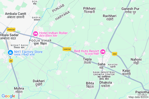
Mithapur Map
EDIT Map
Add Your House
 ..
..
Current Corona Virus Infected Patients Count in Ambala District
| City Name | District Name | Total Covid cases |
|---|---|---|
| Ambala District | Ambala | 12 |
| Ambala | Ambala | 1 |
Locality Name :
Mithapur
( मीठापुर )
Tehsil Name : Saha
District : Ambala
State : Haryana
Division : Ambala
Language : Hindi and Punjabi
Current Time 05:22 AM
Date: Monday , Apr 28,2025 (IST)
Time zone: IST (UTC+5:30)
Elevation / Altitude: 275 meters. Above Seal level
Telephone Code / Std Code: 0184
Assembly constituency : Mullana assembly constituency
Assembly MLA : Varun Chaudhary
Lok Sabha constituency : Ambala parliamentary constituency
Parliament MP : RATTAN LAL KATARIA
Serpanch Name :
Pin Code : 133104
Post Office Name : Saha
Commodities Prices : Mullana(saha) Market / Mandi
Mithapur Live Weather
Temperature: 25.0 °C
clear sky
Humidity: 19%
Wind : 4.13 mt/sec towards SE
StationName : "AmbÄ\u0081la"
observed on Now
Temperature: 25.0 °C
clear sky
Humidity: 19%
Wind : 4.13 mt/sec towards SE
StationName : "AmbÄ\u0081la"
observed on Now
Mithapur Weather Forecast for Next 5 days
29-04-2025
25.0°C to 41.0°C
clear sky
25.0°C to 41.0°C
clear sky
30-04-2025
25.7°C to 43.0°C
clear sky, few clouds
25.7°C to 43.0°C
clear sky, few clouds
01-05-2025
27.5°C to 41.1°C
few clouds, overcast clouds, scattered clouds, clear sky
27.5°C to 41.1°C
few clouds, overcast clouds, scattered clouds, clear sky
02-05-2025
28.0°C to 41.0°C
clear sky, scattered clouds, broken clouds
28.0°C to 41.0°C
clear sky, scattered clouds, broken clouds
Edit below overview about Mithapur
Edit below overview about Mithapur
OverView of Mithapur
Mithapur is very popular village as his history.30 year behind dome well is very popular.because thats waters is sweet so called that village mithapurEdit below overview about Mithapur
National Highways Reachable To Mithapur
Nationa High Way :NH46
Nationa High Way :NH152D
Nationa High Way :NH46
Nationa High Way :NH152D
Rivers Near Mithapur
Uzhavoor River
Chakan
Uzhavoor River
Chakan
About Mithapur
Mithapur is a Village in Saha Tehsil in Ambala District of Haryana State, India. It belongs to Ambala Division . It is located 19 KM towards East from District head quarters Ambala. 4 KM from Saha. 57 KM from State capital Chandigarh
Mithapur Pin code is 133104 and postal head office is Saha .
Samlehri ( 2 KM ) , Manglai ( 3 KM ) , Saha ( 4 KM ) , Sambalkha ( 4 KM ) , Khudda Kalan ( 4 KM ) are the nearby Villages to Mithapur. Mithapur is surrounded by Ambala-Ii Tehsil towards west , Barara Tehsil towards East , Shahzadpur Tehsil towards North , Ambala-I Tehsil towards west .
Babiyal , Ambala , Shahbad , Ladwa are the near by Cities to Mithapur.
Mithapur 2011 Census Details
Mithapur Local Language is Hindi. Mithapur Village Total population is 889 and number of houses are 175. Female Population is 47.0%. Village literacy rate is 71.7% and the Female Literacy rate is 31.5%.
Population
| Census Parameter | Census Data |
| Total Population | 889 |
| Total No of Houses | 175 |
| Female Population % | 47.0 % ( 418) |
| Total Literacy rate % | 71.7 % ( 637) |
| Female Literacy rate | 31.5 % ( 280) |
| Scheduled Tribes Population % | 0.0 % ( 0) |
| Scheduled Caste Population % | 21.4 % ( 190) |
| Working Population % | 28.6 % |
| Child(0 -6) Population by 2011 | 109 |
| Girl Child(0 -6) Population % by 2011 | 43.1 % ( 47) |
Mithapur Census More Deatils.
Politics in Mithapur
BJP , INC , INLD are the major political parties in this area.Polling Stations /Booths near Mithapur
1)Govt. Middle School Milk Dhankota2)Govt. Primary School Khanpura
3)Govt. Middle School Paunti
4)Govt. Senior Secondary School (middle Wing) Saha
5)Govt. Senior Secondary School (west Wing) Saha
HOW TO REACH Mithapur
By Rail
Dukheri Rail Way Station , Kesri Rail Way Station are the very nearby railway stations to Mithapur.Colleges near Mithapur
Ambala College Of Engineering And Research
Address : Mithapur Km 11, Ambala Cantt - Jagadhari Roadp.o.
Schools in Mithapur
Dhuni Dass Middle School
Address : mithapur , saha , ambala , Haryana . PIN- 133104 , Post - Saha
Gms Mithapur
Address : mithapur , saha , ambala , Haryana . PIN- 133004 , Post - Kuldeep Nagar
Govt Health Centers near Mithapur
1) Dhurana , , ,2) Nahra , , ,
3) Mustfabad , Primary Health Centre Mustafabad , Primary Health Centre Mustafabad , Near Govt School
Hospitals in Mithapur,Saha
Up Swasthya Kendra Tepla (Dispensary & Health Care Facility)
Tepla; Haryana 133104; India
2.7 KM distance Detail
LIFE CARE ELECTROHOMEOPAY
Dr.Ravinder Kumar SAHA-SHEZADPUR ROAD NRAR-RED HUT RESORT; Saha; Haryana 133104; India
4.5 KM distance Detail
more ..
Petrol Bunks in Mithapur,Saha
Bharat Petrol Pump
near mithapur and lucky farm;ambala pin code; 133001; India
0.5 KM distance Detail
Jagtar Filling Station Indian Oil Petrol Pump
Tepla; Ambala; SH-5; Ambala Jagadhari Road; Ambala; Ambala; Haryana 133104; India
3.9 KM distance Detail
more ..
Colleges in Mithapur,Saha
Ambala College of Engineering and Applied Research
Devsthali Near Mithapu; Sambhalkha; 78/13; Devsthali Road; Phalail Majra; Haryana 133101; India
2.5 KM distance Detail
more ..
Schools in Mithapur,Saha
Taneja Public School
Tepla; Ambala; SH-5; Ambala Jagadhari Road; Ambala; Ambala; Haryana 133104; India
1.6 KM distance Detail
Electronic Shops in Mithapur,Saha
Shiv Electrical Mithapur
Mithapur; Road; shiv electrical; Sambhalkha; Haryana 133101; India
1.0 KM distance Detail
Police Stations near Mithapur,Saha
Mahesh Nagar Police Station
Mahesh Nagar Police Station Road; Ambala Cantonment; Ambala; Haryana 133001; India
7.8 KM distance Detail
Governement Offices near Mithapur,Saha
Range Forest Office
Saha; Ambala; SH-5; Ambala Jagadhari Road; Ambala; Ambala; Haryana 133104; India
4.4 KM distance Detail
Rajiv Gandhi Seva Center
Saha; Ambala; NH-73; Shahzadpur Road; Ambala; Ambala; Haryana 121139; India
4.9 KM distance Detail
About Mithapur &
History
How to reach Mithapur
Tourist Places Near By Mithapur
Schools in Mithapur
Colleges in Mithapur
Temperature & weather of Mithapur
places in Mithapur
Mithapur photos
More Information
How to reach Mithapur
Tourist Places Near By Mithapur
Schools in Mithapur
Colleges in Mithapur
Temperature & weather of Mithapur
places in Mithapur
Mithapur photos
More Information
Village Talk
Post News or Events about this Village
Near Cities
Babiyal 7 KM near
Ambala 18 KM near
Shahbad 21 KM near
Ladwa 42 KM near
Babiyal 7 KM near
Ambala 18 KM near
Shahbad 21 KM near
Ladwa 42 KM near
Near By Taluks
Saha 5 KM near
Ambala-Ii 11 KM near
Barara 16 KM near
Shahzadpur 18 KM near
Saha 5 KM near
Ambala-Ii 11 KM near
Barara 16 KM near
Shahzadpur 18 KM near
Near By Air Ports
Chandigarh Airport 46 KM near
Simla Airport 101 KM near
Dehra Dun Airport 118 KM near
Muzaffarnagar Airport 136 KM near
Chandigarh Airport 46 KM near
Simla Airport 101 KM near
Dehra Dun Airport 118 KM near
Muzaffarnagar Airport 136 KM near
Near By Tourist Places
Patel Park in Ambala Cantt 18 KM near
Kurukshetra 43 KM near
Yamuna-Nagar 46 KM near
Chhachhrauli 47 KM near
Panchkula 47 KM near
Patel Park in Ambala Cantt 18 KM near
Kurukshetra 43 KM near
Yamuna-Nagar 46 KM near
Chhachhrauli 47 KM near
Panchkula 47 KM near
Near By Districts
Ambala 18 KM near
Yamunanagar 44 KM near
Kurukshetra 44 KM near
Panchkula 47 KM near
Ambala 18 KM near
Yamunanagar 44 KM near
Kurukshetra 44 KM near
Panchkula 47 KM near
Near By RailWay Station
Dukheri Rail Way Station 6.0 KM near
Kesri Rail Way Station 6.9 KM near
Ambala Cantt. Junction Rail Way Station 11 KM near
Barara Rail Way Station 17 KM near
Dukheri Rail Way Station 6.0 KM near
Kesri Rail Way Station 6.9 KM near
Ambala Cantt. Junction Rail Way Station 11 KM near
Barara Rail Way Station 17 KM near