| Home | City Bus | Maps | Villages | Cities | Rail | Tourist Places | School | College | Pin Codes | Corona Cases Count |
| Distance Calculator Bus Services IFSC Codes Trace Mobile Number Weather Search Place Trace IP Available Cash ATM/Banks Locate Polling Booth Report an Error contact People |
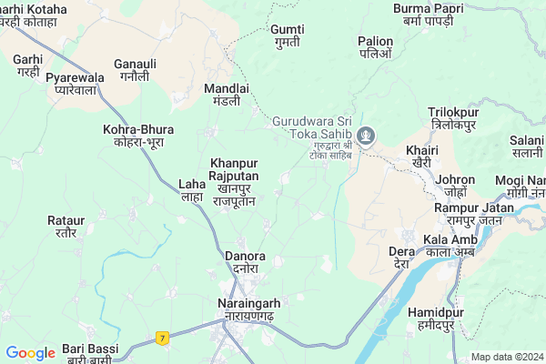
Kathe Majra
Kathe Majra Map
EDIT Map
Add Your House
 ..
..
Current Corona Virus Infected Patients Count in Ambala District
| City Name | District Name | Total Covid cases |
|---|---|---|
| Ambala District | Ambala | 12 |
| Ambala | Ambala | 1 |
Locality Name :
Kathe Majra
( कथे माजरा )
Tehsil Name : Naraingarh
District : Ambala
State : Haryana
Division : Ambala
Language : Hindi and Punjabi
Current Time 07:05 AM
Date: Saturday , Apr 26,2025 (IST)
Time zone: IST (UTC+5:30)
Elevation / Altitude: 275 meters. Above Seal level
Telephone Code / Std Code: 0184
Assembly constituency : Naraingarh assembly constituency
Assembly MLA : Shalley
Lok Sabha constituency : Ambala parliamentary constituency
Parliament MP : RATTAN LAL KATARIA
Serpanch Name :
Pin Code : 134203
Post Office Name : Naraingarh
Commodities Prices : Naraingarh Market / Mandi
National Highways Reachable To Kathe Majra
Nationa High Way :NH95
Nationa High Way :NH5
Nationa High Way :NH95
Nationa High Way :NH5
Rivers Near Kathe Majra
Dabar
Ghagar
Dabar
Ghagar
About Kathe Majra
Correct below Info and add more info about Kathe MajraKathe Majra is a Village in Naraingarh Tehsil in Ambala District of Haryana State, India. It belongs to Ambala Division . It is located 45 KM towards East from District head quarters Ambala. 9 KM from Naraingarh. 49 KM from State capital Chandigarh
Kathe Majra Pin code is 134203 and postal head office is Naraingarh .
Ujjal Majri ( 2 KM ) , Khanpur Rajputan ( 2 KM ) , Sambhalwa ( 3 KM ) , Hussaini ( 3 KM ) , Chechi Majra ( 3 KM ) are the nearby Villages to Kathe Majra. Kathe Majra is surrounded by Sadaura (Part) Tehsil towards South , Raipur Rani Tehsil towards west , Shahzadpur Tehsil towards west , Morni Tehsil towards North .
Nahan , Babiyal , Panchkula , Zirakpur are the near by Cities to Kathe Majra.
This Place is in the border of the Ambala District and Yamunanagar District. Yamunanagar District Sadaura (part) is South towards this place . Also it is in the Border of other district Sirmaur . It is near to the Himachal Pradesh State Border.
Kathe Majra 2011 Census Details
Kathe Majra Local Language is Hindi. Kathe Majra Village Total population is 1072 and number of houses are 196. Female Population is 47.9%. Village literacy rate is 71.8% and the Female Literacy rate is 31.2%.
Population
| Census Parameter | Census Data |
| Total Population | 1072 |
| Total No of Houses | 196 |
| Female Population % | 47.9 % ( 513) |
| Total Literacy rate % | 71.8 % ( 770) |
| Female Literacy rate | 31.2 % ( 334) |
| Scheduled Tribes Population % | 0.0 % ( 0) |
| Scheduled Caste Population % | 20.8 % ( 223) |
| Working Population % | 28.4 % |
| Child(0 -6) Population by 2011 | 139 |
| Girl Child(0 -6) Population % by 2011 | 46.0 % ( 64) |
Kathe Majra Census More Deatils.
Politics in Kathe Majra
BJP , INC , INLD are the major political parties in this area.Polling Stations /Booths near Kathe Majra
1)Govt. Sr. Sec. School Karasan2)Govt. Primary School Panjoto
3)Panchayat Ghar Bharehri Khurd
4)Govt. Primary School Chattan
5)Govt. Middle School Gharauli
HOW TO REACH Kathe Majra
By Rail
There is no railway station near to Kathe Majra in less than 10 km.Colleges near Kathe Majra
Govt. College Narain Garh
Address :
Gurukulam Institution Of Technical Education
Address :
Iclgroup Of Colleges
Address : P.o. Shahzadpur - 134202,tehsil - Naraingarh, Nh
Govt.college Naraingarh
Address : Naraingarh
Shree Ram Mulakh Institute Of Engineering & Technology
Address : Tehsil Naraingarh, Distt. Ambala
Schools in Kathe Majra
Ghs Kathemajra
Address : kathe majra , naraingarh , ambala , Haryana . PIN- 134203 , Post - Naraingarh
Sareswati.n.m.sch.kathemajra
Address : kathe majra , naraingarh , ambala , Haryana . PIN- 134203 , Post - Naraingarh
Govt Health Centers near Kathe Majra
1) SC Baldwala , , ,2) SC Badhaur , , ,
3) SC Kandaiwala , , ,
Hospitals in Kathe Majra,Naraingarh
Orthocare Physiotherapy And Rehabilitation Clinic 2.
College Road Naraingarh; India
4.3 KM distance Detail
Vishal Nursing Home
350; Huda Rd; Huda Sector 4; Naraingarh; Haryana 134203; India
4.3 KM distance Detail
Rana Engineering Works
Sunder Nagar; Mandour; Naraingarh Road; Haryana 130036; India
4.5 KM distance Detail
more ..
Petrol Bunks in Kathe Majra,Naraingarh
SHIVA PETROL SERVICE
HUSSANI ROAD SH 18; NARAIN; AMBALA; Haryana 134203; India
5.3 KM distance Detail
Hardeep Filling Station Indian Oil Petrol Pump
Jangu Majra; Ambala; SH-1; Naraingrah Road; Naraingarh; Naraingarh; Haryana 134007; India
5.3 KM distance Detail
more ..
Colleges in Kathe Majra,Naraingarh
Govt. College Naraingarh
Naraingarh College Rd; Naraingarh; Haryana 134203; India
4.0 KM distance Detail
mohit medical store
Naraingarh - Kathey - Majra Rd; Naraingarh; Haryana 134203; India
4.5 KM distance Detail
more ..
Schools in Kathe Majra,Naraingarh
Mount Carmel International School
Naraingarh - Kathey - Majra Rd; Kathe Majra; Haryana 134203; India
1.4 KM distance Detail
Local Parks in Kathe Majra,Naraingarh
Huda Park No. 1
336; Huda Rd; Huda Sector 4; Naraingarh; Haryana 134203; India
4.2 KM distance Detail
Police Stations near Kathe Majra,Naraingarh
Police Post Sector 4
Naraingarh - Kathey - Majra Rd; Naraingarh; Haryana 134203; India
4.1 KM distance Detail
POLICE STATION NARAINGARH
Naraingarh Market Rd; Naraingarh; Haryana 134203; India
5.3 KM distance Detail
Police Station Kala Amb
Excise Colony; Sirmour; NH-72; Ambala Dehradun Haridwar Road; Kala Amb; Kala Amb; Himachal Pradesh 173030; India
8.6 KM distance Detail
Governement Offices near Kathe Majra,Naraingarh
Block Agriculture Officer; Office
Naraingarh - Kathey - Majra Rd; Naraingarh; Haryana 134203; India
4.2 KM distance Detail
About Kathe Majra &
History
How to reach Kathe Majra
Tourist Places Near By Kathe Majra
Schools in Kathe Majra
Colleges in Kathe Majra
Temperature & weather of Kathe Majra
places in Kathe Majra
Kathe Majra photos
More Information
How to reach Kathe Majra
Tourist Places Near By Kathe Majra
Schools in Kathe Majra
Colleges in Kathe Majra
Temperature & weather of Kathe Majra
places in Kathe Majra
Kathe Majra photos
More Information
Village Talk
Post News or Events about this Village
Near Cities
Nahan 16 KM near
Babiyal 35 KM near
Panchkula 37 KM near
Zirakpur 37 KM near
Nahan 16 KM near
Babiyal 35 KM near
Panchkula 37 KM near
Zirakpur 37 KM near
Near By Taluks
Naraingarh 9 KM near
Raipur Rani 14 KM near
Sadaura (Part) 14 KM near
Shahzadpur 15 KM near
Naraingarh 9 KM near
Raipur Rani 14 KM near
Sadaura (Part) 14 KM near
Shahzadpur 15 KM near
Near By Air Ports
Chandigarh Airport 41 KM near
Simla Airport 74 KM near
Dehra Dun Airport 99 KM near
Ludhiana Airport 145 KM near
Chandigarh Airport 41 KM near
Simla Airport 74 KM near
Dehra Dun Airport 99 KM near
Ludhiana Airport 145 KM near
Near By Tourist Places
Nahan 16 KM near
Morni Hills 23 KM near
Panchkula 37 KM near
Chhachhrauli 41 KM near
Yadavindra gardens 41 KM near
Nahan 16 KM near
Morni Hills 23 KM near
Panchkula 37 KM near
Chhachhrauli 41 KM near
Yadavindra gardens 41 KM near
Near By Districts
Sirmaur 17 KM near
Panchkula 37 KM near
Ambala 42 KM near
Chandigarh 46 KM near
Sirmaur 17 KM near
Panchkula 37 KM near
Ambala 42 KM near
Chandigarh 46 KM near
Near By RailWay Station
Chandi Mandir Rail Way Station 37 KM near
Barara Rail Way Station 39 KM near
Chandi Mandir Rail Way Station 37 KM near
Barara Rail Way Station 39 KM near