| Home | City Bus | Maps | Villages | Cities | Rail | Tourist Places | School | College | Pin Codes | Corona Cases Count |
| Distance Calculator Bus Services IFSC Codes Trace Mobile Number Weather Search Place Trace IP Available Cash ATM/Banks Locate Polling Booth Report an Error contact People |
 ..
..
Current Corona Virus Infected Patients Count in Alwar District
| City Name | District Name | Total Covid cases |
|---|---|---|
| Alwar District | Alwar | 7 |
Tehsil Name : Tijara
District : Alwar
State : Rajasthan
Division : Jaipur
Language : Rajasthani
Current Time 12:35 PM
Date: Wednesday , Apr 30,2025 (IST)
Time zone: IST (UTC+5:30)
Elevation / Altitude: 286 meters. Above Seal level
Telephone Code / Std Code: 01493
Assembly constituency : Tijara assembly constituency
Assembly MLA : Mahant Balak Nath
Lok Sabha constituency : Alwar parliamentary constituency
Parliament MP : Balak Nath
Serpanch Name :
Pin Code : 301411
Post Office Name : Tizara
Commodities Prices : Rewari Market / Mandi
Temperature: 36.0 °C
clear sky
Humidity: 23%
Wind : 3.48 mt/sec towards SE
StationName : "DhÄ\u0081ruhera"
observed on 6 Mins Back
30.3°C to 37.9°C
clear sky
29.0°C to 42.2°C
scattered clouds, few clouds, clear sky
29.3°C to 42.1°C
scattered clouds, broken clouds, clear sky, light rain
27.9°C to 42.4°C
light rain, broken clouds, scattered clouds, few clouds
26.9°C to 41.3°C
few clouds, clear sky, overcast clouds, scattered clouds
OverView of Salarpur
This village is on haryana rajasthan border. Occupation of
mostly people are agriculture and defence service.
In this village jhada of rasoli is also given on Saturday evening. In only one or two time this desease is almost cleared. This is vardan
of bhagwan. This village is
also known for its unity. All people of this village are aheer. And 90% of them are belong to mahla
gotra.
The temple of radha-krisna and baba mitha peer are also very famous. The fair of
baba meetha peer is orgnised every year
and jagaran of khattu shyam baba celebrate every
year.Sarpanch of this village is RAJESH SUNITA YADAV.
Edit below overview about Salarpur
Nationa High Way :NH48
Nationa High Way :NH24
About Salarpur
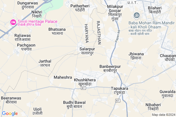
Salarpur is a Village in Tijara Tehsil in Alwar District of Rajasthan State, India. It belongs to Jaipur Division . It is located 77 KM towards North from District head quarters Alwar. 17 KM from Tijara. 194 KM from State capital Jaipur
Salarpur Pin code is 301411 and postal head office is Tizara .
Karoli ( 3 KM ) , Seethal ( 4 KM ) , Budhi Bawal ( 4 KM ) , Tapookara ( 6 KM ) , Jhiwana ( 6 KM ) are the nearby Villages to Salarpur. Salarpur is surrounded by Rewari Tehsil towards west , Pataudi Tehsil towards North , Taoru Tehsil towards East , Kotkasim Tehsil towards South .
Rewari , Bawal , Sohna , Gurgaon are the near by Cities to Salarpur.
This Place is in the border of the Alwar District and Mewat District. Mewat District Nagina is East towards this place . It is near to the Haryana State Border.
Salarpur 2011 Census Details
Salarpur Local Language is Rajasthani. Salarpur Village Total population is 2162 and number of houses are 451. Female Population is 47.5%. Village literacy rate is 69.2% and the Female Literacy rate is 28.7%.
Population
| Census Parameter | Census Data |
| Total Population | 2162 |
| Total No of Houses | 451 |
| Female Population % | 47.5 % ( 1027) |
| Total Literacy rate % | 69.2 % ( 1496) |
| Female Literacy rate | 28.7 % ( 621) |
| Scheduled Tribes Population % | 0.1 % ( 3) |
| Scheduled Caste Population % | 16.5 % ( 356) |
| Working Population % | 62.9 % |
| Child(0 -6) Population by 2011 | 256 |
| Girl Child(0 -6) Population % by 2011 | 41.8 % ( 107) |
Salarpur Census More Deatils.
Politics in Salarpur
Bharatiya Janata Party , BJP , BSP , INC are the major political parties in this area.Polling Stations /Booths near Salarpur
1)Govt. Upper Primary School Bhamdaka2)Govt. Secondary School Left Side Khijuribas
3)Govt. Upper Primary School Right Side Ghatal
4)B S Memorial School Bhiwadi East Side Room No. 1
5)Govt. Secondary School Right Side Khijuribas
HOW TO REACH Salarpur
By Rail
There is no railway station near to Salarpur in less than 10 km.Colleges near Salarpur
Anibesaint Girls CollegeSchools in Salarpur
Sangam Public Sec. SalarpurGovt Health Centers near Salarpur
1) Budhibawal , budhibawal , jodiya , kotkasim2) Nasopur , nasopur , jodiya , kotkasim
3) Jatuwas , jatuwas , makdawa matalwas road jatuwas , kotkasim
Petrol Bunks in Salarpur,Tijara
Baba Bishan Dass Ksk Filling Station
baba bishan dass ksk filling station nand ram purbass haryana near; Rewari; Haryana; India
1.6 KM distance Detail
KRISHNA FILLING STATION
NANDRAMPUR;NANDRAMPUR RD;R; REWARI; Haryana 123106; India
2.5 KM distance Detail
HP PETROL PUMP - SURAJ FILLING STATION
VPO Nandrampur Bass Tehsil Daruhera; Gurgaon; Haryana 123414; India
2.6 KM distance Detail
Rao Inder Singh Ksk Petrol Pump
Nandrampur Bass Rd; Nandrampur Bass; Haryana 123401; India
3.1 KM distance Detail
more ..
Colleges in Salarpur,Tijara
Shri Shyam TT College; Shahpur; Tijara
Lane from Papari Road; Near Tatarpur; India
1.2 KM distance Detail
New Tagore Iti Bhudi Bawal
Near shri shyam mandir budhi bawal; Burhi Bawal - Dharuhera Rd; Budhi Bawal; Rajasthan 301707; India
4.7 KM distance Detail
more ..
Schools in Salarpur,Tijara
Maharishi Dayanand Sr. Sec. School Salarpur Tijara Alwar
Alwar; Rajasthan 301707; India
1.5 KM distance Detail
Gd Goenka Public School; Bhiwadi
Near Omaxe-1; Panorama City; Sec-54; Salarpur 301019; Bhiwadi; Rajasthan; India
1.9 KM distance Detail
Local Parks in Salarpur,Tijara
Park -baba Bishan Dass _-_ Nandrampurbass
Nandrampur Bass; Haryana 123106; India
1.8 KM distance Detail
Governement Offices near Salarpur,Tijara
Ishika Transport Company
khuskhera near; balaji kanta; Khushkhera; Rajasthan; India
2.1 KM distance Detail
How to reach Salarpur
Tourist Places Near By Salarpur
Schools in Salarpur
Colleges in Salarpur
Temperature & weather of Salarpur
places in Salarpur
Salarpur photos
More Information
Village Talk
Post News or Events about this Village
Rewari 18 KM near
Bawal 24 KM near
Sohna 32 KM near
Gurgaon 47 KM near
Tijara 16 KM near
Rewari 17 KM near
Taoru 20 KM near
Pataudi 20 KM near
Indira Gandhi International Airport 62 KM near
Kheria Airport 177 KM near
Muzaffarnagar Airport 187 KM near
Sanganeer Airport 197 KM near
Nuh 23 KM near
Manesar 31 KM near
Sohna 33 KM near
Gurgaon 48 KM near
Bhindawas Lake 55 KM near
Rewari 20 KM near
Mewat 24 KM near
Gurgaon 47 KM near
Palwal 57 KM near
Rewari Junction Rail Way Station 21 KM near
Pataudi Road Rail Way Station 26 KM near