| Home | City Bus | Maps | Villages | Cities | Rail | Tourist Places | School | College | Pin Codes | Corona Cases Count |
| Distance Calculator Bus Services IFSC Codes Trace Mobile Number Weather Search Place Trace IP Available Cash ATM/Banks Locate Polling Booth Report an Error contact People |
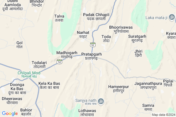
Pratapgarh Map
EDIT Map
Add Your House
 ..
..
Current Corona Virus Infected Patients Count in Alwar District
| City Name | District Name | Total Covid cases |
|---|---|---|
| Alwar District | Alwar | 7 |
Locality Name :
Pratapgarh
( प्रतापगढ़ )
Tehsil Name : Thanagazi
District : Alwar
State : Rajasthan
Division : Jaipur
Language : Rajasthani
Current Time 10:52 AM
Date: Tuesday , Apr 29,2025 (IST)
Time zone: IST (UTC+5:30)
Elevation / Altitude: 265 meters. Above Seal level
Telephone Code / Std Code: 01465
Assembly constituency : Thanagazi assembly constituency
Assembly MLA : Kanti Prasad
Lok Sabha constituency : Dausa parliamentary constituency
Parliament MP : Jaskaur Meena
Serpanch Name :
Pin Code : 301027
Post Office Name : Pratap Garh (Alwar)
Commodities Prices : Dausa Market / Mandi
Pratapgarh Live Weather
Temperature: 35.7 °C
clear sky
Humidity: 14%
Wind : 5.08 mt/sec towards SE
StationName : "Manoharpur"
observed on 42 Mins Back
Temperature: 35.7 °C
clear sky
Humidity: 14%
Wind : 5.08 mt/sec towards SE
StationName : "Manoharpur"
observed on 42 Mins Back
Pratapgarh Weather Forecast for Next 5 days
30-04-2025
27.8°C to 38.1°C
clear sky
27.8°C to 38.1°C
clear sky
01-05-2025
26.5°C to 39.4°C
clear sky
26.5°C to 39.4°C
clear sky
02-05-2025
27.7°C to 42.0°C
few clouds, clear sky, scattered clouds, broken clouds, overcast clouds
27.7°C to 42.0°C
few clouds, clear sky, scattered clouds, broken clouds, overcast clouds
03-05-2025
26.7°C to 40.5°C
overcast clouds, few clouds, broken clouds, light rain
26.7°C to 40.5°C
overcast clouds, few clouds, broken clouds, light rain
04-05-2025
24.7°C to 39.1°C
light rain, overcast clouds, broken clouds, scattered clouds
24.7°C to 39.1°C
light rain, overcast clouds, broken clouds, scattered clouds
Edit below overview about Pratapgarh
Edit below overview about Pratapgarh
OverView of Pratapgarh
This is my village and I love my village. Here is hard work and ladies are work like karpet.Pratagarh in thanagazi tahashil.Edit below overview about Pratapgarh
National Highways Reachable To Pratapgarh
Nationa High Way :NH48
Nationa High Way :NH248A
Nationa High Way :NH48
Nationa High Way :NH248A
Rivers Near Pratapgarh
Mendha
Banganga
Mendha
Banganga
About Pratapgarh
Pratapgarh is a Village in Thanagazi Tehsil in Alwar District of Rajasthan State, India. It belongs to Jaipur Division . It is located 65 KM towards west from District head quarters Alwar. 18 KM from Thanagazi. 59 KM from State capital Jaipur
Pratapgarh Pin code is 301027 and postal head office is Pratap Garh (Alwar).
Jhiri ( 6 KM ) , Piplai ( 11 KM ) , Kyara ( 11 KM ) , Agar ( 11 KM ) , Kishori ( 15 KM ) are the nearby Villages to Pratapgarh. Pratapgarh is surrounded by Viratnagar Tehsil towards North , Jamwa Ramgarh Tehsil towards South , Shahpura Tehsil towards west , Rajgarh Tehsil towards East .
Rajgarh (Alwar) , Bandikui , Jaipur , Alwar are the near by Cities to Pratapgarh.
This Place is in the border of the Alwar District and Jaipur District. Jaipur District Viratnagar is North towards this place .
Pratapgarh 2011 Census Details
Pratapgarh Local Language is Rajasthani. Pratapgarh Village Total population is 3754 and number of houses are 621. Female Population is 46.5%. Village literacy rate is 57.1% and the Female Literacy rate is 20.4%.
Population
| Census Parameter | Census Data |
| Total Population | 3754 |
| Total No of Houses | 621 |
| Female Population % | 46.5 % ( 1747) |
| Total Literacy rate % | 57.1 % ( 2145) |
| Female Literacy rate | 20.4 % ( 765) |
| Scheduled Tribes Population % | 16.8 % ( 632) |
| Scheduled Caste Population % | 14.8 % ( 554) |
| Working Population % | 35.8 % |
| Child(0 -6) Population by 2011 | 577 |
| Girl Child(0 -6) Population % by 2011 | 44.4 % ( 256) |
Pratapgarh Census More Deatils.
Politics in Pratapgarh
Independent , Bharatiya Janata Party , BJP , NPP are the major political parties in this area.Polling Stations /Booths near Pratapgarh
1)Govt. Ps. Nitata2)Govt. Adarsh Ups. South Part Koah
3)Govt. Girls Sec. School Pratapgarh North Part
4)Govt. Ups. New Room Kutuki
5)Govt. Sec. School Kyara
HOW TO REACH Pratapgarh
By Rail
There is no railway station near to Pratapgarh in less than 10 km.Colleges near Pratapgarh
Janki Devi College Thanagazi
Address : Pratapagarh Road Thanagazi
Heeralal Saini Collage Chima Ki Dhani
Address :
Saini Collage Thanagazi
Address :
Tirupati Pvt Iti
Address :
Schools in Pratapgarh
Dev Ups Pratapgarh
Address : pratapgarh , thanagazi , alwar , Rajasthan . PIN- 301027 , Post - Pratap Garh (Alwar)
Govt. Kgbav Pratapgarh
Address : pratapgarh , thanagazi , alwar , Rajasthan . PIN- 301027 , Post - Pratap Garh (Alwar)
Mahaveer International
Address : pratapgarh , thanagazi , alwar , Rajasthan . PIN- 301027 , Post - Pratap Garh (Alwar)
Govt. Ups(san.) Pratapgarh
Address : pratapgarh , thanagazi , alwar , Rajasthan . PIN- 301027 , Post - Pratap Garh (Alwar)
Avm Pratapgarh
Address : pratapgarh , thanagazi , alwar , Rajasthan . PIN- 301027 , Post - Pratap Garh (Alwar)
Govt Health Centers near Pratapgarh
1) Lalpura , Village Lalpura , Village Lalpura Thanagazi ,2) Dhara , , ,
3) Chak Charanwas , upswasthaya kendra , Chak Charanwas , Tala
Petrol Bunks in Pratapgarh,Thanagazi
HP PETROL PUMP - PRATAPGARH FILLING STATION
Pratapgarh Tehsil Thanagazi Pratapgarh-thanagazi Road; Jaipur; Rajasthan 301027; India
1.7 KM distance Detail
more ..
Colleges in Pratapgarh,Thanagazi
ARAVALI GIRLS COLLEGE; PRATAPGARH (ALWAR)
Ajabgarh Road; Chandpura; Rajasthan 301027; India
3.0 KM distance Detail
Baba Narayandas P.G. College
Jaipur-Alwar state Highway; Near Viratnagar Tehsil; Viratnagar; Rajasthan 301027; India
16.9 KM distance Detail
more ..
Schools in Pratapgarh,Thanagazi
Shrimati Krishna Devi Baisiwala Secondry Adarsh Vidhya Mandir; Pratapgarh
Pratapgarh; Rajasthan 303109; India
0.6 KM distance Detail
Electronic Shops in Pratapgarh,Thanagazi
MANISH ELECTRICIANS मैकेनिक(मिस्त्री)
Alwar - Jaipur Rd; Pratapgarh; Rajasthan 301027; India
0.7 KM distance Detail
Super Markets in Pratapgarh,Thanagazi
दुर्गा माँ मिन्दर एवम शिवमिन्दर
Pratapgarh Road; Pratapgarh; Rajasthan 303109; India
0.5 KM distance Detail
Local Parks in Pratapgarh,Thanagazi
Governement Offices near Pratapgarh,Thanagazi
About Pratapgarh &
History
How to reach Pratapgarh
Tourist Places Near By Pratapgarh
Schools in Pratapgarh
Colleges in Pratapgarh
Temperature & weather of Pratapgarh
places in Pratapgarh
Pratapgarh photos
More Information
How to reach Pratapgarh
Tourist Places Near By Pratapgarh
Schools in Pratapgarh
Colleges in Pratapgarh
Temperature & weather of Pratapgarh
places in Pratapgarh
Pratapgarh photos
More Information
Village Talk
Post News or Events about this Village
Near Cities
Rajgarh (Alwar) 51 KM near
Bandikui 52 KM near
Jaipur 56 KM near
Alwar 63 KM near
Rajgarh (Alwar) 51 KM near
Bandikui 52 KM near
Jaipur 56 KM near
Alwar 63 KM near
Near By Taluks
Thanagazi 18 KM near
Viratnagar 26 KM near
Jamwa Ramgarh 27 KM near
Shahpura 31 KM near
Thanagazi 18 KM near
Viratnagar 26 KM near
Jamwa Ramgarh 27 KM near
Shahpura 31 KM near
Near By Air Ports
Sanganeer Airport 66 KM near
Indira Gandhi International Airport 192 KM near
Kheria Airport 199 KM near
Gwalior Airport 259 KM near
Sanganeer Airport 66 KM near
Indira Gandhi International Airport 192 KM near
Kheria Airport 199 KM near
Gwalior Airport 259 KM near
Near By Tourist Places
Sariska 29 KM near
Jamwa Ramgarh 33 KM near
Samode 39 KM near
Galta 53 KM near
Jantar Mantar 54 KM near
Sariska 29 KM near
Jamwa Ramgarh 33 KM near
Samode 39 KM near
Galta 53 KM near
Jantar Mantar 54 KM near
Near By Districts
Dausa 49 KM near
Jaipur 59 KM near
Alwar 63 KM near
Mahendragarh 98 KM near
Dausa 49 KM near
Jaipur 59 KM near
Alwar 63 KM near
Mahendragarh 98 KM near
Near By RailWay Station
Dausa Rail Way Station 47 KM near
Baswa Rail Way Station 47 KM near
Dausa Rail Way Station 47 KM near
Baswa Rail Way Station 47 KM near