| Home | City Bus | Maps | Villages | Cities | Rail | Tourist Places | School | College | Pin Codes | Corona Cases Count |
| Distance Calculator Bus Services IFSC Codes Trace Mobile Number Weather Search Place Trace IP Available Cash ATM/Banks Locate Polling Booth Report an Error contact People |
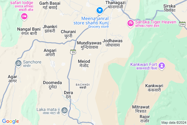
Malutana Map
EDIT Map
Add Your House
 ..
..
Current Corona Virus Infected Patients Count in Alwar District
| City Name | District Name | Total Covid cases |
|---|---|---|
| Alwar District | Alwar | 7 |
Locality Name :
Malutana
( मलुटाना )
Tehsil Name : Thanagazi
District : Alwar
State : Rajasthan
Division : Jaipur
Language : Rajasthani
Current Time 01:06 PM
Date: Tuesday , Apr 29,2025 (IST)
Time zone: IST (UTC+5:30)
Elevation / Altitude: 265 meters. Above Seal level
Telephone Code / Std Code: 01465
Assembly constituency : Thanagazi assembly constituency
Assembly MLA : Kanti Prasad
Lok Sabha constituency : Dausa parliamentary constituency
Parliament MP : Jaskaur Meena
Serpanch Name :
Pin Code : 301022
Post Office Name : Thanagazi
Alternate Village Name : Malootana
Commodities Prices : Khedh(Bodaramev) Market / Mandi
National Highways Reachable To Malutana
Nationa High Way :NH48
Nationa High Way :NH248A
Nationa High Way :NH48
Nationa High Way :NH248A
Rivers Near Malutana
Mendha
Banganga
Mendha
Banganga
About Malutana
Correct below Info and add more info about MalutanaMalutana is a Village in Thanagazi Tehsil in Alwar District of Rajasthan State, India. It belongs to Jaipur Division . It is located 46 KM towards west from District head quarters Alwar. 77 KM from State capital Jaipur
Malutana Pin code is 301022 and postal head office is Thanagazi .
Malutana is surrounded by Viratnagar Tehsil towards west , Rajgarh Tehsil towards East , Umren Tehsil towards East , Shahpura Tehsil towards west .
Rajgarh (Alwar) , Alwar , Bandikui , Neem-Ka-Thana are the near by Cities to Malutana.
This Place is in the border of the Alwar District and Jaipur District. Jaipur District Viratnagar is west towards this place .
Malootana 2011 Census Details
Malutana Local Language is Rajasthani. Malootana Village Total population is 2325 and number of houses are 375. Female Population is 47.4%. Village literacy rate is 48.2% and the Female Literacy rate is 16.0%.
Population
| Census Parameter | Census Data |
| Total Population | 2325 |
| Total No of Houses | 375 |
| Female Population % | 47.4 % ( 1103) |
| Total Literacy rate % | 48.2 % ( 1120) |
| Female Literacy rate | 16.0 % ( 371) |
| Scheduled Tribes Population % | 7.4 % ( 171) |
| Scheduled Caste Population % | 24.9 % ( 578) |
| Working Population % | 43.0 % |
| Child(0 -6) Population by 2011 | 400 |
| Girl Child(0 -6) Population % by 2011 | 50.5 % ( 202) |
Malootana Census More Deatils.
Politics in Malutana
Independent , Bharatiya Janata Party , BJP , NPP are the major political parties in this area.Polling Stations /Booths near Malutana
1)Govt Sec. School Duhar Chugan Sauth Part2)Govt. Ps Mankot
3)Govt. Ups. Amka
4)Govt.ups Boys Narhait
5)Govt. Ups Gopalpura
HOW TO REACH Malutana
By Rail
There is no railway station near to Malutana in less than 10 km.Colleges near Malutana
Janki Devi College Thanagazi
Address : Pratapagarh Road Thanagazi
Heeralal Saini Collage Chima Ki Dhani
Address :
Saini Collage Thanagazi
Address :
Tirupati Pvt Iti
Address :
Schools in Malutana
Pooja Pub. School Malutana
Address : malutana , thanagazi , alwar , Rajasthan . PIN- 301022 , Post - Thanagazi
Govt. Ups (g) Malutana
Address : malutana , thanagazi , alwar , Rajasthan . PIN- 301022 , Post - Thanagazi
Govt. Sec. Malutana
Address : malutana , thanagazi , alwar , Rajasthan . PIN- 301022 , Post - Thanagazi
Govt Health Centers near Malutana
1) Jodhawas , Jodhawas , Jodhawas , Jodhawas2) Dhara , , ,
3) Lalpura , Village Lalpura , Village Lalpura Thanagazi ,
Colleges in Malutana,Thanagazi
Baba Narayandas P.G. College
Jaipur-Alwar state Highway; Near Viratnagar Tehsil; Viratnagar; Rajasthan 301027; India
6.5 KM distance Detail
Janki Devi College Thanagazi
Pratapgarh-Burja Tiraha Rd; Thanagazi; Rajasthan 301022; India
7.6 KM distance Detail
more ..
Electronic Shops in Malutana,Thanagazi
Vardhman Computers
School Ground Ke Samne; Alwar RoadThanagazi; Alwar - Jaipur Rd; Jaipur; Rajasthan 301010; India
7.4 KM distance Detail
Santosh Saini House Thanagazi
road ramanand college ke paas khuntla ki dani; Alwar; Rajasthan; India
7.9 KM distance Detail
Local Parks in Malutana,Thanagazi
Sterling Sariska - Resorts and Hotels
Amra ka baas; Thanaghazi; Rajasthan 301001; India
6.5 KM distance Detail
Police Stations near Malutana,Thanagazi
Police Station Viratnagar
Shahpura Road; Virat Nagar; Rajasthan 303103; India
18.2 KM distance Detail
About Malutana &
History
How to reach Malutana
Tourist Places Near By Malutana
Schools in Malutana
Colleges in Malutana
Temperature & weather of Malutana
places in Malutana
Malutana photos
More Information
How to reach Malutana
Tourist Places Near By Malutana
Schools in Malutana
Colleges in Malutana
Temperature & weather of Malutana
places in Malutana
Malutana photos
More Information
Village Talk
Post News or Events about this Village
Near Cities
Rajgarh (Alwar) 38 KM near
Alwar 45 KM near
Bandikui 48 KM near
Neem-Ka-Thana 66 KM near
Rajgarh (Alwar) 38 KM near
Alwar 45 KM near
Bandikui 48 KM near
Neem-Ka-Thana 66 KM near
Near By Taluks
Thanagazi 0 KM near
Viratnagar 25 KM near
Rajgarh 29 KM near
Umren 37 KM near
Thanagazi 0 KM near
Viratnagar 25 KM near
Rajgarh 29 KM near
Umren 37 KM near
Near By Air Ports
Sanganeer Airport 84 KM near
Indira Gandhi International Airport 175 KM near
Kheria Airport 186 KM near
Gwalior Airport 251 KM near
Sanganeer Airport 84 KM near
Indira Gandhi International Airport 175 KM near
Kheria Airport 186 KM near
Gwalior Airport 251 KM near
Near By Tourist Places
Sariska 11 KM near
Alwar 44 KM near
Jamwa Ramgarh 50 KM near
Samode 56 KM near
Kalakho 57 KM near
Sariska 11 KM near
Alwar 44 KM near
Jamwa Ramgarh 50 KM near
Samode 56 KM near
Kalakho 57 KM near
Near By Districts
Alwar 44 KM near
Dausa 57 KM near
Jaipur 77 KM near
Mahendragarh 89 KM near
Alwar 44 KM near
Dausa 57 KM near
Jaipur 77 KM near
Mahendragarh 89 KM near
Near By RailWay Station
Rajgarh Rail Way Station 37 KM near
Baswa Rail Way Station 39 KM near
Rajgarh Rail Way Station 37 KM near
Baswa Rail Way Station 39 KM near