| Home | City Bus | Maps | Villages | Cities | Rail | Tourist Places | School | College | Pin Codes | Corona Cases Count |
| Distance Calculator Bus Services IFSC Codes Trace Mobile Number Weather Search Place Trace IP Available Cash ATM/Banks Locate Polling Booth Report an Error contact People |
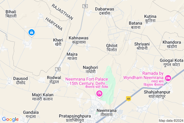
Salarpur Map
EDIT Map
Add Your House
 ..
..
Current Corona Virus Infected Patients Count in Alwar District
| City Name | District Name | Total Covid cases |
|---|---|---|
| Alwar District | Alwar | 7 |
Locality Name :
Salarpur
( सलारपुर )
Tehsil Name : Nimrana
District : Alwar
State : Rajasthan
Division : Jaipur
Language : Rajasthani
Current Time 11:22 PM
Date: Friday , Apr 25,2025 (IST)
Time zone: IST (UTC+5:30)
Elevation / Altitude: 273 meters. Above Seal level
Telephone Code / Std Code: 01494
Assembly constituency : Mundawar assembly constituency
Assembly MLA : Lalit Yadav
Lok Sabha constituency : Alwar parliamentary constituency
Parliament MP : Balak Nath
Serpanch Name :
Pin Code : 301705
Post Office Name : Neemrana
Commodities Prices : Mohindergarh Market / Mandi
Salarpur Live Weather
Temperature: 33.0 °C
overcast clouds
Humidity: 7%
Wind : 2.01 mt/sec towards N
StationName : "Neemrana"
observed on 38 Mins Back
Temperature: 33.0 °C
overcast clouds
Humidity: 7%
Wind : 2.01 mt/sec towards N
StationName : "Neemrana"
observed on 38 Mins Back
Salarpur Weather Forecast for Next 5 days
26-04-2025
29.8°C to 32.9°C
overcast clouds, broken clouds
29.8°C to 32.9°C
overcast clouds, broken clouds
27-04-2025
27.9°C to 41.4°C
broken clouds, few clouds, overcast clouds
27.9°C to 41.4°C
broken clouds, few clouds, overcast clouds
28-04-2025
28.7°C to 42.3°C
overcast clouds, broken clouds, scattered clouds, few clouds, clear sky
28.7°C to 42.3°C
overcast clouds, broken clouds, scattered clouds, few clouds, clear sky
29-04-2025
28.2°C to 43.5°C
clear sky
28.2°C to 43.5°C
clear sky
30-04-2025
29.0°C to 43.4°C
clear sky
29.0°C to 43.4°C
clear sky
Edit below overview about Salarpur
Edit below overview about Salarpur
OverView of Salarpur
Aravali hills branch present in salarpur .its large in size to others side village and developing village 2000 peoples lives in salarpur Yadavs are living in this village. Biggest village of yadav caste . Rich and well educated .Edit below overview about Salarpur
National Highways Reachable To Salarpur
Nationa High Way :NH148B
Nationa High Way :NH48
Nationa High Way :NH148B
Nationa High Way :NH48
Rivers Near Salarpur
Chalak Nala
Chalak Nala
About Salarpur
Salarpur is a Village in Nimrana Tehsil in Alwar District of Rajasthan State, India. It belongs to Jaipur Division . It is located 64 KM towards North from District head quarters Alwar. 158 KM from State capital Jaipur
Salarpur Pin code is 301705 and postal head office is Neemrana .
Salarpur is surrounded by Behror Tehsil towards South , Ateli Nangal Tehsil towards west , Khol At Rewari Tehsil towards North , Mandawar Tehsil towards East .
Narnaul , Bawal , Rewari , Mahendragarh are the near by Cities to Salarpur.
This Place is in the border of the Alwar District and Mahendragarh District. Mahendragarh District Ateli Nangal is west towards this place . It is near to the Haryana State Border.
Salarpur 2011 Census Details
Salarpur Local Language is Rajasthani. Salarpur Village Total population is 2424 and number of houses are 451. Female Population is 48.6%. Village literacy rate is 68.6% and the Female Literacy rate is 28.2%.
Population
| Census Parameter | Census Data |
| Total Population | 2424 |
| Total No of Houses | 451 |
| Female Population % | 48.6 % ( 1178) |
| Total Literacy rate % | 68.6 % ( 1664) |
| Female Literacy rate | 28.2 % ( 683) |
| Scheduled Tribes Population % | 0.0 % ( 0) |
| Scheduled Caste Population % | 18.8 % ( 455) |
| Working Population % | 56.6 % |
| Child(0 -6) Population by 2011 | 338 |
| Girl Child(0 -6) Population % by 2011 | 46.4 % ( 157) |
Salarpur Census More Deatils.
Politics in Salarpur
Bharatiya Janata Party , BJP , INC are the major political parties in this area.Polling Stations /Booths near Salarpur
1)Government Girls Senior Secondaryondary School Neemrana (north Part)2)Government Upper Primary School Munpur Golahera
3)Government Upper Primary School Chudla
4)Government Secondaryondary School Gaduwas (south Part)
5)Government Secondaryondary School Ghiloth (east Part)
HOW TO REACH Salarpur
By Rail
There is no railway station near to Salarpur in less than 10 km.Colleges near Salarpur
Govt. Polytechnic College, Neemrana (rajasthan)
Address :
Shahajhanpur P.g College
Address :
Srsm Educon Services
Address :
Govt Polytechnic College
Address :
Govt Polytechnic College
Address :
Schools near Salarpur
Sidharth Pub. Sch. Doomroli
Address : doomroli , neemrana , alwar , Rajasthan . PIN- 301703 , Post - Majari Kalan
Rao Jaidyal Pub. Majari Kalan
Address : majri kalan , neemrana , alwar , Rajasthan . PIN- 301703 , Post - Majari Kalan
Baba Khmdas School Rayasarana
Address : raysarana , neemrana , alwar , Rajasthan . PIN- 301708 , Post - Kutina
Jagdamba Acadmy Mandhan
Address : mandan , neemrana , alwar , Rajasthan . PIN- 301704 , Post - Mandhan
Govt Health Centers near Salarpur
1) Gandala , PRIMARY HEALTH CENTER , ,2) Gandala , PRIMARY HEALTH CENTER , ,
3) Jat Bahror , , Jatbehror ,
Colleges in Salarpur,Nimrana
Goverment Polotechnic College ; Daulatsinghpura Asd
Daulatsinghpura; Rajasthan 301709; India
5.4 KM distance Detail
more ..
Schools in Salarpur,Nimrana
Saheed Satyaveer Govt. Sec.School.(Kapil Gupta92%)
Basai Bhopalsingh; Rajasthan 301705; India
2.0 KM distance Detail
Satya Bharti Government School; Basai Bhopal Singh
Kund - Majari - Behror Rd; Basai Bhopalsingh; Rajasthan 301705; India
2.1 KM distance Detail
Satya Bharti Government School; Majra
Kund - Majari - Behror Rd; Majra; Rajasthan 301705; India
2.4 KM distance Detail
Government Senior Secondary School Silarpur
; Umraogarh; Rajasthan 301705; India
2.5 KM distance Detail
Satya Bharti Airtel School
Kahnawas; Haryana; Nangal Mehta; Rajasthan 301705; India
2.6 KM distance Detail
Electronic Shops in Salarpur,Nimrana
Bablu Velder Bhimpura Wale Shop
vill/post kanahawas the; Neemrana; Rajasthan; India
3.4 KM distance Detail
Police Stations near Salarpur,Nimrana
Bajad Police Chowki
Rewari - Narnaul - Singhana Rd; Chanedpura; Haryana 123021; India
14.1 KM distance Detail
Governement Offices near Salarpur,Nimrana
Tehsildar Office
Neemrana; Alwar; NH-8; Neemrana Road; Behror; Behror; Rajasthan 301705; India
5.2 KM distance Detail
Health Department Office
Neemrana; Alwar; NH-8; Neemrana Road; Behror; Behror; Rajasthan 301705; India
5.4 KM distance Detail
About Salarpur &
History
How to reach Salarpur
Tourist Places Near By Salarpur
Schools in Salarpur
Colleges in Salarpur
Temperature & weather of Salarpur
places in Salarpur
Salarpur photos
More Information
How to reach Salarpur
Tourist Places Near By Salarpur
Schools in Salarpur
Colleges in Salarpur
Temperature & weather of Salarpur
places in Salarpur
Salarpur photos
More Information
Village Talk
Post News or Events about this Village
Near Cities
Narnaul 21 KM near
Bawal 22 KM near
Rewari 35 KM near
Mahendragarh 40 KM near
Narnaul 21 KM near
Bawal 22 KM near
Rewari 35 KM near
Mahendragarh 40 KM near
Near By Taluks
Nimrana 0 KM near
Behror 18 KM near
Ateli Nangal 18 KM near
Khol At Rewari 21 KM near
Nimrana 0 KM near
Behror 18 KM near
Ateli Nangal 18 KM near
Khol At Rewari 21 KM near
Near By Air Ports
Indira Gandhi International Airport 102 KM near
Sanganeer Airport 163 KM near
Kheria Airport 205 KM near
Muzaffarnagar Airport 224 KM near
Indira Gandhi International Airport 102 KM near
Sanganeer Airport 163 KM near
Kheria Airport 205 KM near
Muzaffarnagar Airport 224 KM near
Near By Tourist Places
Narnaul 29 KM near
Alwar 63 KM near
Bhindawas Lake 65 KM near
Nuh 69 KM near
Manesar 73 KM near
Narnaul 29 KM near
Alwar 63 KM near
Bhindawas Lake 65 KM near
Nuh 69 KM near
Manesar 73 KM near
Near By Districts
Mahendragarh 29 KM near
Rewari 33 KM near
Alwar 62 KM near
Mewat 69 KM near
Mahendragarh 29 KM near
Rewari 33 KM near
Alwar 62 KM near
Mewat 69 KM near
Near By RailWay Station
Rewari Junction Rail Way Station 33 KM near
Mahendragarh Rail Way Station 40 KM near
Rewari Junction Rail Way Station 33 KM near
Mahendragarh Rail Way Station 40 KM near