| Home | City Bus | Maps | Villages | Cities | Rail | Tourist Places | School | College | Pin Codes | Corona Cases Count |
| Distance Calculator Bus Services IFSC Codes Trace Mobile Number Weather Search Place Trace IP Available Cash ATM/Banks Locate Polling Booth Report an Error contact People |
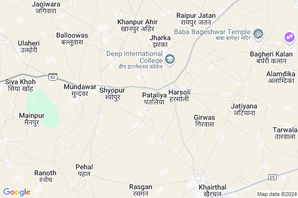
Pataliya Map
EDIT Map
Add Your House
 ..
..
Current Corona Virus Infected Patients Count in Alwar District
| City Name | District Name | Total Covid cases |
|---|---|---|
| Alwar District | Alwar | 7 |
Locality Name :
Pataliya
( पटलिया )
Tehsil Name : Kotkasim
District : Alwar
State : Rajasthan
Division : Jaipur
Language : Rajasthani
Current Time 01:06 PM
Date: Wednesday , Feb 05,2025 (IST)
Time zone: IST (UTC+5:30)
Elevation / Altitude: 273 meters. Above Seal level
Telephone Code / Std Code: 01493
Assembly constituency : Kishangarh Bas assembly constituency
Assembly MLA : Deepchand Khairiya
Lok Sabha constituency : Alwar parliamentary constituency
Parliament MP : Balak Nath
Serpanch Name :
Pin Code : 301403
Post Office Name : Harsauli
Commodities Prices : Khairthal Market / Mandi
Pataliya Live Weather
Temperature: 21.8 °C
clear sky
Humidity: 22%
Wind : 5.22 mt/sec towards NW
StationName : "MandÄ\u0081war"
observed on Now
Temperature: 21.8 °C
clear sky
Humidity: 22%
Wind : 5.22 mt/sec towards NW
StationName : "MandÄ\u0081war"
observed on Now
Pataliya Weather Forecast for Next 5 days
06-02-2025
10.8°C to 22.0°C
clear sky
10.8°C to 22.0°C
clear sky
07-02-2025
9.8°C to 22.6°C
clear sky, few clouds
9.8°C to 22.6°C
clear sky, few clouds
08-02-2025
8.7°C to 23.0°C
clear sky, few clouds, overcast clouds, broken clouds
8.7°C to 23.0°C
clear sky, few clouds, overcast clouds, broken clouds
09-02-2025
11.4°C to 25.2°C
overcast clouds, broken clouds, clear sky, scattered clouds
11.4°C to 25.2°C
overcast clouds, broken clouds, clear sky, scattered clouds
10-02-2025
13.7°C to 27.0°C
few clouds, scattered clouds, clear sky
13.7°C to 27.0°C
few clouds, scattered clouds, clear sky
National Highways Reachable To Pataliya
Nationa High Way :NH48
Nationa High Way :NH148B
Nationa High Way :NH48
Nationa High Way :NH148B
Rivers Near Pataliya
Chalak Nala
Sota
Chalak Nala
Sota
About Pataliya
Correct below Info and add more info about PataliyaPataliya is a Village in Kotkasim Tehsil in Alwar District of Rajasthan State, India. It belongs to Jaipur Division . It is located 37 KM towards North from District head quarters Alwar. 19 KM from Kotkasim. 152 KM from State capital Jaipur
Pataliya Pin code is 301403 and postal head office is Harsauli .
Shyopur ( 3 KM ) , Jatiyana ( 5 KM ) , Mundawar ( 5 KM ) , Khanpur Aheer ( 6 KM ) , Pehal ( 8 KM ) are the nearby Villages to Pataliya. Pataliya is surrounded by Kishangarh Bas Tehsil towards East , Kotkasim Tehsil towards North , Bawal Tehsil towards North , Nimrana Tehsil towards west .
Bawal , Alwar , Rewari , Narnaul are the near by Cities to Pataliya.
This Place is in the border of the Alwar District and Rewari District. Rewari District Bawal is North towards this place . It is near to the Haryana State Border.
Pataliya 2011 Census Details
Pataliya Local Language is Rajasthani. Pataliya Village Total population is 1864 and number of houses are 290. Female Population is 46.8%. Village literacy rate is 62.0% and the Female Literacy rate is 23.0%.
Population
| Census Parameter | Census Data |
| Total Population | 1864 |
| Total No of Houses | 290 |
| Female Population % | 46.8 % ( 873) |
| Total Literacy rate % | 62.0 % ( 1155) |
| Female Literacy rate | 23.0 % ( 428) |
| Scheduled Tribes Population % | 0.0 % ( 0) |
| Scheduled Caste Population % | 28.8 % ( 536) |
| Working Population % | 55.7 % |
| Child(0 -6) Population by 2011 | 287 |
| Girl Child(0 -6) Population % by 2011 | 45.3 % ( 130) |
Pataliya Census More Deatils.
Politics in Pataliya
Bharatiya Janata Party , BJP , BSP , INC are the major political parties in this area.Polling Stations /Booths near Pataliya
1)Govt. Upper Primary School Jhadka Room No. 13 East Side2)Govt. Primary School Meerpur
3)Govt. Upper Primary School Dadarheda
4)Govt. Senior Secondry School Teuwas
5)Govt. Upper Primary School Bajhoth Room No 3 East Side
HOW TO REACH Pataliya
By Rail
Harsauli Rail Way Station , Khanpur Ahir Rail Way Station are the very nearby railway stations to Pataliya.Colleges near Pataliya
Bhagat Singh Mahila College Kotkasim
Address :
Govt Bibirani College, Bibirani, Kotkasim
Address :
Rao Prakash Private Iti College
Address : Patan Ahir,harsoli Road Near Kadiya , Alwar(raj.)
Sharama Morden B.ed Collage
Address : Harsoli Road,patan Aheer
Govt. Sanskrit Coollege
Address : Near Ramleela Ground
Schools near Pataliya
Subham Ups Khanpur
Address : khanpur aheeran , kotkasim , alwar , Rajasthan . PIN- 301702 , Post - Kotkassim
Diksha Pub. Sch. Dhikoka
Address : dhikaka , kotkasim , alwar , Rajasthan . PIN- 301702 , Post - Kotkassim
Happy Pub. Sch. Jhadka
Address : jhadka , kotkasim , alwar , Rajasthan . PIN- 301403 , Post - Harsauli
B.d..mvidhapith Ikrotiya
Address : ikrotiya , kotkasim , alwar , Rajasthan . PIN- 301702 , Post - Kotkassim
Govt Health Centers near Pataliya
1) Tinkiruri , , ,2) Harsoli , Harsoli , harsoli , kotkasim
3) ShriKrishan Nagar , , ,
Hospitals in Pataliya,Kotkasim
आर्युवेद अस्पताल; हरसौली
near railway station; Harsoli; Rajasthan 301403; India
1.8 KM distance Detail
Ashish Chhillar House
v.p.o Harsauli alwar 301403 पुरानी होस्पिटल के; पिछे (बाबा; Harsoli; Rajasthan 301403; India
2.0 KM distance Detail
more ..
Petrol Bunks in Pataliya,Kotkasim
HP PETROL PUMP - CHOUDHARY AGRO SEVICE
Sodawas Road Post Mundawar; Jaipur; Rajasthan 301407; India
6.4 KM distance Detail
more ..
Colleges in Pataliya,Kotkasim
SHRI KRISHAN CO-EDUCATION COLLEGE
Vill-Harsolo(Alwar); Pataliya; Rajasthan; India
1.0 KM distance Detail
SHRI KRISHAN CO-EDUCATION COLLEGE
Mundawar - Harsoli Rd; Rajasthan 301403; India
1.8 KM distance Detail
more ..
Schools in Pataliya,Kotkasim
राजकीय प्राथमिक विद्यालय नंगली जाटान
govt primary school; Nangli Jatan; Rajasthan 301403; India
1.7 KM distance Detail
Govt. Sr. Sec. School
301403; Rice Mill near Railways station; Gahmar; Thana Rd; Gahmar; Uttar Pradesh 232327; India
2.0 KM distance Detail
Governement Offices near Pataliya,Kotkasim
Tehsildar Office
Mundawar; Alwar; SH-52; Alwar Road; Behror; Behror; Rajasthan 301407; India
5.5 KM distance Detail
SHREE SHYAM EMITRA AND CSC CENTER
tehsil road; Mundawar; Rajasthan 301407; India
5.6 KM distance Detail
Atal Seva Center
Tatarpur; Alwar; SH-52; Alwar Road; Behror; Behror; Rajasthan 301407; India
5.6 KM distance Detail
About Pataliya &
History
How to reach Pataliya
Tourist Places Near By Pataliya
Schools in Pataliya
Colleges in Pataliya
Temperature & weather of Pataliya
places in Pataliya
Pataliya photos
More Information
How to reach Pataliya
Tourist Places Near By Pataliya
Schools in Pataliya
Colleges in Pataliya
Temperature & weather of Pataliya
places in Pataliya
Pataliya photos
More Information
Village Talk
Post News or Events about this Village
Near Cities
Bawal 27 KM near
Alwar 36 KM near
Rewari 42 KM near
Narnaul 49 KM near
Bawal 27 KM near
Alwar 36 KM near
Rewari 42 KM near
Narnaul 49 KM near
Near By Taluks
Mandawar 9 KM near
Kishangarh Bas 16 KM near
Kotkasim 18 KM near
Bawal 29 KM near
Mandawar 9 KM near
Kishangarh Bas 16 KM near
Kotkasim 18 KM near
Bawal 29 KM near
Near By Air Ports
Indira Gandhi International Airport 102 KM near
Sanganeer Airport 156 KM near
Kheria Airport 174 KM near
Muzaffarnagar Airport 227 KM near
Indira Gandhi International Airport 102 KM near
Sanganeer Airport 156 KM near
Kheria Airport 174 KM near
Muzaffarnagar Airport 227 KM near
Near By Tourist Places
Alwar 37 KM near
Nuh 53 KM near
Narnaul 58 KM near
Sariska 63 KM near
Sohna 70 KM near
Alwar 37 KM near
Nuh 53 KM near
Narnaul 58 KM near
Sariska 63 KM near
Sohna 70 KM near
Near By Districts
Alwar 35 KM near
Rewari 42 KM near
Mewat 53 KM near
Mahendragarh 58 KM near
Alwar 35 KM near
Rewari 42 KM near
Mewat 53 KM near
Mahendragarh 58 KM near
Near By RailWay Station
Harsauli Rail Way Station 1.9 KM near
Khanpur Ahir Rail Way Station 6.5 KM near
Khairthal Rail Way Station 9.2 KM near
Alwar Junction Rail Way Station 37 KM near
Harsauli Rail Way Station 1.9 KM near
Khanpur Ahir Rail Way Station 6.5 KM near
Khairthal Rail Way Station 9.2 KM near
Alwar Junction Rail Way Station 37 KM near