| Home | City Bus | Maps | Villages | Cities | Rail | Tourist Places | School | College | Pin Codes | Corona Cases Count |
| Distance Calculator Bus Services IFSC Codes Trace Mobile Number Weather Search Place Trace IP Available Cash ATM/Banks Locate Polling Booth Report an Error contact People |
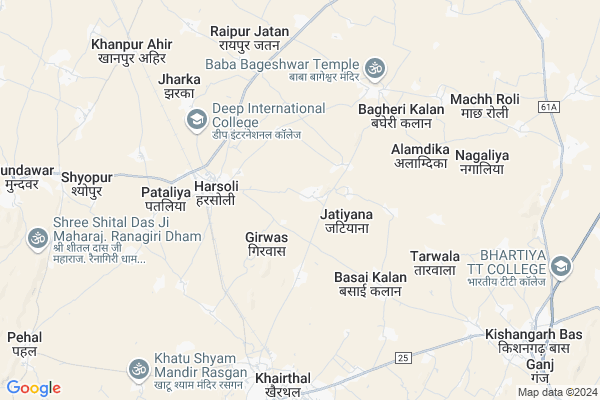
Jatiyana Map
EDIT Map
Add Your House
 ..
..
Current Corona Virus Infected Patients Count in Alwar District
| City Name | District Name | Total Covid cases |
|---|---|---|
| Alwar District | Alwar | 7 |
Locality Name :
Jatiyana
( जटियाना )
Tehsil Name : Kotkasim
District : Alwar
State : Rajasthan
Division : Jaipur
Language : Rajasthani
Current Time 01:19 PM
Date: Wednesday , Feb 05,2025 (IST)
Time zone: IST (UTC+5:30)
Elevation / Altitude: 273 meters. Above Seal level
Telephone Code / Std Code: 01493
Assembly constituency : Kishangarh Bas assembly constituency
Assembly MLA : Deepchand Khairiya
Lok Sabha constituency : Alwar parliamentary constituency
Parliament MP : Balak Nath
Serpanch Name :
Pin Code : 301403
Post Office Name : Harsauli
Commodities Prices : Khairthal Market / Mandi
Jatiyana Live Weather
Temperature: 17.9 °C
clear sky
Humidity: 32%
Wind : 4.22 mt/sec towards NW
StationName : "Kishangarh"
observed on 2 Hours Back
Temperature: 17.9 °C
clear sky
Humidity: 32%
Wind : 4.22 mt/sec towards NW
StationName : "Kishangarh"
observed on 2 Hours Back
Jatiyana Weather Forecast for Next 5 days
06-02-2025
11.0°C to 21.9°C
clear sky
11.0°C to 21.9°C
clear sky
07-02-2025
9.9°C to 22.6°C
clear sky
9.9°C to 22.6°C
clear sky
08-02-2025
8.8°C to 22.9°C
few clouds, clear sky, broken clouds
8.8°C to 22.9°C
few clouds, clear sky, broken clouds
09-02-2025
10.8°C to 24.9°C
broken clouds, scattered clouds, clear sky
10.8°C to 24.9°C
broken clouds, scattered clouds, clear sky
10-02-2025
13.7°C to 27.0°C
scattered clouds, few clouds, clear sky, overcast clouds
13.7°C to 27.0°C
scattered clouds, few clouds, clear sky, overcast clouds
Edit below overview about Jatiyana
Edit below overview about Jatiyana
OverView of Jatiyana
It's a gujjar cast dominated village it had its own gram panchayat ghangals and bhadana are mainly clan found in this VillageEdit below overview about Jatiyana
National Highways Reachable To Jatiyana
Nationa High Way :NH48
Nationa High Way :NH148B
Nationa High Way :NH48
Nationa High Way :NH148B
Rivers Near Jatiyana
Chalak Nala
Sota
Chalak Nala
Sota
About Jatiyana
Jatiyana is a Village in Kotkasim Tehsil in Alwar District of Rajasthan State, India. It belongs to Jaipur Division . It is located 37 KM towards North from District head quarters Alwar. 17 KM from Kotkasim. 155 KM from State capital Jaipur
Jatiyana Pin code is 301403 and postal head office is Harsauli .
Bagheri Khurd ( 5 KM ) , Bagheri Kalan ( 5 KM ) , Pataliya ( 5 KM ) , Tarwala ( 5 KM ) , Noor Nagar ( 6 KM ) are the nearby Villages to Jatiyana. Jatiyana is surrounded by Mandawar Tehsil towards west , Kotkasim Tehsil towards North , Tijara Tehsil towards East , Bawal Tehsil towards North .
Bawal , Alwar , Rewari , Narnaul are the near by Cities to Jatiyana.
This Place is in the border of the Alwar District and Rewari District. Rewari District Bawal is North towards this place . It is near to the Haryana State Border.
Jatiyana 2011 Census Details
Jatiyana Local Language is Rajasthani. Jatiyana Village Total population is 1472 and number of houses are 246. Female Population is 49.3%. Village literacy rate is 57.9% and the Female Literacy rate is 21.8%.
Population
| Census Parameter | Census Data |
| Total Population | 1472 |
| Total No of Houses | 246 |
| Female Population % | 49.3 % ( 725) |
| Total Literacy rate % | 57.9 % ( 853) |
| Female Literacy rate | 21.8 % ( 321) |
| Scheduled Tribes Population % | 0.0 % ( 0) |
| Scheduled Caste Population % | 6.7 % ( 98) |
| Working Population % | 56.3 % |
| Child(0 -6) Population by 2011 | 223 |
| Girl Child(0 -6) Population % by 2011 | 45.3 % ( 101) |
Jatiyana Census More Deatils.
Politics in Jatiyana
Bharatiya Janata Party , BJP , BSP , INC are the major political parties in this area.Polling Stations /Booths near Jatiyana
1)Govt. Upper Primary School Tohri2)Govt. Secondry School Khanpur Ahir
3)Govt.upper Primary School Jatuwas Room No 2 West Side
4)Govt.upper Primary School Dalawas
5)Govt. Senior Secondry School Machoroli Room No. 4 East Side
HOW TO REACH Jatiyana
By Rail
Harsauli Rail Way Station , Khairthal Rail Way Station are the very nearby railway stations to Jatiyana.Colleges near Jatiyana
Bhagat Singh Mahila College Kotkasim
Address :
Govt Bibirani College, Bibirani, Kotkasim
Address :
Rao Prakash Private Iti College
Address : Patan Ahir,harsoli Road Near Kadiya , Alwar(raj.)
Sharama Morden B.ed Collage
Address : Harsoli Road,patan Aheer
Govt. Sanskrit Coollege
Address : Near Ramleela Ground
Schools in Jatiyana
Modren Pub Sch Jatiana
Address : jatiyana , kotkasim , alwar , Rajasthan . PIN- 301403 , Post - Harsauli
Govt. Ss Jatiana
Address : jatiyana , kotkasim , alwar , Rajasthan . PIN- 301403 , Post - Harsauli
Govt Health Centers near Jatiyana
1) Harsoli , Harsoli , harsoli , kotkasim2) Bagherikhurd , Bagherikhurd , harsoli , kotkasim
3) Tinkiruri , , ,
Hospitals in Jatiyana,Kotkasim
Ashish Chhillar House
v.p.o Harsauli alwar 301403 पुरानी होस्पिटल के; पिछे (बाबा; Harsoli; Rajasthan 301403; India
3.8 KM distance Detail
आर्युवेद अस्पताल; हरसौली
near railway station; Harsoli; Rajasthan 301403; India
4.1 KM distance Detail
more ..
Colleges in Jatiyana,Kotkasim
SHRI KRISHAN CO-EDUCATION COLLEGE
Mundawar - Harsoli Rd; Rajasthan 301403; India
4.5 KM distance Detail
SHRI KRISHAN CO-EDUCATION COLLEGE
Vill-Harsolo(Alwar); Pataliya; Rajasthan; India
5.0 KM distance Detail
more ..
Schools in Jatiyana,Kotkasim
राजकीय उच्च माध्यमिक विद्यालय जटियाना तहसील कोटकासिम जिला अलवर राजस्थान
राजकीय उच्च माध्यमिक विद्यालय; Jatiyana; Rajasthan 301403; India
0.2 KM distance Detail
Govt. Upper Primary School Shahpur Alwar Rajasthan
Shahpur; Rajasthan 301405; India
1.8 KM distance Detail
Govt. primary School Ramdhan Prajapati Ki Dhani Jatiyana
Jatiyana; Rajasthan 301405; India
1.9 KM distance Detail
Govt. Upper Primary School Jhiyana Shahjadpur
Jhiryana; Rajasthan 301403; India
2.0 KM distance Detail
Police Stations near Jatiyana,Kotkasim
Govt. School Area
Govt. Sr. Sec. School Basketball ground; Hospital Area; Bundi; Rajasthan 323001; India
7.6 KM distance Detail
Governement Offices near Jatiyana,Kotkasim
P H E D Office
Harsouli Rd; Khairthal Gaon; Khairthal; Rajasthan 301404; India
7.1 KM distance Detail
About Jatiyana &
History
How to reach Jatiyana
Tourist Places Near By Jatiyana
Schools in Jatiyana
Colleges in Jatiyana
Temperature & weather of Jatiyana
places in Jatiyana
Jatiyana photos
More Information
How to reach Jatiyana
Tourist Places Near By Jatiyana
Schools in Jatiyana
Colleges in Jatiyana
Temperature & weather of Jatiyana
places in Jatiyana
Jatiyana photos
More Information
Village Talk
Post News or Events about this Village
Near Cities
Bawal 28 KM near
Alwar 36 KM near
Rewari 42 KM near
Narnaul 54 KM near
Bawal 28 KM near
Alwar 36 KM near
Rewari 42 KM near
Narnaul 54 KM near
Near By Taluks
Kishangarh Bas 11 KM near
Mandawar 14 KM near
Kotkasim 16 KM near
Tijara 29 KM near
Kishangarh Bas 11 KM near
Mandawar 14 KM near
Kotkasim 16 KM near
Tijara 29 KM near
Near By Air Ports
Indira Gandhi International Airport 99 KM near
Sanganeer Airport 159 KM near
Kheria Airport 169 KM near
Muzaffarnagar Airport 225 KM near
Indira Gandhi International Airport 99 KM near
Sanganeer Airport 159 KM near
Kheria Airport 169 KM near
Muzaffarnagar Airport 225 KM near
Near By Tourist Places
Alwar 37 KM near
Nuh 49 KM near
Narnaul 63 KM near
Sariska 65 KM near
Sohna 67 KM near
Alwar 37 KM near
Nuh 49 KM near
Narnaul 63 KM near
Sariska 65 KM near
Sohna 67 KM near
Near By Districts
Alwar 36 KM near
Rewari 42 KM near
Mewat 49 KM near
Mahendragarh 63 KM near
Alwar 36 KM near
Rewari 42 KM near
Mewat 49 KM near
Mahendragarh 63 KM near
Near By RailWay Station
Harsauli Rail Way Station 4.5 KM near
Khairthal Rail Way Station 7.9 KM near
Khanpur Ahir Rail Way Station 9.3 KM near
Alwar Junction Rail Way Station 37 KM near
Harsauli Rail Way Station 4.5 KM near
Khairthal Rail Way Station 7.9 KM near
Khanpur Ahir Rail Way Station 9.3 KM near
Alwar Junction Rail Way Station 37 KM near