| Home | City Bus | Maps | Villages | Cities | Rail | Tourist Places | School | College | Pin Codes | Corona Cases Count |
| Distance Calculator Bus Services IFSC Codes Trace Mobile Number Weather Search Place Trace IP Available Cash ATM/Banks Locate Polling Booth Report an Error contact People |
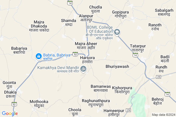
Harsora Map
EDIT Map
Add Your House
 ..
..
Current Corona Virus Infected Patients Count in Alwar District
| City Name | District Name | Total Covid cases |
|---|---|---|
| Alwar District | Alwar | 7 |
Locality Name :
Harsora
( हरसोरा )
Tehsil Name : Bansur
District : Alwar
State : Rajasthan
Division : Jaipur
Language : Rajasthani
Current Time 08:51 AM
Date: Wednesday , Apr 30,2025 (IST)
Time zone: IST (UTC+5:30)
Elevation / Altitude: 289 meters. Above Seal level
Telephone Code / Std Code: 01461
Assembly constituency : Bansur assembly constituency
Assembly MLA : Devi Singh Shekhawat
Lok Sabha constituency : Jaipur Rural parliamentary constituency
Parliament MP : COL. RAJYAVARDHAN RATHORE
Serpanch Name :
Pin Code : 301412
Post Office Name : Harsora
Commodities Prices : Khairthal Market / Mandi
Harsora Live Weather
Temperature: 31.1 °C
clear sky
Humidity: 29%
Wind : 4.82 mt/sec towards SE
StationName : "Behror"
observed on 24 Mins Back
Temperature: 31.1 °C
clear sky
Humidity: 29%
Wind : 4.82 mt/sec towards SE
StationName : "Behror"
observed on 24 Mins Back
Harsora Weather Forecast for Next 5 days
01-05-2025
30.1°C to 39.2°C
clear sky
30.1°C to 39.2°C
clear sky
02-05-2025
28.6°C to 42.4°C
clear sky, few clouds, light rain, overcast clouds
28.6°C to 42.4°C
clear sky, few clouds, light rain, overcast clouds
03-05-2025
28.4°C to 42.2°C
broken clouds, scattered clouds, clear sky, light rain
28.4°C to 42.2°C
broken clouds, scattered clouds, clear sky, light rain
04-05-2025
29.8°C to 40.6°C
broken clouds, light rain, overcast clouds, scattered clouds
29.8°C to 40.6°C
broken clouds, light rain, overcast clouds, scattered clouds
05-05-2025
26.2°C to 38.9°C
scattered clouds, broken clouds, overcast clouds
26.2°C to 38.9°C
scattered clouds, broken clouds, overcast clouds
Edit below overview about Harsora
Edit below overview about Harsora
OverView of Harsora
According to amit kumar meena (guddu) statement he says that harsora is a fertiliser plain and many having a tourist spot such as mud island, fort,hill area and hanuman temple (and many more tourist place). The view form the top of mountain is outstanding the best place in rajasthan for night out is harsora.
Edit below overview about Harsora
National Highways Reachable To Harsora
Nationa High Way :NH148B
Nationa High Way :NH48
Nationa High Way :NH148B
Nationa High Way :NH48
Rivers Near Harsora
Sahibi
Sota
Sahibi
Sota
About Harsora
Harsora is a Village in Bansur Tehsil in Alwar District of Rajasthan State, India. It belongs to Jaipur Division . It is located 32 KM towards North from District head quarters Alwar. 16 KM from Bansur. 133 KM from State capital Jaipur
Harsora Pin code is 301412 and postal head office is Harsora .
Deosan ( 4 KM ) , Babriya ( 6 KM ) , Gopi Pura ( 7 KM ) , Mothooka ( 9 KM ) , Hameerpur ( 9 KM ) are the nearby Villages to Harsora. Harsora is surrounded by Mandawar Tehsil towards North , Behror Tehsil towards west , Kishangarh Bas Tehsil towards East , Nimrana Tehsil towards North .
Alwar , Bawal , Narnaul , Neem-Ka-Thana are the near by Cities to Harsora.
This Place is in the border of the Alwar District and Jaipur District. Jaipur District Kotputli is west towards this place .
Harsora 2011 Census Details
Harsora Local Language is Rajasthani. Harsora Village Total population is 5802 and number of houses are 961. Female Population is 47.3%. Village literacy rate is 57.9% and the Female Literacy rate is 21.5%.
Population
| Census Parameter | Census Data |
| Total Population | 5802 |
| Total No of Houses | 961 |
| Female Population % | 47.3 % ( 2747) |
| Total Literacy rate % | 57.9 % ( 3359) |
| Female Literacy rate | 21.5 % ( 1248) |
| Scheduled Tribes Population % | 11.9 % ( 688) |
| Scheduled Caste Population % | 17.2 % ( 1000) |
| Working Population % | 40.8 % |
| Child(0 -6) Population by 2011 | 939 |
| Girl Child(0 -6) Population % by 2011 | 46.5 % ( 437) |
Harsora Census More Deatils.
Politics in Harsora
INC , BJP , BJP , INC are the major political parties in this area.Polling Stations /Booths near Harsora
1)Govt. Girls Senior Secondary School East Part Rampur2)Govt. Senior Secondary School West Part Ajabpura
3)Govt. Upper Primary School Bhankarwala West Part
4)Govt. Upper Primary School Chandali
5)Govt. Senior Secondary School Harsora Middle Part
HOW TO REACH Harsora
By Rail
There is no railway station near to Harsora in less than 10 km.Colleges near Harsora
Kota College Of Pharmacy
Address : Kota College Of Pharmacy Sp 1, Riico Industrial Ar
Schools in Harsora
Evrest Pub. Sch. Harsora
Address : harsora , bansur , alwar , Rajasthan . PIN- 301402 , Post - Bansur
Joshi Pub. Sch. Harsora
Address : harsora , bansur , alwar , Rajasthan . PIN- 301402 , Post - Bansur
Bra Ups Harsora
Address : harsora , bansur , alwar , Rajasthan . PIN- 301402 , Post - Bansur
Bright Future Ps Harsora
Address : harsora , bansur , alwar , Rajasthan . PIN- 301402 , Post - Bansur
Mjf Sec School Harsora
Address : harsora , bansur , alwar , Rajasthan . PIN- 301402 , Post - Bansur
Govt Health Centers near Harsora
1) Shamda , , ,2) Ranoth , , ,
3) Beroj , , ,
Hospitals in Harsora,Bansur
Government Primary Health Center
Harsaura; Alwar; SH-52; Alwar Road; Alwar; Alwar; Rajasthan 301701; India
0.3 KM distance Detail
more ..
Petrol Bunks in Harsora,Bansur
Abhilash Petrol Pump
Harsaura; Alwar; SH-52; Alwar Road; Alwar; Alwar; Rajasthan 301412; India
1.1 KM distance Detail
Sitaram Kheria Fuels
Tatarpur; Alwar; SH-14; Alwar Road; Behror; Behror; Rajasthan 301407; India
8.4 KM distance Detail
HP PETROL PUMP - SHRI SHYAM FILLING STATION
Village Jeewan Singh Pura Tatarpur Behrora Road Sodawas; Jaipur; Rajasthan 301427; India
9.2 KM distance Detail
more ..
Colleges in Harsora,Bansur
Englishbolega.com
Near- BED collage; Main Market; Sodawas; Rajasthan 301427; India
11.4 KM distance Detail
more ..
Schools in Harsora,Bansur
Government High School
Harsaura; Alwar; SH-52; Alwar Road; Alwar; Alwar; Rajasthan 301701; India
0.2 KM distance Detail
Electronic Shops in Harsora,Bansur
Jai Durge Dj Bansur
Harsora Bypass Near Durga Marrige Garden; Bansur; Rajasthan 301402; India
0.1 KM distance Detail
PATEL Mobile and Electronics Complete Solution Mobile
Tahadki circle Delawas; Alwar; Rajasthan; India
5.0 KM distance Detail
Police Stations near Harsora,Bansur
Soni Hero Honda Service Center
RJ SH 52; Majra Aheer; Rajasthan 301412; India
0.6 KM distance Detail
Governement Offices near Harsora,Bansur
Atal Seva Center
Mundawar; Alwar; SH-14; Alwar Road; Behror; Behror; Rajasthan 301407; India
11.0 KM distance Detail
About Harsora &
History
How to reach Harsora
Tourist Places Near By Harsora
Schools in Harsora
Colleges in Harsora
Temperature & weather of Harsora
places in Harsora
Harsora photos
More Information
How to reach Harsora
Tourist Places Near By Harsora
Schools in Harsora
Colleges in Harsora
Temperature & weather of Harsora
places in Harsora
Harsora photos
More Information
Village Talk
Post News or Events about this Village
Near Cities
Alwar 31 KM near
Bawal 40 KM near
Narnaul 40 KM near
Neem-Ka-Thana 52 KM near
Alwar 31 KM near
Bawal 40 KM near
Narnaul 40 KM near
Neem-Ka-Thana 52 KM near
Near By Taluks
Bansur 15 KM near
Mandawar 16 KM near
Behror 25 KM near
Kishangarh Bas 30 KM near
Bansur 15 KM near
Mandawar 16 KM near
Behror 25 KM near
Kishangarh Bas 30 KM near
Near By Air Ports
Indira Gandhi International Airport 120 KM near
Sanganeer Airport 139 KM near
Kheria Airport 184 KM near
Muzaffarnagar Airport 245 KM near
Indira Gandhi International Airport 120 KM near
Sanganeer Airport 139 KM near
Kheria Airport 184 KM near
Muzaffarnagar Airport 245 KM near
Near By Tourist Places
Alwar 32 KM near
Sariska 48 KM near
Narnaul 49 KM near
Nuh 73 KM near
Manesar 89 KM near
Alwar 32 KM near
Sariska 48 KM near
Narnaul 49 KM near
Nuh 73 KM near
Manesar 89 KM near
Near By Districts
Alwar 30 KM near
Mahendragarh 49 KM near
Rewari 55 KM near
Mewat 72 KM near
Alwar 30 KM near
Mahendragarh 49 KM near
Rewari 55 KM near
Mewat 72 KM near
Near By RailWay Station
Khairthal Rail Way Station 21 KM near
Alwar Junction Rail Way Station 33 KM near
Khairthal Rail Way Station 21 KM near
Alwar Junction Rail Way Station 33 KM near