| Home | City Bus | Maps | Villages | Cities | Rail | Tourist Places | School | College | Pin Codes | Corona Cases Count |
| Distance Calculator Bus Services IFSC Codes Trace Mobile Number Weather Search Place Trace IP Available Cash ATM/Banks Locate Polling Booth Report an Error contact People |
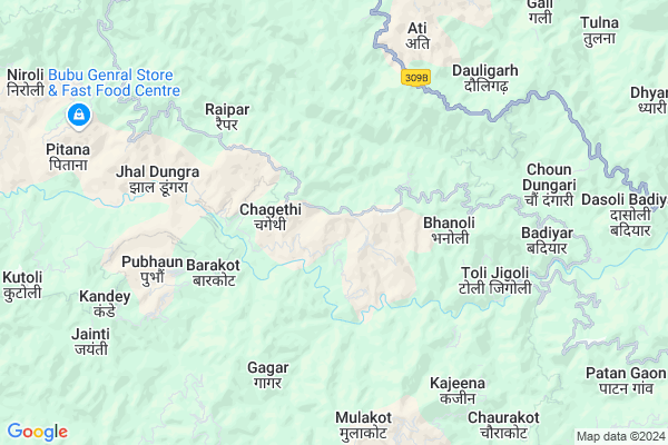
Dungra
Dungra Map
EDIT Map
Add Your House
 ..
..
Current Corona Virus Infected Patients Count in Almora District
| City Name | District Name | Total Covid cases |
|---|---|---|
| Almora District | Almora | 1 |
Locality Name :
Dungra
( डुंग्रा )
Block Name : Dhauladevi
District : Almora
State : Uttarakhand
Language : Hindi and Urdu
Current Time 02:56 PM
Date: Friday , Apr 25,2025 (IST)
Time zone: IST (UTC+5:30)
Telephone Code / Std Code: 05962
Assembly constituency : Jageshwar assembly constituency
Assembly MLA : Mohan Singh
Lok Sabha constituency : Almora parliamentary constituency
Parliament MP : Ajay Tamta
Serpanch Name :
Pin Code : 263623
Post Office Name : Panuwanaula
Commodities Prices : Haldwani Market / Mandi
Dungra Live Weather
Temperature: 32.5 °C
clear sky
Humidity: 8%
Wind : 3.42 mt/sec towards W
StationName : "LohaghÄ\u0081t"
observed on 2 Hours Back
Temperature: 32.5 °C
clear sky
Humidity: 8%
Wind : 3.42 mt/sec towards W
StationName : "LohaghÄ\u0081t"
observed on 2 Hours Back
Dungra Weather Forecast for Next 5 days
26-04-2025
17.3°C to 32.7°C
clear sky, few clouds, scattered clouds, broken clouds
17.3°C to 32.7°C
clear sky, few clouds, scattered clouds, broken clouds
27-04-2025
16.6°C to 33.3°C
overcast clouds, scattered clouds, broken clouds
16.6°C to 33.3°C
overcast clouds, scattered clouds, broken clouds
28-04-2025
17.4°C to 31.4°C
overcast clouds, broken clouds, scattered clouds, few clouds
17.4°C to 31.4°C
overcast clouds, broken clouds, scattered clouds, few clouds
29-04-2025
16.8°C to 33.4°C
scattered clouds, few clouds, clear sky, light rain, broken clouds, overcast clouds
16.8°C to 33.4°C
scattered clouds, few clouds, clear sky, light rain, broken clouds, overcast clouds
30-04-2025
15.5°C to 33.6°C
broken clouds, overcast clouds, clear sky, moderate rain, scattered clouds
15.5°C to 33.6°C
broken clouds, overcast clouds, clear sky, moderate rain, scattered clouds
Edit below overview about Dungra
Edit below overview about Dungra
OverView of Dungra
In past dungra was known as saun dungra(saun patti), it is 63.3 km away from almora, 70.3 km away from champawat and 74.2 km away from pithoragarh. All the indeginious people belongs to this place are called as saun bisht.Edit below overview about Dungra
National Highways Reachable To Dungra
Nationa High Way :NH109
Nationa High Way :NH309A
Nationa High Way :NH109
Nationa High Way :NH309A
Rivers Near Dungra
Ramganga
:काली गाड Sharda :Mahakali River :शारदा नदी :महाकाली नदी
Ramganga
:काली गाड Sharda :Mahakali River :शारदा नदी :महाकाली नदी
About Dungra
Dungra is a Village in Dhauladevi Block in Almora District of Uttarakhand State, India. It is located 32 KM towards East from District head quarters Almora. 10 KM from Dhauladevi. 237 KM from State capital Dehradun
Dungra Pin code is 263623 and postal head office is Panuwanaula .
Kasermanya ( 2 KM ) , Gauli ( 4 KM ) , Bhanoli ( 4 KM ) , Barakot ( 4 KM ) , Gunadity ( 4 KM ) are the nearby Villages to Dungra. Dungra is surrounded by Pati Block towards South , Barakot Block towards East , Lamgara Block towards west , Bhaisiya Chhana Block towards North .
Champawat , Almora , Pithoragarh , Nainital are the near by Cities to Dungra.
Dungra 2011 Census Details
Dungra Local Language is Hindi. Dungra Village Total population is 1634 and number of houses are 326. Female Population is 54.6%. Village literacy rate is 61.9% and the Female Literacy rate is 28.4%.
Population
| Census Parameter | Census Data |
| Total Population | 1634 |
| Total No of Houses | 326 |
| Female Population % | 54.6 % ( 892) |
| Total Literacy rate % | 61.9 % ( 1011) |
| Female Literacy rate | 28.4 % ( 464) |
| Scheduled Tribes Population % | 0.1 % ( 1) |
| Scheduled Caste Population % | 36.5 % ( 597) |
| Working Population % | 49.5 % |
| Child(0 -6) Population by 2011 | 281 |
| Girl Child(0 -6) Population % by 2011 | 52.0 % ( 146) |
Dungra Census More Deatils.
Politics in Dungra
BJP , INC are the major political parties in this area.Polling Stations /Booths near Dungra
1)Do Ghadiya2)Chauda
3)Busoni
4)Dyonathal
5)Bhangadevali
HOW TO REACH Dungra
By Rail
There is no railway station near to Dungra in less than 10 km.Colleges near Dungra
Government Inter College, Bhanoli
Address :
Goverment Junior High School.
Address :
Schools in Dungra
G.g.h.s. Dungra
Address : dungra , dhauladevi , almora , Uttarakhand . PIN- 263622 , Post - Dania
U.p.s Gyanoday Pub School Dungra
Address : dungra , dhauladevi , almora , Uttarakhand . PIN- 263687
Govt Health Centers near Dungra
1) SC Pipeldheeng , SC Pipaldheeng , ,2) Katana , Sub Center , Katana , ANM Center
3) PHC Barakot , PHC Barakote , Barakote ,
Petrol Bunks in Dungra,Dhauladevi
HP Petrol Pump "Hamara Pump"
29°35'47.1"N 79°50'13.; B-17; 2nd Ave; Sheboygan Nagar; Block B; B Block; Annanagar East; Chennai; Tamil Nadu 600102; India
15.7 KM distance Detail
HP PETROL PUMP - KALA FILLING STATION
Shaher Phatak - Haldwani RD. Village - DOL PO- Shaher Phatak; Tehsil- Jainti; Dehradun; 263625; India
19.3 KM distance Detail
HP PETROL PUMP - BHAGWATI FUELS
NH-125 Village Raikot Meher Champawat - Pithoragarh Road; Dehradun; 262524; India
22.1 KM distance Detail
more ..
Colleges in Dungra,Dhauladevi
Government Girls Inter College
Almora-Champawat Rd; Kakarh; Uttarakhand 262527; India
16.6 KM distance Detail
UTTARAKHAND POLYTECHNIC KARMCHARI ASSOCIATION
Dehradun; G P; Lohaghat; Uttarakhand 262524; India
20.9 KM distance Detail
more ..
Schools in Dungra,Dhauladevi
saraswati shishu mandir ;pati
Lohaghat - Devidhura - Almora Rd; Pati Town; Uttarakhand 262580; India
12.3 KM distance Detail
Super Markets in Dungra,Dhauladevi
Patan Kanera Lohaghat
Uttarakhand; Patan Kanera; Khais Kande; Lohaghat; Uttarakhand 262524; India
21.2 KM distance Detail
Mahesh General Store Dakbangla Road Lohaghat
Dak Bangla Rd; Lohaghat Range; Lohaghat; Uttarakhand 262524; India
23.4 KM distance Detail
Local Parks in Dungra,Dhauladevi
Governement Offices near Dungra,Dhauladevi
COMMON SERVICE CENTRE KAKARH (CSC)
Almora-Champawat Rd; Kakarh; Uttarakhand 262527; India
16.5 KM distance Detail
About Dungra &
History
How to reach Dungra
Tourist Places Near By Dungra
Schools in Dungra
Colleges in Dungra
Temperature & weather of Dungra
places in Dungra
Dungra photos
More Information
How to reach Dungra
Tourist Places Near By Dungra
Schools in Dungra
Colleges in Dungra
Temperature & weather of Dungra
places in Dungra
Dungra photos
More Information
Village Talk
Post News or Events about this Village
Near Cities
Champawat 26 KM near
Almora 31 KM near
Pithoragarh 34 KM near
Nainital 51 KM near
Champawat 26 KM near
Almora 31 KM near
Pithoragarh 34 KM near
Nainital 51 KM near
Near By Taluks
Dhauladevi 10 KM near
Pati 12 KM near
Barakot 17 KM near
Lamgara 18 KM near
Dhauladevi 10 KM near
Pati 12 KM near
Barakot 17 KM near
Lamgara 18 KM near
Near By Air Ports
Pantnagar Airport 75 KM near
Dehra Dun Airport 227 KM near
Muzaffarnagar Airport 244 KM near
Indira Gandhi International Airport 328 KM near
Pantnagar Airport 75 KM near
Dehra Dun Airport 227 KM near
Muzaffarnagar Airport 244 KM near
Indira Gandhi International Airport 328 KM near
Near By Tourist Places
Abbott Mount 22 KM near
Champawat 27 KM near
Mukteshwar 29 KM near
Almora 30 KM near
Naukuchiatal 33 KM near
Abbott Mount 22 KM near
Champawat 27 KM near
Mukteshwar 29 KM near
Almora 30 KM near
Naukuchiatal 33 KM near
Near By Districts
Champawat 28 KM near
Almora 31 KM near
Pithoragarh 34 KM near
Bageshwar 44 KM near
Champawat 28 KM near
Almora 31 KM near
Pithoragarh 34 KM near
Bageshwar 44 KM near
Near By RailWay Station
Kathgodam Rail Way Station 49 KM near
Haldwani Rail Way Station 54 KM near
Kathgodam Rail Way Station 49 KM near
Haldwani Rail Way Station 54 KM near