| Home | City Bus | Maps | Villages | Cities | Rail | Tourist Places | School | College | Pin Codes | Corona Cases Count |
| Distance Calculator Bus Services IFSC Codes Trace Mobile Number Weather Search Place Trace IP Available Cash ATM/Banks Locate Polling Booth Report an Error contact People |
Chamua Khalsa
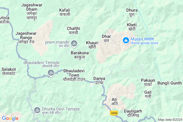
Chamua Khalsa Map
EDIT Map
Add Your House
 ..
..
Current Corona Virus Infected Patients Count in Almora District
| City Name | District Name | Total Covid cases |
|---|---|---|
| Almora District | Almora | 1 |
Locality Name :
Chamua Khalsa
( चमुआ खालसा )
Block Name : Dhauladevi
District : Almora
State : Uttarakhand
Language : Hindi and Urdu
Current Time 02:36 PM
Date: Friday , Apr 25,2025 (IST)
Time zone: IST (UTC+5:30)
Telephone Code / Std Code: 05962
Assembly constituency : Jageshwar assembly constituency
Assembly MLA : Mohan Singh
Lok Sabha constituency : Almora parliamentary constituency
Parliament MP : Ajay Tamta
Serpanch Name :
Commodities Prices : Haldwani Market / Mandi
Chamua Khalsa Live Weather
Temperature: 29.7 °C
clear sky
Humidity: 8%
Wind : 3.48 mt/sec towards W
StationName : "Almora"
observed on 1 Hours Back
Temperature: 29.7 °C
clear sky
Humidity: 8%
Wind : 3.48 mt/sec towards W
StationName : "Almora"
observed on 1 Hours Back
Chamua Khalsa Weather Forecast for Next 5 days
26-04-2025
13.6°C to 29.7°C
few clouds, scattered clouds, broken clouds, overcast clouds
13.6°C to 29.7°C
few clouds, scattered clouds, broken clouds, overcast clouds
27-04-2025
12.8°C to 30.3°C
overcast clouds, scattered clouds, broken clouds
12.8°C to 30.3°C
overcast clouds, scattered clouds, broken clouds
28-04-2025
13.6°C to 28.5°C
overcast clouds, broken clouds, scattered clouds, clear sky
13.6°C to 28.5°C
overcast clouds, broken clouds, scattered clouds, clear sky
29-04-2025
13.2°C to 30.7°C
scattered clouds, clear sky, light rain, broken clouds
13.2°C to 30.7°C
scattered clouds, clear sky, light rain, broken clouds
30-04-2025
11.4°C to 31.2°C
broken clouds, overcast clouds, clear sky, moderate rain
11.4°C to 31.2°C
broken clouds, overcast clouds, clear sky, moderate rain
National Highways Reachable To Chamua Khalsa
Nationa High Way :NH109
Nationa High Way :NH309A
Nationa High Way :NH109
Nationa High Way :NH309A
Rivers Near Chamua Khalsa
Ramganga
:काली गाड Sharda :Mahakali River :शारदा नदी :महाकाली नदी
Ramganga
:काली गाड Sharda :Mahakali River :शारदा नदी :महाकाली नदी
About Chamua Khalsa
Correct below Info and add more info about Chamua KhalsaChamua Khalsa is a Village in Dhauladevi Block in Almora District of Uttarakhand State, India. It is located 29 KM towards East from District head quarters Almora. 232 KM from State capital Dehradun
Chamua Khalsa is surrounded by Bhaisiya Chhana Block towards North , Gangolihat Block towards North , Lamgara Block towards west , Barakot Block towards East .
Almora , Pithoragarh , Champawat , Nainital are the near by Cities to Chamua Khalsa.
Demographics of Chamua Khalsa
Hindi is the Local Language here.Politics in Chamua Khalsa
BJP , INC are the major political parties in this area.Polling Stations /Booths near Chamua Khalsa
1)Taya Pali Naveen2)Chaykhan
3)Mor Padyudi
4)Kafali
5)Naini
HOW TO REACH Chamua Khalsa
By Rail
There is no railway station near to Chamua Khalsa in less than 10 km.Pincodes near Chamua Khalsa
263622 ( Dania ) , 263623 ( Panuwanaula ) , 263626 ( Jainti )Colleges near Chamua Khalsa
Government Inter College, Bhanoli
Address :
Goverment Junior High School.
Address :
Schools near Chamua Khalsa
G.i.c. Paali
Address : gunaditya , dhauladevi , almora , Uttarakhand . PIN- 263623 , Post - Panuwanaula
G.ic. Gurarabaanj
Address : gurara , dhauladevi , almora , Uttarakhand . PIN- 263623 , Post - Panuwanaula
G.i.c.bamanswal
Address : bamanswal , dhauladevi , almora , Uttarakhand . PIN- 263623 , Post - Panuwanaula
G.i.c. Barakuna
Address : barakuna , dhauladevi , almora , Uttarakhand . PIN- 263683
Govt Health Centers near Chamua Khalsa
1) Gangolihat Main Center , Gangolihat Main Center , Gangolihat Main Center , Gangolihat Main Center2) CHC Gangolihat , CHC Gangolihat , CHC Gangolihat , CHC Gangolihat
3) SC Pipeldheeng , SC Pipaldheeng , ,
Petrol Bunks in Chamua Khalsa,Dhauladevi
HP Petrol Pump "Hamara Pump"
29°35'47.1"N 79°50'13.; B-17; 2nd Ave; Sheboygan Nagar; Block B; B Block; Annanagar East; Chennai; Tamil Nadu 600102; India
9.4 KM distance Detail
more ..
Colleges in Chamua Khalsa,Dhauladevi
Rajkiya Inter College
Nou Gao; Almora; NH-309; Bageshwar Didihat Road; Berinag; Berinag; Uttarakhand 263624; India
18.5 KM distance Detail
Government Inter College
Naugaon; Kafligair - Kholsir - Kanyarichhina Rd; Uttarakhand 263628; India
18.5 KM distance Detail
Govt Intermediate College
Naugaon; Almora - Berinag Rd; Jamrari; Uttarakhand 263628; India
18.7 KM distance Detail
more ..
Electronic Shops in Chamua Khalsa,Dhauladevi
Super Markets in Chamua Khalsa,Dhauladevi
Local Parks in Chamua Khalsa,Dhauladevi
About Chamua Khalsa &
History
How to reach Chamua Khalsa
Tourist Places Near By Chamua Khalsa
Schools in Chamua Khalsa
Colleges in Chamua Khalsa
Temperature & weather of Chamua Khalsa
places in Chamua Khalsa
Chamua Khalsa photos
More Information
How to reach Chamua Khalsa
Tourist Places Near By Chamua Khalsa
Schools in Chamua Khalsa
Colleges in Chamua Khalsa
Temperature & weather of Chamua Khalsa
places in Chamua Khalsa
Chamua Khalsa photos
More Information
Village Talk
Post News or Events about this Village
Near Cities
Almora 28 KM near
Pithoragarh 32 KM near
Champawat 35 KM near
Nainital 55 KM near
Almora 28 KM near
Pithoragarh 32 KM near
Champawat 35 KM near
Nainital 55 KM near
Near By Taluks
Dhauladevi 0 KM near
Bhaisiya Chhana 13 KM near
Gangolihat 15 KM near
Lamgara 20 KM near
Dhauladevi 0 KM near
Bhaisiya Chhana 13 KM near
Gangolihat 15 KM near
Lamgara 20 KM near
Near By Air Ports
Pantnagar Airport 84 KM near
Dehra Dun Airport 222 KM near
Muzaffarnagar Airport 244 KM near
Indira Gandhi International Airport 332 KM near
Pantnagar Airport 84 KM near
Dehra Dun Airport 222 KM near
Muzaffarnagar Airport 244 KM near
Indira Gandhi International Airport 332 KM near
Near By Tourist Places
Binsar 26 KM near
Almora 28 KM near
Abbott Mount 28 KM near
Pithoragarh 32 KM near
Mukteshwar 32 KM near
Binsar 26 KM near
Almora 28 KM near
Abbott Mount 28 KM near
Pithoragarh 32 KM near
Mukteshwar 32 KM near
Near By Districts
Almora 28 KM near
Pithoragarh 32 KM near
Bageshwar 34 KM near
Champawat 37 KM near
Almora 28 KM near
Pithoragarh 32 KM near
Bageshwar 34 KM near
Champawat 37 KM near
Near By RailWay Station
Kathgodam Rail Way Station 57 KM near
Haldwani Rail Way Station 62 KM near
Kathgodam Rail Way Station 57 KM near
Haldwani Rail Way Station 62 KM near