| Home | City Bus | Maps | Villages | Cities | Rail | Tourist Places | School | College | Pin Codes | Corona Cases Count |
| Distance Calculator Bus Services IFSC Codes Trace Mobile Number Weather Search Place Trace IP Available Cash ATM/Banks Locate Polling Booth Report an Error contact People |
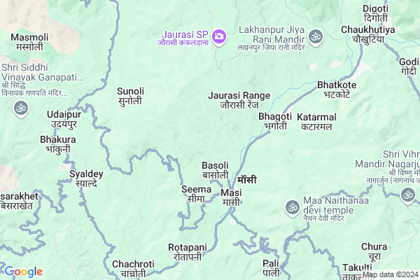
Gopal Gaon
Gopal Gaon Map
EDIT Map
Add Your House
 ..
..
Current Corona Virus Infected Patients Count in Almora District
| City Name | District Name | Total Covid cases |
|---|---|---|
| Almora District | Almora | 1 |
Locality Name :
Gopal Gaon
( गोपाल गाओं )
Block Name : Chaukhutiya
District : Almora
State : Uttarakhand
Language : Hindi and Urdu
Current Time 02:02 PM
Date: Tuesday , Apr 29,2025 (IST)
Time zone: IST (UTC+5:30)
Elevation / Altitude: 345 meters. Above Seal level
Telephone Code / Std Code: 05966
Assembly constituency : Dwarahat assembly constituency
Assembly MLA : Madan Singh Bisht
Lok Sabha constituency : Almora parliamentary constituency
Parliament MP : Ajay Tamta
Serpanch Name :
Pin Code : 263658
Post Office Name : Masi
Alternate Village Name : Gopalgaon
Commodities Prices : Ramnagar Market / Mandi
Gopal Gaon Live Weather
Temperature: 31.7 °C
overcast clouds
Humidity: 23%
Wind : 3.65 mt/sec towards SW
StationName : "DwÄ\u0081rÄ\u0081hÄ\u0081t"
observed on 1 Hours Back
Temperature: 31.7 °C
overcast clouds
Humidity: 23%
Wind : 3.65 mt/sec towards SW
StationName : "DwÄ\u0081rÄ\u0081hÄ\u0081t"
observed on 1 Hours Back
Gopal Gaon Weather Forecast for Next 5 days
30-04-2025
15.0°C to 27.9°C
broken clouds, light rain, overcast clouds
15.0°C to 27.9°C
broken clouds, light rain, overcast clouds
01-05-2025
14.0°C to 28.9°C
overcast clouds, broken clouds, clear sky, light rain, scattered clouds
14.0°C to 28.9°C
overcast clouds, broken clouds, clear sky, light rain, scattered clouds
02-05-2025
12.8°C to 26.3°C
scattered clouds, broken clouds, light rain, overcast clouds
12.8°C to 26.3°C
scattered clouds, broken clouds, light rain, overcast clouds
03-05-2025
13.5°C to 26.2°C
light rain, overcast clouds, moderate rain, heavy intensity rain
13.5°C to 26.2°C
light rain, overcast clouds, moderate rain, heavy intensity rain
04-05-2025
15.3°C to 25.0°C
overcast clouds, light rain
15.3°C to 25.0°C
overcast clouds, light rain
National Highways Reachable To Gopal Gaon
Nationa High Way :NH309A
Nationa High Way :NH534
Nationa High Way :NH309A
Nationa High Way :NH534
Rivers Near Gopal Gaon
Kosi River
Kosi River
Kosi River
Kosi River
About Gopal Gaon
Correct below Info and add more info about Gopal GaonGopal Gaon is a Village in Chaukhutiya Block in Almora District of Uttarakhand State, India. It is located 53 KM towards west from District head quarters Almora. 7 KM from Chaukhutiya. 153 KM from State capital Dehradun
Gopal Gaon Pin code is 263658 and postal head office is Masi .
Dang ( 2 KM ) , Bhagoti ( 3 KM ) , Masi ( 3 KM ) , Seema ( 3 KM ) , Laluri ( 4 KM ) are the nearby Villages to Gopal Gaon. Gopal Gaon is surrounded by Syaldey Block towards west , Bhikiyasain Block towards South , Dwarahat Block towards East , Sult Block towards South .
Almora , Ramnagar , Nainital , Pauri are the near by Cities to Gopal Gaon.
This Place is in the border of the Almora District and Chamoli District. Chamoli District Gairsain is North towards this place .
Gopalgaon 2011 Census Details
Gopal Gaon Local Language is Hindi. Gopalgaon Village Total population is 92 and number of houses are 27. Female Population is 59.8%. Village literacy rate is 69.6% and the Female Literacy rate is 38.0%.
Population
| Census Parameter | Census Data |
| Total Population | 92 |
| Total No of Houses | 27 |
| Female Population % | 59.8 % ( 55) |
| Total Literacy rate % | 69.6 % ( 64) |
| Female Literacy rate | 38.0 % ( 35) |
| Scheduled Tribes Population % | 0.0 % ( 0) |
| Scheduled Caste Population % | 0.0 % ( 0) |
| Working Population % | 63.0 % |
| Child(0 -6) Population by 2011 | 7 |
| Girl Child(0 -6) Population % by 2011 | 28.6 % ( 2) |
Gopalgaon Census More Deatils.
Politics in Gopal Gaon
UKKD , UKDP , UKKD , BJP , INC are the major political parties in this area.Polling Stations /Booths near Gopal Gaon
1)Thapla2)Kotila
3)Godi
4)Khalna
5)Satinaugaon
HOW TO REACH Gopal Gaon
By Rail
There is no railway station near to Gopal Gaon in less than 10 km.Colleges near Gopal Gaon
Govt. Inter College Masi
Address :
G I C Masi
Address :
Schools in Gopal Gaon
P.s. Surna Gopalgaon
Address : gopalgaon , chaukhutiya , almora , Uttarakhand . PIN- 263658 , Post - Masi
Govt Health Centers near Gopal Gaon
1) Boongidhar SC , Subcentre Boongidhar , Boongidhar , PWD gest House2) Health Sub Center Gwaldam , SC Gwaldam , , Main Market
3) Kingodikhal SC , , Kingodikhal , Kingodikhal
Petrol Bunks in Gopal Gaon,Chaukhutiya
HP PETROL PUMP - JAI JIYA FILLING STATION
Karn Prayag Road Chaukhutia Dist- UA; Dehradun; 263656; India
12.3 KM distance Detail
HP PETROL PUMP - CHAUDHARY FUEL
NH-87E; Vill-khurudgaar Dawarahart UL; Chaukhutia Road; Uttarakhand 263653; India
19.7 KM distance Detail
more ..
Colleges in Gopal Gaon,Chaukhutiya
Government Higher Secondary School; Chachroti
Deghat Road; Faniya; Uttarakhand 263661; India
8.2 KM distance Detail
more ..
Super Markets in Gopal Gaon,Chaukhutiya
Police Stations near Gopal Gaon,Chaukhutiya
Police Station
Kali kholi; Tehsil Road; Sinar Rd; Dwarahat; Uttarakhand 263653; India
19.2 KM distance Detail
Governement Offices near Gopal Gaon,Chaukhutiya
Tehsil Chaukhutia
Agneri Mandir Road;; Chaukhutiya; Uttarakhand 263656; India
11.2 KM distance Detail
Tahsil Office Someshwar
Tahsil Rd; Someshwar Range; Uttarakhand 263653; India
18.9 KM distance Detail
About Gopal Gaon &
History
How to reach Gopal Gaon
Tourist Places Near By Gopal Gaon
Schools in Gopal Gaon
Colleges in Gopal Gaon
Temperature & weather of Gopal Gaon
places in Gopal Gaon
Gopal Gaon photos
More Information
How to reach Gopal Gaon
Tourist Places Near By Gopal Gaon
Schools in Gopal Gaon
Colleges in Gopal Gaon
Temperature & weather of Gopal Gaon
places in Gopal Gaon
Gopal Gaon photos
More Information
Village Talk
Post News or Events about this Village
Near Cities
Almora 51 KM near
Ramnagar 57 KM near
Nainital 61 KM near
Pauri 65 KM near
Almora 51 KM near
Ramnagar 57 KM near
Nainital 61 KM near
Pauri 65 KM near
Near By Taluks
Syaldey 6 KM near
Chaukhutiya 7 KM near
Bhikiyasain 16 KM near
Dwarahat 20 KM near
Syaldey 6 KM near
Chaukhutiya 7 KM near
Bhikiyasain 16 KM near
Dwarahat 20 KM near
Near By Air Ports
Pantnagar Airport 103 KM near
Dehra Dun Airport 145 KM near
Muzaffarnagar Airport 180 KM near
Simla Airport 277 KM near
Pantnagar Airport 103 KM near
Dehra Dun Airport 145 KM near
Muzaffarnagar Airport 180 KM near
Simla Airport 277 KM near
Near By Tourist Places
Dwarahat 18 KM near
Gairsain 29 KM near
Ranikhet 30 KM near
Kasauni 36 KM near
Jageshwar 41 KM near
Dwarahat 18 KM near
Gairsain 29 KM near
Ranikhet 30 KM near
Kasauni 36 KM near
Jageshwar 41 KM near
Near By Districts
Almora 51 KM near
Bageshwar 54 KM near
Nainital 61 KM near
Rudra Prayag 63 KM near
Almora 51 KM near
Bageshwar 54 KM near
Nainital 61 KM near
Rudra Prayag 63 KM near
Near By RailWay Station
Ramnagar Rail Way Station 58 KM near
Kathgodam Rail Way Station 77 KM near
Ramnagar Rail Way Station 58 KM near
Kathgodam Rail Way Station 77 KM near