| Home | City Bus | Maps | Villages | Cities | Rail | Tourist Places | School | College | Pin Codes | Corona Cases Count |
| Distance Calculator Bus Services IFSC Codes Trace Mobile Number Weather Search Place Trace IP Available Cash ATM/Banks Locate Polling Booth Report an Error contact People |
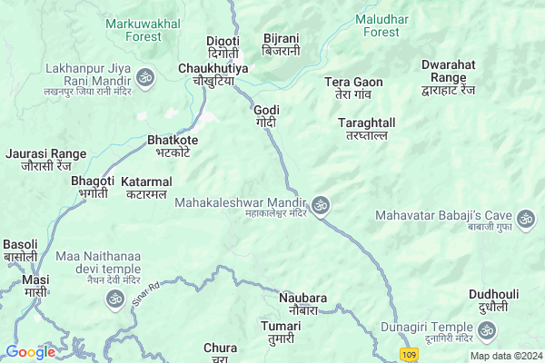
Dantola
Dantola Map
EDIT Map
Add Your House
 ..
..
Current Corona Virus Infected Patients Count in Almora District
| City Name | District Name | Total Covid cases |
|---|---|---|
| Almora District | Almora | 1 |
Locality Name :
Dantola
( दंतोला )
Block Name : Chaukhutiya
District : Almora
State : Uttarakhand
Language : Hindi and Urdu
Current Time 02:16 PM
Date: Tuesday , Apr 29,2025 (IST)
Time zone: IST (UTC+5:30)
Elevation / Altitude: 345 meters. Above Seal level
Telephone Code / Std Code: 05966
Assembly constituency : Dwarahat assembly constituency
Assembly MLA : Madan Singh Bisht
Lok Sabha constituency : Almora parliamentary constituency
Parliament MP : Ajay Tamta
Serpanch Name :
Pin Code : 263656
Post Office Name : Ganai
Commodities Prices : Ramnagar Market / Mandi
National Highways Reachable To Dantola
Nationa High Way :NH309A
Nationa High Way :NH534
Nationa High Way :NH309A
Nationa High Way :NH534
Rivers Near Dantola
Kosi River
Kosi River
Kosi River
Kosi River
About Dantola
Correct below Info and add more info about DantolaDantola is a Village in Chaukhutiya Block in Almora District of Uttarakhand State, India. It is located 45 KM towards west from District head quarters Almora. 4 KM from Chaukhutiya. 162 KM from State capital Dehradun
Dantola Pin code is 263656 and postal head office is Ganai .
Reeta Chaura ( 3 KM ) , Siroli ( 3 KM ) , Bagari ( 4 KM ) , Chandikhet ( 4 KM ) , Ganai ( 4 KM ) are the nearby Villages to Dantola. Dantola is surrounded by Dwarahat Block towards South , Syaldey Block towards west , Bhikiyasain Block towards South , Gairsain Block towards North .
Almora , Nainital , Ramnagar , Pauri are the near by Cities to Dantola.
This Place is in the border of the Almora District and Chamoli District. Chamoli District Gairsain is North towards this place .
Dantola 2011 Census Details
Dantola Local Language is Hindi. Dantola Village Total population is 191 and number of houses are 44. Female Population is 58.6%. Village literacy rate is 73.3% and the Female Literacy rate is 41.9%.
Population
| Census Parameter | Census Data |
| Total Population | 191 |
| Total No of Houses | 44 |
| Female Population % | 58.6 % ( 112) |
| Total Literacy rate % | 73.3 % ( 140) |
| Female Literacy rate | 41.9 % ( 80) |
| Scheduled Tribes Population % | 10.5 % ( 20) |
| Scheduled Caste Population % | 46.6 % ( 89) |
| Working Population % | 54.5 % |
| Child(0 -6) Population by 2011 | 24 |
| Girl Child(0 -6) Population % by 2011 | 41.7 % ( 10) |
Dantola Census More Deatils.
Politics in Dantola
UKKD , UKDP , UKKD , BJP , INC are the major political parties in this area.Polling Stations /Booths near Dantola
1)Basarkhet2)Faldwadi Musnzula
3)Mahakaleshwar
4)Chhabbisa
5)Gopalgaon Tayasunra
HOW TO REACH Dantola
By Rail
There is no railway station near to Dantola in less than 10 km.Colleges near Dantola
Govt. Inter College Masi
Address :
G I C Masi
Address :
Schools near Dantola
G.h.s. Timilkhal
Address : aadi. kanojiya , chaukhutiya , almora , Uttarakhand . PIN- 263658 , Post - Masi
G.i.c. Patalgaon
Address : patalgaon , chaukhutiya , almora , Uttarakhand . PIN- 263658 , Post - Masi
G.i.c. Mahakaleshwar
Address : mehalchaura , chaukhutiya , almora , Uttarakhand . PIN- 263646 , Post - Bhatronjkhan
G.h.s. Chitreshwar
Address : bairati , chaukhutiya , almora , Uttarakhand . PIN- 263653 , Post - Dwarahat
Govt Health Centers near Dantola
1) Health Sub Center Gwaldam , SC Gwaldam , , Main Market2) Health Sub Center Nandkeshri , SC Nandkeshri , , Near Nanda devi Temple
3) Health Sub Center Vijaypur , SC Vijaypur , Budjola ,
Petrol Bunks in Dantola,Chaukhutiya
HP PETROL PUMP - JAI JIYA FILLING STATION
Karn Prayag Road Chaukhutia Dist- UA; Dehradun; 263656; India
6.3 KM distance Detail
HP PETROL PUMP - CHAUDHARY FUEL
NH-87E; Vill-khurudgaar Dawarahart UL; Chaukhutia Road; Uttarakhand 263653; India
11.5 KM distance Detail
more ..
Colleges in Dantola,Chaukhutiya
Government Inter College
Badrinath Road; National Highway 87; Chaukhutiya; Uttarakhand 263656; India
5.2 KM distance Detail
more ..
Schools in Dantola,Chaukhutiya
G.P.S. BASBHIRA
VILL/POST: BASBHIRA; P.S: CHAUKHUTIA; DIST:; Uttarakhand 263653; India
0.6 KM distance Detail
Electronic Shops in Dantola,Chaukhutiya
Kirola Computer & Electronics
kirola computer & electronics; Chaukhutiya; Uttarakhand; India
5.0 KM distance Detail
Amazon.in (India Largest Online Store)
bdarinath road; Chaukhutiya; Uttarakhand 263656; India
5.3 KM distance Detail
Super Markets in Dantola,Chaukhutiya
Police Stations near Dantola,Chaukhutiya
Police Station
Kali kholi; Tehsil Road; Sinar Rd; Dwarahat; Uttarakhand 263653; India
10.9 KM distance Detail
Governement Offices near Dantola,Chaukhutiya
Tehsil Chaukhutia
Agneri Mandir Road;; Chaukhutiya; Uttarakhand 263656; India
5.7 KM distance Detail
Tahsil Office Someshwar
Tahsil Rd; Someshwar Range; Uttarakhand 263653; India
10.5 KM distance Detail
About Dantola &
History
How to reach Dantola
Tourist Places Near By Dantola
Schools in Dantola
Colleges in Dantola
Temperature & weather of Dantola
places in Dantola
Dantola photos
More Information
How to reach Dantola
Tourist Places Near By Dantola
Schools in Dantola
Colleges in Dantola
Temperature & weather of Dantola
places in Dantola
Dantola photos
More Information
Village Talk
Post News or Events about this Village
Near Cities
Almora 43 KM near
Nainital 59 KM near
Ramnagar 62 KM near
Pauri 73 KM near
Almora 43 KM near
Nainital 59 KM near
Ramnagar 62 KM near
Pauri 73 KM near
Near By Taluks
Chaukhutiya 4 KM near
Dwarahat 14 KM near
Syaldey 17 KM near
Bhikiyasain 19 KM near
Chaukhutiya 4 KM near
Dwarahat 14 KM near
Syaldey 17 KM near
Bhikiyasain 19 KM near
Near By Air Ports
Pantnagar Airport 102 KM near
Dehra Dun Airport 155 KM near
Muzaffarnagar Airport 191 KM near
Simla Airport 285 KM near
Pantnagar Airport 102 KM near
Dehra Dun Airport 155 KM near
Muzaffarnagar Airport 191 KM near
Simla Airport 285 KM near
Near By Tourist Places
Dwarahat 10 KM near
Kasauni 25 KM near
Ranikhet 26 KM near
Gairsain 29 KM near
Jageshwar 33 KM near
Dwarahat 10 KM near
Kasauni 25 KM near
Ranikhet 26 KM near
Gairsain 29 KM near
Jageshwar 33 KM near
Near By Districts
Bageshwar 43 KM near
Almora 43 KM near
Nainital 59 KM near
Rudra Prayag 68 KM near
Bageshwar 43 KM near
Almora 43 KM near
Nainital 59 KM near
Rudra Prayag 68 KM near
Near By RailWay Station
Ramnagar Rail Way Station 63 KM near
Kathgodam Rail Way Station 75 KM near
Ramnagar Rail Way Station 63 KM near
Kathgodam Rail Way Station 75 KM near