| Home | City Bus | Maps | Villages | Cities | Rail | Tourist Places | School | College | Pin Codes | Corona Cases Count |
| Distance Calculator Bus Services IFSC Codes Trace Mobile Number Weather Search Place Trace IP Available Cash ATM/Banks Locate Polling Booth Report an Error contact People |
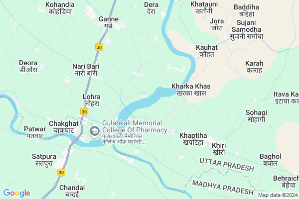
Gargata
Gargata Map
EDIT Map
Add Your House
 ..
..
Current Corona Virus Infected Patients Count in Allahabad District
| City Name | District Name | Total Covid cases |
|---|
Locality Name :
Gargata
( गरजता )
Block Name : Koraon
District : Allahabad
State : Uttar Pradesh
Division : Allahabad
Language : Hindi and Urdu, Awadhi, Bagheli
Current Time 09:34 PM
Date: Tuesday , Apr 29,2025 (IST)
Time zone: IST (UTC+5:30)
Elevation / Altitude: 92 meters. Above Seal level
Telephone Code / Std Code: 05334
Assembly constituency : Koraon assembly constituency
Assembly MLA : Raj Mani
Lok Sabha constituency : Allahabad parliamentary constituency
Parliament MP : Rita Bahuguna Joshi
Serpanch Name :
Pin Code : 212106
Post Office Name : Jari Bazar
Main Village Name : Mahuli Khurd
Commodities Prices : Chaakghat Market / Mandi
Gargata Live Weather
Temperature: 35.6 °C
clear sky
Humidity: 19%
Wind : 1.91 mt/sec towards E
StationName : "SohÄ\u0081gi"
observed on 2 Hours Back
Temperature: 35.6 °C
clear sky
Humidity: 19%
Wind : 1.91 mt/sec towards E
StationName : "SohÄ\u0081gi"
observed on 2 Hours Back
Gargata Weather Forecast for Next 5 days
30-04-2025
27.1°C to 36.8°C
clear sky
27.1°C to 36.8°C
clear sky
01-05-2025
26.3°C to 41.2°C
clear sky
26.3°C to 41.2°C
clear sky
02-05-2025
28.2°C to 42.6°C
clear sky, few clouds
28.2°C to 42.6°C
clear sky, few clouds
03-05-2025
27.7°C to 42.5°C
clear sky, scattered clouds, few clouds
27.7°C to 42.5°C
clear sky, scattered clouds, few clouds
04-05-2025
29.1°C to 42.5°C
broken clouds, light rain, overcast clouds, scattered clouds, clear sky
29.1°C to 42.5°C
broken clouds, light rain, overcast clouds, scattered clouds, clear sky
National Highways Reachable To Gargata
Nationa High Way :NH30
Nationa High Way :NH30
Rivers Near Gargata
Tudiyari Nadi
Lapri Nadi
Tudiyari Nadi
Lapri Nadi
About Gargata
Correct below Info and add more info about GargataGargata is a small Village/hamlet in Koraon Block in Allahabad District of Uttar Pradesh State, India. It comes under Mahuli Khurd Panchayath. It belongs to Allahabad Division . It is located 50 KM towards South from District head quarters Allahabad. 30 KM from Koraon. 251 KM from State capital Lucknow
Gargata Pin code is 212106 and postal head office is Jari Bazar .
Gargata is surrounded by Kaudhiyara Block towards North , Shankargarh Block towards North , Jasra Block towards North , Koraon Block towards East .
Allahabad , Mauganj , Phulpur , Lal Gopalganj Nindaura are the near by Cities to Gargata.
Gargata 2011 Census Details
Gargata Local Language is Hindi. Gargata Village Total population is 497 and number of houses are 60. Female Population is 44.7%. Village literacy rate is 68.6% and the Female Literacy rate is 24.5%.
Population
| Census Parameter | Census Data |
| Total Population | 497 |
| Total No of Houses | 60 |
| Female Population % | 44.7 % ( 222) |
| Total Literacy rate % | 68.6 % ( 341) |
| Female Literacy rate | 24.5 % ( 122) |
| Scheduled Tribes Population % | 0.0 % ( 0) |
| Scheduled Caste Population % | 37.8 % ( 188) |
| Working Population % | 57.7 % |
| Child(0 -6) Population by 2011 | 76 |
| Girl Child(0 -6) Population % by 2011 | 50.0 % ( 38) |
Gargata Census More Deatils.
Politics in Gargata
CPM , BSP are the major political parties in this area.Polling Stations /Booths near Gargata
1).uchchpra.pa. Khiri U. Bhag2)Pra.pa.jmuva
3)Pra.pa.joravat Pashchi.bhag
4)Pra.pa.taraon Uttri Bhag-1
5)Pra.pa.taungakala Dakshini Bhag
HOW TO REACH Gargata
By Rail
There is no railway station near to Gargata in less than 10 km.Colleges near Gargata
Gopal Vidayalaya Inter College
Address :
Prathamik Vidyalay Mahuli
Address : Vill And Post Mahuli Koraon Allahabad
Gopal Vidyalay Inter Collage
Address : Koraon Allahabad
Schools near Gargata
U.p.s. Baghol
Address : baghol , koraon , allahabad , Uttar Pradesh . PIN- 212306 , Post - Koraon
U.p.s. Basaha
Address : basaha , koraon , allahabad , Uttar Pradesh . PIN- 212306 , Post - Koraon
U.p.s. Kudi
Address : gobari , koraon , allahabad , Uttar Pradesh . PIN- 212306 , Post - Koraon
U.p.s. Piyari Kurmiyan
Address : piyari kachiyan , koraon , allahabad , Uttar Pradesh . PIN- 212306 , Post - Koraon
Govt Health Centers near Gargata
1) Taunga , , ,2) Naribari , , ,
3) MAIDA , , ,
Sub Villages in Gargata
Petrol Bunks in Gargata,Koraon
ALLAHABAD SERVICE STATION; INDIAN OIL PUMP
Lohra; Uttar Pradesh 212106; India
5.1 KM distance Detail
ANANT RAM MANIK CHANDRA
BHARATNAGAR;ON NH; LOHRA;D; ALLAHABAD; Uttar Pradesh 212106; India
5.2 KM distance Detail
Akshay Filling Station
94;Lohar;Bharat nagar; NH30; Allahabad; Uttar Pradesh; India
5.3 KM distance Detail
more ..
Colleges in Gargata,Koraon
GK Collage Of Education chaktghat
Chakghat Road; Pura Binjhoo; Madhya Pradesh 212106; India
5.4 KM distance Detail
Gulab Kali Memorial College Of Pharmacy
Gaura Road Tehsil Chakghat; Chakghat; Madhya Pradesh 486220; India
7.3 KM distance Detail
more ..
Schools in Gargata,Koraon
शिव बालक माझी मेमोरियल इण्टर कॉलेज मवैया कला नारी बारी इलाहाबाद
Mahuli Khurd; Uttar Pradesh 212106; India
2.2 KM distance Detail
D.S.D.P.Inter College Deori Bargahi
bargahi naribari; Devari; Uttar Pradesh; India
2.4 KM distance Detail
Purva Madhyamik Vidyalaya
Jorwat; Allahabad; SH-102; Gohaniya Koraon Road; Koraon; Koraon; Uttar Pradesh 212106; India
3.8 KM distance Detail
Government Primary School
Jorwat; Allahabad; SH-102; Gohaniya Koraon Road; Koraon; Koraon; Uttar Pradesh 212106; India
3.8 KM distance Detail
Local Parks in Gargata,Koraon
Black Buck Conservation Area - Meja Range
Mahuli Kala; Uttar Pradesh 212106; India
14.6 KM distance Detail
Police Stations near Gargata,Koraon
Naribari Police Station
Naribari; National Highway 27; Uttar Pradesh 212106; India
5.2 KM distance Detail
About Gargata &
History
How to reach Gargata
Tourist Places Near By Gargata
Schools in Gargata
Colleges in Gargata
Temperature & weather of Gargata
places in Gargata
Gargata photos
More Information
How to reach Gargata
Tourist Places Near By Gargata
Schools in Gargata
Colleges in Gargata
Temperature & weather of Gargata
places in Gargata
Gargata photos
More Information
Village Talk
Post News or Events about this Village
Near Cities
Allahabad 48 KM near
Mauganj 50 KM near
Phulpur 70 KM near
Lal Gopalganj Nindaura 75 KM near
Allahabad 48 KM near
Mauganj 50 KM near
Phulpur 70 KM near
Lal Gopalganj Nindaura 75 KM near
Near By Taluks
Teonthar 16 KM near
Shankargarh 22 KM near
Kaudhiyara 22 KM near
Jasra 27 KM near
Teonthar 16 KM near
Shankargarh 22 KM near
Kaudhiyara 22 KM near
Jasra 27 KM near
Near By Air Ports
Bamrauli Airport 47 KM near
Varanasi Airport 130 KM near
Khajuraho Airport 212 KM near
Kanpur Airport 226 KM near
Bamrauli Airport 47 KM near
Varanasi Airport 130 KM near
Khajuraho Airport 212 KM near
Kanpur Airport 226 KM near
Near By Tourist Places
Allahabad 48 KM near
Kaushambi 56 KM near
Shringverpur 80 KM near
Vindhyachal 82 KM near
Rewa 85 KM near
Allahabad 48 KM near
Kaushambi 56 KM near
Shringverpur 80 KM near
Vindhyachal 82 KM near
Rewa 85 KM near
Near By Districts
Allahabad 48 KM near
Kaushambi 71 KM near
Chitrakoot 76 KM near
Sidhi 82 KM near
Allahabad 48 KM near
Kaushambi 71 KM near
Chitrakoot 76 KM near
Sidhi 82 KM near
Near By RailWay Station
Shankargarh Rail Way Station 23 KM near
Meja Road Rail Way Station 40 KM near
Shankargarh Rail Way Station 23 KM near
Meja Road Rail Way Station 40 KM near