| Home | City Bus | Maps | Villages | Cities | Rail | Tourist Places | School | College | Pin Codes | Corona Cases Count |
| Distance Calculator Bus Services IFSC Codes Trace Mobile Number Weather Search Place Trace IP Available Cash ATM/Banks Locate Polling Booth Report an Error contact People |
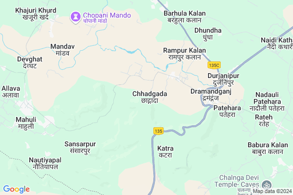
Chhadgada
Chhadgada Map
EDIT Map
Add Your House
 ..
..
Current Corona Virus Infected Patients Count in Allahabad District
| City Name | District Name | Total Covid cases |
|---|
Locality Name :
Chhadgada
( छाड़गड़ा )
Block Name : Koraon
District : Allahabad
State : Uttar Pradesh
Division : Allahabad
Language : Hindi and Urdu, Awadhi, Bagheli
Current Time 08:11 AM
Date: Saturday , Apr 26,2025 (IST)
Time zone: IST (UTC+5:30)
Elevation / Altitude: 92 meters. Above Seal level
Telephone Code / Std Code: 05334
Assembly constituency : Koraon assembly constituency
Assembly MLA : Raj Mani
Lok Sabha constituency : Allahabad parliamentary constituency
Parliament MP : Rita Bahuguna Joshi
Serpanch Name :
Commodities Prices : Sirsa Market / Mandi
Chhadgada Live Weather
Temperature: 36.6 °C
clear sky
Humidity: 6%
Wind : 1.86 mt/sec towards SW
StationName : "Mauganj"
observed on Now
Temperature: 36.6 °C
clear sky
Humidity: 6%
Wind : 1.86 mt/sec towards SW
StationName : "Mauganj"
observed on Now
Chhadgada Weather Forecast for Next 5 days
27-04-2025
32.9°C to 43.5°C
clear sky, scattered clouds, broken clouds, overcast clouds
32.9°C to 43.5°C
clear sky, scattered clouds, broken clouds, overcast clouds
28-04-2025
28.9°C to 41.9°C
broken clouds, scattered clouds, overcast clouds
28.9°C to 41.9°C
broken clouds, scattered clouds, overcast clouds
29-04-2025
27.7°C to 42.5°C
overcast clouds, broken clouds, scattered clouds, clear sky
27.7°C to 42.5°C
overcast clouds, broken clouds, scattered clouds, clear sky
30-04-2025
26.3°C to 42.5°C
broken clouds, overcast clouds, scattered clouds, few clouds, clear sky
26.3°C to 42.5°C
broken clouds, overcast clouds, scattered clouds, few clouds, clear sky
01-05-2025
25.4°C to 41.8°C
broken clouds, clear sky
25.4°C to 41.8°C
broken clouds, clear sky
National Highways Reachable To Chhadgada
Nationa High Way :NH30
Nationa High Way :NH30
Rivers Near Chhadgada
Tudiyari Nadi
Lapri Nadi
Tudiyari Nadi
Lapri Nadi
About Chhadgada
Correct below Info and add more info about ChhadgadaChhadgada is a Village in Koraon Block in Allahabad District of Uttar Pradesh State, India. It belongs to Allahabad Division . It is located 80 KM towards South from District head quarters Allahabad. 18 KM from Koraon. 290 KM from State capital Lucknow
Sansarpur ( 7 KM ) , Barhula Kalan ( 7 KM ) , Patehri ( 7 KM ) , Rajapur ( 7 KM ) , Mandav ( 7 KM ) are the nearby Villages to Chhadgada. Chhadgada is surrounded by Hallia Block towards East , Hanumana Block towards South , Manda Block towards North , Meja Block towards North .
Mauganj , Mirzapur , Sidhi , Allahabad are the near by Cities to Chhadgada.
Chhadgada 2011 Census Details
Chhadgada Local Language is Hindi. Chhadgada Village Total population is 3682 and number of houses are 591. Female Population is 48.2%. Village literacy rate is 41.4% and the Female Literacy rate is 16.0%.
Population
| Census Parameter | Census Data |
| Total Population | 3682 |
| Total No of Houses | 591 |
| Female Population % | 48.2 % ( 1774) |
| Total Literacy rate % | 41.4 % ( 1523) |
| Female Literacy rate | 16.0 % ( 590) |
| Scheduled Tribes Population % | 0.0 % ( 0) |
| Scheduled Caste Population % | 35.8 % ( 1319) |
| Working Population % | 41.1 % |
| Child(0 -6) Population by 2011 | 725 |
| Girl Child(0 -6) Population % by 2011 | 50.2 % ( 364) |
Chhadgada Census More Deatils.
Politics in Chhadgada
CPM , BSP are the major political parties in this area.Polling Stations /Booths near Chhadgada
1)Pra.pa.pasanapu.bhag2)Pra.pa.paitiha Pu.. Bhag
3)Pra.pa.siravalpu.bhag
4)Pra.pa.semri Jirauha
5)Pra.pa.chaparo
HOW TO REACH Chhadgada
By Rail
There is no railway station near to Chhadgada in less than 10 km.Pincodes near Chhadgada
212306 ( Koraon ) , 212104 ( Bharatganj ) , 231211 ( Lalganj (Mirzapur) )Colleges near Chhadgada
Gopal Vidayalaya Inter College
Address :
Prathamik Vidyalay Mahuli
Address : Vill And Post Mahuli Koraon Allahabad
Gopal Vidyalay Inter Collage
Address : Koraon Allahabad
Schools near Chhadgada
U.p.s. Baghol
Address : baghol , koraon , allahabad , Uttar Pradesh . PIN- 212306 , Post - Koraon
U.p.s. Basaha
Address : basaha , koraon , allahabad , Uttar Pradesh . PIN- 212306 , Post - Koraon
U.p.s. Kudi
Address : gobari , koraon , allahabad , Uttar Pradesh . PIN- 212306 , Post - Koraon
U.p.s. Piyari Kurmiyan
Address : piyari kachiyan , koraon , allahabad , Uttar Pradesh . PIN- 212306 , Post - Koraon
Govt Health Centers near Chhadgada
1) Ramgarh , , ,2) Ramgarh , , ,
3) Dohtha , , ,
Colleges in Chhadgada,Koraon
Ramanuj Pratap PG College-Drumandganj
Durjanipur; Uttar Pradesh 231211; India
6.7 KM distance Detail
more ..
Schools in Chhadgada,Koraon
Jawahar Navodaya Vidyalaya
Pipersand; Lucknow; Uttar Pradesh; Lucknow; Uttar Pradesh 226008; India
5.6 KM distance Detail
Shri Hanuman Prasad Inter Mediat Collega Rampur Kalan Karoan Allahabad
Rampur Kalan; Uttar Pradesh 212306; India
5.8 KM distance Detail
About Chhadgada &
History
How to reach Chhadgada
Tourist Places Near By Chhadgada
Schools in Chhadgada
Colleges in Chhadgada
Temperature & weather of Chhadgada
places in Chhadgada
Chhadgada photos
More Information
How to reach Chhadgada
Tourist Places Near By Chhadgada
Schools in Chhadgada
Colleges in Chhadgada
Temperature & weather of Chhadgada
places in Chhadgada
Chhadgada photos
More Information
Village Talk
Post News or Events about this Village
Near Cities
Mauganj 38 KM near
Mirzapur 59 KM near
Sidhi 65 KM near
Allahabad 77 KM near
Mauganj 38 KM near
Mirzapur 59 KM near
Sidhi 65 KM near
Allahabad 77 KM near
Near By Taluks
Koraon 17 KM near
Hallia 20 KM near
Hanumana 23 KM near
Manda 30 KM near
Koraon 17 KM near
Hallia 20 KM near
Hanumana 23 KM near
Manda 30 KM near
Near By Air Ports
Bamrauli Airport 82 KM near
Varanasi Airport 108 KM near
Khajuraho Airport 249 KM near
Kanpur Airport 269 KM near
Bamrauli Airport 82 KM near
Varanasi Airport 108 KM near
Khajuraho Airport 249 KM near
Kanpur Airport 269 KM near
Near By Tourist Places
Vindhyachal 55 KM near
Allahabad 77 KM near
Kaushambi 100 KM near
Rewa 102 KM near
Shringverpur 104 KM near
Vindhyachal 55 KM near
Allahabad 77 KM near
Kaushambi 100 KM near
Rewa 102 KM near
Shringverpur 104 KM near
Near By Districts
Mirzapur 60 KM near
Sidhi 64 KM near
Sant Ravidas Nagar 70 KM near
Allahabad 77 KM near
Mirzapur 60 KM near
Sidhi 64 KM near
Sant Ravidas Nagar 70 KM near
Allahabad 77 KM near
Near By RailWay Station
Meja Road Rail Way Station 42 KM near
Vindhyachal Rail Way Station 55 KM near
Meja Road Rail Way Station 42 KM near
Vindhyachal Rail Way Station 55 KM near