| Home | City Bus | Maps | Villages | Cities | Rail | Tourist Places | School | College | Pin Codes | Corona Cases Count |
| Distance Calculator Bus Services IFSC Codes Trace Mobile Number Weather Search Place Trace IP Available Cash ATM/Banks Locate Polling Booth Report an Error contact People |
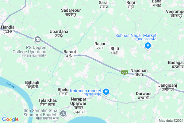
Paklur
Paklur Map
EDIT Map
Add Your House
 ..
..
Current Corona Virus Infected Patients Count in Allahabad District
| City Name | District Name | Total Covid cases |
|---|
Locality Name :
Paklur
( पाकलूर )
Block Name : Handia
District : Allahabad
State : Uttar Pradesh
Division : Allahabad
Language : Hindi and Urdu, Awadhi, Bagheli
Current Time 12:25 PM
Date: Tuesday , Apr 29,2025 (IST)
Time zone: IST (UTC+5:30)
Elevation / Altitude: 88 meters. Above Seal level
Telephone Code / Std Code: 05465
Assembly constituency : Handia assembly constituency
Assembly MLA : Hakim Lal Bind
Lok Sabha constituency : Bhadohi parliamentary constituency
Parliament MP : RAMESH CHAND
Serpanch Name :
Pin Code : 221502
Post Office Name : Baraut
Alternate Village Name : Paklor
Commodities Prices : Gopiganj Market / Mandi
Paklur Live Weather
Temperature: 32.5 °C
overcast clouds
Humidity: 30%
Wind : 5.3 mt/sec towards E
StationName : "HandiÄ\u0081"
observed on 2 Hours Back
Temperature: 32.5 °C
overcast clouds
Humidity: 30%
Wind : 5.3 mt/sec towards E
StationName : "HandiÄ\u0081"
observed on 2 Hours Back
Paklur Weather Forecast for Next 5 days
30-04-2025
28.6°C to 38.7°C
overcast clouds, broken clouds, clear sky
28.6°C to 38.7°C
overcast clouds, broken clouds, clear sky
01-05-2025
26.6°C to 41.2°C
clear sky
26.6°C to 41.2°C
clear sky
02-05-2025
27.9°C to 41.7°C
clear sky, light rain, few clouds
27.9°C to 41.7°C
clear sky, light rain, few clouds
03-05-2025
27.2°C to 41.5°C
clear sky, scattered clouds, few clouds
27.2°C to 41.5°C
clear sky, scattered clouds, few clouds
04-05-2025
29.2°C to 42.7°C
scattered clouds, light rain, broken clouds, overcast clouds
29.2°C to 42.7°C
scattered clouds, light rain, broken clouds, overcast clouds
National Highways Reachable To Paklur
Nationa High Way :NH35
Nationa High Way :NH30;NH35
Nationa High Way :NH35
Nationa High Way :NH30;NH35
Rivers Near Paklur
Sasur Khaderi River
Sasur Khaderi River
Sasur Khaderi River
Sasur Khaderi River
About Paklur
Correct below Info and add more info about PaklurPaklur is a Village in Handia Block in Allahabad District of Uttar Pradesh State, India. It belongs to Allahabad Division . It is located 55 KM towards East from District head quarters Allahabad. 7 KM from Handia. 251 KM from State capital Lucknow
Paklur Pin code is 221502 and postal head office is Baraut .
Rasar ( 1 KM ) , Ramnathi ( 1 KM ) , Sikaraha ( 1 KM ) , Ataraura ( 2 KM ) , Sahila ( 2 KM ) are the nearby Villages to Paklur. Paklur is surrounded by Deegh Block towards South , Dhanupur Block towards North , Gyanpur Block towards East , Uruwan Block towards west .
Phulpur , Mirzapur , Allahabad , Jaunpur are the near by Cities to Paklur.
This Place is in the border of the Allahabad District and Sant Ravidas Nagar District. Sant Ravidas Nagar District Suriyavan is East towards this place . Also it is in the Border of other district Jaunpur .
Paklur 2011 Census Details
Paklur Local Language is Hindi. Paklur Village Total population is 2441 and number of houses are 322. Female Population is 47.3%. Village literacy rate is 50.7% and the Female Literacy rate is 15.9%.
Population
| Census Parameter | Census Data |
| Total Population | 2441 |
| Total No of Houses | 322 |
| Female Population % | 47.3 % ( 1155) |
| Total Literacy rate % | 50.7 % ( 1238) |
| Female Literacy rate | 15.9 % ( 387) |
| Scheduled Tribes Population % | 0.1 % ( 2) |
| Scheduled Caste Population % | 22.0 % ( 538) |
| Working Population % | 30.8 % |
| Child(0 -6) Population by 2011 | 475 |
| Girl Child(0 -6) Population % by 2011 | 47.6 % ( 226) |
Paklur Census More Deatils.
Politics in Paklur
BJP , SP , BSP , PMSP are the major political parties in this area.Polling Stations /Booths near Paklur
1)Zila Parishad Pra0pa0 Aura West2)Zila Parishad Pra0pa0 Bithauli
3)Junior High School Shahipur West
4)Zila Parishad Pra0pa0 Bheski West
5)Zila Parishad Pra0pa0 Bhiti North
HOW TO REACH Paklur
By Rail
Atraura Rail Way Station , Bhiti Rail Way Station are the very nearby railway stations to Paklur.Colleges near Paklur
Vidyavati Yadav Smarak Maharshi Krishna Inter College
Address :
Schools in Paklur
Ps Paklor
Address : paklor , handia , allahabad , Uttar Pradesh . PIN- 222150
Govt Health Centers near Paklur
1) Kardhana II , , ,2) Madhopur , , ,
3) F.P , , Bhawapur , Panchayat building Bhawapur
Sub Villages in Paklur
Hospitals in Paklur,Handia
Navjeevan Hospital
Baraut; Allahabad; NH-2; Allahabad Varanasi Road; Handia; Handia; Uttar Pradesh 221502; India
0.6 KM distance Detail
Jivandeep Hospital
Baraut; Allahabad; NH-2; Allahabad Varanasi Road; Handia; Handia; Uttar Pradesh 221502; India
0.6 KM distance Detail
more ..
Petrol Bunks in Paklur,Handia
Bharat Petroleum
NH-2; Allahabad Varanasi Road; Chhini; Allahabad; Handia; Uttar Pradesh 221502; India
1.0 KM distance Detail
Hamar Pump HP Baraut
Baraut - Dhobaha Rd; Baraut; Uttar Pradesh 221502; India
3.2 KM distance Detail
Mirzapuri Filling Station (Indian Oil Corporation Ltd.)
Uzmugaraha; Uttar Pradesh 221309; India
5.0 KM distance Detail
more ..
Colleges in Paklur,Handia
Urmila Devi Degree College
Baraut; Allahabad; NH-2; Allahabad Varanasi Road; Handia; Handia; Uttar Pradesh 221502; India
1.9 KM distance Detail
Seth Ganga Ram Intermediate College
NH2; Pure Gobai; Uttar Pradesh 221502; India
2.3 KM distance Detail
more ..
Schools in Paklur,Handia
yadav basti
s.s Paklur; 221502; Buddha Lok Meerut Road Hapur; SH 18; Hapur; Uttar Pradesh 245101; India
0.2 KM distance Detail
Electronic Shops in Paklur,Handia
Mukesh Printing Press
Grand Trunk Rd; Bhiti Chauraha; Handia; Uttar Pradesh 221502; India
0.4 KM distance Detail
Manish Mobile Reparing Shop
Grand Trunk Rd; Bhitti; Uttar Pradesh 221502; India
0.9 KM distance Detail
Police Stations near Paklur,Handia
Koiraina Police Station Bhadohi
Jangiganj Dhantulsi Marg; Narepar Uparwar; Uttar Pradesh 221309; India
6.5 KM distance Detail
Governement Offices near Paklur,Handia
Vivek Kumar Sharma Annual Status of Education Report (ASER 2016)
Baraut - Dhobaha Rd; Devataiya; Uttar Pradesh 221502; India
3.3 KM distance Detail
Panchayat Bhawa ; Unj Migaraha
Sant Ravidas Nagar; Uttar Pradesh 221309; India
3.9 KM distance Detail
About Paklur &
History
How to reach Paklur
Tourist Places Near By Paklur
Schools in Paklur
Colleges in Paklur
Temperature & weather of Paklur
places in Paklur
Paklur photos
More Information
How to reach Paklur
Tourist Places Near By Paklur
Schools in Paklur
Colleges in Paklur
Temperature & weather of Paklur
places in Paklur
Paklur photos
More Information
Village Talk
Post News or Events about this Village
Near Cities
Phulpur 34 KM near
Mirzapur 39 KM near
Allahabad 52 KM near
Jaunpur 70 KM near
Phulpur 34 KM near
Mirzapur 39 KM near
Allahabad 52 KM near
Jaunpur 70 KM near
Near By Taluks
Handia 7 KM near
Deegh 8 KM near
Dhanupur 13 KM near
Gyanpur 16 KM near
Handia 7 KM near
Deegh 8 KM near
Dhanupur 13 KM near
Gyanpur 16 KM near
Near By Air Ports
Bamrauli Airport 63 KM near
Varanasi Airport 65 KM near
Gorakhpur Airport 218 KM near
Amausi Airport 237 KM near
Bamrauli Airport 63 KM near
Varanasi Airport 65 KM near
Gorakhpur Airport 218 KM near
Amausi Airport 237 KM near
Near By Tourist Places
Vindhyachal 31 KM near
Allahabad 53 KM near
Shringverpur 61 KM near
Jaunpur 66 KM near
Varanasi 77 KM near
Vindhyachal 31 KM near
Allahabad 53 KM near
Shringverpur 61 KM near
Jaunpur 66 KM near
Varanasi 77 KM near
Near By Districts
Sant Ravidas Nagar 21 KM near
Mirzapur 39 KM near
Allahabad 52 KM near
Jaunpur 67 KM near
Sant Ravidas Nagar 21 KM near
Mirzapur 39 KM near
Allahabad 52 KM near
Jaunpur 67 KM near
Near By RailWay Station
Atraura Rail Way Station 0.7 KM near
Bhiti Rail Way Station 3.4 KM near
Jangiganj Rail Way Station 7.8 KM near
Gyanpur Road Rail Way Station 16 KM near
Suriawan Rail Way Station 22 KM near
Atraura Rail Way Station 0.7 KM near
Bhiti Rail Way Station 3.4 KM near
Jangiganj Rail Way Station 7.8 KM near
Gyanpur Road Rail Way Station 16 KM near
Suriawan Rail Way Station 22 KM near