| Home | City Bus | Maps | Villages | Cities | Rail | Tourist Places | School | College | Pin Codes | Corona Cases Count |
| Distance Calculator Bus Services IFSC Codes Trace Mobile Number Weather Search Place Trace IP Available Cash ATM/Banks Locate Polling Booth Report an Error contact People |
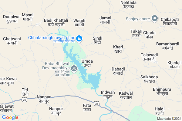
Umda
Umda Map
EDIT Map
Add Your House
 ..
..
Current Corona Virus Infected Patients Count in Alirajpur District
| City Name | District Name | Total Covid cases |
|---|---|---|
| Alirajpur District | Alirajpur | 2 |
Locality Name :
Umda
( उम्दा )
Tehsil Name : Jobat
District : Alirajpur
State : Madhya Pradesh
Division : Indore
Language : Hindi
Current Time 11:35 PM
Date: Wednesday , Feb 05,2025 (IST)
Time zone: IST (UTC+5:30)
Elevation / Altitude: 288 meters. Above Seal level
Telephone Code / Std Code: 07393
Assembly constituency : Jobat assembly constituency
Assembly MLA : Sena - Mahesh Patel
Lok Sabha constituency : Ratlam parliamentary constituency
Parliament MP : GUMAN SINGH DAMOR
Serpanch Name :
Pin Code : 457990
Post Office Name : Jobat
Commodities Prices : Jobat Market / Mandi
Umda Live Weather
Temperature: 20.2 °C
clear sky
Humidity: 27%
Wind : 2.6 mt/sec towards NE
StationName : "Jobat"
observed on 3 Mins Back
Temperature: 20.2 °C
clear sky
Humidity: 27%
Wind : 2.6 mt/sec towards NE
StationName : "Jobat"
observed on 3 Mins Back
Umda Weather Forecast for Next 5 days
06-02-2025
18.4°C to 19.6°C
clear sky
18.4°C to 19.6°C
clear sky
07-02-2025
17.3°C to 29.4°C
clear sky
17.3°C to 29.4°C
clear sky
08-02-2025
18.0°C to 30.5°C
clear sky, few clouds
18.0°C to 30.5°C
clear sky, few clouds
09-02-2025
19.1°C to 31.8°C
clear sky, scattered clouds, broken clouds, few clouds
19.1°C to 31.8°C
clear sky, scattered clouds, broken clouds, few clouds
10-02-2025
20.8°C to 33.8°C
clear sky, scattered clouds, broken clouds
20.8°C to 33.8°C
clear sky, scattered clouds, broken clouds
Rivers Near Umda
Hindola Nadi
Ghatwal
Hindola Nadi
Ghatwal
About Umda
Correct below Info and add more info about UmdaUmda is a Village in Jobat Tehsil in Alirajpur District of Madhya Pradesh State, India. It belongs to Indore Division . It is located 26 KM towards East from District head quarters Alirajpur. 15 KM from Kasba Jobat. 362 KM from State capital Bhopal
Umda Pin code is 457990 and postal head office is Jobat .
Indwan ( 5 KM ) , Wagdi ( 5 KM ) , Fata ( 6 KM ) , Jamni ( 6 KM ) , Badi Khattali ( 7 KM ) are the nearby Villages to Umda. Umda is surrounded by Alirajpur Tehsil towards west , Dahi Tehsil towards South , Udaigarh Tehsil towards North , Kukshi Tehsil towards East .
Barwani , Jhabua , Manawar , Rajgarh are the near by Cities to Umda.
Umda 2011 Census Details
Umda Local Language is Hindi. Umda Village Total population is 2531 and number of houses are 385. Female Population is 50.8%. Village literacy rate is 25.9% and the Female Literacy rate is 11.5%.
Population
| Census Parameter | Census Data |
| Total Population | 2531 |
| Total No of Houses | 385 |
| Female Population % | 50.8 % ( 1287) |
| Total Literacy rate % | 25.9 % ( 656) |
| Female Literacy rate | 11.5 % ( 290) |
| Scheduled Tribes Population % | 98.0 % ( 2481) |
| Scheduled Caste Population % | 2.0 % ( 50) |
| Working Population % | 58.9 % |
| Child(0 -6) Population by 2011 | 440 |
| Girl Child(0 -6) Population % by 2011 | 52.7 % ( 232) |
Umda Census More Deatils.
Politics in Umda
Bharatiya Janata Party , BJP , INC are the major political parties in this area.Polling Stations /Booths near Umda
1)Kharakhadi2)Khattaleebadi
3)Chichalana
4)Jameri
5)Jamni
HOW TO REACH Umda
By Rail
There is no railway station near to Umda in less than 10 km.Colleges near Umda
Govt. College
Address : Govt. Collegealirajpur Madhya Pradesh
Government Post Graduate College
Address : Hospital Road Alirajpurdist.- Jhabua (m.p.) Pin Co
Schools in Umda
Ms Umda
Address : umda , jobat , alirajpur , Madhya Pradesh . PIN- 457990 , Post - Jobat
Govt Health Centers near Umda
1) SHC Kattali , SHC Kattali , sector Kattali , SHC BADI KHATTALI PHC khattali2) SHC Takari , Sub Health Center Takari , Patel Pura , Near Talawdi Road
3) PHC Talavadi , , ,
Electronic Shops in Umda,Jobat
Super Markets in Umda,Jobat
Local Parks in Umda,Jobat
Police Stations near Umda,Jobat
Governement Offices near Umda,Jobat
About Umda &
History
How to reach Umda
Tourist Places Near By Umda
Schools in Umda
Colleges in Umda
Temperature & weather of Umda
places in Umda
Umda photos
More Information
How to reach Umda
Tourist Places Near By Umda
Schools in Umda
Colleges in Umda
Temperature & weather of Umda
places in Umda
Umda photos
More Information
Village Talk
Post News or Events about this Village
Near Cities
Barwani 51 KM near
Jhabua 57 KM near
Manawar 60 KM near
Rajgarh 62 KM near
Barwani 51 KM near
Jhabua 57 KM near
Manawar 60 KM near
Rajgarh 62 KM near
Near By Taluks
Jobat 14 KM near
Alirajpur 21 KM near
Dahi 21 KM near
Kukshi 24 KM near
Jobat 14 KM near
Alirajpur 21 KM near
Dahi 21 KM near
Kukshi 24 KM near
Near By Air Ports
Indore Airport 150 KM near
Vadodara Airport 157 KM near
Ahmedabad Airport 243 KM near
Bhavnagar Airport 285 KM near
Indore Airport 150 KM near
Vadodara Airport 157 KM near
Ahmedabad Airport 243 KM near
Bhavnagar Airport 285 KM near
Near By Tourist Places
Toranmal 55 KM near
Dahod 79 KM near
Kevadia Narmada 115 KM near
Maheshwar 117 KM near
Champaner 122 KM near
Toranmal 55 KM near
Dahod 79 KM near
Kevadia Narmada 115 KM near
Maheshwar 117 KM near
Champaner 122 KM near
Near By Districts
Alirajpur 25 KM near
Barwani 49 KM near
Jhabua 57 KM near
Dohad 74 KM near
Alirajpur 25 KM near
Barwani 49 KM near
Jhabua 57 KM near
Dohad 74 KM near
Near By RailWay Station
Meghnagar Rail Way Station 74 KM near
Dahod Rail Way Station 76 KM near
Meghnagar Rail Way Station 74 KM near
Dahod Rail Way Station 76 KM near